~ |
Online free nautical charts and publications
open data/open access - libre accès
Cartes marines gratuites et ouvrages nautiques en ligne
 | COM |

| MISCMiscellaneous | 
| ||
List by Type of Document/ Liste par type de document
Sailing Directions/Instructions nautiques List of Lights/Livres des feux
Radio Signals/Ouvrages de radiosignaux
Tide Tables/Annuaire des marées
About Nautical Free
Nautical Free provides a list of free nautical charts and online publications.There is a list by country from letter A to letter V, for each country the organizations and for each organization a list of free online documents (charts, nautical books, notice to mariners...). There is two special lists: one for the international organizations and one for the private companies. There is also a reverse list by type of documents: sailing directions, radio signals, tide tables, nautical charts... You can also find on Nautical Free wave forecast maps for tomorrow, space weather forecast for GPS, how to check your computer clock, as well as information about celestial navigation or about ice navigation...
Au sujet de Nautical Free
Nautical Free fournit une liste de cartes marines gratuites et d'ouvrages nautiques en ligne.Il y a une liste par pays de la lettre A à la lettre V, pour chaque pays les organisations et pour chaque organisation une liste de documents libres en ligne (cartes marines, ouvrages nautiques, avis aux navigateurs...). Il existe deux listes spéciales : une pour les organisations internationales et une pour les sociétés privées. Il existe également une liste inverse par type de documents : instructions nautiques, ouvrages de radiosignaux, tables des marées, cartes marines... Vous trouverez également sur Nautical Free des cartes de prévision de la hauteur des vagues pour demain, des prévisions de la météo de l'espace pour les GPS, comment vérifier l'heure de son ordinateur, ainsi que des informations sur la navigation astronomique ou la navigation dans les glaces...
Advice / Conseils
For navigation use only updated regulatory documents /
Pour la navigation n'utiliser que des documents réglementaires à jour.
GPS is more accurate than nautical charts /
Un GPS est plus précis qu'un carte marine
Web Servers / Serveurs Web
You can use the nearest or faster server / Vous pouvez utiliser le serveur le plus proche ou le plus rapide :
- French mirror with one page by section / Serveur en France avec une page par section : http://nauticalfree.free.fr
- French mirror on one page / Serveur en France sur une page : http://nauticalfree.free.fr/onepage.html
- French mirror without image on one page / Serveur en France sans image sur une page : http://nauticalfree.free.fr/noimage/
- US mirror with one page by section / Serveur au États-Unis avec une page par section : http://nauticalfree.eu5.org
- US mirror on one page / Serveur au États-Unis sur une page : http://nauticalfree.eu5.org/onepage.html
- US mirror without image on one page / Serveur au États-Unis sans image sur une page : http://nauticalfree.eu5.org/noimage/
- US mirror on seven pages / Serveur au États-Unis sur sept pages : https://sites.google.com/site/nauticalfree/
Caption / Légende
- The nautical books are in standard fonts / Les ouvrages sont en caractères droits
- In Italic the maps and the charts / Les cartes sont en italiques
- The last item for an organization is the Notices to Mariners. The first issue of each year is often a special publication /
La dernier item pour un service hydrographique est un lien vers les avis au navigateurs. Le premier numéro de chaque année est souvent un numéro spécial
- Raster Navigational Charts (RNC)
- Bitmap electronic images of paper charts that conform to IHO standard S-61 /
Carte marine matricielle, fac-similé numérique d'une carte papier (scan) conforme à la norme de l'OHI S-61 - Electronic Navigational Charts (ENC)
- Vector charts that conform to IHO standard S-57 /
Carte électronique de navigation, carte vectorielle conforme à la norme de l'OHI S-57
|
|
Cartes marines gratuites et ouvrages nautiques en ligne : Liste par type de document
II - List by type of document / Liste par type de document
II-1 - Main Nautical Publications / Ouvrages nautiques principaux
II-2 - Other Nautical Documents / Autres documents nautiques
II-1 - Main Nautical Publications / Ouvrages nautiques principaux
Sailing Directions (Pilots) / Instructions nautiques (Pilotes)
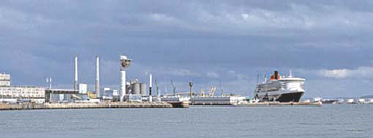
Le Havre: Outer harbor / Avant port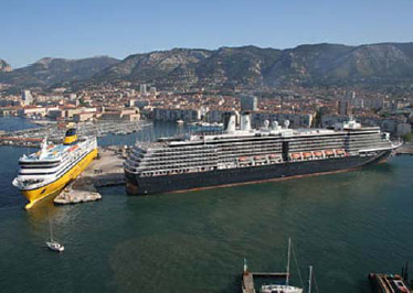
Toulon: Cruise Ship Terminal / Terminal de croisière - Worldwide / Mondiale : Enroute - Coastal and port approach information - English/anglais (NGA/USA)
- Worldwide / Mondiale : Planning Guide - Information about the countries - English/anglais (NGA/USA)
- Baltic Sea / mer Baltique : Mariners' Routeing Guide Baltic Sea - HTML - English/anglais (GST/Denmark-BSH/Germany)
- Australia / Australie : Western Australian Cruising Guide - PDF (FSC/Australia)
- Bermuda / Bermudes : Yachts (Private) sailing to Bermuda - English/anglais (Marine & Ports Services/Bermuda, UK)
- Brazil / Brésil : Guides nautiques Caramel - French/français (Caramel/France)
- Canada / Canada - PDF - English/anglais (SHC/Canada)
- Canada / Canada - PDF - French/français (SHC/Canada)
- Chile / Chili : Estrecho de Magallanes - HTML - Spanish/espagnol (DIRECTEMAR/Chile)
- Chile / Chili : Strait of Magellan - HTML - English/anglais (DIRECTEMAR/Chile)
- Chile / Chili : Isla de Pascua - Rapa Nui Anchoring Guide, 2008 - PDF - English/anglais (Migrations)
- Denmark / Danemark : Den danske Havnelods - Harbours - HTML - Danish/danois (GST/Danmark)
- Denmark / Danemark : Generelle oplysninger - PDF - Danish/danois (GST/Danmark)
- Denmark / Danemark : DanPilot Pre-planning Guides - PDF -English/anglais (DanPilot/Danmark)
- Denmark / Danemark : Navigation through Danish Waters - PDF - English/anglais (DMA/Danmark)
- Ecuador / Équateur - PDF, 2005 - Spanish/espagnol (INOCAR/Equador)
- Estonia/ Estonie - Gulf of Riga, Väinameri, Baltic Sea, Golf of Finland - English/anglais (Transport Administration/Estonia)
- Estonia / Estonie - osa Liivi laht, osa Väinameri osa Läänemeri, osa Soome laht- Estonian/estonien (Transpordiamet/Estonia)
- Finland / Finlande - PDF - English/anglais (Traficom/Finland)
- Finnish VTS / VTS de Finlande - English/anglais (Liikenneviraston/Finland)
- Finnish channels and harbours / Chenaux et ports de Finlande - English/anglais (Liikenneviraston/Finland)
- France / France : Guide des ports de plaisance Provence, Côte d'Azur et Corse - PDF - French/français (Guides Pratiques form'actuel/France)
- French Polynesia / Polynésie Française : Carnet d'escale - HTML et PDF - French/français (YellowFlagGuides/France)
- French Polynesia / Polynésie Française : Stopover Handbook - HTML and PDF - English/anglais (YellowFlagGuides/France)
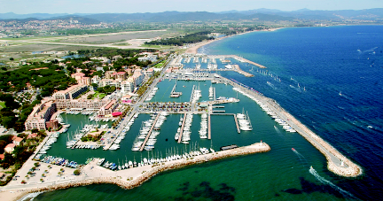
Hyères: Saint-Pierre Harbor / Port Saint-Pierre - Greenland / Groenland : - HTML - English/anglais (GST/Danmark)
- Greenland / Groenland : Den grønlandske Havnelods - HTML - Danish/danois (GST/Danmark)
- Greenland / Groenland : Den grønlandske Lods - PDF - Danish/danois (GST/Danmark)
- Greenland / Groenland : Greenland Harbour Pilot - HTML - English/anglais (GST/Danmark)
- Greenland / Groenland : Greenland Pilot - PDF - English/anglais (GST/Danmark)
- Iceland / Islande : Guidelines for masters of cruise and passenger ships arriving in Iceland - PDF - English/anglais (ICG/Iceland)
- Japan / Japon : Vessel Traffic Service of Japan - VTS Guide - English/anglais (JCG/Japan)
- Japan / Japon : プレジャーボート・小型船用港湾案内 - 1995年から2000年の間に出版された本 - Japanese/japonais (JHA/Japan)
- Latvia / Lettonie - Latvian/letton (LJA/Latvia)
- Latvia / Lettonie - English/anglais (LJA/Latvia)
- Morocco / Maroc : Guide le la plaisance au Maroc - French/français (METLE/Morocco)
- Morocco / Maroc : Les ports du Maroc - French/français (ANP/Morocco)
- Mexico / Mexique - HTML/PDF - Spanish/espagnol (DIGAOHM/Mexico)
- New Caledonia / Nouvelle-Calédonie : Présentation de la côte et des ports - French/français (Pilotes Maritimes NC/France)
- New Caledonia / Nouvelle-Calédonie : Presentation of the coast and harbours - PDF - English/anglais (Maritime Pilot NC/France)
- New Caledonia / Nouvelle-Calédonie : Carnet d'escale - PDF - French/français (DAM-YellowFlagGuides/France)
- New Caledonia / Nouvelle-Calédonie : Stopover Handbook - PDF - English/anglais (DAM-YellowFlagGuides/France)
- New Caledonia / Nouvelle-Calédonie : Carnet d'escale - HTML et PDF - French/français (YellowFlagGuides/France)
- New Caledonia / Nouvelle-Calédonie : Stopover Handbook - HTML and PDF - English/anglais (YellowFlagGuides/France)
- Norway / Norvège : Svalbard - Jan Mayen - English/anglais (Kartverket/Norway)
- Norway / Norvège - HTML - Norwegian/norvégien (Kartverket/Norway)
- Norway / Norvège - PDF, 2018 - Norwegian/norvégien (Kartverket/Norway)
- Slovenia / Slovénie - HTML - Slovenian/slovéne (GIS/Slovenia)
- United Arab Emirates / Émirats arabes unis : Marinas in Dubai - PDF - English/anglais (DMCA/UAE)
- United States of America / États-Unis d'Amérique - English/anglais (OCS-NOAA/USA)
- Worldwide / Mondiale : Enroute - Coastal and port approach information - English/anglais (NGA/USA)
List of Lights / Livres des feux
- Worldwide / Mondiale : NGA List of Lights - English/anglais (NGA/USA)
- Argentina / Argentine - Spanish/espagnol (SNH/Argentina)
- Belgium / Belgique - Dutch/néerlandais (VH/Belgium)
- Brazil / Brésil - Portuguese/portugais (CHM/Brazil)
- Canada / Canada - English/anglais (CCG/Canada)
- Canada / Canada - French/français (GCC/Canada)
- Croatia / Croatie - HTML - English/anglais (Plovput/Croatia)
- Denmark / Danemark - Danish/danois (Søfartsstyrelsen/Denmark)
- Estonia / Estonie - PDF files - English/Estonian (Transport Administration/Estonia)
- Estonia / Estonie - AtN database - Estonian/estonien (Transpordiamet/Estonia)
- Faroe Islands / Îles Féroé - Icelandic / Islandais (Landsverk/Faroe Islands)
- Finland / Finlande - Introduction in English and list in Finnish - English/anglais (FTA/Finland)
- Finland / Finlande - Finnish/Finlandais (Väylä/Finland)
- Finland / Finlande - Swedish/suédois (Trafikledsverket/Finland)
- France / France : Provence, Côte d'Azur et Corse - PDF, 2021 - French/français (Guides-Pratiques.net/France)
- Ireland / Irlande - English/anglais (CIL/Ireland)
- Iceland / Islande - Icelandic/islandais (ICG-HD/Iceland)
- Italy / Italie - HTML - Italian/italien (Servizio Fari e Segnalamenti/Italy)
- Latvia / Lettonie - English/Latvian (Maritime Administration/Latvia)
- Lithuania / Lituanie - Lithuanian/English (LMSA/Lithuania)
- Malaysia / Malaisie - English/anglais (Marine Department/Malaysia)
- Morocco / Maroc - French/français (METLE/Morocco)
- Mexico / Mexique - Spanish/espagnol (SEMAR/Mexico)
- New Zealand / Nouvelle-Zélande - English/anglais (LINZ/New Zealand)
- Norway / Norvège - Norwegian/norvégien (Kystverket/Norway)
- Pakistan / Pakistan - Coastal lights only, no harbor lighthouses - English/anglais (MMD/Pakistan)
- Spain / Espagne - HTML - English/anglais (IHM/Spain)
- Spain / Espagne - HTML - Spanish/espagnol (IHM/Spain)
- Ukraine / Ukraine - HTML - Ukrainian/ukrainien (Держгідрографія/Ukraine)
- UK: England and Wales / RU : Angleterre et Pays de Galles - Lighthouses and lightvessels - English/anglais (Trinity House/UK)
- UK: Scotland and the Isle of Man / RU : Ecosse et île de Man - English/anglais (NBL/UK)
- United States of America / États-Unis d'Amérique - English/anglais (NGA&USCG/USA)
- United States of America / États-Unis d'Amérique - English/anglais (USCG/USA)
- Venezuela / Vénézuéla - Map - Spanish/espagnol (SHN/Venezuela)
- Vietnam, North / Viêt Nam, nord - HTML - English/anglais (VMS-North/Vietnam)
- Vietnam, South / Viêt Nam, sud - HTML - English/anglais (VMS-South/Vietnam)
- Links to free list of lights: The Lighthouse Directory

Symbols and abbreviations for light characteristics- Worldwide / Mondiale : NGA List of Lights - English/anglais (NGA/USA)
List of Radio Signals / Ouvrages de radiosignaux
- Introduction to GMDSS (CCG/Canada)
- Aperçu GMDSS
- Überblick GMDSS
- Sintesi GMDSS
- Distress and Safety Radiotelephone Procedures (Transport Canada/Canada)
- Processus de détresse, d'urgence et de sécurité
- Not-, Dringlichkeits- und Sicherheitsverfahren
- Procedure di soccorso, di urgenza e di sicurezza (OFCOM/Switzerland)
Radio VHF marine sur le canal 16 Marine MF radio on 2182 KHz - - Documents by areas / Documents par zones
- - Positioning Systems / Systèmes de localisation
- - Space Weather / Météo de l'espace
- - Radio Time Signals / Radiosignaux horaire
- - Radio Email Services / Services d'email par radio
- - Radio Communication & GMDSS Manuals / Guide sur les communications radio et le SMDSM
- - Vocabulary & Phrases / Vocabulaire et phrases
- - Telemedical Maritime Assistance Services (TMAS) / Centres de Consultation Médicale Maritime (CCMM)
- Worldwide Coverage / Couverture mondiale
- Radio Navigational Aids - NGA Pub. 117 - English/anglais (NGA/USA)
- Weather reporting, Information for shipping - WMO-No. 9, Volume D - English/anglais (WMO)
- Weather Facsimile - Worldwide Marine Radiofacsimile Broadcast Schedules - English/anglais (NWS-NOAA/USA)
- Inmarsat SafetyNET Weather Forecast - METAREA (high seas), legacy site - English/anglais (JCOMM/WMO)
- SafetyNET - MSI satellite transmission schedule (NtM, Section VI, UKHO)
- NAVTEX Station Database - HTML - English/anglais (ICS Electronics/UK)
- World NAVTEX database - Sorted by frequency & Navarea order - English/anglais (NDB List)
- HF MSI teletype stations - Sorted by time, frequency & Navarea order - English/anglais (NDB List)
- Coast stations and special service stations - Search by country, band, service... - English/anglais (ITU)
- By Geographical Area / Par zone géographique
- Europe & Mediterranean sea / Europe & Méditerranée : Radio facsimile and telex broadcast of meteorological information (DDH & DDK) - English/anglais (DWD/Germany)
- Europe & Mediterranean sea / Europe & Méditerranée : Funkfernschreibausstrahlungen und faksimile des Seewetterdienstes für die Schifffahrt (DDH & DDK) - German/allemand (DWD/Germany)
- Baltic sea / mer Baltique : Weather forecasts - HTML - English/anglais (The Weather Window/UK)
- Mediterran sea / Méditerranée : Weather Forecasts - HTML - English/anglais (The Weather Window/UK)
- East Atlantic & Western Mediterran / Atlantique Est & Ouest Méditerranée : Prévisions météo - HF - French/francais (Monaco Radio-Naya/Monaco)
- Transatlantic / Transatlantique : Weather Forecasts - HTML - English/anglais (The Weather Window/UK)
- Europe & Mediterranean / Europe & Méditerranée : NAVTEX Weather Broadcasts - HTML - English/anglais (The Weather Window/UK)
- Western Europe / Europe de l'ouest : Marine VHF Schedules for western Europe - HTML - English/anglais (The Weather Window/UK)
- West Pacific / Pacifique ouest: JMH Broadcast Schedule of Meteorological Charts - English/anglais (JMA/Japan)
- By Country / Par pays
- Australia / Australie : MSI - Chapter 8 - PDF - English/anglais (AHO/Australia)
- Australia / Australie : Port Information - Chapter 11 - PDF - English/anglais (AHO/Australia)
- Australia / Australie : weather forecast - HTML - English/anglais (Bureau of Meteorology/Australia)
- New South Wales: Radio Network Services - HTML - English/anglais (Maritime Services)
- Northern Territory: Marine Safety Information & weather - VHF & HF - HTML - English/anglais (Department of Transport)
- South Australia: Navigation warnings and weather broadcasts - HTML - English/anglais (Boating and marine)
- Tasmania: HF Marine Communications - MSI schedules and frequencies - HTML - English/anglais (MAST)
- Tasmania: VHF Repeater Network - HTML - English/anglais (MAST)
- Tasmania: Tas Maritime Radio (TMR) - VHF/HF frequencies and schedules (MSI) - English/anglais (TMR)
- Belgium / Belgique : Oostenderadio (OSU) - VHF & HF MSI - Dutch/néerlandais (Marinecomponent/Belgium)
- Bermuda / Bermudes : Maritime Safety Information (MSI) - VHF/MF/NAVTEX - Bermuda Radio (ZBR) - English/anglais (Marine & Ports Services/Bermuda, UK)
- Brazil / Brésil : Lista de Auxílios-Rádio - Portuguese/portugais (DHN-CHM/Brazil)
- Brazil / Brésil : Maritime Safety Information (MSI) - HF/VHF/Satellite - English/anglais (DHN-CHM/Brazil)
- Brazil / Brésil : Transmissões de meteoromarinhas e avisos de mau tempo - VHF/HF/satélite - Portuguese/portugais (DHN-CHM-SMM/Brazil)
- Brazil / Brésil : Transmissões de produtos gráficos por radiofacsímile - HF - Portuguese/portugais (DHN-CHM-SMM/Brazil)
- Canada / Canada : Aides Radio à la Navigation Maritime (ARNM) - French/français (GCC/Canada)
- Canada / Canada : Radio Aids Marine Navigation (RAMN) - English/anglais (CCG/Canada)
- Chile / Chili : Telecomunicaciones Marítimas - Spanish/espagnol (DIRECTEMAR/Chile)
- China / Chine : List of Coastal Radio Stations - MF, HF and VHF - Doc file - English/anglais (MSA/China)
- Croatia / Croatie : Maritime Safety Information (MSI) - HTML - English/anglais (Plovput/Croatia)
- Cyprus / Chypre : VHF Weather Forecast Services - English/anglais (JRCC/Cyprus)
- Cyprus / Chypre : VHF Channels Allocation - English/anglais (JRCC/Cyprus)
- Denmark / Danemark : Maritime Safety Information - MSI - English/anglais (GST/Danemark)
- Denmark / Danemark : Udsendelse af navigationsadvarsler og meteorologiske meldinger - MSI - Danish/danois (GST/Danemark)
- Denmark (Greenland) / Danemark (Groenland) - Aasiaat radio, OYR: VHF-kanaler & Trafiklister - MF-frekvenskort - Storm-, kuling- og overisningsvarsler - NAVTEX - HTML - Danish/danois (Tusass/Danemark)
- Denmark (Greenland) / Danemark (Groenland) - Aasiaat radio, OYR:
VHF channels & traffic lists - MF frequency list - VHF/M
F/NAVTEX weather warnings - NAVTEX - HTML - English/anglais (Tusass/Danemark)
- Estonia / Estonie : Maritime Safety Information (MSI) - Also radio phone VHF/MF/HF - HTML - English/anglais (RIKS/Estonia)
- Estonia / Estonie : VHF channels and call signs of most popular pleasure boat harbors in Estonia - PDF - English/anglais (RIKS/Estonia)
- Estonia / Estonie : Meresõiduohutuse informatsiooni (MSI) - Ka raadiotelefoni VHF/MF/HF - HTML - Estonian / estonien (RIKS/Estonia)
- Estonia / Estonie : Valik Eesti väikesadamate VHF raadiokanaleid ja kutsungeid - PDF - Estonian / estonien (RIKS/Estonia)
- Finland / Finlande : MSI broadcast on VHF - Broadcast times of Turku Radio - HTML - English/anglais (TMF/Finland)
- Finland / Finlande : VHF radio stations map - Frequencies of Turku Radio - PDF - Finnish/finlandais (Väylä/Finland)
- France / France : Guide marine de Méteo France - VHF/MHF/Navtex/Inmarsat - French/français (METEO FRANCE/France)
- France, Mediterranean / France, Mediterranée : Prévisions météo - VHF - French/français (Monaco Radio-Naya/Monaco)
- France, West Indies / Antilles : Guide marine Antilles - VHF/MF/NAVTEX - French/français (METEO FRANCE/France)
- France, New Caledonia / Nouvelle-Calédonie : Guide de météo marine en Nouvelle-Calédonie - VHF - French/français (METEO FRANCE/France)
- France, New Caledonia / Nouvelle-Calédonie : Horaires et fréquences des bulletins météo et Avurnav - VHF - French/français (MRCC Nouméa/France)
- French Polynesia / Polynésie Française : Avis cotiers aux navigateurs et bulletin météo - VHF/HF/Satellites - French/français (JRCC Tahiti/French Polynesia)
- French Polynesia / Polynésie Française : Avis cotiers aux navigateurs et bulletin météo - VHF/HF/Satellites, page 51 - French/français (ANFR/France)
- France, Guiana / Guyane : Horaires et fréquences de la météo et des avis aux navigateurs - VHF - French/français (DM Guyane/France)
- Germany / Allemagne : Wetter- und Warnfunk - German/allemand (BSH/Germany)
- Germany / Allemagne : Sturmwarnungen und Seewetterberichte für die Sport- und Küstenschifffahrt - German/allemand (DWD/Germany)
- Germany / Allemagne : DP07 Seefunk, Seewetterbericht für Nord- und Ostsee - German/allemand (DP07/Germany)
- Greece / Grèce : Navigational warnings on VHF - English/anglais (HNHS/Greece)
- Greece / Grèce : Navigational warnings broadcasts - VHF/MF/HF/NAVTEX - Pages 6-13 - English/anglais (HNHS/Greece)
- Greece / Grèce : Παραγγελίες για τους ναυτιλλόμενους - VHF/MF/HF/NAVTEX - Pages 5-12 - Greek/grec (HNHS/Greece)
- Greece / Grèce : Weather Forecasts in Greece - HTML - English/anglais (Nautilia Yachting/Greece)
- Ireland / Irelande : Irish Coast Guard VHF Forecasts - PDF - English/anglais (Met Éireann/Ireland)
- Ireland / Irlande : Irish Coast Guard VHF Forecasts - HTML - English/anglais (Met Éireann/Ireland)
- Ireland / Irlande : Met Eireann Weather Services - PDF - English/anglais (Safety on the water/Ireland)
- Ireland / Irelande : Irish Coast Guard Broadcast Times - English/anglais (CoastalRadio.Org/United Kingdom)
- Ireland / Irelande : Safety on the Water Radio & Weather Sticker - PDF - English/anglais (Safety on the Water/Ireland)
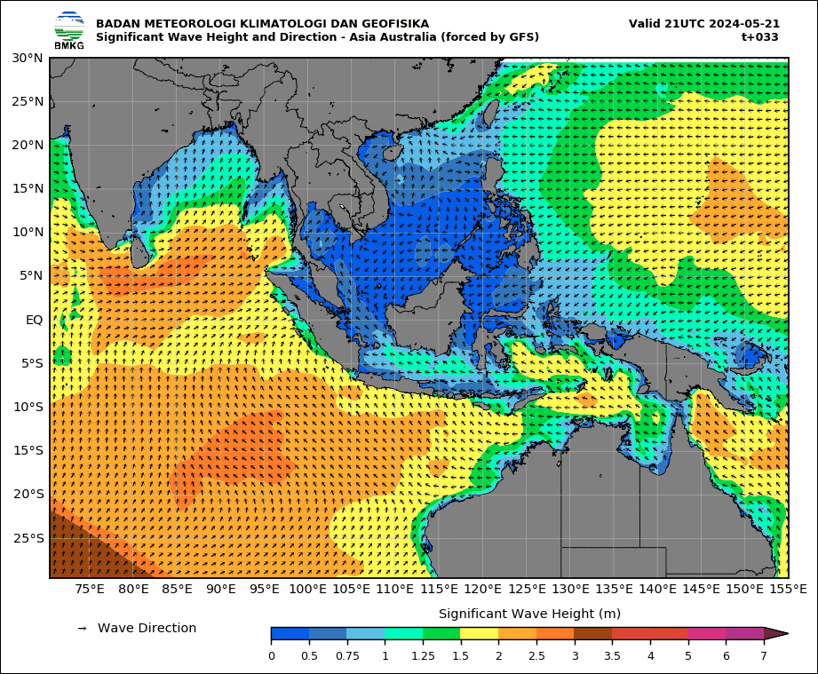
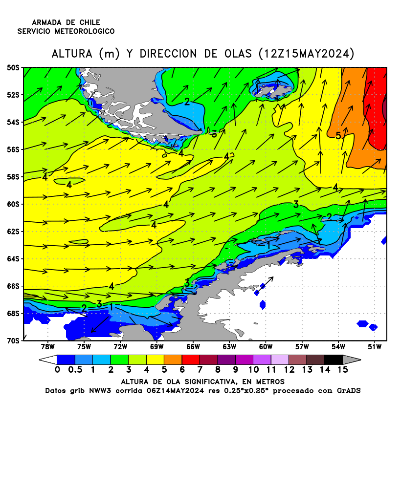
Asia & Autralia: Wave forecast for tomorrow - Height in metres (BMKG) Indonesian archipelago: Wave forecast for tomorrow - Height in metres (BMKG) - Monaco / Monaco : Monaco Radio (3AC) - Fréquences radio VHF et HF - HTML - French/français (Naya/Monaco)
- Montenegro / Monténégro / : Weather reports and Radio notices - Barradio VHF & HF - English/anglais (MSDM/Montenegro)
- New Zealand / Nouvelle-Zélande : Radio Handbook - English/anglais (Maritime New Zealand/New Zealand)
- New Zealand / Nouvelle-Zélande : Maritime Safety Information (MSI) - English/anglais (LINZ/New Zealand)
- New Zealand / Nouvelle-Zélande : Coastguard VHF Radio Channels - Locations & Channels Map - English/anglais (Coastguard/New Zealand)
- New Zealand / Nouvelle-Zélande : VHF Weather Channels - Coastguard NowCasting Locations & Channels Map - English/anglais (Coast Guard/New Zealand)
- New Zealand / Nouvelle-Zélande Maritime Radio VHF Channels - Locations & Channels Map - English/anglais (Maritime New Zealand/New Zealand)
- New Zealand / Nouvelle-Zélande : HF weather broadcast schedule - By Taupo maritime radio ZLM - English/anglais (MetService/New Zealand)
- New Zealand / Nouvelle-Zélande : INMARSAT C weather broadcast schedule - English/anglais (MetService/New Zealand)
- New Zealand / Nouvelle-Zélande : ZKLF weather radiofax schedule - Also in PDF - English/anglais (MetService/New Zealand)
- Norway / Norvège : Coastal Radio – MSI - English/anglais (Kartverket/Norway)
- Norway / Norvège : Kystradio – MSI - Norwegian/novégien (Kartverket/Norway)
- Norway / Norvège : Sikkerhetsmeldinger (MSI) - p139-143, p170-174 - Norwegian/novégien (Kartverket/Norway)
- Norway / Norvège : Maritime Safety Information (MSI) - Norwegian/novégien (Telenor Maritim radio/Norway)
- Russia / Russie : Radio communication for the Northern sea route - English/anglais (NSRA/Russia)
- Singapore / Singapour : VHF Communication Channels - English/anglais (MPA/Singapore)
- Singapore / Singapour : MSI broadcast - English/anglais (MPA/Singapore)
- Spain / Espagne : Estaciones costeras VHF, MF y HF del servicio móvil marítimo para la seguridad - Spanish/espagnol (Ministerio de Transportes/Spain)
- Spain / Espagne : Guía de Meteorología Marítima - Alta mar y zonas costeras - Spanish/espagnol (AEMet/Spain)
- Spain / Espagne : Horarios y frecuencias VHF, MF y NAVTEX de boletines meterológicos - Spanish/espagnol (Salvamento Marítimo/Spain)
- Spain / Espagne : Horarios y frecuencias NAVTEX de avisos a navegantes y bolitines meteorológicos - Spanish/espagnol (Salvamento Marítimo/Spain)
- Spain / Espagne : Horarios y frecuencias NAVTEX de bolitines meteorológico - Spanish/espagnol (Salvamento Marítimo/Spain)
- Slovenia / Slovénie : Vremenske napovedi - HTML - Slovenian/slovène (GIS/Slovenia)
- Sweden / Suéde : Navtex map - English/anglais (Swedish Maritime Administration/Sweden)
- Sweden / Suéde : Map of VHF and MF coast stations - English/anglais (Swedish Maritime Administration/Sweden)
- Sweden / Suéde : Map of VHF coast stations - Also map for Scandinavia - Swedish/suédois (Stockhom Radio/Sweden)
- Sweden / Suéde : Kustväder (VHF): broadcast schedule for coastal weather - Swedish/suédois (Stockhom Radio/Sweden)
- Sweden / Suéde : Gränsvåg MF - MF frequencies - Swedish/suédois (Stockhom Radio/Sweden)
s
- Turkey / Turquie : Meteorological Broadcasts For Shipping - HTML - English/anglais (MGM/Turkey)
- United Kingdom / Royaume-Uni : Maritime Safety Information (MSI) - English/anglais (MCA/United Kingdom)
- United Kingdom / Royaume-Uni : UK Coastguard Broadcast Times - English/anglais (CoastalRadio/United Kingdom)
- United States of America / États-Unis d'Amérique : Discontinuance of the National DGPS - English/anglais (USCG/USA)
- United States of America / États-Unis d'Amérique : Weather Forecasts - HTML - English/anglais (NWS-NOAA/USA)
- United States of America / États-Unis d'Amérique : VTS Radio Frequencies - English/anglais (USCG/USA)
- United States of America / États-Unis d'Amérique : VTS Radio Frequencies - Paragraph 24, pages 19-21 - English/anglais (NGA/USA)
- Uruguay / Uruguay : Frecuencias y horarios de los avisos y boletines meteorológicos - VHF/MF - Spanish/espagnol (SOHMA/Uruguay)
- Vietnam / Viêt Nam : MSI Broadcast for Fishing vessels - Vietnamese/vietnamien (VISHIPEL/Vietnam)
- Positioning Systems / Systèmes de localisation
General Information / Généralités
- Satellite Navigation - APN, volume I, chapter 22, pages 371-398, 2019 - English/anglais (NGA/USA)
- Electronic Navigation Systems - Guidance for safe use on leisure vessels - English/anglais (RIN/UK)
- GPS: Biases and Solutions - English/anglais (PSU/USA)
- GPS - Essentials of Satellite Navigation - Compendium - English/anglais (u‑blox/Switzerland)
- u-blox' GPS Dictionary - English/anglais (u‑blox/Switzerland)
- Error analysis for the GPS - English/anglais (WikipediA/USA)
- GPS User Equipment Introduction - English/anglais (USCG/USA)
- GNSS Data Processing: Fundamentals and Algorithms - GPS, Glonass, Galileo and Beidou - English/anglais (ESA/Europe)
- Loran-C: an overview - English/anglais (WikipediA/USA)
- Loran Navigation - APN, volume I, chapter 24, pages 399-413, 2019 - English/anglais (NGA/USA)
- Loran-C User's Handbook - English/anglais (USCG/USA)
- The Technical Approach to Establishing a Maritime eLoran Service - Guideline G1125 - English/anglais (IALA)
- Guide du LORAN·C pour le pêcheur - 1978 - French/français (SHC/Canada)
GNSS Constellation Status / Statut des constellations GNSS
- GPS constellation status - English/anglais (USCG/USA)
- Состав и состояние орбитальной группировки GPS - Russian/russe (IAC/Russian Federation)
- GPS constellation status - English/anglais (CSNO-TARC/China)
- GPS satellites health - Picture with 24 hours status monitoring - English/anglais (CSNO-TARC/China)
- Часовой мониторинг GPS - Russian/russe (IAC/Russian Federation)
- Notice Advisory to Navstar-GPS Users (NANU) - English/anglais (AFSPC-GPSOC/USA)
- Current Notice Advisory to Navstar Users - NANU (USCG/USA)
- NANU abbreviations and descriptions (USCG/USA)
- GLONASS constellation status - Russian/russe (IAC/Russian Federation)
- GLONASS satellites health - Picture with 24 hours status monitoring - English/anglais (IAC/Russian Federation)
- GLONASS satellites health - English/anglais (CSNO-TARC/China)
- Notice Advisory to GLONASS Users (NAGU) - English/anglais (IAC/Russian Federation)
- BeiDou constellation status - English/anglais (CSNO-TARC/China)
- Состав и состояние орбитальной группировки БЭЙДОУ - Russian/russe (IAC/Russian Federation)
- BeiDou satellites health - Picture with 24 hours status monitoring - English/anglais (CSNO-TARC/China)
- Часовой мониторинг БЭЙДОУ - Russian/russe (IAC/Russian Federation)
- BeiDou monitoring and evaluation - Map with number of visible satellites - English/anglais (BNSS/China)
- Galileo constellation information - English/anglais (GSC/Europe)
- Состав и состояние орбитальной группировки ГАЛИЛЕО - Russian/russe (IAC/Russian Federation)
- Часовой мониторинг ГАЛИЛЕО - Russian/russe (IAC/Russian Federation)
- Notice Advisory to Galileo Users (NAGUs) - English/anglais (GSC/Europe)
- QZSS Constellation Status - English/anglais (QSS/Japan)
- SBAS status : List of satellites - EGNOS (Europe) - GAGAN (India) - WAAS (USA)
- GPS: Position Dilution of Precision Map (PDOP) - English/anglais (FAA/USA)
- GPS: Геометрический фактор точности определения (PDOP) - Russian/russe (IAC/Russian Federation)
- GPS: Position Dilution of Precision Map (PDOP) - English/anglais (CSNO-TARC/China)
- GLONASS: Position Dilution of Precision Map (PDOP) - English/anglais (IAC/Russian Federation)
- GLONASS: Position Dilution of Precision Map (PDOP) - English/anglais (CSNO-TARC/China)
- BeiDou: Position Dilution of Precision Map (PDOP) - English/anglais (CSNO-TARC/China)
- БЭЙДОУ: Геометрический фактор точности определения (PDOP) - Russian/russe (IAC/Russian Federation)
- ГАЛИЛЕО: Геометрический фактор точности определения (PDOP) - Russian/russe (IAC/Russian Federation)
- How one vessel master managed safe navigation during a GPS outage - English/anglais (USCG/USA)
- Understanding GNSS Availability and How it Impacts Maritime Safety - English/anglais (GLA/UK)
- The Impact of GPS Jamming on the Safety of Navigation - Presentation - English/anglais (GLA/UK)
- GNSS Vulnerability and Mitigation Measures - Recommendation R129 - English/anglais (IALA)
- GNSS reliance and vulnerabilties - English/anglais (RAENG/UK)
- DHS S&T/USA)
- Assessing Vulnerability Of Transportation Infrastructure Relying on Global Positioning System - English/anglais (DOT/USA)
- Satellite-derived time and position: a study of critical dependencies - English/anglais (GO-Science/UK)
- Resources and References About Resilient Navigation - English/anglais (RNTFND/USA)
- Resource Portal for Resilient Positioning, Navigation and Timing - English/anglais (RIN/UK)
- Report GPS Service Disruptions - English/anglais (GPS.gov/USA)
- GPS et risques de brouillage - French/francais (ANFR/France)
Others Systems / Autres systèmes
- Radiobeacons / Radiophares - Sections of NGA List of Lights - English/anglais (NGA/USA)
- Differential GPS Stations - Sections of NGA List of Lights - English/anglais (NGA/USA)
- World DGNSS Stations List - English/anglais (IALA)
- DGPS beacons - Sorted by frequency - English/anglais (NDB List)
- LORAN-C: Worldwide Station List - Chapter 6 of NGA Pub. 117 (2014) - English/anglais (NGA/USA)
- Loran-C: Korea Chain - English/anglais (NMPNT/Korea)
- Loran-C: Far East Radio Navigation Service (FERNS) - English/anglais (NMPNT/Korea)
- Space Weather / Météo de l'espace
The Sun continuously emits energy into space. That energy emission by the Sun is variable and hence shapes a variable space environment which also impacts the Earth's atmosphere and magnetosphere. Here are some impacts of the sun:
- Radiation at flight altitude
- HF communication disturbance
- GNSS positional errors
- ...
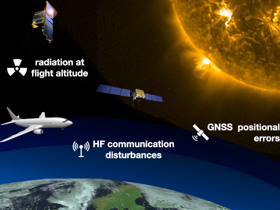
GNSS positional errors
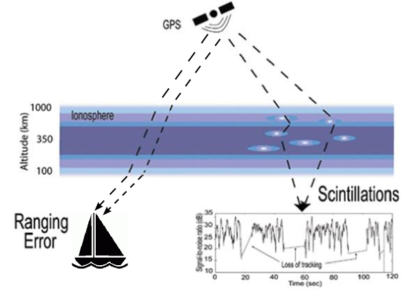
The accuracy of positioning using GPS is degraded when there are Sun stroms. For exemple when charged particles ejected from the Sun arrive at the Earth, they can cause perturbations in the geomagnetic field. These disturbances will significantly modify the ionospheric propagation of radio waves used by GPS. The GPS accuracy depends on amplitude scintillations and variation of total electron contents (TEC). These phenomena are associated with geomagnetic stroms that create disturbances in the ionosphere. The total electron contents (TEC) of the ionosphere is the electron density (number of electrons in a given volume) and the can vary considerably, both in time and space. The time of GPS signal propagation increase with TEC. More information about Space Weather.
La précision du positionnement par GPS est dégradée lors de tempêtes solaires. Par exemple lorsque des particules chargées émises par le soleil atteignent la terre, elles peuvent perturber le champ géomagnétique terrestre. Ces perturbations vont modifier de manière importantes la propagation ionosphérique des ondes radioélectriques qui sont utilisées par le GPS. La précison du GPS depend de la scintillation d’amplitude et de la variation du contenu électronique total (TEC). Ces phénomènes sont associés aux tempêtes géomagnétiques qui créent des perturbations dans l'ionosphère. Les scintillations d'amplitude sont des fluctuations de l'amplitude du signal GPS (comme pour la lumière des étoiles). Le contenu électronique total (TEC) de l'ionosphère est la densité d'électrons (nombre d'électrons dans une région donnée) et il peut varier considérablement, dans le temps et dans l'espace. Le temps de propagation du signal GPS augmente avec le TEC. Plus d'information sur la météo de l'espace.
GNSS & GPS vulnerabilties / Vulnérabilités du GPS et des GNSS
- Australian Space Weather Alert System - English/anglais (SWS-BOM/Autralia)
- Space Weather Hazard - English/anglais (AWS-BOM/Autralia)
- Fact sheet on the potential impacts of space weather - English/anglais (SWS-BOM/Autralia)
- Space weather: Effects on technology - English/anglais (NRC/Canada)
- Space Weather: Storms from the Sun - Booklet - English/anglais (SWPC-NOAA/USA)
- Space Weather of Earth: Presentations & Videos - English/anglais (Heliophysics/NASA)
- Space Weather and Society - Textbook - English/anglais (Heliophysics/NASA)
- Space Weather: Ionospheric Effects on GPS (John A. Klobuchar) - English/anglais (GPS World)
- Space weather: effects on infrastructure - Malfunction of satellites, degradation of GPS accuracy (ISES-NICT/Japan)
- Space Weather Glossary (SWPC-NOAA/USA)
- Météo spatiale : Effets sur la technologie - French/français (NRC/Canada)
Analysis, Forecasts & Advisories / Analyse, prévisions & avertissements
- Space Weather Conditions - English/anglais (SWS-BOM/Autralia)
- Solar Influences Data Analysis Center - English/anglais (SIDC-RWC/Belgium)
- Space weather: Fast warning for important solar events
- Sunspot number series
The Sun is an active place and solar activity changes over time. Sunspots are dark, planet-sized regions that appear on the surface of the Sun. Because sunspots are associated with increased solar activity, space weather forecasters track these features to help predict solar storms that can impact Earth. Solar activity cycles between a minimum and a maximum about every 11 years. Studying how solar activity changes throughout the entire cycle improves our understanding of how Earth is affected and improves our space-weather forecasting abilities. When solar activity is at a maximum, strong magnetic fields cause numerous sunspots and more frequent solar storms. When solar activity is at a minimum, the Sun’s magnetic field weakens and there are few to no sunspots and fewer solar storms. Sunspots can cause geomagnetic storms in Earth’s magnetosphere. During a solar maximum, when sunspot numbers are at their peak, the Sun emits more electrons and protons than usual. These charged solar particles emitted from the Sun can enter the atmosphere and can disrupt infrastructure, such as satellites, navigation, communications, and the electric power grid. Through careful counting of sunspots, solar prediction scientists determined that a solar minimum (when there are the fewest number of sunspots) occurred in December 2019. This recent solar minimum marks the beginning of Solar Cycle 25 (the current 11-year sunspot cycle). Scientists predict that Solar Cycle 25 will peak in July 2025 (+/- eight months). As Solar Cycle 25 approaches its peak, and even for several years after, Earth will likely experience increased geomagnetic storms in both the northern and southern hemispheres.
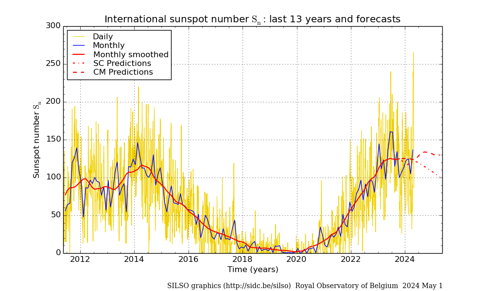
Daily and monthly sunspot number - Space Weather Canada: Forecast - English/anglais (NRC/Canada)
- Space weather advisories - English/anglais (FMI/Finland)
- Ionosphere Monitoring and Prediction Center - English/englais (IMPC-DLR/Germany)
- British Geological Survey: Space Weather - English/anglais (BGS/UK)
- Space Weather Today and Related Phenomena - English/anglais (FGBO-IAG/Russia)
- Map about Total Electon Content (TEC) : World Map - Russian Federation - Other maps

Space Weather Overview on NOAA Scales (SWPC-NOAA)
Актуальная космическая погода (ФГБУ "ИПГ") - Space Weather Prediction Center - English/anglais (SWPC-NOAA/USA)
- Space Weather: GPS Community Dashboard
- Space Weather: Satellites Community Dashboard
- Space Weather: Radio Communications Dashboard
- Solar Cycle Progression - Prediction gives an idea of the frequency of space weather storms
- Three day forecast of space weather conditions
- Alerts, Watches and Warnings
- Space weather alerts in force - English/anglais (HKO/HK)
- Space Weather Forecast Center - English/englais (ISES-NICT/Japan)
- Space weather: current status - Sun, magnetosphere, ionosphere
- Space weather: forecast - Flare, proton, geomagnetic ionospheric storm
- Space weather forecast from warning centers
- Solar proton at geostationary orbit: Possible problems with satellites
- Solar flare: Solar X ray: Possible radio blackouts
- Dellinger phenomenon: Interrupts/interferes with MF/HF systems
- Estimated international sunspot number
- Météo Spatiale Canada : Prévision - French/français (NRC/Canada)
- 情報通信研究機構 宇宙天気予報センター - Japanese/japonais (ISES-NICT/Japan)
- 社会システムとの関わり: 人工衛星の障害、測位(GPS)の誤差
- Космическая погода - Russian/russe (ФГБУ-ИПГ/Russia)
- Space Weather: Ionospheric Effects on GPS (John A. Klobuchar)
The ionosphere can be the largest source of error in GPS positioning and navigation. Furthermore, under certain conditions, amplitude fading and phase scintillation effects can cause loss of carrier lock and intermittent GPS receiver operation.
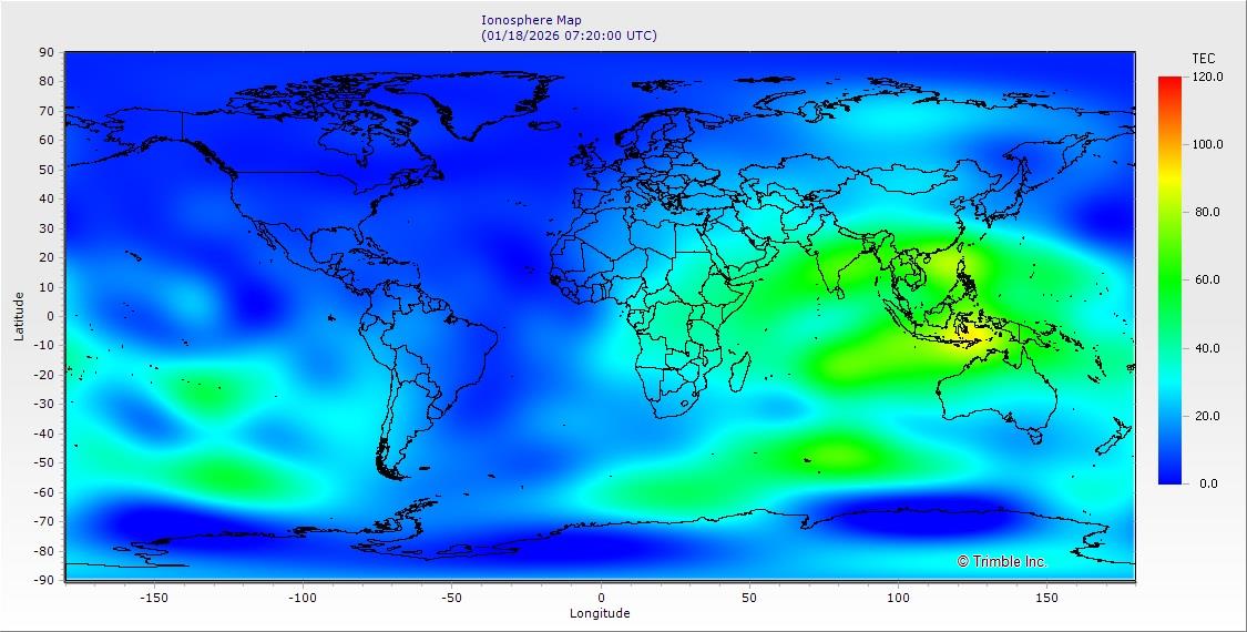
- TEC: Affected by solar activity, Total Electron Content (TEC) describes the total number of free electrons present within one square meter between two points (i.e. between the receiver and satellite). The GPS radio signal is slowed by the presence of free electrons, causing an additional time delay. The larger the TEC quantity, the longer the delay in a received GNSS signal. The delay will cause a range error for the measures of the distance between a satelite and the receiver: one TEC unit causes a range error of 0.162 meter. The range errors will cause a position error if they remain uncorrected. However, this position error will usually be smaller than the range errors. Standard GPS receivers correct by software more than 50% of the range error (More information).
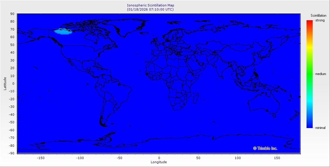
- Scintillation: Ionospheric scintillation is a rapid fluctuation of radio-frequency signal amplitude. It is generated when a signal passes through the ionosphere in a region with small scale irregularities in electron density. Ionosphere scintillation follows the 'solar cycle' which is affected by maximum sunspot activity and is primarily an equatorial and high-latitude ionospheric phenomenon. Scintillation affects satellites transmission with short-sterm signal fading that can severely stress the tracking capabilities of a GPS receiver. The higher the level of scintillation, the greater the errors (More information).
General Information / Généralités
Ionosphere Total Electron Content (TEC) Map (Trimble)
Ionosphere Scintillation Map (Trimble) - Time in Navigation - APN, volume I, chapter 16, pages 275-289, 2019 - English/anglais (NGA/USA)
- From Sundials to Atomic Clocks: Understanding Time and Frequency - Jespersen & Fitz-Randolph, 1999 - English/anglais (NIST/USA)
- Time on computers: Network Time Protocol (NTP) - HTML - WikipediA
- NIST Internet time service - HTML - English/anglais (NIST/USA)
- NPL Telephone & Internet Time Service - HTML/PDF - English/anglais (NPL/UK)
- Time on computers with a GPS receiver - GPSD Time Service HOWTO - HTML - English/anglais (catb.org/USA)
- Protocoles de synchronisation horaires par réseau (NTP) - HTML - French/français (CNRC/Canada)
- Diffusion de l’heure par internet : NTP - HTML - French/français (SYRTE-Observatoire de Paris/France)
- Worldwide / Mondiale : Radio Time Signals - Chapter 2 of NGA Pub. 117, 2014 - English/anglais (NGA/USA)
- Worldwide / Mondiale : Radio clock - HTML - English/anglais (WikipediA)
- Worldwide / Mondiale : Time signal emissions - PDF file - English/anglais (BIPM/France)
- Worldwide / Mondiale : Time dissemination services - Web, NTP, phone... - PDF file - English/anglais (BIPM/France)
- Worldwide / Mondiale : Standard Frequency and Time Signal Stations on Longwave and Shortwave - PDF file, 2007 - English/anglais (DL4BBL/Germany)
- Worldwide / Mondiale : Time Signal Transmitter - HTML - English/anglais (Meinberg/Germany)
- Worldwide / Mondiale : HF Time & Frequency Standard Stations - HTML - English/anglais (S-Meter/USA)
- Argentina / Argentine : Servicio de Frecuencia Patrones y Hora (LOL) - HTML - Spanish/epagnol (SHN/Argentina)
- Brazil / Brésil : Rádio-Difusão de Sinais Horários (PPE) - HTML - Portugues/portugais (ON-DSHO/Brazil)
- Canada / Canada : NRC Short wave station broadcasts (CHU) - HTML - English/anglais (NRC/Canada)
- Canada / Canada : Diffusion de signaux horaires par radio ondes courtes du CNRC (CHU) - HTML - French/français (NRC/Canada)
- Russia / Russie : Эталонные сигналы частоты и времени - PDF - Russian/russe (VNIIFTRI/Russia)
- USA / États-Unis : NIST Radio Stations (WWV, WWVB, WWVH) - HTML - English/anglais (NIST/USA)
- USA / États-Unis : NIST Time and Frequency Services - PDF - English/anglais (NIST/USA)
- Check your computer clock:
- Radio Time Signals / Radiosignaux horaires
Time on time.is Time on timeanddate.comTime on your local computer
- Clocks with offset from local device:
- Canada / Canada (NRC): Your local clock is ___ seconds fast / slow.
- Canada / Canada (NRC): L'horloge locale a ___ secondes d'avance / de retard.
- Germany / Allemagne (PTB): Click on Abweichung (vor: fast, nach: slow)
- Japan / Japon (NICT): Difference from Local Standard Time: ___ second(s) fast / slow.
- USA / États-Unis (Time.is): Your clock is ___ seconds ahead / behind.
- Time zone maps
- Standard time zone chart of the world - PDF color map, NtM 05/2023 (UKHO/UK)
- Standard time zone chart of Europe & North Africa - PDF color map, NtM 05/2023 (UKHO/UK)
- HMNAO World Time Zone Map - PDF & PNG files, 2021 (HMNAO/UK)
- HMNAO World Time Zone Map - PDF & PNG map, 2015 (USNO/USA)
- International Time Zone Map - With world time (HKO/HK)
- World Time Zones Chart (N°3003) - PNG map (Ukrmorcartographia/Ukraine)

World Map of Time Zones (HMNAO) - Radio Email Services / Services d'email par radio
- SailMail - SSB-Pactor marine frequencies - English/anglais (SailMail Association/USA)
- Winlink 2000 - SSB-Pactor ham frequencies - English/anglais (ARSFi/USA)
- Radio Communication & GMDSS Manuals / Guide sur les communications radio et le SMDSM
- Australian Global Maritime Distress and Safety System (GMDSS) Handbook - English/anglais (AMSA/Australia)
- Distress Beacon & Maritime Mobile Service Identity FAQ - English/anglais (AMSA/Australia)
- Marine Radio Operators Handbook - English/anglais (AMC/Australia)
- Marine VHF Radio Operators Handbook - view online, 2018 - English/anglais (AMC/Australia)
- Marine VHF Radio Operators Handbook - pdf, 2008 - English/anglais (AMC/Australia)
- Maritime Communications Satellite Systems and Equipment - MCSSE Handbook 2019 - English/anglais (AMC/Australia)
- Bermuda / Bermudes : Guide to Marine VHF Radiotelephone Communications in Bermuda - English/anglais (Marine & Ports Services/Bermuda, UK)
- Safety and Distress Radiotelephone Procedures - With text description - English/anglais (TC/Canada)
- Radio Handbook: Your guide to marine communication - English/anglais (MNZ/New Zealand)
- VHF Fact Sheet - For recreational boaties - English/anglais (MNZ/New Zealand)
- Radio Distress Calling - English/anglais (MaritimeNZ-LINZ/New Zealand)
- GMDSS Quiz: GOC, ROC, LRC and Satellite module - English/anglais (AMREC/UK)
- Radio Waves - Chapter 21 of APN, pages 357-370 (2017) - English/anglais (NGA/USA)
- Introduction to GMDSS - Chapter 30 of APN, pages 463-478 (2017) - English/anglais (NGA/USA)
- Distress, Emergency and Safety Traffic - With Rescue Coordination Center (RCC) stations - Chapter 4 of NGA Pub. 117, 2014 - English/anglais (NGA/USA)
- International SafetyNET Manual - 2018 Edition - MSC.1/Circ.1364/Rev.1 - English/anglais (IMO)
- International SafetyNET Services - 2019 edition - MSC.1/Circ.1364/Rev.2 - English/anglais (IMO)
- Revised NAVTEX Manual - 2016 edition - MSC.1/Circ.1403/Rev.1 - English/anglais (IMO)
- NAVTEX Abbreviations - - English/anglais (NDB List)
- Manual for Use by the Maritime Mobile and Maritime Mobile-Satellite Services - Edition 2011 - English/anglais (ITU)
- Inmarsat Maritime Communications Handbook - 2002 edition - English/anglais (Inmarsat)
- International SafetyNET Handbook - 2020 edition - English/anglais (Inmarsat)
- Inmarsat Free Emergency Calls - English/anglais (Inmarsat)
- Radio regulations 2020 - English/anglais (ITU)
- Information distress beacon - English/anglais (OFCOM/Switzerland)
- Cospas-Sarsat (EPIRB: distress beacon): Overview -
Introduction -
Glossary (English, French, Russian) -
Beacon Regulations Handbook -
LEOSAR/GEOSAR/MEOSAR Satellites Status -
GEOSAR Coverage -
LEOSAR Coverage -
Beacon Registration (IBRD)
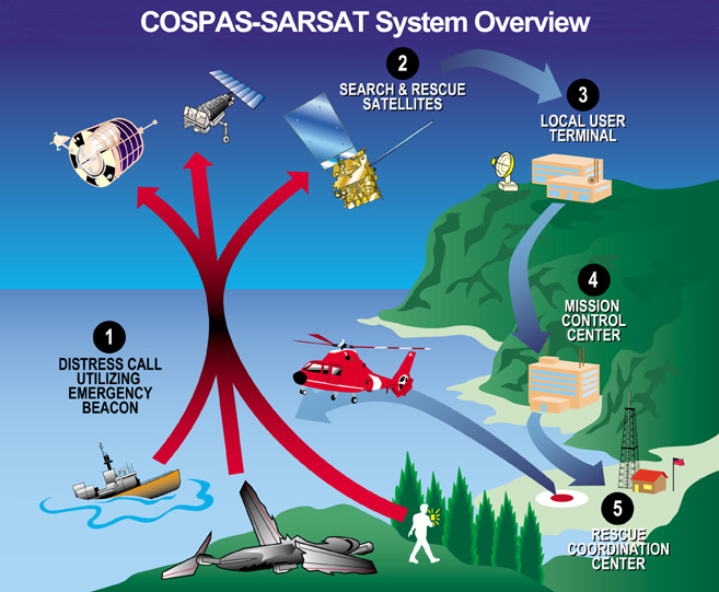
- Cospas-Sarsat (RLS/EPIRB : balise de détresse) : Conception générale - Introduction - État des satellites LEOSAR/GEOSAR - Couverture GEOSAR - Couverture LEOSAR - Enregistrement des balises (IBRD)
- Balise de détresse du service maritime (EPIRB) - French/français (OFCOM/Switzerland)
- Manuel VHF Maritime - French/français (IBPT/Belgium)
- Procédures de sécurité et de détresse radiotéléphoniques - French/français (TC/Canada)
- Manuel de préparation du CRR maritime - French/français (ANFR/France)
- Guide de préparation au CRR maritime pour la Polynésie - French/français (ANFR/France)
- Entraînement en ligne au CRR - French/français (ANFR/France)
- Programmation du MMSI en pratique - French/français (ANFR/France)
- La balise de détresse Cospas-Sarsat - French/français (ANFR/France)
- La VHF sauve des vies, pensez-y ! - French/français (DAM-NC/France)
- Balise de détresse du service maritime (EPIRB) - French/français (OFCOM/Switzerland)
- Aperçu du SMDSM (GMDSS) - French/français (OFCOM/Switzerland)
- Processus de détresse, d'urgence et de sécurité au service mobile maritime - French/français (OFCOM/Switzerland)
- Manuel SafetyNET international Révisé - French/français (OMI)
- Manuel NAVTEX révisé - French/français (OMI)
- Règlement des radiocommunications 2020 - French/français (UIT)
- Handboek VHF Maritiem - Flemish/flamand (IBPT/Belgium)
- Cartilla radiotelefónica del servicio móvil marítimo (TM-021) - Spanish/espagnol (DIRECTEMAR/Chile)
- Manual para uso en el servicio móvil marítimo (TM-011A) - Spanish/espagnol (DIRECTEMAR/Chile)
- Reglamento general de radiocomunicaciones del servicio móvil marítimo (TM-011) - Spanish/espagnol (DIRECTEMAR/Chile)
- Registro Radioeléctrico del SMSSM (GMDSS Radio Logbook) - Spanish/espagnol (DIRECTEMAR/Chile)
- Radiocomunicaciones - Spanish/espagnol (Fomento/Spain)
- Manual NAVTEX de la OMI - Edición 2009 - MSC.1/Circ.1310 - Spanish/espagnol (IMO)
- Reglamento de Radiocomunicaciones 2020 - Spanish/espagnol (UIT)
- EROG Especial de RadiOperador Geral - Portugues/portugais (Marinha do Brasil/Brazil)
- Überblick GMDSS - German/allemand (OFCOM/Switzerland)
- Not-, Dringlichkeits- und Sicherheitsverfahren im Seefunkdienst - German/allemand (OFCOM/Switzerland)
- Merkblatt über Seenotfunkbaken (EPIRB) - German/allemand (OFCOM/Switzerland)
- Sintesi GMDSS - Italian/italien (OFCOM/Switzerland)
- Procedure di soccorso, di urgenza e di sicurezza per la radiocomunicazione marittima - Italian/italien (OFCOM/Switzerland)
- Scheda per radiofari di emergenza (EPIRB) - Italian/italien (OFCOM/Switzerland)
- Επικοινωνίες Ι (VHF) - Greek/grec (Eugenides Foundation/Greece)
- Επικοινωνίες II (GMDSS, δορυφορικών) - Greek/grec (Eugenides Foundation/Greece)
- Rannikkolaivurin radioliikenneopas - Finnish/Finlandais (TRAFICOM/Finland)
- VHF-Introduksjonskurs (Telenor Kystradio/Norway)
- Poszukiwanie i Ratownictwo: COSPAS-SARSAT - Polish/polonais (ULC/Poland)
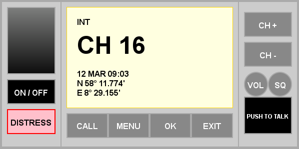
Online VHF marine radio simulator (Telenor Kystradio) - Vocabulary & Phrases / Vocabulaire et phrases
- IMO Standard Marine Communication Phrases (SMCP) - English/anglais (IMO)
- Standard Marine Navigational Vocabulary - English/anglais - ČTÚ (TC/Canada)
- Glossary and English to French Lexicon - anglais/français (CPS/Canada)
- VTS VHF Voice Communication - Guideline G1132 - English/anglais (IALA)
- Vocabulaire normalisé de la navigation maritime - French/français - CUBIQ (TC/Canada)
- Glossaire/Lexique français-anglais - French/English (ECP/Canada)
- Frases normalizadas de la omi para las comunicaciones marítimas (TM-087) - Spanish/espagnol (DIRECTEMAR/Chile)
- IMO τυποποιημένες ναυτικές φράσεις επικοινωνίας (SMCP) - Greek/grec (Eugenides Foundation/Greece)
- Enskt-íslenskt hugtakasafn um siglingamá - Icelandic/islandais (Vegagerðin/Island)
- Multilingual questions for the medical assessment and treatment of seafarers (ISWAN & Shipowners)
English, Arabic, Bahasa Indonesia, Burmese, Chinese, Filipino, Hindi, Portuguese, Russian, Spanish and Thai- Telemedical Maritime Assistance Services (TMAS) / Centres de Consultation Médicale Maritime (CCMM)
- Coronavirus disease (COVID-19) - IMO
- Operational considerations for managing COVID-19 cases/outbreak on board ships - WHO
- Notice to the Master on Recommended Measures to Address COVID-19 Risks on Board - MSA, China
- Guidance on the prevention and control of COVID-19 on board(Version 4.0) - MSA, China
- Coronavirus Disease 2019 Guidance for Ships - CDC, USA
- Coronavirus (COVID-19) - Guidance for Ship Operators for the Protection of the Health of Seafarers - ICS
- 船舶船员新冠肺炎疫情防控操作指南(V4.0) - 中华人民共和国海事局
- Pandémie de COVID-19 - IMO
- Worldwide / Mondiale : Stations Transmitting Medical Advice - Chapter 5 of NGA Pub. 117, 2014 - English/anglais (NGA/USA)
- Denmark / Danemark : Radio Medical Denmark (RMD) - English/anglais (Sydvestjysk Hospital/Denmark)
- Denmark / Danemark : Radio Medical Danmark (RMD) - Danish/danois (Sydvestjysk Sygehus/Denmark)
- Denmark (Greenland) / Danemark (Groenland) - Aasiaat radio, OYR - English/anglais (Tusass/Danemark)
- Denmark (Greenland) / Danemark (Groenland) - Aasiaat radio, OYR - Danish/danois (Tusass/Danemark)
- Denmark (Greenland) / Danemark (Groenland) - Aasiaat radio, OYR - Greenlandic/groenlandais (Tusass/Danemark)
- Estonia / Estonie : Provision of medical consultations VHF/HF (Tallinn Radio) - HTML - English/anglais (RIKS/Estonia)
- Estonia / Estonie : Meditsiinikonsultatsiooni vahendamine VHF/HF (Tallinn Raadio) - HTML - Estonian/estonien (RIKS/Estonia)
- France / France : Centre de consultation médicale maritime (CCMM) - HTML - French/français (CHU de Toulouse/France)
- France / France : How to call CCMM? (French TMAS) - PDF - English/anglais (Toulouse's hospital/France)
- Georgia / Géorgie : Maritime hospital - English/anglais (Maritime hospital/Georgia)
- Germany / Allemagne : Telemedical Maritime Assistance Service (TMAS Germany) - Medico Cuxhaven - English/anglais (Deutsche Flagge/Germany)
- Germany / Allemagne : Kontakt zur funkärztlichen Beratung (TMAS Germany) - Medico Cuxhaven - German/allemand (Deutsche Flagge/Germany)
- Greece / Grèce : Κέντρο Ιατρικών Συμβουλών (Κ.Ι.Σ) - Greek/grec (Ε.Ε.Σ./Greece)
- Greece / Grèce : Medical Advice Center (M.A.C) - English/anglais (H.R.C./Greece)
- Ireland / Irlande : Medico Cork - English/anglais (Cork University Hospital/Ireland)
- Italy / Italie : Centro Internazionale Radio Medico (CIRM) - Italian/italien (CIRM/Italy)
- Netherlands / Pays-Bas : KNRM Radio Medische Dienst (RMD) - Dutch/néerlandais (KNRM/Netherlands)
- Netherlands / Pays-Bas : KNRM Radio Medische Dienst (RMD) - Procedure, PDF - Dutch/néerlandais (KNRM/Netherlands)
- Netherlands / Pays-Bas : KNRM Radio Medical Service - English/anglais (KNRM/Netherlands)
- Netherlands / Pays-Bas : KNRM Radio Medical Service - Procedure, PDF - English/anglais (KNRM/Netherlands)
- Norway / Norvège : Radio Medico - English/anglais (NCMM/Norway)
- Poland / Pologne : Uniwersyteckie Centrum Medycyny Morskiej i Tropikalnej - Służba TMAS - Polish/polonais (UCMMT/Poland)
- Portugal / Portugal : Centro de Orientação de Doentes Urgentes Mar (CODU-Mar) - Portuguese/portugais (INEM/Portugal)
- Spain / Espagne : Centro Radio-Médico Español (CRME) - Spanish/espagnol (ISM/Spain)
- Spain / Espagne : Buques de asistencia médica y logística - Spanish/espagnol (ISM/Spain)
- Spain / Espagne : Buques de asistencia médica y logística - PDF - Spanish/espagnol (ISM/Spain)
- Spain / Espagne : Spanish Medical Radio Centre (SMRC) - English/anglais (ISM/Spain)
- Spain / Espagne : Medical and Logistical Assistance Vessel - English/anglais (ISM/Spain)
- Sweden / Suède : Sahlgrenska Universitetssjukhuset - Swedish/suédois (Sjöfartsverket/Sweden)
For first aid see also / Pour les premiers soins voir aussi : Medical Guides for Ships
Tide Tables / Annuaire des marées
-
What the Moon looks like 
Link between tides and phases of the moon - Tides and Tidal Currents: an introduction - APN, volume I, chapter 35, pages 561-582, 2019 (NGA/USA)
- Worldwide / Mondiale - HTML - French/français (SHOM/France)
- Worldwide / Mondiale - HTML - Chinese/chinois (CNSS/China)
- Pacific and Indian Oceans / Océans Pacifique et Indien - View online - With tidal currents - Korean with English/coréen avec de l'anglais (KHOA/Republic of Korea)
- List of International tidal services - HTML - (BSH/Germany)
- Antarctica / Antarctique 2022 - PDF - Spanish/espagnol (SHN/Argentina)
- Argentina / Argentine - HTML - Spanish/espagnol (SHN/Argentina)
- Australia / Australie - HTML & PDF - English/anglais (BoM/Australia)
- New South Wales - Sydney - PDF & EPUB - English/anglais (Maritime Services)
- Northern Territory - PDF - English/anglais (Department of Transport)
- Queensland - PDF - English/anglais (MSQ)
- Victoria - PDF - English/anglais (VRCA)
- Western Australia - PDF - English/anglais (Department of Transport)
- Belgium / Belgique - Dutch/néerlandais (VH/Belgium)
- Bermuda / Bermudes - HTML - English/anglais (Bermuda Weather Service/Bermuda)
- Brazil / Brésil - PDF - Portugues/portugais (CHM/Brazil)
- Brunei / Brunei - JPG - English/anglais (Marine Department/Brunei)
- Canada - PDF - English/anglais (CHS/Canada)
- Canada - PDF - French/français (SHC/Canada)
- Canada - HTML - English/anglais (CHS/Canada)
- Canada - HTML - French/français (SHC/Canada)
- Cayman Islands / Îles Caïmans - Html & Excel file - English/anglais (NWS/Cayman Islands)
- Chile / Chili - HTML - Spanish/espagnol (SHOA/Chile)
- Chile / Chili - HTML - English/anglais (SHOA/Chile)
- China / Chine - Monthly - HTML - Chinese/chinois (COIN-NMDIS/China)
- China / Chine - By day, also worldwide - HTML - Chinese/chinois (COIN-NMDIS/China)
- China / Chine - By day, also worldwide - HTML - Chinese/chinois (COIN-NMDIS/China)
- China / Chine - By day, Indian Ocean (Silk Road) - HTML - Chinese/chinois (COIN-NMDIS/China)
- China / Chine - HTML - Chinese/chinois (NMEFC/China)
- China / Chine : Hong Kong - PDF - English/Chinese (HKO/Hong Kong)
- China / Chine : Hong Kong - PDF, 1 file per month - English/Chinese (HKO/Hong Kong)
- China / Chine : Hong Kong - HTML - Chinese/chinois (HKHO/Hong Kong)
- China / Chine : Hong Kong - HTML - Click on the earth then "English" - English/anglais (HKHO/Hong Kong)
- China / Chine : Hong Kong - HTML - English/anglais (HKO/Hong Kong)
- Croatia / Croatie - HTML - English/anglais (HHI/Croatia)
- Croatia / Croatie - HTML - Croatian/croate (HHI/Croatia)
- Croatia / Croatie - HTML, Oceanography portal - Croatian/croate (HHI/Croatia)
- Denmark / Danemark - Samlet link for one PDF files - Danish/English (DMI/Denmark)
- Denmark / Danemark - TXT and PDF files - Danish/danois (DMI/Denmark)
- Ecuador / Équateur - Spanish/espagnol (INOCAR/Ecuador)
- Faroe Islands / Îles Féroé - Samlet link for one PDF file - Danish/English (DMI/Denmark)
- Faroe Islands / Îles Féroé - TXT and PDF files - Danish/danois (DMI/Denmark)
- France / France - HTML - French/français (SHOM/France)
- France / France - and others oceans - HTML/PDF - French/français (Meteo Consult/France)
- France / France - HTML - French/français (marée.info/France)
- Germany / Allemagne - HTML/PDF - German/allemand (BSH/Germany) https://www.bsh.de/EN/DATA/Predictions/Tides/tides_node.html
- Greenland / Groenland - Samlet link for one PDF file - Danish/English (DMI/Denmark)
- Greenland / Groenland - TXT and PDF files - Danish/danois (DMI/Denmark)

Southeast Asia, Indonesia - Current Tropical Cyclones (TCWC/BMKG)- India / Inde - HTML - English/anglais (ESSO-INCOIS/India)
- Iceland / Islande - HTML - English/anglais (Vegagerðin/Island)
- Japan / Japon - HTML - English/anglais (JHOD/Japan)
- Republic of Korea / République de Corée - HTML - English/anglais (KHOA/Republic of Korea)
- Republic of Korea / République de Corée - view online - Korean with English/coréen avec de l'anglais (KHOA/Republic of Korea)
- Malaysia / Malaisie - Malaysian/malais (JUPEM/Malaysia)
- Mexico / Mexique - Spanish/espagnol (DIGAOHM/Mexico)
- Montenegro / Monténégro - English/anglais (SEAODC/Montenegro)
- New Zealand / Nouvelle-Zélande - PDF/CSV - English/anglais (LINZ/New Zealand)
- New Zealand / Nouvelle-Zélande - HTML - English/anglais (MetService/New Zealand)
- Norway / Norvège - PDF - English/anglais (Kartverket/Norway)
- Norway / Norvège - HTML - English/anglais (Kartverket/Norway)
- Norway / Norvège - PDF - Norwegian/norvégien (Kartverket/Norway)
- Norway / Norvège - HTML - Norwegian/norvégien (Kartverket/Norway)
- Panama / Panama - Balboa and Cristobal - PDF - English/anglais (PCA/Panama)
- Panama / Panama - Balboa y Cristobal - PDF - Spanish/espagnol (ACP/Panama)
- Pacific Islands / Îles du Pacifique - PDF - English/anglais (Ocean Portal/Pacific Community)
- Pakistan / Pakistan - HTML/PDF - English/anglais (PNHD/Pakistan)
- Peru / Pérou - PDF files - Spanish/espagnol (DHN/Peru)
- Portugal / Portugal - PDF by e-mail - Portuguese/portugais (Instituto Hidrográfico/Portugal)
- Portugal / Portugal - HTML with map - English/anglais (Instituto Hidrográfico/Portugal)
- Portugal / Portugal - HTML with list - English/anglais (Instituto Hidrográfico/Portugal)
- São Tomé and Príncipe / Sao Tomé-et-Principe - HTML - Portuguese/portugais (Enaport/São Tomé e Príncipe)
- Saudi Arabia / Arabie Saoudite - Red Sea and Gulf of Aqaba, Arabian Gulf, current month, PDF - English/Arabic (GEOSA/Saudi Arabia)
- Singapore / Singapour - HTML, by month - English/anglais (MSS/Singapore)
- Singapore / Singapour - HTML, by month - English/anglais (NEA/Singapore)
- Spain / Espagne - HTML - English/anglais (Puertos del Estado/Spain)
- Spain / Espagne - HTML - Spanish/espagnol (Puertos del Estado/Spain)
- South Africa / Afrique du Sud - HTML/PDF - English/anglais (SANHO/South Africa)
- Thailand / Thaïlande - HTML/PDF - English/anglais, Thai/haïlandais (Hydrographic Department/Thailand)
- United Arab Emirates / Émirats arabes unis : Dubai - HTML - English/anglais (DMCA/UAE)
- United Kingdom / Royaume-Uni - HTML - English/Anglais (UKHO/United Kingdom)
- United Kingdom / Royaume-Uni - HTML - English/anglais (Met Office/United Kingdom)
- United States of America / États-Unis d'Amérique - English/anglais (CO-OPS NOAA/USA)
- United States of America / États-Unis d'Amérique : Bay & River Delaware - English/anglais (Pilots’ Association Delaware-MAC/USA)
- Uruguay / Uruguay - Spanish/espagnol (SOHMA/Uruguay)
-
Free nautical charts / Cartes marines gratuites
- Behind the nautical chart - Surveying, reliability and use (GST/Denmark)
- Accuracy and reliability of Paper Nautical Charts (AHO/Australia)
- Mariners’ Guide to Accuracy of Depth Information in Electronic Navigational Charts - S-67 (IHO)
- L'hydrographie, les documents nautiques, leurs imperfections et leur bon usage (SHOM/France)
GPS is more accurate than nautical charts / Un GPS est plus précis qu'un carte marine 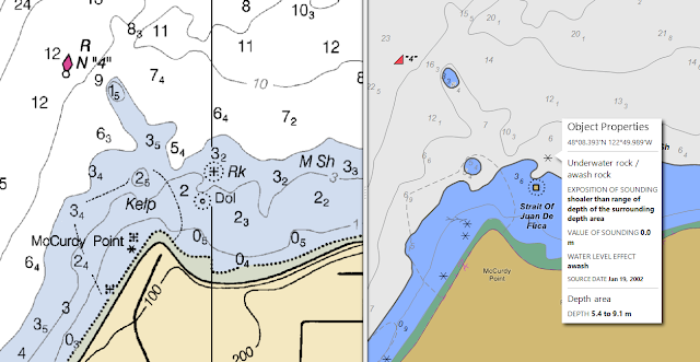
From paper charts to Electronic Navigational Charts (ENC) - - View online nautical charts / Cartes marines consultables en ligne
- - Printable nautical charts / Cartes marines imprimables
- - Raster Navigational Charts - RNC / Cartes marines matricielles- CMM
- - Inland Electronic Navigational Charts - IENC / Cartes électroniques de navigation intérieure - CENI
- - Electronic Navigational Charts - ENC / Cartes électroniques de navigation - CEN
View online nautical charts / Cartes marines consultables en ligne
- Worldwide / Mondiale - ENC (Navionics/Italy)
- Worldwide / Mondiale - ENC & OSM (C-Map/Norway)
- Worldwide / Mondiale - ENC (C-Map/Norway)
- Worldwide / Mondiale - ENC (SVB/Germany)
- Worldwide / Mondiale - NGA RNC, Chart by Chart (NGA-Nautical Charts Online/USA)
- Worldwide / Mondiale - ENC (Gps Nautical Charts-Bist LLC/USA)
- Europe, USA East coast, Bahamas & Caribbean Sea / Europe, côte est des États-Unis, Bahamas & mer des Caraïbes - Web App (NV charts/Germany)
- MesoAmerican and Caribbean Sea / Méso-Amérique et mer des Caraïbess - ENC (MACHC/IHO)
- Scandinavia / Scandinavie - ENC (enrio/Sweden)
- Argentina / Argentine - ENC (SHN, Argentina)
- Australia / Australie - ENC - Click on the four windows icon and on the ENC icon (AHO/Autralia)
- Australia / Australie - ENC Navionics - Click on "Nautical Chart" (MAST/Autralia)
- Belgium / Belgique - Simplified ENC - (VH/Belgium)
- Brazil/Brésil - ENC (Aqua Map/Italy)
- Croatia / Croatie - For list of layers select "Male karte v2" (HHI/Croatia)
- Denmark / Danemark - ENC (krak-eniro/Sweden)
- Estonia / Estonie - ENC - (Veeteede Amet/Estonia)
- Greece / Grèce - ENC (HNHS/Greece)
- Finland / Finlande - RNC and ENC (TRAFICOM/Finland)
- France & overseas / France et outre-mer - RNC and ENC charts (SHOM/France)
- France & overseas / France et outre-mer - Carte littorale du Géoportail (SHOM-IGN/France)
- France / France - NV charts coverage (Voiles et Voiliers/France)
- Iceland / Islande - RNC (ICG-HD/Iceland)
- New Zealand / Nouvelle-Zélande - RNC, by chart sets (LINZ/New Zealand)
- New Zealand / Nouvelle-Zélande - RNC, chart by chart (LINZ/New Zealand)
- New Zealand / Nouvelle-Zélande (Aqua Map/Italy)
- Norway / Norvège - RNC and ENC (Kartverket sjødivisjonen/Norway)
- Norway / Norvège - ENC (Gulde Sider-eniro/Sweden)
- Norway / Norvège - NHS RNC, Chart by Chart (Nautical Charts Online/USA)
- United Kingdom & Ireland / Royaume-Uni et Irlande - RNC harbours only (Visit My Harbour/UK)
- United Kingdom & Ireland / Royaume-Uni et Irlande - RNC medium scale (HARBOURGUIDES.com/UK)
- Ukraine / Ukraine - ENC (SHSU/Ukraine)
- Spain / Espagne - Geoportal de la Infraestructura de datos espaciales (IHM/Spain)
- Sweden / Suède - Tjänsterna i kartvisaren (Sjöfartsverket/Sweden)
- Sweden / Suède - ENC (enrio/Sweden)
- United States of America / États-Unis d'Amérique - Paper/RNC, Select chart from map (OCS-NOAA/USA)
- United States of America / États-Unis d'Amérique - Paper/RNC, Select chart from list (OCS-NOAA/USA)
- United States of America / États-Unis d'Amérique (Aqua Map/Italy)
- Australia / Australie - ENC Navionics - Click on "Nautical Chart" (MAST/Autralia)
Printable nautical charts / Cartes marines imprimables
- Australia / Australie : New South Wales - Boating maps, PDF files (Transport for NWS/Australia)
- Australia / Australie : Queensland - PDF files (Maritime Safety Queensland/QLD-Australia)
- Australia / Australie : Western Australia - PDF files (Department of Transport/WA-Australia)
- Arctic / Arctique - PDF files (NGA/USA)
- Bahamas / Bahamas - Overview chart, 2010 (Landfall-Explorer Chartbooks/USA)
- China / Chine - Medium resolution scan - JPEG files (MSA/China)
- France / France : Cartes marines Zonex - PDF & JPEG files (INSU-CNRS/France)
- Haiti / Haïti - Haiti's BookletCharts from NGA charts (NGA-NOAA/OCS-IHO/MACHC)
- New Zealand / Nouvelle-Zélande - TIFF files (LINZ/New Zealand)
- Norway / Norvège : For teaching and exercises - PDF (Kartverket/Norway)
- Saudi Arabia / Arabie Saoudite - Red Sea, King Abdullah Port, 4 JPEG files (GEOSA/Saudi Arabia)
- Slovenia / Slovénie - Adriatic Sea, Bay of Koper, 1: 15 000 - GIF file (GIS/Slovenia)
- United States of America / États-Unis d'Amérique - Paper/RNC, PDF files, Select chart from map (OCS-NOAA/USA)
- Venezuela / Vénézuéla - Medium to high resolution - PNG files (SHN/Venezuela)
- Worldwide / Mondiale : Atlas of Pilot Charts - PDF files (NGA/US)
- Italy / Italie : Atlante della correnti superficiali dei mari italiani - PDF file (IIM/Italy)
- Brazil / Brésil : Atlas de Cartas Piloto - PDF files (CHM/Brazil)
Raster Navigational Charts - RNC (georeferenced digital images) / Cartes marines matricielles - CMM (fac-similés numériques géoréférencées)
- Brazil / Brésil (CHM/Brazil)
- New Zealand / Nouvelle-Zélande (LINZ/New Zealand)
- Peru / Pérou (DHN/Peru)
- Peru, Amazon River / Pérou, fleuve Amazone (DHN/Peru)
- United States of America / États-Unis d'Amérique - Select chart from map (OCS-NOAA/USA)
- United States of America / États-Unis d'Amérique - Charts upload by area (OCS-NOAA/USA)
- Worldwide / Mondiale : Atlas of Pilot Charts - Conversion by OpenCPN (NGA/US
- Georeferenced Raster Images - MBTiles and other formats (OpenCPN)
- Mexico, French Polynesia & South Pacific / Mexique, Polynésie française & Pacifique Sud - Chart Locker (Migrations)
- Brazil / Brésil (CHM/Brazil)
Inland Electronic Navigational Charts - IENC / Cartes électroniques de navigation intérieure - CENI
- Belgium / Belgique - Scheldt River Region / Région de l'Escaut (VTS-Scheldt/Belgium-Netherlands)
- Belgium / Belgique - Scheldt River Region / Région de l'Escaut (EuRIS/Belgium-Netherlands)
- Brazil / Brésil (CHM/Brazil)
- Netherlands / Pays-Bas - Costal areas / Zones côtières (Vaarweginformatie/Netherlands)
Electronic Navigational Charts - ENC (vectors) / Cartes électroniques de navigation - CEN (vectorielles)
- ECDIS – Guidance for Good Practice (IMO)
- ECDIS - APN, volume I, chapter 5 (NGA/USA)
- Over-scaling: Guidance on the proper display scale (NGA/USA)
- Information on ENC Generalization, Over-Scaling and Safety Checking Functions in ECDIS (IHO)
- Mariners’ Guide to Accuracy of Depth Information in ENC - S-67 (IHO)
- Accuracy of Depth Information in ENC - AHP20, chapter 13 (AHO/Australia)
- Electronic Navigation Systems - Guidance for safe use on leisure vessels (RIN/UK)
- Notes on Electronic Chart Navigation (David Burch Blog/Starpath)
- ECDIS - Guide de bonnes pratiques (IMO)
- Sivce - Guía De Buenas Prácticas (IMO)
- New Zealand / Nouvelle-Zélande - Need to register and a S-63 UserPermit (LINZ/New Zealand)
- United States of America / États-Unis d'Amérique - Select chart from map (OCS-NOAA/USA)
- United States of America / États-Unis d'Amérique - Charts upload by area (OCS-NOAA/USA)
- South China Sea - Scale 1:700.000 (EAHC)
- Link to free nautical charts: OpenCPN
II-2 - Other Nautical Documents / Autres documents nautiques
Chart Legend / Légende des cartes marines
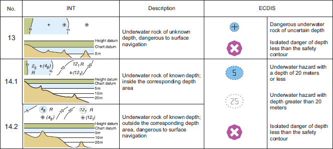
- Chart 1 : Symbols, Abbreviations and Terms (CHS/Canada)
- Chart 5020: Symbols and abbreviations used on charts (INHD, India)
- U.S. Chart No. 1, Symbols, Abbreviations and Terms used on Paper and Electronic Navigational Charts (NGA-NOAA/USA)
- U.S. Chart No. 1, Symbols, Abbreviations and Terms used on Paper and Electronic Navigational Charts (NOAA-NGA/USA)
- Carte n° 1 : Signes conventionnels, abréviations et termes (SHC/Canada)
- Symboles, abréviations et termes utilisés sur les cartes marines (SHOM/France)
- Símbolos, Abreviaturas y Términos Usados en las Cartas Náuticas Chilenas (SHOA/Chile)
- Carta 1 : Símbolos, abreviaturas y términos usados en las cartas náuticas (DIGAOHM/Mexico)
- INT1 – Tekens, Afkortingen, Begrippen voorkomend op Zeekaarten / INT1 - Symbols, Abbreviations, Terms used on Charts (Flemish Hydrography/Belgium)
- Kort 1 • INT 1: Symbols, abbreviations and terms used on charts / Symboler, forkortelser og begreber i søkort (GST/Denmark)
- Jūras navigācijas karšu simboli un saīsinājumi / Symbols and Abbreviations on Latvian Navigational Charts (Maritime Administration/Latvia)
- 香港海圖一號 / Hong Kong Chart 1 (HKHO/China-Hong Kong)
ENC Symbols
- U.S. Chart No. 1, Nautical Chart Symbols, Abbreviations and Terms (NOAA-NGA/USA)
- Description of symbols for use on ECDIS - S-52, Annex A (IHO)
- Przewodnik w zakresie symboli, znaków i terminologii stosowanych w ENC i ECDIS - Numer katalogowy 540 (BHMW/Poland)
Fact About Electronic Charts / Faits sur les cartes numériques (S-66)
International Code of Signals / Code international de signaux
- International Code of Signals - Pub 102, 1969, revised 2020 (NGA/USA)
- Code international de signaux - Ouvrage n°32, 1996 (SHOM/France)
Collision Regulations (COLREGS)/ Règlement sur les abordages (RIPAM)
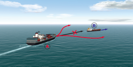
Overtaking, Action by Give-way Vessel - Rules 13 and 16
Navire qui en rattrape un autre - Règles 13 et 16- Collision at Sea (AustLII/Australia)
- Prevention of collisions (ComLaw/Autralia)
- Collision Regulations (Department of Justice/Canada)
- The Merchant Shipping (Distress Signals and Prevention of Collisions) Regulations 1996 - Update 2004 (MCA/United Kingom)
- USCG Navigation Rules and Regulations Handbook (USCG/USA)
- Convention on the International Regulations for Preventing Collisions at Sea - COLREGS (Admiralty and Maritime Law Guide)
- Règlement sur les abordages (Ministère de la Justice/Canada)
- Règlement international pour prévenir les abordages en mer, RIPAM 1972 (SHOM/France)
- Règlement international pour prévenir les abordages en mer, COLREG 72 (Ministère de la Mer/France)
- Convenio Sobre el Reglamento Internacional Para Prevenir los Abordajes, COLREG (DIRECTEMAR/Chile)
- Convenio sobre Reglamento Internacional para Prevenir los Abordajes, COLREG (DIMAR/Colombia)
- Convenção Sobre o Regulamento Internacional para Evitar Abalroamentos no Mar, COLREG 1972 - PDF (Salvamar-Marinha/Brazil)
- 1972 年国际海上避碰规则公约 (MSA/China)
- O izbjegavanju sudara na moru - HTML (Narodne novine/Croatia)
- Internationale søvejsregler - HTML (Retsinformation/Denmark)
- Rahvusvahelise laevakokkupõrgete vältimise eeskirja konventsioon - HTML (Riigi Teataja/Estonia)
- Internationale Regeln von 1972 zur Verhütung von Zusammenstößen auf See (Kollisionsverhütungsregeln - KVR) - Auch PDF (WSV/Germany)
- Pravila o izogibanju trčenju na morju - HTML (GIS/Slovenia)
- Denizde Çatışmayı Önleme Tüzüğü - HTML (Mevzuat/Turkey)
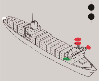
Vessel not under command - Rule 27a
Navire non maître de sa manoeuvre - Règle 27a
Maritime Security / Sûreté maritime
Mariners are warned to be extra cautious and to take necessary precautionary measures when transiting the following areas:
South East Asia and Indian Sub-Continent, Africa and Red Sea, South and Central America and the Caribbean Waters.
Vessels are encouraged to send regular position reports on these areas.
Always report all actual, attempted or suspicious piracy and armed robbery incidents occurring anywhere.- Maritime Security and Piracy: Information and related links - IMO
- Guidance about Maritime Security - IMO
- Guidance to shipowners and ship operators, shipmasters and crews on preventing and suppressing acts of piracy and armed robbery against ships - MSC.1/Circ.1334, IMO (2009)
- Revised interim guidance to shipowners, ship operators and shipmasters on the use of privately contracted armed security personnel on board ships in the High Risk Area - MSC.1/Circ.1405/Rev2, IMO (2012)
- ...
- Global Counter Piracy Guidance for Companies, Masters and Seafarers - BIMCO & alt. (2018)
- NCAGS Guide to Owners, Operators, Masters and Officers - ATP-02.1, NATO (2014)
- Interim guidance for UK flagged shipping on the use of armed guards - UK DfT (2011)
- Piracy Information - NGA, USA
- Maritime security information - Office of Maritime Security, MARAD, USA
- Overview of the U.S. Maritime Advisory System - Maritime security resources, websites, and information - U.S. Maritime Advisory 2023-007, MARAD, USA (2023)
- MSCI portal: U.S. Maritime Alert - U.S. Maritime Advisory - MARAD, USA
- Security Related Information to Mariners - UKHO
- Coronavirus disease (COVID-19) - IMO
- Operational considerations for managing COVID-19 cases/outbreak on board ships - WHO
- Notice to the Master on Recommended Measures to Address COVID-19 Risks on Board - MSA, China
- Guidance on the prevention and control of COVID-19 on board(Version 4.0) - MSA, China
- Coronavirus Disease 2019 Guidance for Ships - CDC, USA
- Coronavirus (COVID-19) - Guidance for Ship Operators for the Protection of the Health of Seafarers - ICS
- 船舶船员新冠肺炎疫情防控操作指南(V4.0) - 中华人民共和国海事局
- 船舶船员新冠肺炎疫情防控操作指南 (V1.0) - 中华人民共和国海事局
- Pandémie de COVID-19 - IMO
- Maritime cyber risk: Information and related documents - IMO
- Guidelines on Maritime Cyber Risk Management - MSC-FAL.1/Circ.3, IMO (2017)
- The Guidelines on Cyber Security onboard Ships - Second edition - BIMCO, ICS & alt. (2017)
- Guidelines: Cyber security of a ship - French Maritime Affairs (2016)
- Cyber security library for shipping - SAFETY4SEA (2018)
- Code of practice: cyber security for ships - UK MCA & alt. (2017)
- Worldwide-Maritime Port Vulnerabilities: Foreign Adversarial Technological, Physical, and Cyber Influence - U.S. Maritime Advisory 2023-009, MARAD, USA (2023)
- Cyber sécurité du navire : Évaluer et protéger, renforcer, bonnes pratiques, synthèse - Affaires Maritimes, France (2017)
- Guide des bonnes pratiques de sécurité informatique à bord des navires - DAM & ANSSI, France (2016)
- Various-GPS Interference & AIS Spoofing - MSCI Advisory 2023-005 - US Maritime Administration (2023)
- Assessing Vulnerability Of Transportation Infrastructure Relying on Global Positioning System - DOT, USA (2001)
- The Impact of GPS Jamming on the Safety of Navigation - GLA, UK (2008)
- GPS Jamming and the Impact on Maritime Navigation - GLA, UK (2009)
- GPS Jamming and its impact on maritime navigation - Presentation - GLA, UK (2010)
- GPS spoofing: What’s the risk for ship navigation? - Ship Technology (2019)
- How to steal a ship: GPS vulnerability & maritime - Presentation - RTNF (2019)
- Improving the Operation and Development of GPS Equipment Used by Critical Infrastructure - DHS S&T, USA (2017)
- Responsible Use of GPS for Critical Infrastructure - Presentation - DHS/HSSEDI, USA (2017)
By Geographical Area / Par zone géographique
Security Charts / Cartes de sûreté
- Indian Maritime Safety & Security Chart (Chart 5010) - INHD, India (2021)
- Carte de sûreté dans le Golfe de Guinée (MDAT-GoG) - SHOM, France (2017)
- Carta de seguridad marítima para el mar Rojo, golfo de Adén y mar de Arabia - SEG100, IHM, Spain (2019)
- Carta de seguridad marítima para para el Golfo de Guinea - SEG200, IHM, Spain (2020)
Mediterranean / Méditerranée
- Electronic interference in Mediterranean - Vicinity of Cyprus and the entrance to the Suez Canal - NSC/NATO (2019)
- Threat to commercial shipping in the Mediterranean - NSC/NATO (2020)
- Black Sea and Sea of Azov - Military Combat Operations - U.S. Maritime Advisory 2023-010, MARAD, USA (2023)
Gulf of Guinea / Golfe de Guinée
- BMP West Africa: Best Management Practices to deter piracy and enhance maritime security off the Coast of West Africa including the Gulf of Guinea - BIMCO & alt. (2020)
- Guidelines for Owners, Operators and Masters for Protection against Piracy in the Gulf of Guinea Region - BIMCO & alt. (2016)
- Advice for sailing vessels - Gulf of Guinea - MSCHOA (2018)
- Piracy/Armed Robbery/Kidnapping for Ransom - Gulf of Guinea - U.S. Maritime Advisory 2023-008, MARAD, USA (2023)
Indian Ocean / Océan Indien
- BMP5: Best Management Practices to deter Piracy and enhance maritime safety in the Red Sea, Gulf of Aden, Indian Ocean and the Arabian Sea - One PDF file by section - BIMCO & alt. (2018)
- BMP5: Best Management Practices - One PDF file - UKMTO (2018)
- Threats to Commercial Vessels - Persian Gulf, Strait of Hormuz, Gulf of Oman, Arabian Sea, Gulf of Aden, Bab al Mandeb Strait, Red Sea, and Somali Basin - U.S. Maritime Advisory 2023-011, MARAD, USA (2023)
- Mer Rouge et Golfe d'Aden : Zone de piraterie et routes recommandées - Golfe d'Aden, détroit de Bab El Mandeb - Avis n°23 03-T-08 - SHOM, France (2023)
- Golfe d'Aden et océan Indien : Zone de piraterie et route recommandée - Avis n°23 11-T-12 - SHOM, France (2023)
- Risques de piraterie : Recommandations pour plaisanciers et professionnels de la voile - Océan Indien - Marine Nationale, France (2011)
Asia / Asie
- ReCAAP: Regional Guide to Counter Piracy and Armed Robbery against Ships in Asia - ReCAAP (2016)
- Guidance on Abduction of Crew in the Sulu-Celebes Seas and Waters off Eastern Sabah - ReCAAP (2019)
- Guide for Tankers Operating in Asia Against Piracy and Armed Robbery Involving Oil Cargo Theft - ReCAAP (2015)
- Tub Boats and Barges (TaB) Guide Against Piracy and Sea Robbery - ReCAAP (2013)
- Tips on Avoiding Piracy, Robbery and Theft (Pocket guide) - BIMCO, ReCAAP & IMB (2008)
- Training Videos on Combating Piracy: Vigilance, Risk Assessment, Be Prepared, The Need to Report - RECAAP
Reports and Incidents Maps / Rapports et cartes d'incidents
- Prone Areas and Warnings - ICC/IBM/PRC
- Worldwide Live Piracy Map - ICC/IBM/PRC
- ONI Monthly Worldwide Threat to Shipping (WTS) Reports - Monthly - ONI/US Navy s
- UKTMO weekly-reports for Horn of Africa - UKTMO
- Map of Horn of Africa with Recent Incidents - UKTMO
- Map of Asia with Incident Reports - ReCAAP
Contact Points / Points de contact
- Gulf of Guinea / Golfe de Guinée : MDAT-GoG - +33 2 98 22 88 88 - watchkeepers@mdat-gog.org
- Horn of Africa / Corne de l'Afrique : Report to UKMTO - +44 (0) 2392 222060 - watchkeepers@ukmto.org - https://www.ukmto.org/
Register to MSCHOA - + 33 (0)2 98 220 220 - postmaster@mschoa.org - https://www.mschoa.org/
En cas d'urgence Marine Nationale française - +971 26574102 - alindien-comforeau@imfeau.ae - Asia / Asie : National Contact Points for Asia - Incident Report
General contact for Asia: ReCAAP ISC - +65 6376 3063 - info@recaap.org - https://www.recaap.org/ - Everywhere / Mondial : ICC-IMB-PRC - +60 3 2031 0014 - piracy@icc-ccs.org - https://www.icc-ccs.org/
- Everywhere for GPS / Mondial pour le GPS : GPS Problem Reporting (USCG/USA)
General Information / Généralités
Celestial Navigation / Navigation astronomique
Manuals / Guides
- Navigational Astronomy - PDF - APN, volume I, chapter 13, pages 215-258, 2019 (NGA/USA)
- Instruments for Celestial Navigation - PDF - APN, volume I, chapter 14, pages 259-268, 2019 (NGA/USA)
- The Almanacs - PDF - APN, volume I, chapter 17, pages 291-300, 2019 (NGA/USA)
- Sight Planning - PDF - APN, volume I, chapter 18, pages 301-308, 2019 (NGA/USA)
- Sight Reduction - PDF - APN, volume I, chapter 19, pages 309-331, 2019 (NGA/USA)
- A Short Guide to Celestial Navigation - PDF (Henning Umland's Homepage)
- Celestial Navigation in a Teacup - PDF (Farley/Teacup Navigation)
- Celestial Navigation - Exercises Book - PDF (Iori/NauticalAlmanac)
- Abrégés de navigation astronomique - PDF (Œuvre du Marin Breton/France)
- Cours de navigation astronomique - HTML (Navastro/France)
- Navigation astronomique et calculatrices programmables - View online - P. Posth, 1997 (Navastro/Google Books)
- La navigation astronomique sans peine - P. Chalmeau, 2021 (Skøiern/France)
- Fundamentos da navegação astronômica - HTML (Reis/Tecepe)
- Navigazione astronomica - PDF (Iori/NauticalAlmanac)
Nautical Tables / Tables de navigation
- Sight Reduction Tables for Air Navigation, HO-249, Volume 1 (NGA/USA)
- Sight Reduction Tables for Air Navigation, HO-249, Volumes 2 & 3 (NGA/USA)
- Sight Reduction Tables for Marine Navigation, HO-229 (NGA/USA)
- Tables de Dieumegard (Le Diouris)
- Tables de Bataille (Le Diouris)
Nautical Almanach for the Sun (More material)Nautical Almanac / Ephémérides nautiques
- Geocentric Positions of Major Solar System Objects and Bright Stars - HTML (USNO/USA)
- Celestial Navigation Data for Assumed Position and Time - HTML (USNO/USA)
- The Air Almanac - PDF (USNO/USA)
- The Air Almanac 2023 - PDF (USNO/USA - TheNauticalAlmanac.com)
- Sun Almanac - PDF (Backbearing)
- Nautical Almanacs - PDF (NavSoft)
- Navigator Nautical Almanac 2022 - PDF (Reis/Tecepe)
- The Online Nautical Almanac - HTML (Reis/Tecepe)
- The Nautical Almanac - XLS & PDF (Iori/NauticalAlmanac)
- Nautical Almanac - PDF (Ruiz/Navigational Algorithms)
- Online Nautical Almanac - HTML (Reed Navigation)
- The Nautical Almanac - PDF (Rodegerdts/INUA)
- TheNauticalAlmanac.com - PDF (CelNav57-Rodegerdts/INUA)
- Astron Almanac Page - Click on Almanac - HTML (Vigilance of Brixham)
- Éphémérides nautiques abrégées - PDF (Navastro)
- Éphémérides Nautiques - XLS & PDF (Iori/NauticalAlmanac)
- Suplemento al Almanaque Náutico y Aeronáutico (Supl.H-225) - PDF (SHN/Argentina)
- Complete Sun and Moon Data for One Day - Civil twilight, sunrise, transit, sunset - HTML (USNO/USA)
- Sun and Moon Data for an Entire Year - Sunrise/Sunset or Moonrise/Moonset or Twilight Times - HTML (USNO/USA)
- Compute Sunrise, Transit, Sunset and Twilight Times - HTML (GA/Australia)
- The UK Air Almanac (AP 1602) - Sunrise/sunset or transit, sunset... - PDF (UKHO/UK)
Star Chart / Carte du ciel
- Navigational Star Chart - PDF (USNO/USA)
- List of selected stars for navigation - HTML (Wikipedia)
- Les étoiles du marin - PDF (Navastro)
- Carte du ciel - PDF (Caramel)
- Navigator Star Finder - For chart select "Printer friendly" (Reis/Tecepe)
- Astron Sight Planner and Sky Chart - Click on Planner - HTML (Vigilance of Brixham)
- Star finder for celestial navigation - XLS file (Iori/NauticalAlmanac)
Celestial Calculators / Calculatrices astronomiques
- ASTRON: Integrated Astro Navigation Software - Also User notes (Vigilance of Brixham)
- MSO Celestial Navigation Calculators (NGA/USA)
- Starpath Celestial Navigation (Starpath/USA)
Software / Logiciel
- Navastro - Windows (Ravet & Cazaux)
- TeacupNav - Windows (Farley/Teacup Navigation)
- AstroNavigation - Windows (Ruiz/Navigational Algorithms)
- XEphem - Linux/Unix (Downey/CSI)
- MSI Celestial Navigation Calculators (NGA/USA)
- Efemérides - Windows (SHN/Argentina)
- Interactive Spreadsheets for Celestial Navigation - XLS files (Pmh099/USA)
- Spreadsheet for Nautical Astronomyb - XLS files (Iori/NauticalAlmanac)
- Navigational Astronomy - PDF - APN, volume I, chapter 13, pages 215-258, 2019 (NGA/USA)
Ice Navigation / Navigation dans les glaces
General Information / Généralités
- Manual of ice seamanship - Pub. No.551, 1950 (U.S. Hydrographic 0ffice/USA)
- U.S. Navy Cold Weather Handbook for Surface Ships - 1988 (US Navy/USA)
- Ice Navigation - APN, volume I, chapter 32, pages 495-524, 2019 (NGA/USA)
- Polar Navigation - APN, volume I, chapter 33, pages 525-552, 2019 (NGA/USA)
- NGA Arctic Support (NGA/USA)
- Polar Yacht Guide:
Guidance to pleasure yachts (RCCPF/UK)
- Sailing Directions: Arctic Ocean (Planning Guide) - Pub. 180 (NGA/USA)
- Sailing Directions: General Information, Northern Canada - ARC 400E (CHS/Canada)
- Naval Arctic Manual - ATP-17(C), 2007 (NATO)
- Artic Marine Weather Guide - HTML version, 2017 (ECCC/Canada)
- Artic Marine Weather Guide - PDF file, 2017
- Arctic Climatology - HTMl files, 2015 (MMD-NRL-US Navy/USA)
- The Arctic Forecaster's Handbook - HTML files, 2014 (MMD-NRL-US Navy/USA)
- Sailing Directions: Antarctica (Planning Guide and Enroute) - Pub. 200 (NGA/USA)
- International Antarctic Weather Forecasting Handbook - PDF file, 2004 (BAS et al.)
- International Antarctic Weather Forecasting Handbook - HTML version with supplements, 2008
- Instructions nautiques : Renseignements généraux, Nord canadien - ARC 400F (SHC/Canada)
- Guide de météo marine pour l’Arctique - HTML version, 2017 (ECCC/Canada)
- Guide de météo marine pour l'Artique - PDF file, 2017
- ЛЕДОВЫЕ УСЛОВИЯ ПЛАВАНИЯ В ЮЖНОМ ОКЕАНЕ - ВМО/ТД- No. 783, 1996 (WMO)
- Dinamiche della copertura glaciale artica e rotte di navigazione (IIM/Italy)
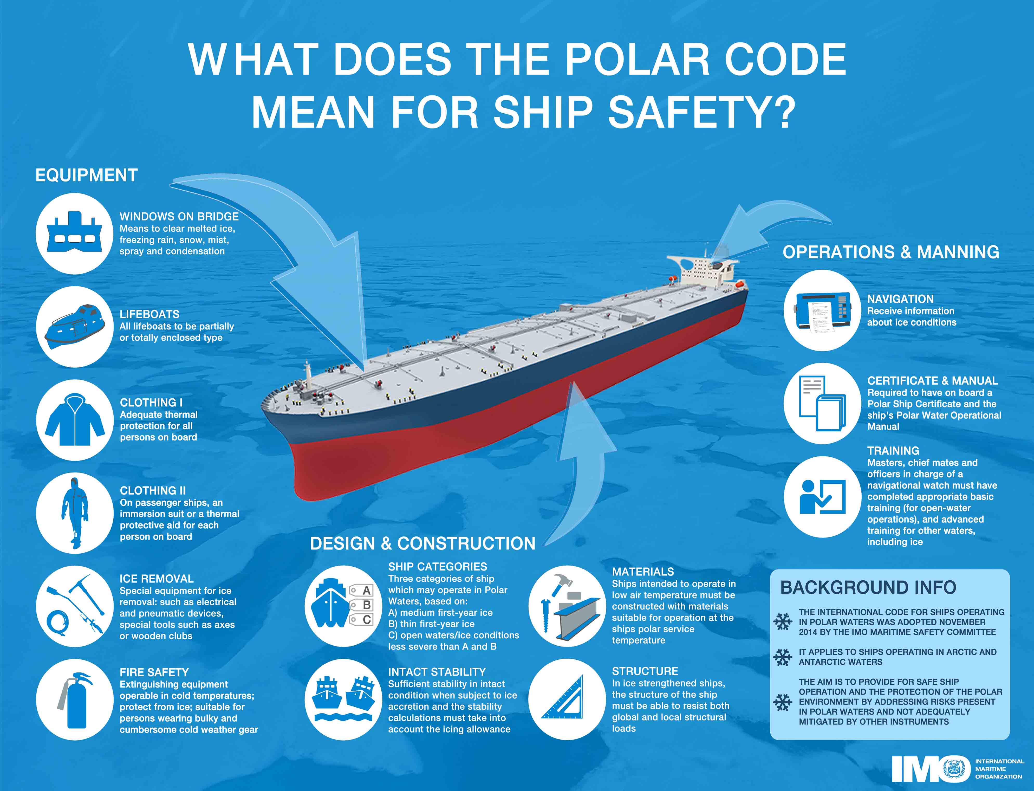
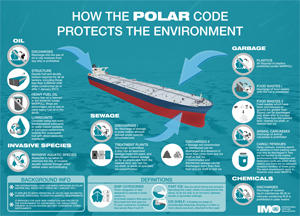
Polar Code: Shipping in polar waters (IMO)IMO & IALA / OMI & AISM
- Shipping in polar waters: In focus - Html and Pdf (IMO)
- Polar Code: International Code for Ships Operating in Polar Waters - MEPC 68/21/Add.1 Annex 10: Resolution MEPC.264(68), 2015 (IMO)
- Guidelines for ships operating in polar waters - Resolution A.1024(26), 2010 (IMO)
- Guidelines For Ships Operating in Arctic Ice-Covered Waters - MSC/Circ.1056 MEPC/Circ.399, 2002 (IMO)
- Polar Code Resources: Interpretation, POLARIS, operating envelope, operational assessment, existing ships (LR/UK)
- Providing AtoN Services in Polar Regions - Guideline No. 1108, 2013 (IALA)
- Transports maritimes dans les eaux polaires : En savoir plus (OMI)
- Polar Code : Recueil international de règles applicables aux navires exploités dans les eaux polaires - Recueil sur la navigation polaire, MEPC 68/21/Add.1 Annexe 10: Résolution MEPC.264(68), 2015 (OMI)
- Directives pour les navires exploités dans les eaux polaires - Résolution A.1024(26), 2010 (OMI)
- Código Internacional para los buques que operen en Aguas Polares (Código Polar) - Resoluciones MSC.385(94) y MEPC.264(68), 2015 (DIRECTEMAP-OMI)
Cold Water Survival / Survie en eau froide
- Cold water and hypothermia (NWS/Autralia)
- Guide For Cold Water Survival - MSC.1/Circ.1185/Rev.1, 2012 (IMO)
- Cold Water Immersion - Video (MAST/Autralia)
- Survival in Cold Waters - TP 13822 E, 2003 (Transport Canada)
- Small Vessel Safety Video: Hypothermia - TP 15280 E, 2016 (Transport Canada)
- Cold Injuries Guidelines - 2014 (DHSS-Alaska/USA)
- Cold Water Hazards and Safety - HTML (NWS-NOAA/USA)
- Cold Water Survival - HTML & slidess (Shipwrite Productions/Canada)
- Guide sur la survie en eau froide - MSC.1/Circ.1185/Rev.1, 2013 (OMI)
- La survie en eaux froides - TP 13822 F, 2003 (Transport Canada)
- Vidéo sur la sécurité des petits bâtiments : Hypothermie - TP 15280, 2016 (Transport Canada)
- Guía para la supervivencia en aguas frías - MSC.1/Circ.1185/Rev.1, 2013 (IMO)
- Leitfaden für das Überleben in kaltem Wasser - Rundschreiben MSC.1/Circ.1185/Rev.1, 2012 (IMO)
WMO & Sea Ice / OMM & glace de mer
- WMO Sea-Ice Nomenclature - WMO-No. 259, 2015 (JCOMM/WMO)
- Electronic version of the WMO Sea-Ice nomenclature - English, French, Russian and Spanish versions in alphabetic/subject order, equivalents, search/selection option (WMO/AARI)
- Sea Ice Nomenclature - Linguistic equivalents - English, French, Russian & Spanish - WMO-No. 259 Suppl.No.5, 2009 (WMO)
- Sea-Ice Information Services in the World - WMO-No. 574, 2017 (WMO)
- WMO-IOC JCOMM Sea-Ice Regulatory Documents (JCOMM)
- Ice Chart Colour Code Standard - WMO/TD-No. 1215, 2014 (WMO)
- Nomenclature des glaces de mer - Équivalents linguistiques - En anglais, français, russe et espagnol - WMO-No. 259 Suppl.No.5 (WMO)
  
Interpreting ice charts : colour code & egg code |
- Quick facts, basic science, and information about snow, ice: Ice sheets, ice shelves, sea ice, glossary... (NSIDC/USA)
- Interpreting Ice Charts - Egg Code & Colour Code (Environment Canada/Canda)
- WMO ice chart codes: Egg code - Colour code - Symbols (DMI/Danemark)
- Fortolkning af iskort: Ægkoden - Iskoncentrationskoden - Symboler og linier (DMI/Danemark)
- Manual of Standard Procedures for Observing and Reporting Ice Conditions (MANICE) - Manual of Ice, 2005 (Environment Canada/Canada)
- Observers' Guide to Sea Ice - 2007 (NOAA Ocean Service/USA)
- Baltic Sea Ice Code (SMHI/Sweden)
- Interprétation des cartes de glaces - Code de l'œuf & code de couleur (Environnement Canada/Canada)
- Manuel des normes d'observation des glaces (MANICE) - Manuel des glaces, 2005 (Environnement Canada/Canada)
- Newest operational ice charts worldwide (Ice Logistics Portal)
Ice Glossary / Glossaire des glaces
- Ice Glossary (ECCC/Canada)
- Cryosphere Glossary (NSIDC/USA)
- Sea ice Nomenclature: terms and description, many languages (BSIS/Germany)
- Baltic terms I: in English, Dutch, German, Norwegian, Polish and Russian
- Baltic terms II: in English, Danish, Estonian, Finnish, Latvian and Swedish
- Russian Glossary of Sea Ice Terminology (English Edition) (AARI/Russia)
- Glossary of the sea-ice terms: Russian-English - English-Russian
- Ice terms arranged by subject: In English - In Russian
- Glossaire des glaces (ECCC/Canada)
- Ледовые термины, расположенные в тематическом порядке (AARI/Russia)
- Terminología del hielo ordenada alfabéticamente - Nomenclatura de la OMM (SHN/Argentina)
Canada, Alaska & Arctic Northwest Passage / Canada, Alaska & passage arctique du nord-ouest
Sea Ice / Glace de mer
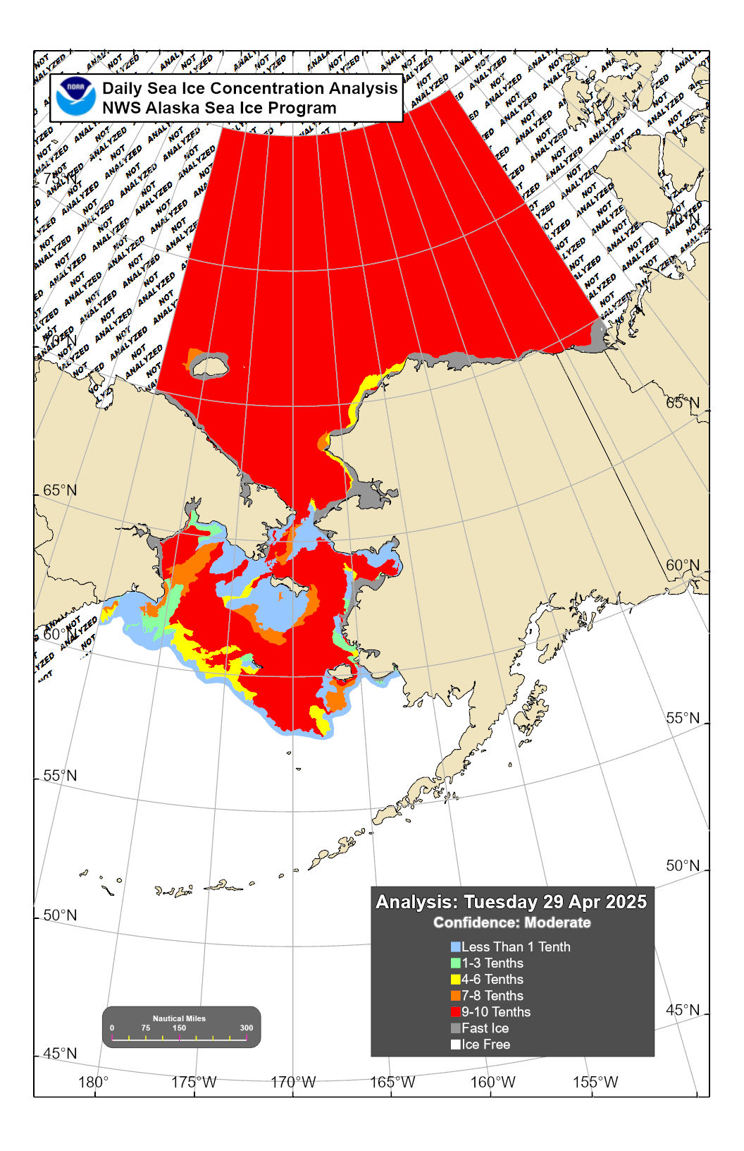 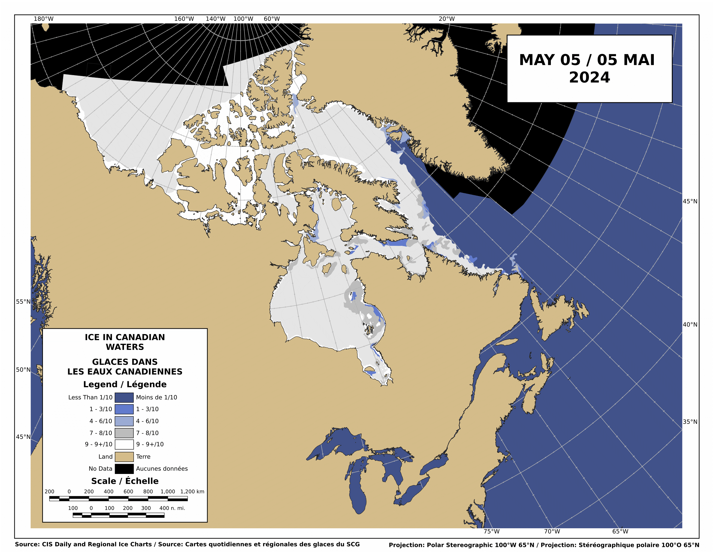 Alaska: Sea Ice Analysis (NWS-NOAA/USA)Ice in Canadian waters (CIS/Canada) |
- Ice Navigation in Canadian Waters - 2012 (Canadian Coast Guard)
- Winter Navigation on the River and Gulf of St. Lawrence - TP 14335 E, 2009 (Transport Canada)
- Arctic Shipping (Transport Canada)
- Arctic Ice Regime Shipping System (AIRSS) Standards - TP 12259 E, 2018 (Transport Canada)
- Arctic Ice Regime Shipping System Pictorial Guide - TP 14044 E, 2003 (Transport Canada)
- Guidelines for the Operation of Passenger Vessels in Canadian Arctic Waters - TP 13670 E, 2017 (Transport Canada)
- Arctic Voyage Planning Guide - AVPG (Canadian Hydrographic Service)
- Artic Marine Weather Guide - HTML version, 2017 (ECCC/Canada)
- Artic Marine Weather Guide - PDF file, 2017
- Icebreaking: Services and information (Canadian Coast Guard)
- Canadian Ice Service - CIS (ECCC/Canada)
- Nautical Charts for Arctic regions - PDF files (NGA/USA)
- Sailing Directions
- Sailing Directions: Arctic Ocean (Planning Guide) - Pub. 180 (NGA/USA)
- U.S. Coast Pilot 9: Alaska from Cape Spencer to Beaufort Sea (OCS-NOAA/USA)
- Sailing Directions: Northern Canada (CHS/Canada)
- Instructions nautiques : Nord du Canada (SHC/Canada)
- Victor Wejer's Periplus to Northwest Passage - PDF file, 2021 (RCCPF/UK)
- Aleutian Islands and the Alaska Peninsula to Prince William Sound - PDF file - Need free account (RCCPF/UK)
- Cruising Notes from SE Alaska to Vancouver Island - PDF file (RCCPF/UK)
- Ice Charts for the Arctic Northwest Passage (Ice Logistics Portal)
- Ice map graphics around Alaska (NWS-NOAA/USA)
- Zoomable ice maps for Alaska waters (NWS-NOAA/USA)
- Great Lakes Ice Analysis (NWS-NOAA/USA)
- North American Ice Service - NAIS (USCG/USA)
- U.S. National Ice Center - USNIC (US Navy-NOAA-USCG/USA)
- Ice products for Canada: Ice and Iceberg Bulletins - Daily Ice Charts - Regional Ice Charts - Iceberg Charts (CIS-ECCC/Canada)
|
|
|
- Produits des glaces pour le Canada : Bulletins des glaces et des icebergs - Cartes quotidiennes des glaces - Cartes régionales des glaces - Cartes des icebergs (SCG-ECCC/Canada)
- Navigation dans les glaces en eaux canadiennes - 2012 (Garde côtière canadienne)
- Navigation hivernale sur le Fleuve et le Golfe du Saint-Laurent - TP 14335 F, 2009 (Garde côtière canadienne)
- Navigation dans l'Arctique (Transports Canada)
- Normes pour le système des régimes de glaces pour la navigation dans l'arctique - SRGNA - TP 12259 F, 2018 (Transports Canada)
- Guide illustré du Système des régimes de glaces pour la navigation dans l’Arctique - TP 14044 F, 2003 (Transports Canada)
- Lignes directrices concernant l'exploitation des navires à passagers dans les eaux arctiques canadiennes - TP 13670 F, 2018 (Transports Canada)
- Guide de planification de navigation en Arctique (GPNA) (Service hydrographique du Canada)
- Guide de météo marine pour l’Arctique - HTML version, 2017 (ECCC/Canada)
- Guide de météo marine pour l'Artique - PDF file, 2017
- Déglaçage : Services et renseignements (Garde côtière canadienne)
- Service canadien des glaces (ECCC/Canada)
- The ice silk road (NMEFC/China)
- 海上丝绸之路 (NMEFC/China)
Iceland, Greenland & Norway / Islande, Groenland et Norvège
- Safety of navigation in Greenland waters (DMA/DK)
- General information regarding Danish, Greenlandic and Faroe waters - EfS A, 2022 (DMA)
- Sea Ice around Iceland (IMO/IS)
- Sailing Directions
- Sailing Directions : Greenland and Iceland (Enroute) - Pub. 181 (NGA/USA)
- Sailing Directions: North and West Coasts of Norway (Enroute) - Pub. 182 (NGA/USA)
- Guidelines for masters of cruise and passenger ships arriving in Iceland (ICG/Iceland)
- Port information guide - Reykjavík, Grundartangi, Akranes and Borgarnes (AIP/Iceland)
- Ice charts for the Greenland waters (DMI/DK)
- Satellite images for the Greenland coasts (DMI/DK)
- Greenland polarview: ice charts (DMI)
- Cryo - Norwegian Ice Service: ice charts (NMI/DK)
- Tide Tables for the Norwegian Coast and Svalbard
- The Arctic World
- Animated ice charts around Greenland
- Ice and Ocean Forecasts
- ArcticInfo: Provides mariners with important information on Arctic conditions (former ArcticWeb)
Baltic Sea / Mer Baltique
- Baltic Sea Ice Services: ice services, ice bulletins, ice charts, ice code...
- Ice Logistics Portal: ice charts (JCOMM)
- Baltice.org: Baltic Icebreaking Management (BIM): AIS ships & icebreakers map, ports & traffic restrictions, ice map...
- Baltic Sea Ice Code (SMHI/Sweden)
- Sailing Directions
- Mariners' Routeing Guide Baltic Sea (web version) - Chart 2911/INT 1200 (GST/Denmark-BSH/Germany)
- Sailing Directions: Skagerrak and Kattegat (Enroute) - Pub. 193 (NGA/USA)
- Sailing Directions: Baltic Sea - Southern Part (Enroute) - Pub. 194 (NGA/USA)
- Sailing Directions: Gulf of Finland and Gulf of Bothnia (Enroute) - Pub. 195 (NGA/USA)
- Finland´s Winter Navigation 2021-22 - Instructions for winter navigation operators (Väylä/Finland)
- Suomen talvimerenkulku 2021-22 (Väylä/Finland)
- Finlands vintersjöfart 2021-22 (Väylä/Finland)
- Зимняя навигация Финляндии 2020-21 (Väylä/Finland)
- Finland´s Winter Navigation : Finnish, Swedish & English 2020-21 - (Väylä/Finland)
- Sweden's Winter Navigation 2021-22 (Sjöfartsverket/Sweden)
- Vintersjöfart 2021-22 (Sjöfartsverket/Sweden)
- Ice map for the Baltic Sea
- Ice map around Danmark - HTML (Danish Navy/Denmark)
- Ice chart of the Baltic Sea - GIF & PDF file (FMI/Finland)
- Ice chart of the Baltic Sea - PDF files (BSH/Germany)
- Ice chart of the Baltic Sea - PDF file (IMGW/Poland)
- Ice chart of the Baltic Sea - PNG file (ЕСИМО/Russia)
- Ice chart of the Baltic Sea - PNG & PDF file (SHMI/Sweden)
- Ice charts for the Baltic Sea (Ice Logistics Portal)
Russia & Arctic Northeast Passage / Russie et passage arctique du nord-est
 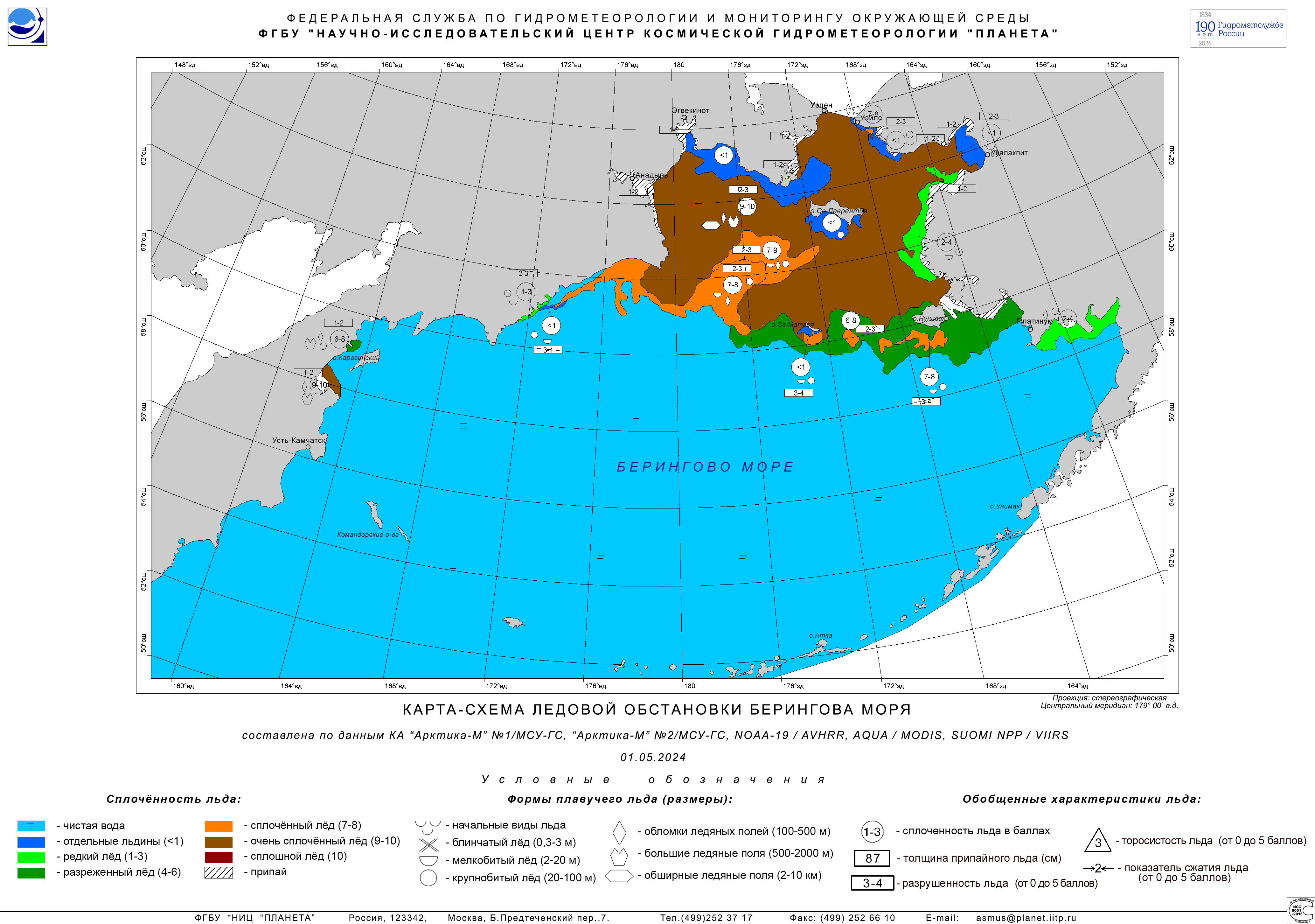 Arctic: Ice Analysis from satellite imagery (AARI/Russia)Bering Sea: Ice cover chart-map (Planeta/Russia) |
- Northern Sea Route General Administration - NSR (NSRA/Russia)
- Главное управление Северного морского пути» (ФГБУ «ГлавСевморпуть») (NSRA/Russia)
- Nautical Charts for Arctic regions - PDF files (NGA/USA)
- Sailing Directions
- Sailing Directions: Arctic Ocean (Planning Guide) - Pub. 180 (NGA/USA)
- Sailing Directions: North Coast of Russia (Enroute) - Pub. 183 (NGA/USA)
- Sailing Directions: East Coast of Russia (Enroute) - Pub. 155 (NGA/USA)
- Arctic Shipping Routes: Analysis of sea ice condition (USNIC/USA)
- Arctic Ocean: Sea ice thickness with Risk Index Outcome (RIO) - For polar classes PC4, PC5 and PC7 (FMI/Finland)
- More information: Polar Class and Risk Index Outcome (RIO)
- Review ice charts for the Arctic Ocean (AARI/Russia)
- Regional ice charts for the Eurasian Arctic, Northern Pacific, Caspian and Baltic Seas (AARI/Russia)
- Ice charts for the Arctic Ocean, Kara Sea, Laptev Sea, East-Siberian Sea and Chukchi Sea (NSR/Russia)
- Ice map for the Barents Sea
- Barents Sea: satellite data (Planeta/Russia)
- Barents Sea: ice concentration (Roshydromet/Russia)
- Barents Sea: ice concentration (Cryo-NIS-NMI/Norway)
- Bartents Sea: Sea ice thickness with Risk Index Outcome (RIO) - For polar classes PC4, PC5 and PC7 (FMI/Finland)
- Southeastern Barents Sea: stage of development (Planeta/Russia)
- White Sea: stage of development (Planeta/Russia)
- Ice map for the Kara Sea
- Kara Sea: Map with type of ice conditions (NSR/Russia)
- Kara Sea: Sea ice forecasts - For 48 hours to 9 days (FMI/Finland)
- Kara Sea: Sea ice thickness with Risk Index Outcome (RIO) - For polar classes PC4, PC5 and PC7 (FMI/Finland)
- Ice map for the Laptev Sea
- Laptev Sea: stage of development (Planeta/Russia)
- Ice map for the Bering Sea
- Bering Sea: ice concentration (Roshydromet/Russia)
- Bering Sea: stage of development (Planeta/Russia)
- Bering Sea: ice concentration, stage & 5 day forecast (NWS-NOAA/USA)
- Ice Charts for the Arctic Northeast Passage (Ice Logistics Portal)
Yellow Sea, Japan Sea and Sea of Okhotsk / Mer Jaune, mer du Japon et mer d'Okhotsk
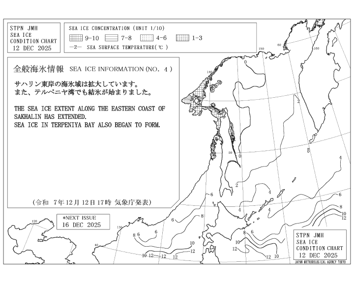
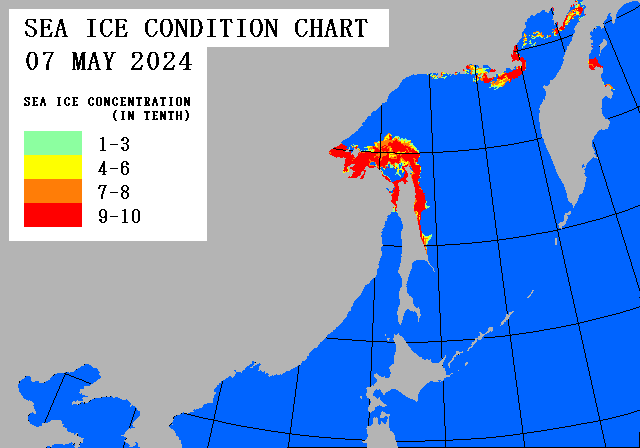 |
- Sailing Directions: Coasts of Korea and China (Enroute) - Pub. 157 (NGA/USA)
- Sailing Directions: Japan - Volume II (Enroute) - Pub. 159 (NGA/USA)
- Ice charts for Hokkaidō island
- Color ice chart & Visual observation (JCG/Japan)
- B&W forecast chart - Day+2 and Day+7 (JMA/Japan)
- 数値海氷予想図
- オホーツク海の海氷解析図 (JMA/Japan)
- 北海道地方海氷情報 (JMA/Japan)
- Ice chart for the Okhotsk Sea, the northern Japan Sea, the northern Yellow Sea and the Bohai Sea
- B&W sea ice information chart (JMA/Japan)
- Latest sea ice condition chart - Daily sea ice condition chart (JMA/Japan)
- オホーツク海、海氷解析図 (JMA/Japan)
- 海道地方海氷情報 (JMA/Japan)
- Ice charts for the Okhotsk Sea
- Okhotsk Sea: ice concentration (Roshydromet/Russia)
- Okhotsk Sea: stage of development (Planeta/Russia)
- Okhotsk Sea: stage of development with analysis (Roshydromet/Russia)
- Okhotsk Sea: details (Planeta/Russia)
- Ice charts for the Okhotsk Sea (Ice Logistics Portal)
- 全般海氷情報 (JMA/Japan)
- Ice charts for the Japan Sea
- Sea of Japan: ice concentration (Roshydromet/Russia)
- Sea of Japan: stage of development (Planeta/Russia)
- Sea of Japan: details (Planeta/Russia)
- Ice charts for the Japan sSea (Ice Logistics Portal)
- Ice chart for the Yellow Sea
Antarctica / Antarctique
Norwegian Ice Service - U.S. National Ice Center - Russian Arctic and Antarctic Research Institute 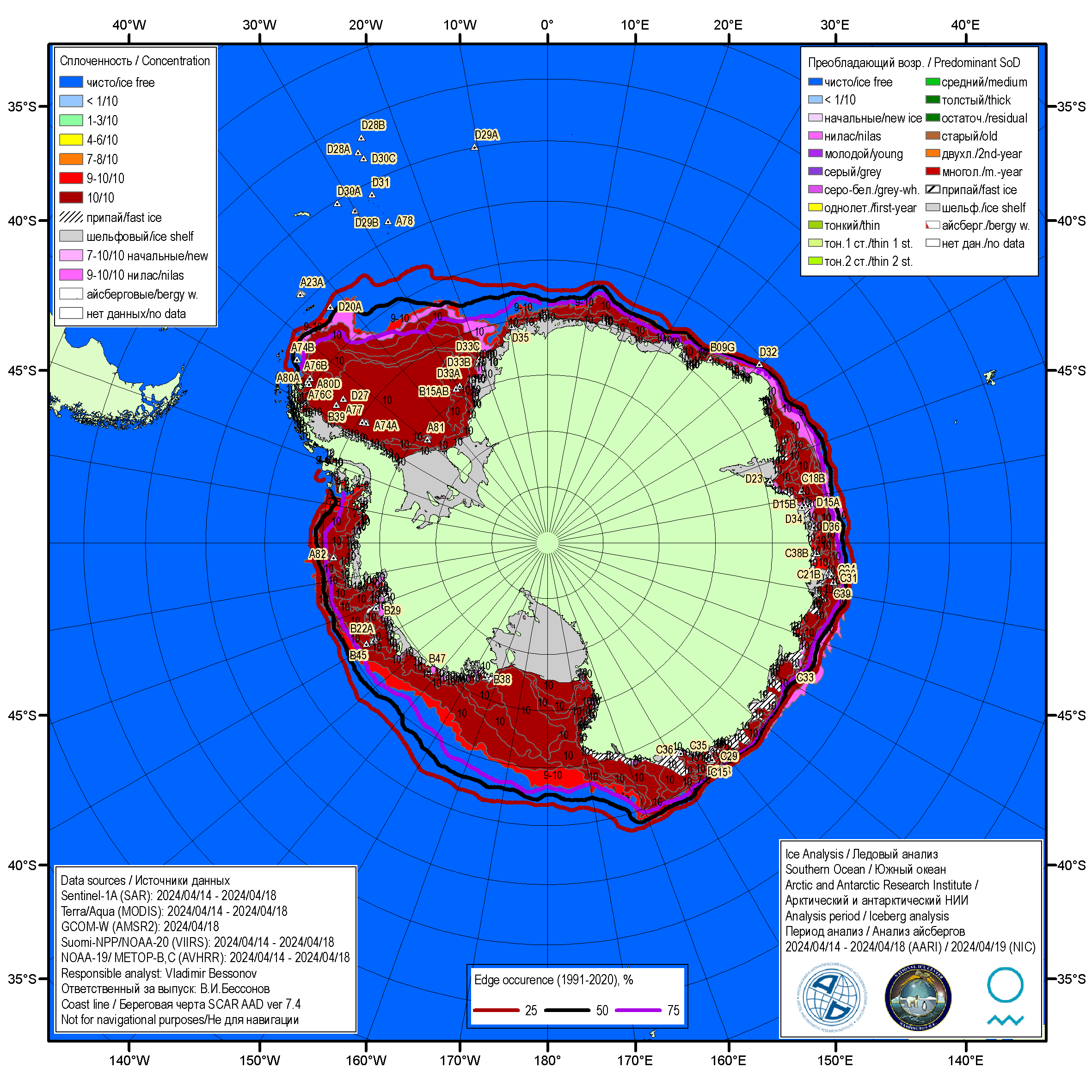 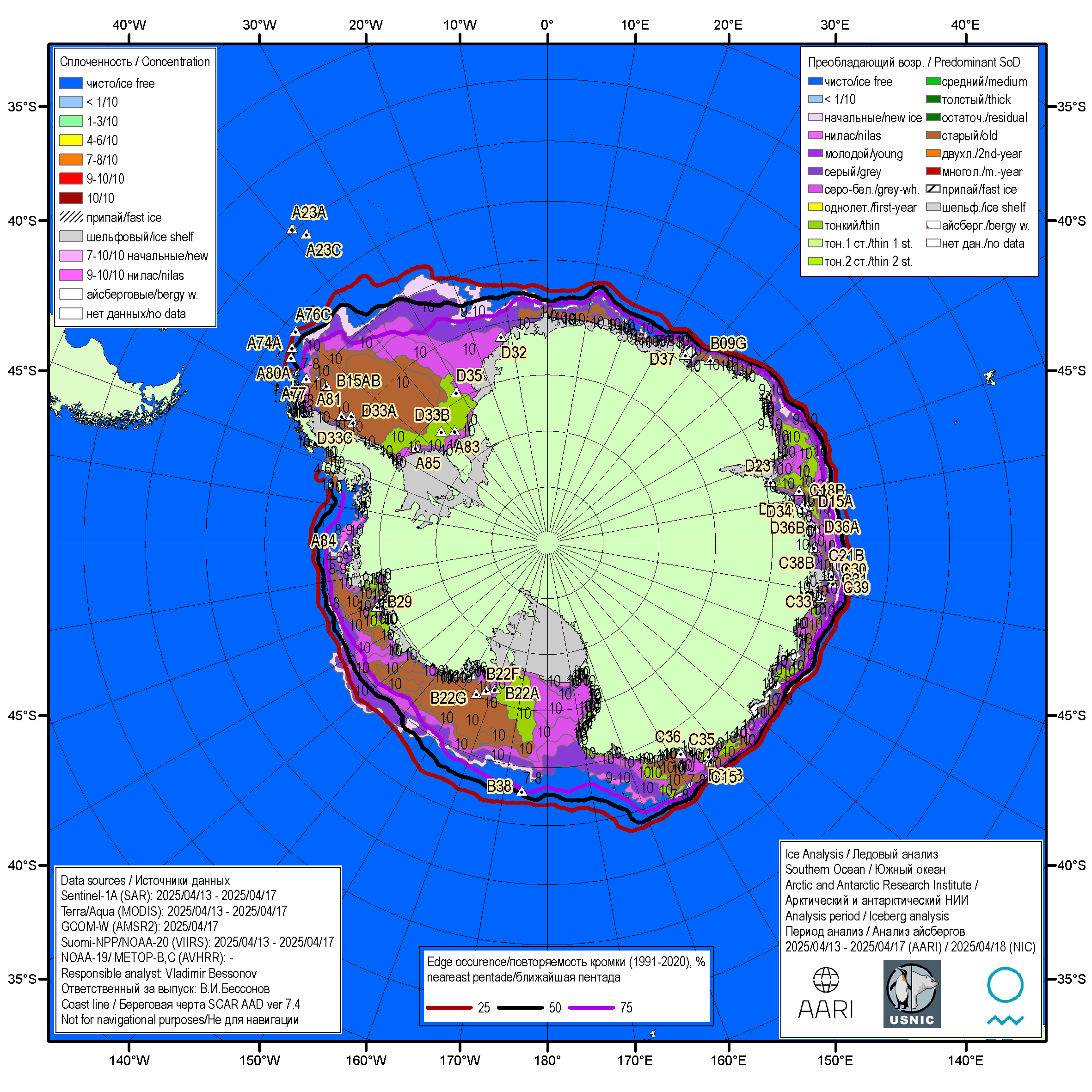 ConcentrationWeekly Antarctic Ice ChartsStage of development |
- Sailing Directions
- Sailing Directions: Antarctica (Planning Guide and Enroute) - Pub. 200 (NGA/USA)
- South Shetland Islands and Antarctic Peninsula - PDF file - Need free account (RCCPF/UK)
- Antarctic Peninsula Compendium - PDF file, 2011 (Oceanites/USA)
- Information on guidelines, preparation and requirements for traveling to Antarctica by yachts (IAATO)
- Yachting guidelines for Antarctic cruises - General Guidelines for Visitors to the Antarctic - Visitor Site Guidelines (ATS)
- Lignes directrices relatives aux yachts pour les croisières en Antarctique - Lignes directrices générales pour les visiteurs de l’Antarctique - Lignes directrices relatives aux sites pour les visiteurs (ATS)
- Directrices para yates relativas a los cruceros antárticos - Directrices generales para visitantes a la Antártida - Directrices para sitios que reciben visitantes (ATS)
- Руководство по плаванию на яхтах в Антарктике - Общее руководство для посетителей Антарктики - Правила поведения для посетителей участков (ATS)
- Antarctica Search and Rescue (SAR): Map with SRRs & RCCs -
Search and Rescue Authorities & Rescue Coordination Centres - SAR Authorities & RCCs (COMNAP)
- Tablas de Marea para la Antártida - HTML (SHN/Argentina)
- Significant Wave Height Forecast for Drake Passage - PDF (SHN/Argentina)

White color: height < 3m (SHN) |
Color blanco: hielo (SMA) |
- Waves Forecast for the Drake Passage up to 120h : Loop File - Slideshow (SMA/Chile)
- International Antarctic Weather Forecasting Handbook - PDF file, 2004 (BAS et al.)
- International Antarctic Weather Forecasting Handbook - HTML version with supplements, 2008
- Información General sobre Hielos en la Antártida : Nomenclatura, Código del Ovalo, Mural, Hielo flotante en el mar, Gruñones (SHN/Argentina)
- Situación Glaciológica en la Antártida: Carta de Témpanos, Carta de Borde de Hielo Marino, Cartas de Hielo, Observaciones Glaciológicas (SHN/Argentina)
- Observaciones de Hielo
- Cartas de Concentracion de Hielo Marino: Pasaje Drake, Islas Orcadas del Sur y adyacencias, Mar de la Flota e islas Shetland del Sur, Canales hasta Isla Belgrano, Bellingshausen y Bahía Margarita, Estrecho Antarctic y Golfo Erebus y Terror, Weddell general, Weddell NW, Weddell Sur
- Ice charts for the Antarctic Peninsula (Tierra de O'Higgins): Antarctic Penninsula (B&W limits), Antarctic Penninsula (concentration), Bransfield Strait, Anvers and Adelaide islands, Margerite Bay (SMA/Chile)
- Ice charts for the Southern Hemisphere (Ice Logistics Portal)
- Collaborative Antarctic Ice Charts (NMI-AARI-USNIC)
- Ice maps: Antarctic, Antarctic Peninsula, Weddell Sea-East, Bransfield Strait, Adelaide Island (Cryo-NIS-NMI/Norway, AARI/Russia &zmp; NIC/USA)
- Ice maps: Antarctica with concentration or stage of development (AARI/Russia, NIS-NMI/Norway & NIC/USA)
- Antarctica: Tabular iceberg analysis (AARI/Russia, NIC/USA & NIS-NMI/Norway)
| | MISC |


L'urgence prime la forme - By Cr - 2012-2024
For updates, corrections, new charts or new documents please send an e-mail to
For my father and my mother / Pour mon père et ma mère


