~ |
Online free nautical charts and publications
open data/open access - libre accès
Cartes marines gratuites et ouvrages nautiques en ligne
 | B |

| D | 
| ||
C
Canada/Canada
Chile/Chili
China/Chine
About Nautical Free
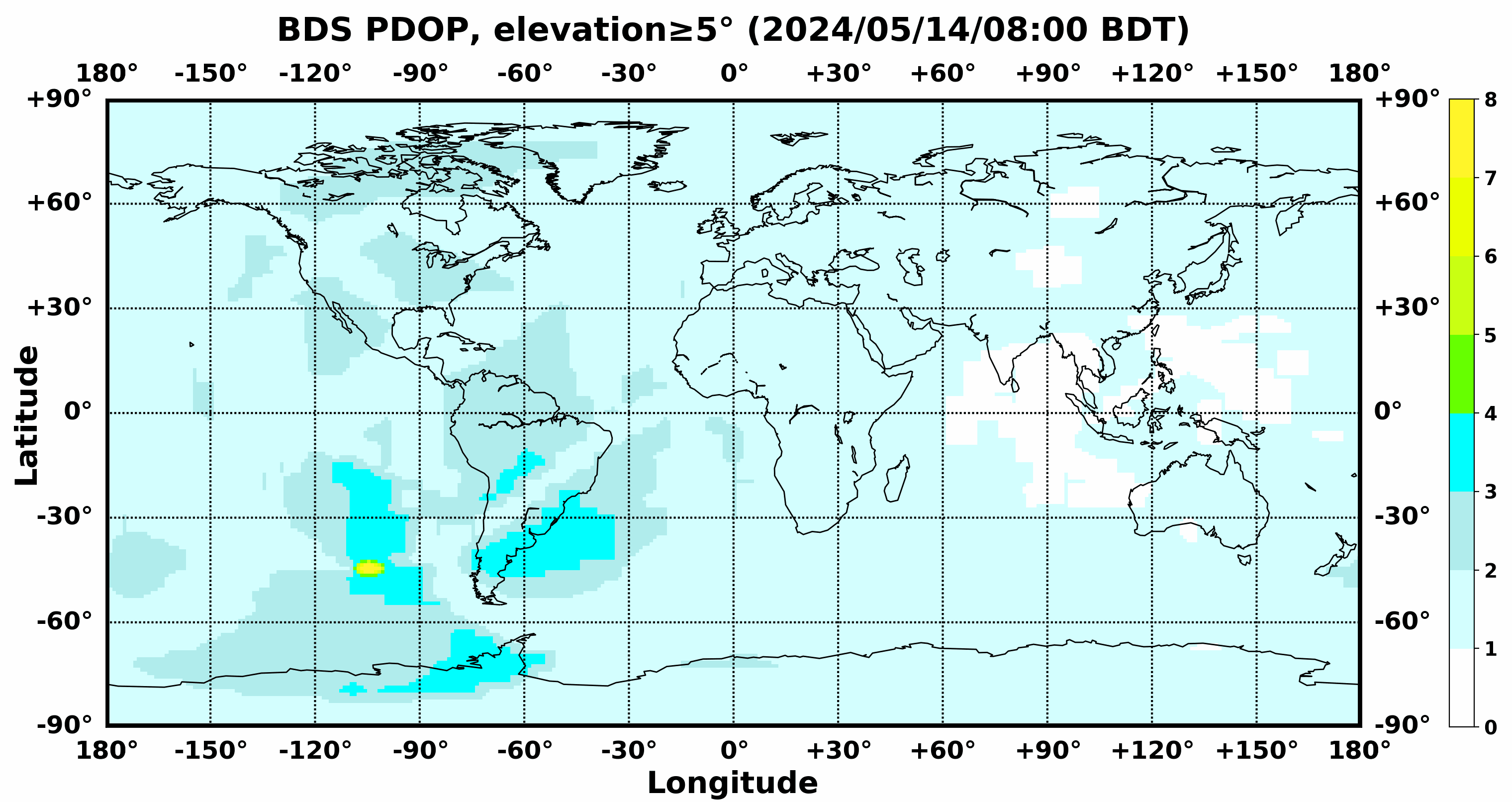
Nautical Free provides a list of free nautical charts and online publications.There is a list by country from letter A to letter V, for each country the organizations and for each organization a list of free online documents (charts, nautical books, notice to mariners...). There is two special lists: one for the international organizations and one for the private companies. There is also a reverse list by type of documents: sailing directions, radio signals, tide tables, nautical charts... You can also find on Nautical Free wave forecast maps for tomorrow, space weather forecast for GPS, how to check your computer clock, as well as information about celestial navigation or about ice navigation...
Au sujet de Nautical Free
Nautical Free fournit une liste de cartes marines gratuites et d'ouvrages nautiques en ligne.Il y a une liste par pays de la lettre A à la lettre V, pour chaque pays les organisations et pour chaque organisation une liste de documents libres en ligne (cartes marines, ouvrages nautiques, avis aux navigateurs...). Il existe deux listes spéciales : une pour les organisations internationales et une pour les sociétés privées. Il existe également une liste inverse par type de documents : instructions nautiques, ouvrages de radiosignaux, tables des marées, cartes marines... Vous trouverez également sur Nautical Free des cartes de prévision de la hauteur des vagues pour demain, des prévisions de la météo de l'espace pour les GPS, comment vérifier l'heure de son ordinateur, ainsi que des informations sur la navigation astronomique ou la navigation dans les glaces...
Advice / Conseils
For navigation use only updated regulatory documents /
Pour la navigation n'utiliser que des documents réglementaires à jour.
GPS is more accurate than nautical charts /
Un GPS est plus précis qu'un carte marine
Web Servers / Serveurs Web
You can use the nearest or faster server / Vous pouvez utiliser le serveur le plus proche ou le plus rapide :
- French mirror with one page by section / Serveur en France avec une page par section : http://nauticalfree.free.fr
- French mirror on one page / Serveur en France sur une page : http://nauticalfree.free.fr/onepage.html
- French mirror without image on one page / Serveur en France sans image sur une page : http://nauticalfree.free.fr/noimage/
- US mirror with one page by section / Serveur au États-Unis avec une page par section : http://nauticalfree.eu5.org
- US mirror on one page / Serveur au États-Unis sur une page : http://nauticalfree.eu5.org/onepage.html
- US mirror without image on one page / Serveur au États-Unis sans image sur une page : http://nauticalfree.eu5.org/noimage/
- US mirror on seven pages / Serveur au États-Unis sur sept pages : https://sites.google.com/site/nauticalfree/
Caption / Légende
- The nautical books are in standard fonts / Les ouvrages sont en caractères droits
- In Italic the maps and the charts / Les cartes sont en italiques
- The last item for an organization is the Notices to Mariners. The first issue of each year is often a special publication /
La dernier item pour un service hydrographique est un lien vers les avis au navigateurs. Le premier numéro de chaque année est souvent un numéro spécial
- Raster Navigational Charts (RNC)
- Bitmap electronic images of paper charts that conform to IHO standard S-61 /
Carte marine matricielle, fac-similé numérique d'une carte papier (scan) conforme à la norme de l'OHI S-61 - Electronic Navigational Charts (ENC)
- Vector charts that conform to IHO standard S-57 /
Carte électronique de navigation, carte vectorielle conforme à la norme de l'OHI S-57
|
|
Cartes marines gratuites et ouvrages nautiques en ligne : Canada, Chili, Chine, Colombie et Croatie
C
- Canada / Canada
- Chile / Chili
- China / Chine
- China - Hong Kong / Chine - Hong Kong
- Colombia / Colombie
- Croatia / Croatie
Canada / Canada
- Service hydrographique du Canada (SHC)
- Canadian Hydrographic Service (CHS)
- Garde côtière canadienne (GCC)
- Canadian Coast Guard (CCG)
- Environnement et Changement Climatique Canada : Météo Maritime
- Environment and Climate Change Canada : Marine Weather
- Transport Canada : Transport maritime
- Transport Canada: Marine Transportation
- Canadian Power and Sail Squadrons (CPS)
- Escadrilles canadiennes de plaisance (ECP)
Service hydrographique du Canada (SHC)
- Catalogues des cartes marines
- Catalogue PDF en 4 parties : 1 Côte atlantique - 2 Côte pacifique - 3 Ontario et Manitoba, incluant les Grands Lacs - 4 Arctique
- Catalogue graphique : papier, BSB et CÉN
- Liste des cartes marines en papiers
- Listes de cartes électroniques : Liste des cartes marines matricielles (CMM BSB) - Cartes électroniques de navigation (CÉN S-57)
- Listes de prix : Liste de prix des cartes papiers - Liste de prix des cartes électroniques
- Catalogues des publications nautiques
Ces produits connexes des cartes marines sont indispensables pour assurer votre sécurité en mer. Également la liste de prix des publications nautiques.
- Carte n° 1 : Signes conventionnels, abréviations et termes
La Carte n° 1 comprend la liste des signes conventionnels, abréviations et termes utilisés dans les cartes marines publiées par le Service hydrographique du Canada (SHC), conformément au Règlement de l’OHI pour les cartes internationales (INT) et spécifications de l’OHI pour les cartes marines. Matières : Introduction et disposition schématique, Général, Topographie, Hydrographie, Aides et services, Index alphabétiques.
- Cartes de formation
Le Service hydrographique du Canada offre 2 cartes marines destinées à la formation à la navigation. Ces cartes marines représentent un amalgame du contenu cartographique canadien et sont utilisées dans le cadre de programmes de formation maritime, pour les cours et les examens. Ces cartes de formation contiennent des « données fictives » qui ont été insérées dans un but de formation et ne devraient pas être utilisées pour la navigation. Ces cartes de formation sont les suivante : 1) Chart 9996IC, Canadian Power Squadrons - Training Chart A/escadrilles canadiennes de plaisance - carte de formation (CPS-A). 2) Chart 9997IC, Cape Hurd to/à Lonely Island.
- Instructions nautiques
Les Instructions nautiques sont les compagnons indispensables des cartes, de même que d'excellents outils de planification et d'aide à la navigation. Elles fournissent des renseignements qui ne peuvent pas être illustrés sur les cartes. Il incombe aux navigateurs de tenir à jour leur fichier numérique des Instructions nautiques en s'assurant que la dernière version est toujours téléchargée. Si le navigateur choisit d'imprimer son propre livret des Instructions nautiques, il doit absolument y appliquer les mises à jour actuelles des Avis aux navigateurs. Zones couvertes : Côte atlantique - Centre du Canada - Nord du Canada.
- Guide de planification de navigation en Arctique (GPNA)
Compilation de données et de services destinés aux navigateurs se déplaçant dans la région arctique du Canada. Le but du Guide de planification de navigation en Arctique (GPNA) est d’offrir un outil de planification stratégique aux bâtiments nationaux et internationaux qui naviguent dans l'Arctique canadien. Le but du GPNA est d’offrir un outil numérique complet aux navigateurs qui prévoient d’appareiller pour l’Arctique. L’information offerte dans ce guide devrait être utilisée conjointement avec toute autre information pertinente, conformément aux lois, normes et bons usages maritimes. Le GPNA ne se substitue en aucun cas aux informations ou produits soumis à l’obligation d’emport et fournis par des sources canadiennes.
- Tables de marées et courants du Canada
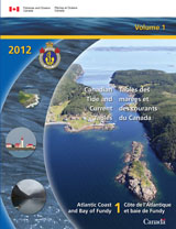
Les tables des marées comprennent les heures et les hauteurs prévues des marées hautes et basses associées au mouvement vertical de la marée. Elles sont disponibles sous forme de tableaux, de graphiques ou de textes pour plus de 700 localités au Canada. Ces tables sont nécessaires pour déterminer la profondeur de l'eau sous la quille des bateaux ou sur les hauts-fonds, pour le mouillage et pour établir l’heure à laquelle il convient de tirer une embarcation sur la berge. Les tables des courants donnent les temps d'étale prévue et les temps et vitesses maximaux des courants reliés au mouvement horizontal de la marée. - Marées, courants et niveaux d'eau
Le site Web des Marées, courants et niveaux d'eau donne les prédictions des heures et des hauteurs des pleines et des basses mers ainsi que les niveaux d'eau horaires pour plus de sept cents stations au Canada. Il est également possible d'obtenir sur le site Web les observations des niveaux d'eau. Les données disponibles sur ce site Web peuvent différer légèrement de celles contenues dans les documents officiels publiés par le ministère canadien des Pêches et des Océans et intitulés : Tables des marées et courants du Canada. Si ces données ne concordent pas, celles des publications officielles prévaudront.
- Application de niveaux d'eau pour appareils mobiles
Cette application pour les niveaux d’eau est un site web optimisé pour appareils mobiles. Cela permet d’afficher l’information à la façon d’une application mobile installée sur un appareil mobile (téléphone, tablette). On y retrouve les données sur les niveaux d’eau (incluant les marées) de toutes les stations du Canada. Les données offertes sont les prédictions de niveaux d’eau (tables des marées), les observations des niveaux d’eau en temps réel pour les stations munies d’appareil de mesure et les prévisions des niveaux d’eau. On retrouve également l’information sur les dégagements verticaux dynamiques de certains ponts. Les prédictions pour le mascaret sont disponibles pour les stations désignées ainsi que la renverse de courants pour les chutes réversibles du fleuve Saint-Jean (Nouveau-Brunswick).
- Manuel canadien des marées
Le Manuel canadien des marées a été conçu pour fournir le contexte théorique et les instructions techniques nécessaires à un travail efficace en ce qui concerne la collecte et l'utilisation des données sur les marées, les courants et les niveaux de l'eau, lors des recherches hydrographiques menées sur le terrain (Warren D. Forrester, 1983).
- Océanographie de la côte de la Colombie-Britannique
Le présent ouvrage traite des aspects physiques de la mer en utilisant comme exemples l'océan Pacifique et les eaux adjacentes à la côte de la Colombie-Britannique. Il porte particulièrement sur les vagues, les courants et les marées, et aborde également divers sujets qui vont de la météorologie et de la biologie marine à la géologie marine passée et présente. Il tente d'expliquer les mouvements de la mer et de les relier à l'expérience de tous les jours; il peut donc intéresser tant le profane sque le marin, le scientifique ou l'ingénieur (Bibliothèque du MPO).
- Annonces et messages importants
Trouvez des annonces et messages importants touchant la section de notre site Web qui traite des cartes et des services marins. Ceux-ci comprennent l’entretien programmé, le signalement de problèmes avec les tables des marées et courants, et des changements dans la façon de communiquer de l’information nautique.
- Mise à jour de vos cartes marines
De nombreux navigateurs sont conscients de l’importance d’avoir des cartes à bord, mais il est tout aussi important d’assurer de leur mise à jour. Si une bouée a changé ou s’il y a un nouvel obstacle, vous devez en être informé avant de tomber dessus, pas après. Comment effectuer la mise à jour de vos cartes marines, cartes numériques et cartes papier.
Canadian Hydrographic Service (CHS)
- Chart Catalogues
- PDF catalogue in 4 documents: 1 Atlantic Coast - 2 Pacific Coast - 3 Ontario/Manitoba including Great Lakes - 4 Arctic
- Graphical Catalogue: paper, BSB and ENC
- List of Paper Charts
- List of Digital charts: List of Digital Raster Navigational Charts (BSB RNC) - List of Digital Electronic Navigational Charts (S57 ENC)
- List of Price Lists : Price List of Paper and Digital Charts
- Catalogues of nautical publications
CHS offers a wide range of nautical publications that are indispensable companions to charts, enhancing safety at sea. Canadian Hydrographic Service and Canadian Coast Guard publications.
-
Chart 1 : Symbols, Abbreviations and Terms
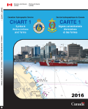
CHART NO. 1 contains the symbols, abbreviations and terms used on navigation charts published by the Canadian Hydrographic Service, which are based upon the Chart Specifications of the International Hydrographic Organization. Contents: Introduction and Schematic Layout, General, Topography, Hydrography, Aids and Services, Alphabetical Indexes. - Instructional charts
The Canadian Hydrographic Service offers two charts for instructional purposes. These charts represent a cross-section of content found on Canadian charts and are used by marine training programs as part of their course and examination materials. These instructional charts contain "fictitious data" that has been included for training purposes and should not be used for navigation. These two charts are: 1) Chart 9996IC, Canadian Power and Sail Squadrons - Training Chart A/escadrilles canadiennes de plaisance - carte de formation (CPS-A). 2) Chart 9997IC, Cape Hurd to/à Lonely Island.
- Sailing Directions
The Sailing Directions booklets are an indispensable companion to nautical charts. They are a great tool for planning and assisting in navigation because they provide information that cannot be shown on a chart. It is the mariners' responsibility to maintain their digital Sailing Directions file by ensuring that the latest version is always downloaded. If the mariner chooses to print their own Sailing Directions booklet, it is imperative that the current Notices to Mariners updates are applied. Areas: Atlantic Coast - Central Canada - Pacific Coast - Northern Canada.
- Arctic Voyage Planning Guide (AVPG)
A compilation of data and services relevant to mariners travelling in the Arctic region of Canada. The Arctic Voyage Planning Guide (AVPG) is intended as a strategic planning tool for national and international vessels traveling in the Canadian Arctic. The intent of the AVPG is to provide a comprehensive digital planning tool for mariners considering an Arctic voyage. The information provided in this guide should be used together with all other relevant information, as required by law, standards and good seamanship practices. The AVPG is not intended to replace official carriage information or products provided from Canadian sources
- Canadian Tide and Current Tables
Tide tables include predicted times and heights of the high and low waters associated with the vertical movement of the tide. They're available in table, graphic and text formats for over 700 stations in Canada. These tables are necessary for obtaining the depth of water under the keel or over a shoal, for anchoring and for establishing the appropriate times for beaching a boat. Current tables provide predicted slack water times and maximum current times and velocities associated with the horizontal movement of the tide.
- Tides Currents and Water Levels
The Tides, Currents, and Water Levels Web Site provides predicted times and heights of high and low waters, and the hourly water levels for over seven hundred stations in Canada. The printed version is published yearly and is available through the authorized chart dealers. It is also possible to obtain water level observations. The information available on this Web site may vary slightly from the information in the official documents published annually by the Department of Fisheries and Oceans and entitled Canadian Tide and Current Tables. In case of disparity, the information contained in the official publications will prevail.
- Water level application for mobile devices
This application for water levels is a website optimized for mobile devices. This displays the information in the same way as a mobile application installed on a mobile device (phone, tablet). It contains data on water levels (including tides) for all stations in Canada. The data offered are water level predictions (tide tables), real-time water level observations for stations equipped with monitoring gauges and water level forecasts. There is also information on the dynamic vertical clearances of certain bridges. Predictions for tidal bore are available for designated stations as well as time of slack waters for the Reversible falls on the Saint John River(New Brunswick).
- Canadian Tidal Manual
The Canadian Tidal Manual is designed to provide the theoretical background and the technical instruction necessary for the effective performance of the tasks involved in gathering and using tide, current, and water level information on hydrographic field surveys (Warren D. Forrester, 1983). Also the Manual by chapter on PSMSL.
- Tidal Glossary (David Pugh, 2004)
- Oceanography of the British Columbia coast
This book deals with the physical aspects of the sea as exemplified by the Pacific Ocean and the contiguous waters of the British Columbia coast. Although principally devoted to waves, currents, and tides, the book spans a broad spectrum of topics ranging from meteorology and marine biology to past and present marine geology. It attempts to elucidate the nature of oceanic motions and to relate them to everyday experience for the general interest of the casual reader and for the practical benefit of the professional mariner, scientist, or engineer (DFO Library).
- Announcements and important messages
Find announcements and important messages concerning the nautical charts and services section of our website. This includes scheduled maintenance, reported issues with tide and current tables, and changes to how nautical information is communicated.
- Update your nautical charts
Many mariners understand the importance of having charts onboard but it is just as important to ensure that your charts are up to date. If a buoy has changed or there is a new obstruction, you need to know about it before you encounter it, not after. How to update your chart, digital charts and paper charts.
Garde côtière canadienne  Canadian Coast Guard
Garde côtière canadienne (GCC)
- Publications de la Garde côtière canadienne
Trouvez de l’information et des publications sur nos programmes et services : Déglaçage, Épaves et navires abandonnés ou dangereux, Flotte, Information organisationnelle, Intervention environnementale, Navigation, Gestion des voies navigables, Recherche et sauvetage, Services de communications et de trafic maritimes (SCTM), Sûreté maritime.
- Avertissements de navigation
Avertissements de navigation (AVNAVs), incluant les avis aux navigateurs (NOTMAR), les hauts-fonds et l'état des aides à la navigation. Les Avertissements de navigation (AVNAVs) sont des renseignements sur les changements apportés aux aides à la navigation et sur les activités ou les dangers maritimes actuels. Les Avis aux navigateurs (NOTMAR) sont des informations nécessaire sur les mises à jour des cartes et les publications nautiques.
- Portail e-Navigation
Accèdez aux données et services électroniques officiels requis pour la planification d'un voyage au Canada, incluant la météo maritime, les marées, les courants, les avis à la navigation, les conditions de glace, les cartes marines et les instructions nautiques.
- Aides radio à la navigation marine (ARNM)
Ce document a pour but de présenter des renseignements sur les services de radiocommunications et d'aides radio à la navigation assurés au Canada par la Garde côtière canadienne ainsi que sur les installations radio des autres organismes du gouvernement qui contribuent à assurer la sécurité des navires dans les eaux canadiennes. Publication en un seul volume qui couvre : Atlantique, Saint-Laurent, Grands Lacs, Lac Winnipeg, Arctique et Pacifique.
- Livre des feux, des bouées et des signaux de brume
Vous y trouverez des informations importantes sur les feux, bouées et signaux de brume approuvés et gérés par la Garde côtière canadienne, notamment leur position, caractéristiques et hauteur ainsi que les cartes marines de référence. Le document se comopose de 4 volumes : Terre-Neuve - Côte de l'Atlantique - Eaux Intérieures - Côte du Pacifique.
- Le Système Canadien d'Aides à la Navigation (SCAN)
Les aides à la navigation sont des dispositifs et des systèmes qui aident à assurer la sécurité des navigateurs et à les prévenir des dangers. Cette publication présente en détail les caractéristiques du système de balisage canadien, y compris les feux, bouées, phares, signaux de brume, etc. Elle comprend également une affiche en couleurs qui indique comment utiliser ces aides à la navigation.
- Norme de diffusion du DGPS pour la navigation maritime
La norme de diffusion du système mondial de localisation différentiel (DGPS) de la Garde côtière canadienne est un document de référence qui spécifie le format, le contenu d'information, les paramètres de modulation, la zone de couverture et l'utilisation du signal qui est diffusé par un réseau de radiophares maritimes qu'exploite la Garde côtière canadienne. Ce réseau dessert les régions côtières canadiennes, les grandes voies navigables, les zones des services de gestion du trafic maritime et les ports. Sa couverture chevauche aussi celle du DGPS des états-Unis dans les eaux contiguës.
- Services opérationnels de déglaçage
La Garde côtière canadienne fournit des services de déglaçage aux navires commerciaux, aux traversiers et aux bateaux de pêche dans les eaux canadiennes prises par des glaces. Elle offre entre autres les services suivants : escorte, dégagement des ports, entretien des voies de navigation et fournit de l’information sur les glaces. Ces services contribuent à garantir une navigation sécuritaire, empêcher la formation d’embâcles et les inondations et maintenir les routes de transport maritime commercial.
- Navigation dans les glaces en eaux canadiennes
En hiver, les conditions climatiques rigoureuses de l'Atlantique posent de rudes défis aux navires sur la côte est du Canada. Des glaces de deux mètres et des crêtes de six mètres sont très fréquentes dans les eaux du nord-est de la côte de Terre-Neuve et dans le Golfe Saint-Laurent. Le présent manuel a pour objectif d'aider les navires à affronter les conditions glacielles dans toutes les eaux canadiennes, y compris celles de l'Arctique. Les capitaines et le personnel de quart des navires traversant des eaux couvertes de glaces au Canada y trouveront l'information nécessaire pour bien comprendre les dangers, les techniques de navigation et les réactions des bâtiments.
- Alerte, Détection et Intervention : Faire face aux accidents maritimes
Renseignements sur la sécurité des petits navires de pêche profesionnelle. La pêche peut être une activité extrêmement dangereuse. Bien que les pêcheurs professionnels canadiens soient encouragés à assurer la sécurité en prenant des mesures préventives, parfois des mesures supplémentaires sont nécessaires. Lorsqu’un accident survient, le système de recherche et de sauvetage (SAR) devient rapidement un filet de sécurité de premier ordre. En cas d’urgence, les pêcheurs professionnels doivent connaître trois éléments importants du système SAR : alerte, détection et intervention.
- Avertissements de navigation pour l'Artique : NAVAREA XVII et XVIII
Messages d'avertissements en français diffusés pour les NAVAREA XVII et NAVAREA XVIII : zone de l'océan Arctique circonscrite entre l'ouest de l'Alaska, l'est du Groenland et le pôle Nord, figure.
- Avertissements de Navigation (AVNAVs)
Nouveau service, migration de janvier à mai 2019. Les Services de Communication et de Traffic Maritimes (SCTM) de la Garde côtière canadienne (GCC) ont mis en œuvre un service national d’émission d’Avertissements de Navigation (AVNAV) pour remplacer les services domestiques existants d’avis à la navigation. Le nouveau Système d’Émission des AVNAVs permettra une plus grande harmonisation à la fois du format et du contenu des avertissements de navigation. Les visiteurs sont en mesure de consulter et de rechercher des AVNAVs ou bien de s’abonner pour recevoir des AVNAVs par courriel.
- Édition annuelle des Avis aux navigateurs
Cette édition annuelle offre des renseignements sur le système de balisage utilisé au Canada, les services de pilotage, les services de communications marines et de trafic maritime, la recherche et sauvetage, les phénomènes marins et la pollution, les zones de protection marine, les activités de pêche, les avis liés à la défense nationale et une foule de renseignements d'ordre plus général concernant la sécurité de la navigation en mer.
- Édition mensuelle des Avis aux navigateurs
Ces avis publiés mensuellement sont disponibles auprès de la Garde côtière canadienne, en ligne ou par abonnement à un service d’envoi gratuit sous format papier. Ces publications indispensables offrent les renseignements les plus récents sur les modifications au système de balisage canadien, ainsi que les mises à jour des cartes marines et publications nautiques du SHC.
- Avis aux navigateurs - NOTMAR
Vous trouverez sur le site Web des Avis à la navigations (NOTMAR) de la Garde côtière canadienne (GCC) toutes les informations nécessaires pour mettre à jour vos cartes et publications nautiques. Il vous informera des nouvelles initiatives, services et aussi des annonces importantes concernant la communauté maritime.
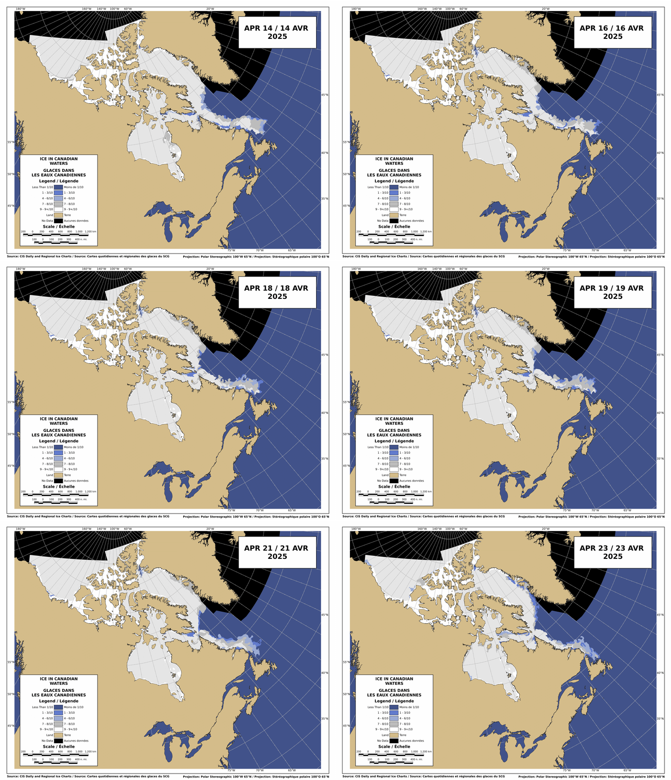
Canadian waters - Ice concentration map for the last 10 days (CIS) Canadian Coast Guard (CCG)
- Canadian Coast Guard publications
Find corporate information and publications from our programs and services: Corporate information, Environmental response, Fleet, Icebreaking, Marine communications and traffic services (MCTS), Maritime security, Navigation, Wrecked, abandoned or hazardous vessels, Search and rescue.
- Navigational Warnings and Notices
Current navigational warnings (NAVWARNs), including notices to shipping, notices to mariners (NOTMAR), shoals and status of aids to navigation. Navigational Warnings (NAVWARNs) contain information about changes to navigational aids and current marine activities or hazards. Notices to Mariners (NOTMAR) provide the necessary information to update charts and nautical publications.
- e-Navigation Portal
Access all the official electronic data and services needed to plan a voyage in Canada, including marine weather, tides, currents, hazards, notices, ice conditions, charts and sailing directions.
- Canada Aids to Navigation System (CANS)
Aids to navigation are devices and systems to help vessel operators navigate safely, and to warn of hazards. This publication describes, in detail, the characteristics of the aids to navigation system in Canada, including lights, buoys, lightstations, fog signals and more. It also includes a full-colour poster that describes how to use the system.
- List of Lights, Buoys and Fog Signals
Providing key information about Canadian Coast Guard approved and managed lights, buoys and fog signals, including position, characteristics, height and reference charts. In 4 volumes: Newfoundland - Atlantic Coast - Inland Waters - Pacific Coast
- Radio Aids to Marine Navigation (RAMN)
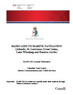
The main purpose of RAMN is to present information on radio communications and radio navigational aids services provided in Canada by the Canadian Coast Guard. Radio facilities of other government agencies that contribute to the safety of ships in Canadian waters are also included. Publication in one volume for: Atlantic, St. Lawrence, Great Lakes, Lake Winnipeg, Arctic and Pacific.
- Search and Rescue Contacts
Find Rescue Coordination Centres Worldwide. SAR contacts is a database of international search and rescue agencies and rescue coordination centres The worldwide Search and Rescue Contacts website is managed by the Canadian Coast Guard in JRCC Halifax location.
- Canadian Marine DGPS Broadcast Standard
The Canadian Coast Guard Differential Global Positioning System (DGPS) Broadcast Standard is a reference document that specifies the format; information content, modulation parameters, coverage area, and use of the signal that is broadcast from a network of Canadian Coast Guard operated marine radio beacons. This network provides coverage to Canadian coastal areas, major waterways, Vessel Traffic Services zones and ports. It also overlaps US DGPS coverage of contiguous waters.
- Ice Navigation in Canadian Waters
The bitter Atlantic winter weather can bring harsh challenges for ships navigating on the east coast of Canada. Two metre thick ice and six metre high ridges are common off the north-east coast of Newfoundland and in the Gulf of St. Lawrence. This manual aims to assist ships operating in ice in all Canadian waters, including the Arctic. This document will provide Masters and watchkeeping crew of vessels transiting Canadian ice-covered waters with the necessary information to achieve an understanding of the hazards, navigation techniques, and response of the vessel.
- Icebreaking operations services
The Canadian Coast Guard provides icebreaking services for commercial ships, ferries and fishing vessels in ice-covered Canadian waters, including vessel escorts, harbour breakouts, maintaining shipping routes and providing ice information services. These services ensure safe navigation, prevent the formation of ice jams and flooding and maintain open routes for maritime commerce.
North Atlantic - East Newfoundland
Daily Chart, Ice Concentration & Iceberg Areas
North Atlantic - East Coast of Canada - WMO Code
Weekly Chart - Ice Concentration & Iceberg Areas
North Atlantic - Newfoundland and Labrador
Daily Iceberg Analysis Chart - Bulletin (CIS) - Alerting, Detection & Response: Dealing with accidents at sea
Safety information for small vessel fish harvesters. Fishing can be a dangerous activity that involves an extremely high level of risk. While Canadian fish harvesters are encouraged to achieve safety through preventative actions, there are times when additional measures are necessary. When an accident occurs, the Search and Rescue (SAR) system quickly becomes the primary safety net. When dealing with emergencies, fish harvesters should understand three important components of the SAR system: alerting, detection and response.
- Navigational Warnings for Artic: NAVAREA XVII and XVIII
Broadcast warning messages in english for NAVAREA XVII and NAVAREA XVIII: area of the Arctic Ocean delimited between western Alaska, eastern Greenland and the North Pole, figure.
- Navigational Warnings (NAVWARNs)
New service, migration from January to May 2019. The Canadian Coast Guard’s (CCG) Marine Communications and Traffic Services (MCTS) program has launched a national navigational warning (NAVWARN) issuing service to replace the existing domestic Notice to Shipping (NOTSHIP) services. The new NAVWARN Issuing System will provide greater harmonization in both the format and content of navigational warnings. Visitors will be able to search NAVWARNs or subscribe to receive NAVWARNs by email.
- Notices to Mariners Annual Edition
This annual edition provides information on the aids to navigation system in Canada, pilotage services, marine communications and traffic services, search and rescue, marine occurrences and pollution, marine protected areas, fishing activity, national defence notices and a variety of general information regarding marine navigation safety.
- Notices to Mariners Monthly Edition
Published monthly and available from the Canadian Coast Guard both online or through a free hardcopy subscription service. This essential publication provides the latest information on changes to the aids to navigation system, as well as updates from CHS regarding CHS charts and publications.
- Notices to Mariners - NOTMAR
The Canadian Coast Guard (CCG) Notices to Mariners (NOTMAR) Web site provides you with the necessary information to update all of your charts and nautical publications. It will advise you of our new initiatives, services and also of some important announcements concerning the maritime community.
Environnement et Changement
climatique Canada
Environment and Climate
Change CanadaEnvironnement et Changement Climatique Canada : Météo Maritime
- Guide des prévisions météorologiques maritimes
Environnement Canada (EC) fournit un service de prévisions maritimes aux navigateurs. EC émet trois principaux types de bulletins de prévisions maritimes, qui sont accompagnés d’une description de la situation maritime générale : Prévisions maritimes régulières - Prévisions maritimes à long terme - Prévisions de la hauteur des vagues. Ils sont accompagnés d’une description de la situation maritime générale.
- Guide de météo marine national (Met 101)
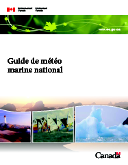
Le Guide de météo marine national vise à fournir aux navigateurs, quel que soit leur niveau de compétence, des renseignements et des conseils pratiques en matière de navigation sécuritaire pour le large éventail de conditions météorologiques qu'ils peuvent rencontrer lorsqu'ils croisent en eaux canadiennes. Table des matières : Introduction - Notions élémentaires de météorologie marine - Le vent - L’état de la mer - Le brouillard - La glace - Autres conditions météorologiques dangereuses - Glossaire. Également le guide météo au format PDF.
- Guides de météorologie maritime régionaux
Les guides de météo marine régional complètent le guide national et contiennent des renseignements sur les effets des conditions météorologiques locales particulières. Les guides sont au format HTML mais sont également disponibles en PDF : cliquer sur le titre du guide situé dans le paragraphe sous la carte.
- Guide de météo marine régional pour l’Ontario
- Guide de météo marine régional pour la Colombie Britannique
- Guide de météo marine régional pour le Québec
- Guide de métao marine régional pour les Prairies
- Guide de météo marine régional pour le Canada Atlantique
- Guide de météo marine régional pour l’Arctique
- Renseignements météorologiques maritimes régionaux
Ce type de guide donne rapidement un aperçu des services de prévisions météorologiques maritimes disponibles pour toutes les régions maritimes qui reçoivent une prévision d'Environnement et Changement climatique Canada. Information régionale pour les régions maritimes suivantes : Côte du Pacifique - Baie d'Hudson, Fleuve Mackenzie et les eaux arctiques - Lacs du Manitoba - Grands Lacs - Fleuve Saint-Laurent - Côte Atlantique.
- Manuel d’observations météorologiques maritimes (MANMAR)
Le Manuel d’observations météorologiques maritimes (MANMAR) contient les renseignements requis au fil du temps en ce qui concerne les procédures, l’équipement et les formats de codage utilisés pour l’observation de phénomènes météorologiques maritimes et la préparation de rapports d’observations météorologiques maritimes. Le MANMAR est la norme qui régit le programme d’observation volontaire des navires (OVN) fournissant auparavant des observations manuelles. Toutefois, ce programme a été abandonné à l’intérieur du territoire canadien. Le MANMAR est le document de référence actuellement en usage au sein du Service météorologique du Canada pour tout ce qui a trait à la présentation des données météorologiques maritimes (SHIP) et aux procédures d’observation de l’ancien programme OVN.
- Information sur les trajectoires d'ouragans
Carte où figurent les trajectoires actuelles et prévues des tempêtes en cours sur l'océan Atlantique Nord. En cas d’ouragan ou de tout autre phénomène météorologique violent: « n’ayez pas peur, ayez un plan ».
- Les secrets du Saint-Laurent
Cette publication est conçue pour qui navigue sur le Saint-Laurent. Elle a été préparée par les météorologues québécois d'Environnement Canada, avec la collaboration de marins, de pêcheurs et de plaisanciers expérimentés. On y présente : Tout sur le comportement du vent et de la mer - La personnalité topographique du Saint-Laurent - Un répertoire de quelque 150 lieux où le vent et la mer créent des conditions particulières, parfois risquées - Les principaux signes annonciateurs du changement du temps - Les prévisions météorologiques maritimes - La façon d'avoir accès directement et rapidement aux prévisions (1992).
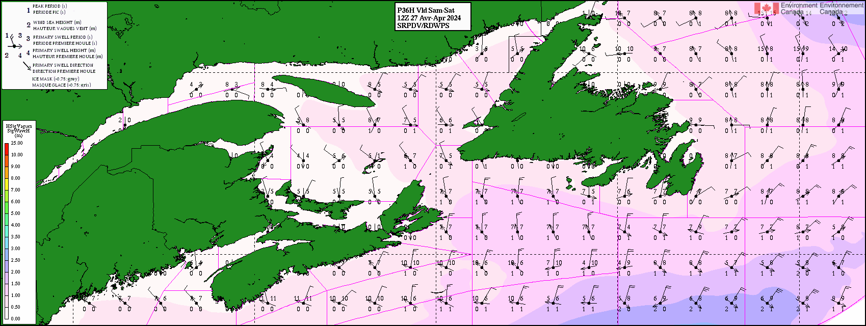
- Prévisions de modèles de vagues
Accédez à des informations à deux jours sur la modélisation des vagues. Cartes pour les zones suivantes : Atlantique (Golfe du Saint-Laurent - Atlantique nord-ouest) - Arctique est (Arctique est - Baie de Baffin - Bassin Kane - Baie d'Hudson) - Arctique ouest (Arctique ouest - Mer de Beaufort) - Pacifique nord-est - Grands Lacs (Lac Érié - Lac Huron - Lac Ontario - Lac Supérieur). Hauteur en mètre. Les vagues maximales peuvent atteindre 2 fois la hauteur significative.
Golfe du Saint-laurent : Hauteur et direction des vagues de vent et de la houle pour demain - Hauteur en mètre
- Manuel des glaces (MANICE)
MANICE est le Manuel des normes d'observation des glaces. C'est le document de référence pour l'observation de toutes les formes de glace de mer, de lac et de rivière, ainsi que des glaces d'origine terrestre. L'on y décrit les méthodes standard appliquées par le Service canadien des glaces (SCG) pour l'observation, l'enregistrement et la signalisation des conditions glaciales. Également disponible au format PDF. La version la plus récente du MANICE à été révisée en 2005.
- Interprétation des cartes de glaces : codes de l'œuf et de couleur
Les couleurs sont utilisées pour améliorer l'apparence et la compréhension des cartes de glace. Ces codes de couleur permettent aux utilisateurs de juger rapidement des conditions globales et de suivre facilement l'évolution de celles-ci. Il est important de souligner que pour prendre des décisions relatives à la navigation, l'utilisation d'un tel code de couleur est insuffisant et que des informations beaucoup plus détaillées sont communiquées à l'aide du code de l'oeuf
- Bulletins et cartes des glaces et des icebergs
Guide des produits des glaces. Le Service canadien des glaces (SCG) fournit une variété de produits donnant une information exacte et ponctuelle sur l'état des glaces et des icebergs dans les eaux canadiennes.
- Bulletins des glaces et des icebergs
- Cartes quotidiennes des glaces - Cartes régionales des glaces
- Cartes des icebergs
- ...
- Publications du Service canadien des glaces
Dans cette section, vous trouverez de l'information générales au sujet des publications suivantes : MANICE - Atlas annuels des glaces de l'Arctique - Atlas climatiques des glaces sur 30 ans - Aperçus saisonniers - Résumés saisonniers.
- Prévisions et avertissements maritimes pour le Canada
Carte avec les avis, veilles et avertissements. Le programme de veilles et d’avertissements maritimes fournit des avis aux navigateurs pour les informer des conditions météorologiques maritimes qui peuvent présenter des risques pour leur sécurité ou leurs activités. Les avis (gris) sont émis pour les phénomènes météorologiques spécifiques qui sont plutôt sévères et pourraient avoir un impact significatif sur les Canadiens. Les veilles (jaune) annoncent des conditions météorologiques propices à une tempête ou à du temps violent pouvant compromettre la sécurité de la population. Lorsqu'on connaît avec certitude la trajectoire et la puissance d'un système de tempête, une veille peut se transformer en avertissement (rouge), qui est un message urgent indiquant la présence de temps violent ou son imminence.
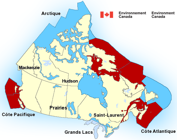
Marine Weather Warnings for Canada (in red)
Météo : Avertissements maritimes pour le Canada (en rouge)
Environment and Climate Change Canada : Marine Weather
- Guide to Marine Weather Forecasts
Environment and Climate Change Canada (EC) provides a marine forecasting service to mariners and marine interests. There are three main marine forecast bulletins issued by EC: Regular Marine Forecast - Extended Marine Forecast - Wave Height Forecast. In addition to this, descriptive marine synopses are also issued.
- National Marine Weather Guide (Met 101)
The National Marine Weather Guide is intended to provide mariners of all levels of ability with practical information and advice on safe navigation on the wide range of weather conditions they may encounter while travelling in Canadian waters. Table of Contents: Introduction - Marine Meteorology Primer - Wind - Sea State - Fog - Ice - Other Hazardous Weather - Glossary. Also the weather guide in PDF format.
- Regional marine weather guides
The regional marine weather guides complete the National Guide and contains information on specific local weather effects. Guides are in HTML format are also available in PDF format: click on the title of the guide in the paragraph under the map.
- Ontario regional marine guide
- British Columbia Regional Marine Guide
- Quebec regional marine guide
- Prairies regional marine guide
- Atlantic Canada regional marine guide
- Arctic regional marine guides
- Regional marine weather information
These quick reference guides outline the marine weather forecast services available for all marine areas that receive an Environment Canada forecast. Regional Marine Information for the following marine areas: Pacific Coast - Hudson, Mackenzie & Arctic Waters - Manitoba Lakes - Great Lakes - St. Lawrence River - Atlantic Coast.
- Manual of Marine Weather Observations (MANMAR)
The Manual of Marine Weather Observations (MANMAR) prescribes the legacy information on the procedures, equipment and coding formats used in the observation of marine weather phenomenon and the preparation of marine weather reports. MANMAR is the standard for the legacy manually observed Voluntary Observing Ship (VOS) program. The VOS program has been discontinued within Canada. MANMAR is currently used as a reference for the SHIP data format and historical VOS program observing procedure.
- Hurricane Track Information
Altantic map of the storms tracked by the Canadian Hurricane Centre. Hurricane season runs from June through November when the waters of the Atlantic Ocean are warm enough to produce a tropical cyclone. When it comes to hurricanes or any type of severe weather, remember: "Don’t be scared. Just be prepared".

Hurricane Track Forecast / Prévision de trajectoires d'ouragans - Secrets of the St. Lawrence
This guide is designed especially for mariners on the St Lawrence. The guide was prepared by Environment Canada meteorologists in Québec, with the assistance of many seasoned mariners, fishermen and recreational sailors. The guide contains: Full details on wind and sea conditions - A description of the geography of the St Lawrence - A listing of some 150 locations in which wind and sea combine to create special, and sometimes dangerous, situations - The main warning signs indicating a change in weather - Information on marine weather forecasts - Details on how to obtain forecasts directly and quickly (1992).
- Wave Model Forecasts
Access information for two days on wave modelling. Maps for the following areas : Atlantic (Gulf of St. Lawrence - Northwest Atlantic) - Arctic-East (Arctic-East- Baffin Bay - Kane Basin - Hudson Bay) - Arctic-West (Arctic West - Beaufort Sea) - Northeast Pacific - Great Lakes ( Lake Erie - Lake Huron - Lake Ontario - Lake Superior). Height in meters. Maximum waves may be up to twice the significant height.
- Manual of Ice (MANICE)
MANICE is the Manual of Standard Procedures for Observing and Reporting Ice Conditions. This is the authoritative document for observing all forms of Sea, Lake and River Ice, as well as Ice of Land Origin. It describes the standard procedures of the Canadian Ice Service (CIS) for observing, recording and reporting ice conditions. Also available in PDF file. The most recent version of MANICE was revised in 2005.
- Interpreting Ice Charts: egg and colour codes
Colours are used to enhance ice charts for presentations and briefings. The colour codes allow users to make a quick assessment of the general ice conditions and to visually follow trends. It is important to remember that the colours alone cannot be used for navigation decisions and that more detailed ice information is contained within the Egg Code.
- Ice and iceberg bulletins or charts
The Ice Products Guide: the Canadian Ice Service (CIS) provides a variety of products, representing accurate and timely information about ice and iceberg conditions in Canadian waters.
- Canadian Ice Service Publications
In this section, you will find background information regarding the following publications: MANICE - Annual Arctic Ice Atlas - 30-year Climatic Ice Atlases - Seasonal Outlooks - Seasonal Summaries.
- Marine Forecasts and Warnings for Canada
Map with advisories, watches and warnings. The Marine Warning and Watches Program provides advisories to mariners or marine interests to inform them of marine weather conditions that may pose a hazard to their safety, security, or operation. Advisories are issued for specific weather events that are quite severe and could significantly impact Canadians. Watches alert you about weather conditions that are favourable for a storm or severe weather, which could cause safety concerns. As certainty increases about the path and strength of a storm system, a watch may be upgraded to a warning, which is an urgent message that severe weather is either occurring or will occur.
Transports Canada  Transport Canada
Transports Canada : Transport maritime
- Information pour les visiteurs
Exigences applicables aux plaisanciers étrangers en eaux canadiennes. On s'attend des plaisanciers, qu'ils soient canadiens ou étrangers, à ce qu'ils connaissent les règles de sécurité nautique du Canada. Pour naviguer sur les eaux du Canada, vous devez observer les règles relatives à l'équipement de sécurité, à l'exploitation sécuritaire de votre embarcation et à la protection de l'environnement. Prenez soin de vous informer des restrictions à la conduite des bateaux et des règlements en matière de limites de vitesse.
- Guide de sécurité nautique (TP 511 F)
Transports Canada le publie pour que vous connaissiez bien la réglementation sur la navigation et en appreniez davantage sur les pratiques de navigation sûres et responsables. La navigation de plaisance est censée être une activité agréable. Pourtant, environ 100 personnes perdent la vie et de nombreuses autres sont gravement blessées chaque année dans des incidents nautiques. Or, la plupart de ces décès et de ces blessures peuvent être évités. Si ce guide offre un aperçu de base de la sécurité nautique, il ne devrait pas être votre seule source d’information. Table des matières : Introduction, Pour commencer, Avant de partir, Sur l'eau, En cas d'urgence, Coordonnées et références.
- La sécurité à bord du navire (TP 5021 F)
Tout marin connaît les risques du travail en mer. Chaque année, on signale à l'administration canadienne du transport maritime de Transports Canada plus de 1000 incidents maritimes. Bien que le travail à bord d'un navire puisse s'avérer dangereux, de nombreux incidents pourraient être évités si on observait les règles de sécurité appropriées telles que décrites dans le “Règlement sur les mesures de sécurité au travail”. La Garde côtière canadienne a préparé la présente brochure dans le but d'expliquer ces règles. Document également disponible en format pdf (1984).
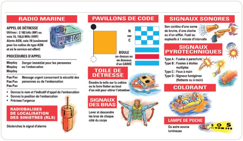
- Procédures de sécurité et de détresse radiotéléphoniques (TP 9878)
Procédure de transmission des messages de détresse. Signaux de détresse, d’urgence et de sécurité. Image et description texte de l'image.
- Livret de radio pour les navires immatriculés au Canada (TP 13926)
Conformément à la Loi sur la marine marchande du Canada et aux dispositions de l'article 41 du Règlement technique de 1999 sur les stations de navires (radio), tout navire doté d’équipement de radiocommunication maritime doit avoir à bord un livret de radio. Le livret de radio est conservé au poste principal de la station de navire durant le séjour du navire en mer. Il doit être accessible a des fins d'inspection à toute personne autorisée du Bureau de la sécurité des transports du Canada, et de Transports Canada, à un inspecteur radio ou tout représentant autorisé d'une administration étrangère.
- Vocabulaire normalisé de la navigation maritime (TP 4330 F)
Vocabulaire normalisé de la navigation maritime comprenant toutes les modifications adoptées par le comité de la sécurité maritime, jusqu’à la cinquante et unième session y compris (1985). Le présent Vocabulaire a été établi : 1) en vue de contribuer à l’amélioration de la sécurité de la navigation et de la conduite des navires; 2) en vue de normaliser le vocabulaire utilisé lors des communications concernant la navigation en mer, aux abords des ports, dans les voies de navigation et dans les ports (CUBIQ).
- Petits bâteaux de pêche - Manuel de sécurité (TP 10038 F)
Cette publication est un manuel de sécurité. Elle discute les sujets suivants : sécurité de la navigation, la stabilité, les urgences, équipement et installation, informations météorologiques, équipements de sauvetage et signaux de détresse maritime. Ce manuel donne des renseignements sur la sécurité à bord des bateaux de pêche de moins de 24 mètres et il est surtout destiné aux bateaux dont le capitaine ou l'exploitant n'est pas titulaire d'un certificat de capacité ou n'a reçu qu'une formation professionnelle limitée. Document également disponible en format PDF.
- Lignes directrices en matière de stabilité et de sécurité adéquates pour les bâtiments de pêche (TP 15393 F)
Le règlement sur la sécurité des bâtiments de pêche est entré en vigueur le 13 juillet 2017. Le règlement contient des nouvelles exigences en matière de stabilité pour les petits bâtiments de pêche. Les bâtiments qui ne sont pas tenus de subir une évaluation de la stabilité doivent avoir une stabilité adéquate. les lignes directrices sont un outil pour les propriétaires et exploitants de bâtiments de pêche qui les aidera à prendre des mesures préventives destinées à maintenir la stabilité de leurs bâtiments ainsi que leur donner des conseils portant sur les meilleures pratiques opérationnelles pour éviter l'envahissement ou le chavirement d'un bâtiment de pêche. Document également disponible en format PDF.
- Guide de sécurité des petits bâtiments commerciaux (TP 14070 F)
Ce guide s'adresse à vous, propriétaires et exploitants de petits bâtiments commerciaux, car selon la loi, vous avez la responsabilité de connaître votre bâtiment, de savoir comment le manœuvrer et de vous protéger contre les risques liés à son utilisation. Ce guide vous informe de ces responsabilités, vous fait connaître les exigences relatives à la sécurité qui s'appliquent à l'exploitation de votre bâtiment et vous indique comment vous y conformer pour éviter les accidents. Ce guide s'applique aux bâtiments suivants: les bâtiments à passagers commerciaux d'une jauge brute d'au plus 15, qui ne transportent pas plus de 12 passagers; les bateaux de travail (les bâtiments commerciaux qui ne transportent pas de passagers) d'une jauge brute d'au plus 15. Document également disponible en format PDF.
- Règlement sur les abordages (TP 10739)
Règlement sur les abordage avec modifications canadiennes (C.R.C., chapitre 1416). Table des matières : 1) Définitions et interprétation; 2) Interdiction; 3) Application; 4) Conformité; 5) Preuve de conformité — feux, marques, appareils de signalisation sonore et réflecteurs radar; 6) Normes — feux, marques, appareils de signalisation sonore et réflecteurs radar; 7) Avis à la navigation et avis aux navigateurs; Annexe) Règlement international de 1972 pour prévenir les abordages en mer, avec modifications canadiennes. Document également disponible en format PDF avec le texte en français et en anglais côte à côte.
- Fiche de référence sur les régles de route et les bouées
- Régles de route (TP 14352)
- Bouées latérales et balises de jour ordinaires (TP 14541)
- Bouées cardinales et bouées spéciales (TP 14542)
- Navigation dans l'Arctique
Au Canada, la navigation dans l’Arctique est régie par plusieurs textes de loi. Ces lois concernent les exigences de rapports sur la navigation, la prévention de la pollution, les navires de croisière, les exigences pour navires de classe polaire, les exigences d'armement en équipage.
- Normes pour le système des régimes de glaces pour la navigation dans l'arctique - SRGNA (TP 12259 F)
Ce document indique la méthodologie qui doit être utilisée pour évaluer les capacités et les limites d'exploitation des navires dans les glaces, telle que les conditions décrites par le paragraphe 8(2) du Règlement sur la sécurité de la navigation et la prévention de la pollution dans les eaux arctiques (RSNPPEA), avec aussi la forme selon laquelle le message prescrit par l'article 9 du RSNPPEA sera transmis. Document également disponible en format PDF.
- Lignes directrices concernant l'exploitation des navires à passagers dans les eaux arctiques canadiennes (TP 13670 F)
Les présentes Lignes directrices visent à donner de l’information sur les exigences formulées par les organismes gouvernementaux fédéraux et territoriaux à l’égard de la phase de planification des croisières et des voyages subséquents dans l’Arctique. Elles visent à aider les exploitants de navires de croisière à réaliser des voyages réussis et à favoriser les bonnes relations avec l’ensemble des cultures du Nord. Le lecteur doit savoir que la présente publication n’est pas un document juridique. Ces Lignes directrices portent sur l’exploitation sécuritaire et la navigation sans pollution des navires de croisière dans les eaux arctiques canadiennes. Document également disponible en format PDF.
- Guide illustré du Système des régimes de glaces pour la navigation dans l’Arctique (TP 14044 F)
Cette brochure se veut un guide de référence pour le Système des régimes de glaces pour la navigation dans l'Arctique (SRGNA). Il s'agit d'un guide illustré indiquant les quatre étapes à suivre pour appliquer le système des régimes de glaces. En première étape, l'utilisateur caractérise le régime de glaces. En deuxième étape, il établit les multiplicateurs glaciels selon la catégorie de navire. Ensuite, il combine les renseignements sur le régime de glaces et les multiplicateurs glaciels pour établir le numéral glaciel. Enfin, le numéral glaciel sert à décider si le navire peut emprunter l'itinéraire choisi ou en prendre un autre. Document également disponible en format PDF
- Navigation hivernale sur le Fleuve et le Golfe du Saint-Laurent (TP 14335 F)
Guide pratique à l’intention des officiers de pont et des officiers mécaniciens de navires. Les marins qui ne sont pas familiers avec les navires opérant dans les glaces peuvent ne pas apprécier pleinement les risques qui y sont associés et, par le fait même, peuvent ne pas y être adéquatement préparés. Le but de cette publication est de permettre une meilleure compréhension des dangers que l’on peut rencontrer lorsque l’on traverse en hiver les eaux de l’est du Canada. La but est également d’identifier les précautions qui peuvent être prises et les problèmes récurrents rencontrés chaque hiver dans les différents secteurs du navire dans une tentative d’apporter des solutions pratiques.
- La survie en eaux froides (TP 13822 F)
Le présent rapport a été commandé par la Direction de la sécurité marine de Transports Canada pour traiter du problème de la survie en eau froide. Le rapport se subdivise en six chapitres : 1) Brève introduction au problème; 2) Physiologie de l'immersion en eau froide; 3) Recherche menée sur la protection des personnes contre des dangers d'une immersion soudaine en eau froide; 4) Conception et mise au point des actuelles combinaisons d'immersion; 5) Compatibilité entre la combinaison d'immersion et le gilet de sauvetage; 6) Examen des différents groupes de personnes qui travaillent ou pratiquent des activités de loisir sur l'eau ou qui la survolent et du type de protection dont ces groupes ont besoin. Document également disponible en format PDF.
- Vidéos sur la sécurité des petits bâtiments
Transports Canada est fier de présenter une série de vidéos sur l’exploitation sécuritaire et responsable de votre bateau. Suivez-nous d’un bout à l’autre du Canada et explorez avec nous les questions de sécurité et les solutions s’offrant aux propriétaires de bateaux comme vous : Mon bateau. Mon entreprise. Ma reponsablité.
- Stabilité (TP 15278) - Hypothermie (TP 15280)
- Bâtiments à passagers (TP 15279) - Remorqueurs (TP 15281) - Bateaux de pêche (TP 15282)
- Sensibilisation à la sûreté des petits bâtiments et de leurs installations (TP 15206)
- Système de recherche d'informations sur l'immatriculation des bâtiments
Pour trouver des renseignements à jour sur l’immatriculation d’un bâtiment, que vous en soyez le propriétaire ou non, vous pouvez utiliser le Système de recherche d'informations sur l'immatriculation des bâtiments. Vous pouvez effectuer une recherche en utilisant le numéro matricule ou le nom du bâtiment, ou utiliser la page de recherche plus étendue qui permet d'effectuer une recherche avec un plus grand nombre de caractéristiques.
- Liste des lois de transport maritime
Transports Canada administre un certain nombre de lois liées au secteur des transports. Il participe aussi à l'administration d'un grand nombre d'autres lois. L'accès au texte complet des Lois et des règlements est fourni par le ministère de la Justice du Canada, qui a la responsabilité de tenir à jour les Lois codifiées du Canada.
- Publications de transports (TPs) relatives à la Sécurité maritime
Publications de Transports Canada relatives à la sécurité et à la sûreté maritime : Normes, pratiques sécuritaires, lignes directrices, formulaires, guides, guides d’examen, descriptions de programmes, matériel de formation, avis. La liste est classée par numéro de publication de transport (TP). Des publications sur la sécurité maritime sont également disponibles sur le site des publications du gouvernement du Canada.
- Bulletins de la sécurité des navires (TP 3231)
Les Bulletins de la sécurité des navires sont destinés aux propriétaires, représentants autorisés et exploitants de navires commerciaux. Les bulletins sont une source de renseignements exacts et à jour portant sur la sécurité des navires et l'un des mécanismes importants de communication de renseignements opportuns concernant les mesures de protection contre des risques connus et/ou des directives destinées à l'industrie.
Transport Canada: Marine Transportation
- Visitor Information
Requirements for foreign recreational boaters in Canadian waters. All recreational boaters, both foreign and domestic, are expected to know the rules that govern their safe enjoyment in Canadian waters. Once in Canadian waters, you must follow the rules that govern safety equipment, the safe operation of your pleasure craft, and protection of the environment that apply in Canada. Watch for boating restrictions such as speed limits or vessel prohibitions.
- Safe Boating Guide (TP 511 E)
Transport Canada publishes this resource to make sure that you know the regulations that apply to boating and that you learn more about safe and responsible boating practices. Boating is fun, but about 100 people die and many more get seriously injured every year in boating incidents. Most boating deaths and injuries can be avoided. While this guide offers a basic overview of boating safety, it should not be your only source of information. Table of contents: Introduction, Geting started, Before you go, On the water, In an emergency, Contact information and reference cards. - Personal Safety on Ships (TP 5021 E)
All mariners know the hazards of working at sea. Every year more than 1000 marine incidents are reported to the Canadian Marine Administration of Transport Canada. Although work on board ship can be dangerous, many incidents could be avoided if proper safety procedures, as laid down in Canada's “Safe Working Practices Regulations”, were followed. This booklet has been prepared by the Canadian Coast Guard to explain those regulations. References to specific sections of the official regulations are included so you can find more detailed information if you need it (1984).
- Distress and safety radiotelephone procedures (TP 9878 E)
Distress procedures. Distress, urgency ans safety signals. Figure and text description of figure.
- Radio Log Book for Canadian Flag Vessels (TP 13926)
In accordance with the Canada Shipping Act and the provisions of Section 41 of the Ship Station (Radio) Technical Regulations, 1999, a Radio Log shall be carried on board vessels with marine radio installations. The Log shall be located at the main operating position of the ship radio station while the ship is at sea. It must be available for inspection by any person authorized by Transportation Safety Board of Canada, Transport Canada, a Radio Inspector or a authorized representative of another Administration.
- Standard Marine Navigational Vocabulary (TP 4330 E)
Standard Marine Navigational Vocabulary incorporating all amendments adopted by the Maritime Safety Committee up to and including its fifty-first session (1985). This vocabulary has been compiled: 1) to assist in the greater safety of navigation and of the conduct of ships; 2) to standardize the language used in communication for navigation at sea, in port-approaches, in waterways and harbours (ČTÚ).
- Small Fishing Vessel Safety Manual (TP 10038 E)
This publication is a Safety Manual for small fishing vessels and discusses topics such as: stability, emergencies, navigating safely, life saving equipment, weather information, distress signals, safety on the job and equipment and installation. This handbook provides information on safety on small fishing vessels (under 24 metres), and is intended primarily for vessels where the Master or Operator does not hold a certificate of competency or has limited vocational training. Document also available in PDF format.
- Small Commercial Vessel Safety Guide (TP 14070 E)
This guide is for owners and operators of small commercial vessels because you are responsible, by law, for knowing, controlling and defending against the risks related to your vessel and its use. The purpose of this guide is to inform you of these responsibilities, and to let you know the safety requirements that apply to your operation and how to comply with them to avoid accidents. The information in this guide relates to: assenger-carrying commercial vessels that are not more than 15 gross tonnage and that carry no more than 12 passengers; and workboats (commercial vessels that do not carry passengers) that are not more than 15 gross tonnage. Document also available in PDF format.
- Collision Regulations (TP 10739)
Collision regulations with Canadian modifications. Table of Contents: 1) Interpretation; 2) Prohibition; 3) Application; 4) Compliance; 5) Proof of compliance — lights, shapes, sound-signalling appliances and radar reflectors; 6) Standards — lights, shapes, sound-signalling appliances and radar reflectors; 7) Notices to mariners and notices to shipping; Schedule) International regulations for preventing collisions at sea, 1972 with Canadian modifications. Document also available in PDF format with text in French and English side by side.
- Reference cards about rules of the road and buoys
- Rules of the road (TP 14352)
- Lateral buoys and standard daybeacons (TP 14541)
- Cardinal buoys and special buoys (TP 14542)
- Arctic Shipping
Arctic shipping in Canada is governed by several pieces of legislation. These laws relate to voyage reporting requirements, pollution prevention rules, cruise ships, polar class vessel requirements, crewing requirements.
- Arctic Ice Regime Shipping System (AIRSS) Standards (TP 12259 E)
This document is an overview of the methodology to be used to assess vessel operations capabilities and limitations in ice when navigating in the in circumstances described in section 8(2) of the Arctic Shipping Safety and Pollution Prevention Regulations (ASSPPR), along with the message that is to be sent, as required by section 9 of the ASSPPR. Document also available in PDF format.
- Guidelines for the Operation of Passenger Vessels in Canadian Arctic Waters (TP 13670 E)
These Guidelines are intended to provide information on the requirements of Federal and Territorial government agencies during the planning phase of cruises and during the subsequent Arctic voyages. The Guidelines are intended to assist cruise operators in achieving successful voyages and promoting good relations with all the cultures of the North. The reader should note that this publication is not a legal document.The focus of these Guidelines is the safe and pollution-free operation of cruise ships in Canadian Arctic waters. Document also available in PDF format.
- Arctic Ice Regime Shipping System Pictorial Guide (TP 14044 E)
This book was developed as a reference guide for the Arctic Ice Regime Shipping System (AIRSS). It is a pictorial guide that outlines the four steps that are needed to apply the Ice Regime System. First, the user characterizes the Ice Regime. Second, the Classdependent Ice Multipliers are obtained. Third, information about the Ice Regime and the Ice Multipliers is combined to determine the Ice Numeral. Finally, the Ice Numeral is used to decide whether the vessel should proceed or take an alternate route. Document also available in PDF format
- Winter Navigation on the River and Gulf of St. Lawrence (TP 14335 E)
Practical Notebook for Marine Engineers and Deck Officers. Seafarers that are not familiar with vessels operating in ice conditions may not fully appreciate the risks involved and in consequence may not be adequately prepared. The goal of this publication is to to provide a better understanding of hazards which may be encountered when transiting Eastern Canadian ice covered waters during the winter navigation season. The goal is also to identify precautions that can be taken and recurring problems encountered every winter season in various locations of a vessel in an attempt to bring practical solutions.
- Survival in Cold Waters (TP 13822 E)
This report was requested by the Marine Safety Directorate of Transport Canada to address the problem of survival in cold waters. It is divided into six specific chapters: 1) A brief introduction to the problem; 2) The physiology of cold water immersion; 3) The research that has been conducted to protect the human from the dangers of sudden cold water immersion; 4) The design and development of current immersion suits; 5) The inter-relationship between the immersion suit and the lifejacket; 6) A review of the different groups of people who fly over, work on or play on the water and what protection these groups need. Document also available in format PDF. - Small Vessel Safety Videos
Transport Canada is proud to present a series of videos on operating your small vessel safely and responsibly. Follow us across Canada as we explore safety issues and solutions with vessel owners like you: My Vessel. My Business. My Responsibility.
- Stability (TP 15278) - Hypothermia (TP 15280)
- Passenger vessels (TP 15279) - Tow Boats (TP 15281) - Fishing Vessels (TP 15282)
- Small Vessel and Facility Security Awareness (TP 15206)
- Vessel Registration Query System
To search for current information on the registration of your own vessel or another vessel, use the Vessel Registration Query System. You can search for a ship's official number or by name, or use the advanced search page which permits searching on a wider variety of attributes.
- List of Marine Transportation Acts
Transport Canada administers a number of Acts (laws) related to transportation. It also assists with the administration of many others. Access to the full text of federal Acts and Regulations is provided by the Department of Justice Canada, which is responsible for maintaining the Consolidated Statutes of Canada.
- Marine Safety Transport Publications (TPs)
Marine safety and security publications by Transport Canada: Standards, safe practices, guidelines, forms, guides, examination guides, program descriptions, training materials, notices. The list is sorted by Transport Publication number (TP). Marine safety publications are also available on the Government of Canada publications site.
- Ship Safety Bulletins (TP 3231)
Ship Safety Bulletins are aimed at owners, authorized representatives and operators of commercial vessels, including other interested marine industry stakeholders. The bulletins are a source of accurate and up-to-date ship safety information, paramount to the safety of life at sea and one of the important mechanisms for conveying timely information pertaining to safeguards against identified risks and/or direction to industry.

Canadian Power and Sail Squadrons (CPS) / Escadrilles canadiennes de plaisance (ECP)
- Glossaire/Lexique français-anglais
Le glossaire fournit une définition des termes marins utilisés dans les cours de navigation des Escadrilles canadiennes de plaisance (ECP). Ce glossaire est aussi un lexique des termes équivalents en anglais. Vous pouvez consulter la version anglaise afin d’obtenir la traduction française d’un terme anglais de navigation.
- Téléchargements nautiques
Documents à téléchargez : Guide de sécurité nautique, Glossaire, Échelle Beaufort, Sécurité nautique, 5 bonnes actions pour une saison de navigation agréable et sécuritaire, Journal de board, Signaux à bras pour le ski nautique, Plan de route.
- Glossary and English to French Lexicon
The CPS Glossary: a compilation of the glossaries from all of our course material.
- Boating Downloads
Documents to download: Transport Canada Safe Boating Guide, Spring pre-launch, Simulator for charting/GPS, Glossary, Deck Log, Trip Plan, Beaufort Scale, Hand Signals for Watersports, Tips for boaters.
- Catalogues des cartes marines
 Canadian Hydrographic Service
Chile / Chili
- Servicio Hidrográfico y Oceanográfico de la Armada (SHOA) / Chilean Navy Hydrographic and Oceanographic Service
- Servicio Meteorológico de la Armada
- Dirección General del Territorio Marítimo y de Marina Mercante (DIRECTEMAR)
Servicio Hidrográfico y Oceanográfico de la Armada (SHOA) / Chilean Navy Hydrographic and Oceanographic Service
- Catálogo de Cartas y Publicaciones Náuticas (N°3000)
El SHOA entrega una nueva edición de su Catálogo de Cartas y Publicaciones Náuticas, el cual contiene toda la producción cartográfica y de publicaciones vigente; y contempla y finaliza el cambio de numeración de la Cubierta Cartográfica Nacional, iniciado el año 2001.
- Símbolos, Abreviaturas y Términos Usados en las Cartas Náuticas Chilenas (N°1)
This publication contains symbols, abbreviations and terms used in nautical charts published by the Servicio Hidrográfico y Oceanográfico de la Armada (SHOA), whether or not they belong to the international series. All new edition charts by SHOA are in accordance with this publication.
- Glosario de Marea y Corrientes (N°3013)
Esta nueva edición del "Glosario de Marea y Corrientes" tiene como objetivos dar a conocer, uniformar y oficializar los términos y definiciones que emplea el Servicio Hidrográfico y Oceanográfico de la Armada de Chile en todo lo relacionado con marea y corrientes.
- Pronósticos de Mareas
Conocer la marea en una fecha determinada: predicciones de marea durante un mes con un elección entre 2 meses. Localidades: Arica, Iquique, Mejillones Del Sur, Antofagasta, Caldera, Hanga Piko (Isla De Pascua), Coquimbo, Quintero, Valparaiso, San Antonio, Bahía Cumberland (Isla Robinson Crusoe), Talcahuano, Coronel, Valdivia (Rio Calle Calle), Corral, Puerto Chacao, Puerto Montt, Ancud, Castro, Puerto Chacabuco, Angostura Inglesa (Canal Messier), Puerto Natales, Punta Arenas, Caleta Percy (Bahia Gente Grande), Punta Delgada (Estrecho De Magallanes), Puerto Williams (Canal Beagle), Bahía Orange (Península Hardy), Puerto Soberania (Isla Greenwich), Rada Covadonga (Tierra De O'Higgins). Mas informacion sobre las horas de las predicciones entregadas.
- Tides Predictions
To know the tide at a certain date: tidal predictions for the month with a choice between 2 months. Location: Arica, Iquique, Mejillones Del Sur, Antofagasta, Caldera, Hanga Piko (Isla De Pascua), Coquimbo, Quintero, Valparaiso, San Antonio, Bahía Cumberland (Isla Robinson Crusoe), Talcahuano, Coronel, Valdivia (Rio Calle Calle), Corral, Puerto Chacao, Puerto Montt, Ancud, Castro, Puerto Chacabuco, Angostura Inglesa (Canal Messier), Puerto Natales, Punta Arenas, Caleta Percy (Bahia Gente Grande), Punta Delgada (Estrecho De Magallanes), Puerto Williams (Canal Beagle), Bahía Orange (Península Hardy), Puerto Soberania (Isla Greenwich), Rada Covadonga (Tierra De O'Higgins). More about the time of the forecast on all the information is conveyed.
- Tablas de Distancias (N°3010)

Esta edición, entrega toda la información sobre distancias en millas náuticas entre los principales puertos de la costa de Chile y del mundo - actualizada de acuerdo a los recientes cambios geopolíticos del orbe - ; constituyéndose en un valioso material de consulta para el navegante a la hora de planificar el trazado de la derrota, pues tiene como propósito dar a conocer con antelación la cantidad de millas que su buque deberá navegar desde su punto de salida hasta su punto de destino.
- Publicaciones: Descargas Gratuitas
Publicaciones: Publicaciones oceanográficas, publicaciones hidrográficas, otras publicaciones.
- Publications: Free Downloads
Publications: Oceanographic publications, hydrographic publications and others.
- ENC: Download Update
Cell updates are made known through the Bulletin of Notices to Mariners and are available on SHOA webpage for free download by users.
- Radio Avisos
Noticias Urgentes a los Navegantes (Nurnav). Radio avisos a la navegación para la área costera (Navtex) y la área alta mar (Inmarsat C). La disponibilidad de los radio avisos a la navegación en el sitio Web del SHOA, no exime a los Comandantes y Capitanes, de su obligación de recibir la Información de Seguridad Marítima (ISM), en la mar o en puerto, a través de los sistemas de radiodifusión NAVTEX y SafetyNet.
- Radio Warnings
Radio navigational warnings for the costal area (Navtex) and the high sea (Inmarsat C). The availability of the radio navigational warnings on the SHOA web site does not exempt Master and Captains from their obligations to receive Maritime Safety Information (MSI), at sea or port, through NAVTEX and SafetyNet systems.
- Boletín de Noticias a los Navegantes
Este Boletín que se edita mensualmente contiene todas las informaciones y novedades hidrográficas acaecidas durante ese período, y sirve para corregir las cartas y publicaciones náuticas usadas a bordo de los buques y que son afectadas por tales noticias. Esto es muy importante para la seguridad de la navegación, ya que las cartas y publicaciones náuticas son corregidas al momento de su distribución, pero muchos cambios, necesarios de considerar, pueden ocurrir posteriormente, tales como: boyas fuera de sitio, faros apagados, inaugurados o retirados, nuevas sondas, cambio en las características de los puertos, etc.
- Catálogo de Cartas y Publicaciones Náuticas (N°3000)
Servicio Meteorológico de la Armada
- Simbología empleada en la transmisión de radiofaxímil.
- Conversión de Medidas
Esta calculadora cuenta con las herramientas para convertir los valores obtenidos en las distintas escalas de unidades, junto con proporcionar la ayuda necesaria para el manejo de algunos parámetros meteorológicos. Conversiónes y cálculos: Conversión de Temperatura - Conversión de Velocidad del Viento - Cálculo de Humedad Relativa del Aire - Cálculo de Sensación Térmica - Conversión de Presión Atmosférica - Cálculo Reducción Presión Atmosférica Nivel Medio del Mar - Cálculo de Viento Geostrófico.
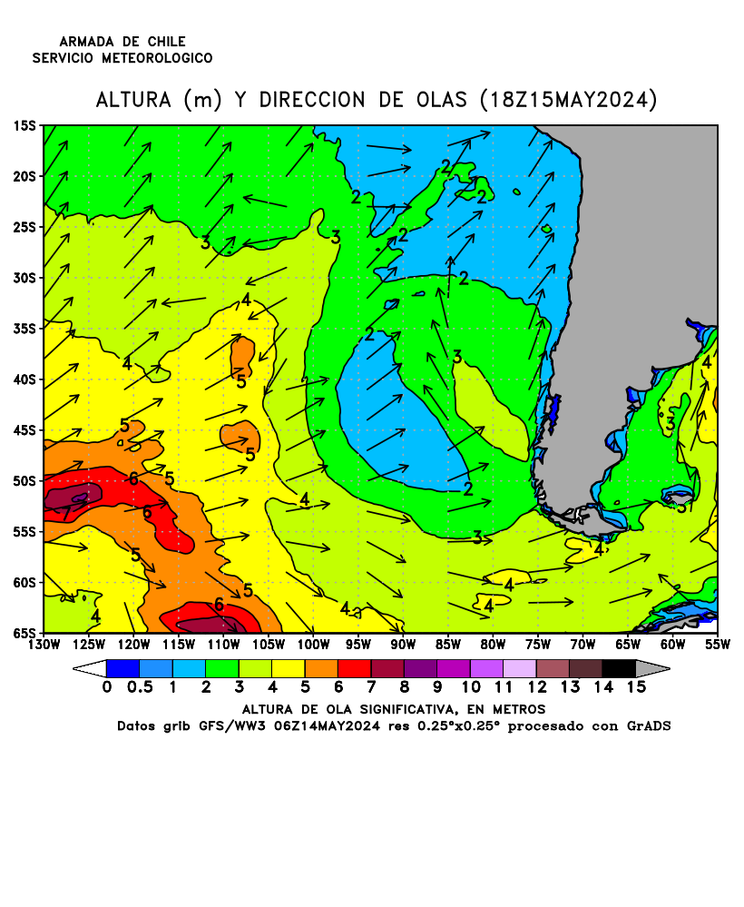
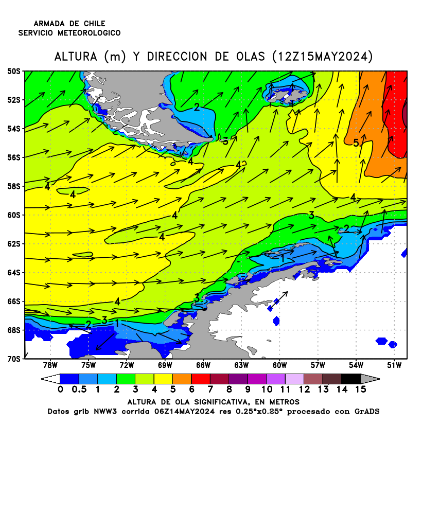
- Altura y direccion de olas
En la sección 6 (Modelamiento) cartas con previsión de altura de ola significativa para el Pacífico Sureste en color o en B/N de H+12 to H+120. Cartas en colores con olas de 5 metros y mas. Cartas en colores con pronóstico de olas para le Paso Drake. También animación y diapositivas. Se recomienda descargar este archivo y trabajar desde su PC. Versión sencilla, diseñada para navegantes y usuarios con acceso restringido a internet. Altura en metros.
Océano Pacifico: Costa occidental de Sudamérica Océano Austral: Paso Drake Carta con oleaje significativa para mañana (0Z, 6Z, 12Z o 18Z). Altura in metro - Wave Height Forecast
In section 6 (Models) maps with significant waves forecast for the Eastern South Pacific in colour or in B/W from H+12 to H+120. Color maps with waves of 5 meters or more. Color maps with wave forecast for the Drake Passage. Also loop file and slideshow loop. Save this file as a simple version designed for mariners and internet users with low bandwidth access. Height in meters.
- Cartas de hielo para la península Antártica (Tierra de O'Higgins)
En la sección 6 (Monitoreo de hielos) de la página: Información glaciológica y cartas con concentración de hielo con código oval.
- Península Antártica : Carta con concentración de hielo
- Cartas detallados con concentración de hielo : Estrecho de Bransfield - Islas Amberes y Adelaida - Bahía Margarita - Paso Antarctic y Mar de Weddell
- Carta con témpanos en la península Antártica
- Ice charts for the Antarctic Peninsula (Tierra de O'Higgins)
In section 6 (Floating Ice) of the page: Ice reports, satellite images and concentration ice charts with egg code.
- Antarctic Penninsula: Concentration ice chart
- Detailed concentration ice charts: Bransfield Strait - Anvers and Adelaide islands - Margerite Bay - Antarctic Pass and Weddell Sea
- Icebergs chart for the Antarctic Peninsula
- WMO egg code
- Manual de Servicios Meteorológicos Marinos (OMM Nº558, 2017)
El presente Manual tiene por objeto: a) determinar las obligaciones de los Miembros en lo que respecta a la ejecución de los servicios meteorológicos marinos; facilitar la cooperación en materia de coordinación internacional de los servicios meteorológicos marinos, en concreto el suministro del Servicio mundial de información y avisos meteorológicos y oceanográficos de la OMI y la OMM; facilitar la cooperación entre la Vigilancia Meteorológica Mundial y los servicios meteorológicos marinos; velar adecuadamente por la uniformidad y la normalización de las prácticas y los procedimientos empleados para conseguir los objetivos enunciados en a), b) y c).
- Guía de los Servicios Meteorológicos Marinos (OMM Nº471, 2017)
La presente Guía responde al propósito de completar le Manual de Servicios Meteorológicos Marinos como sigue: a) describir las necesidades requeridas para los distintos tipos de servicios; b) explicar las razones a que responden los métodos convenidos para la prestación de servicios;c) orientar sobre la manera de constituir y mantener servicios meteorológicos marinos.
- Manual Conjunto OMI/OHI/OMM relativo a la ISM (OMM Circ 1310, 2014)
Información sobre seguridad marítima (ISM) : radioavisos náuticos y meteorológicos, pronósticos meteorológicos y otros mensajes urgentes relacionados con la seguridad que se transmiten a los buques. El presente Manual es una guía práctica para todas las personas interesadas en elaborar o en transmitir ISM en el marco del sistema mundial de socorro y seguridad marítima (SMSSM).
- Estado de Puertos
Situatión portuaria: Bahías con Restricción Temporal, Aviso de Marejadas, Aviso de Mal tiempo, Avisos Especiales, Pronóstico Meteorológico, Naves Recalando, Naves en Puerto, Naves que Zarparon. También: Estado de Puertos Cerrados.

- Simbología empleada en la transmisión de radiofaxímil.
Dirección General del Territorio Marítimo y de Marina Mercante (DIRECTEMAR)
- Estrecho de Magallanes: rutas y direcciones de pilotaje
Derroteros con rutas, regulaciones y direcciones de pilotaje para le Estrecho de Magallanes, canales y fiordos chilenos. Resumen: A - Disposiciones e informaciones generales de pilotaje; B - Navegación por el Estrecho de Magallanes o el Paso de Drake; C - Rutas de navegación en canales, estrechos y fiordos chilenos (Canal Chacao al Cabo de Hornos) (de Norte a Sur).
- Strait of Magellan: routes and information for piloting
Sailing directions with routes, regulations and information for piloting for the Strait of Magellan, Chilean channels and fiords. Summary: A - General piloting regulations and information; B - Sailing along strait of Magellan or Drake Passage; C - Sailing routes throughout Chilean straits, channels and fiords (from Chacao Channel to Cape Horn, Southbound).
- Telecomunicaciones Marítimas
El Servicio de Telecomunicaciones Marítimas administra una Red Nacional de Radioestaciones Marítimas encargada de proveer a las naves de un servicio de difusión coordinada de información sobre seguridad marítima, escucha de seguridad de las frecuencias de socorro y tramitación de la correspondencia pública y privada, dando cumplimiento a los acuerdos internacionales adoptados por el Estado y teniendo presente las recomendaciones sugeridas por la Organización Marítima Mundial (OMI). Temas: Listado de radioestaciones marítimas - Horarios de difusión radiotelefónica de información meteorológica - Zonas meteorológicas.
- Manual Internacional de los Servicios Aeronáuticos y Marítimos de Búsqueda y Salvamento II (IAMSAR)
Manual IAMSAR volumen II: Coordinación de las Misiones (2007). También: Guía sobre las técnicas de rescate (MSC.1/Circ.1182/Rev.1).
- Guías sobre Técnicas de Rescate
Su papel en el rescate el el mar. Como navegante, es posible que usted tenga que rescatar a personas en peligro en el mar. Puede tratarse de alguien que haya caído por la borda de su propio buque o puede que su buque haya acudido al lugar en el que se ha producido un suceso. Es posible que le avisen con poco tiempo y que haya vidas que dependan de usted. En muchas zonas del mundo, particularmente en zonas que están fuera del alcance de los medios de búsqueda y salvamento (SAR) en tierra, puede que su buque sea la primera unidad de salvamento, o incluso la única, que llegue a tiempo. El proceso de rescate es a menudo difícil. La guía se centra en el rescate y en lo que usted puede tener que hacer para lograrlo. Está destinada a ser utilizada como documento de referencia. Debe usted leerla ahora y remitirse a ella mientras se dirija al lugar del suceso a fin de prepararse para las operaciones de rescate. En ella se sugieren técnicas de rescate prácticas que han sido utilizadas con éxito para rescatar a personas en peligro en el mar (OMI, MSC.1/Circ.1182/Rev.1, 2014).
- Documentos sobre las radiocomunicaciones marítimas (Servicio Móvil Marítimo)
- Cartilla radiotelefónica del servicio móvil marítimo (TM-021)
- Manual para uso en el servicio móvil marítimo (TM-011A)
- Reglamento general de radiocomunicaciones del servicio móvil marítimo (TM-011)
- Frases normalizadas de la omi para las comunicaciones marítimas (TM-087)
- Registro Radioeléctrico del SMSSM (GMDSS Radio Logbook)
- Convenio Sobre el Reglamento Internacional Para Prevenir los Abordajes (COLREG)
COLREG: Reglamento Internacional Para Prevenir los Abordajes, 1972 (Enmiendas).
- Resoluciones Comité MSC de la OMI
El Comité de Seguridad Marítima es el más alto órgano técnico de la Organización. Está integrado por todos los miembros. Entre las funciones del Comité de seguridad marítima se incluye "examinar todas las cuestiones que sean competencia de la organización en relación con ayudas a la navegación, construcción y equipo de buques, dotación desde un punto de vista de seguridad, reglas destinadas a prevenir abordajes, manipulación de cargas peligrosas, procedimientos y prescripciones relativos a la seguridad marítima, información hidrográfica, diarios y registros de navegación, investigación de siniestros marítimos, salvamento de bienes y personas, y toda otra cuestión que afecte directamente a la seguridad marítima".
- Resoluciones Comité MEPC de la OMI
El Comité de protección del medio marino, que se compone de todos los Estados Miembros, está facultado para examinar toda cuestión que sea competencia de la organización en relación con la prevención y contención de la contaminación del mar, ocasionada por los buques. Especialmente se ocupa de la aprobación y enmienda de convenios y otras reglas y medidas para garantizar su observancia.
- Código Internacional para los buques que operen en Aguas Polares (Código Polar)
El Código internacional para los buques que operen en aguas polares se ha elaborado como complemento de los instrumentos actuales de la OMI con objeto de incrementar la seguridad de las operaciones de los buques y reducir sus repercusiones en las personas y el medio ambiente en las aguas polares, remotas, vulnerables y posiblemente inhóspitas. Texto refundido del Código polar que figura en los anexos de las resoluciones MSC.385(94) y MEPC.264(68), 2019.
- Sistema de Notificación de la Situación de las Naves - CHILREP
El CHILREP es un sistema voluntario "positivo", es decir, si se pierde contacto con el buque y no se recibe una notificación de la situación o final (arribo a puerto o salida del área SAR nacional), el Centro o Subcentro Coordinador de Búsqueda y Salvamento Marítimo iniciará las indagaciones y adoptará los procedimientos para determinar si el buque se encuentra o no seguro. Sin perjuicio que el CHILREP es voluntario, la reglamentación nacional dispone que todo buque extranjero que se dirija a un puerto chileno debe comunicar su arribo con un mínimo de 24 horas de anticipación. Cuando los buques extranjeros se desplacen por aguas interiores de la República deberán comunicar su posición a las 12:00Z y 24:00Z. En las demás situaciones, el sistema considera un informe diario entre las 12:00Z y 16:00Z. Los buques de bandera chilena deben notificar su posición a las 12:00Z y 24:00Z diariamente (También archivo PDF descargable).
- CHILREP - Ship Reporting System
CHILREP is a “positive” voluntary system that is, if contact with a vessel is lost and no report is received (arrival in port or departure from the national SAR area), the Maritime Search and Rescue Coordination Centre or Sub-Centre shall initiate inquiries and adopt procedures to determine whether the vessel is safe or not. Notwithstanding that participation in the system is voluntary, domestic regulations provide that all foreign vessel bound to a Chilean port must report her arrival at least 24 hours in advance. When foreign vessels navigate inland waters of the Chilean Republic they must report their position at 12:00 Z and 24:00 Z. Under other conditions, the system considers a daily report between 12:00 Z and 16:00 Z. Chilean flagged vessels must report their position at 12:00 Z and 24:00 Z daily.
- Contacto MRCC/MRSC Chile
La misión del Servicio de Búsqueda y Salvamento Marítimo es organizar y efectuar la búsqueda de las naves, artefactos navales u otros vehículos de transporte en el área marítima de responsabilidad nacional, con el propósito de salvar a su dotación y pasajeros que se hallen en peligro, a consecuencias de un accidente en el mar.
- Boletín Informativo Marítimo (BIM)
El boletín informativo marítimo (bim) es un completo compilado de las resoluciones emitidas por la directemar y sus direcciones técnicas marítimas dependientes. su edición es mensual y el trabajo es realizado por la división reglamentos y publicaciones
- Estado de Puertos
Situatión portuaria: Bahías con Restricción Temporal, Aviso de Marejadas, Aviso de Mal tiempo, Avisos Especiales, Pronóstico Meteorológico, Naves Recalando, Naves en Puerto, Naves que Zarparon. También: Estado general capitanías de puerto.
- Estrecho de Magallanes: rutas y direcciones de pilotaje
China / Chine
- Navigation Guarantee Department (NGD) / 海军司令部航海保证部
- Maritime Safety Administration (China MSA) / 中国沿海港口航道图目录
- China Satellite Navigation Office (CNSO-TARC) / 中国卫星导航系统管理办公室测试评估研究中心
- 国家海洋环境预报中心 (National Marine Environmental Forecasting Center)
- China Oceanic Information Network (COIN/NMDIS) / 中国海洋信息网
- National Meteorological Center (NMC/CMA) / 中央气象台
- Hong Kong organizations / Organisations de Hong Kong
Navigation Guarantee Department (NGD) / 海军司令部航海保证部
- List of publications
- 航海通告
航海通告由索引、永久性通告、预告、航行警告、航标改正、贴图改正、航路指南和其它航海信息、海区情况报告表及其使用说明等内容组成。主要通报了助航设备的设置与更改,水中危险物和障碍物的发现和清除,水下建筑物的变化,港区、航道和锚地水深的更正,特殊海区的变化,航海图书的出版信息和其它与航行有关的内容。 若浏览通告,如果您还没有下载浏览器或浏览不正常,请下载: 中文版: ReaderSetup3.2 本网站公布的航海通告资料供参考使用!详见我部出版的纸质《航海通告》!
- 航海通告在线查询系统 (NTM query)
- Notices to Mariners
The weekly edition of Notices to Mariners is to promulgate changes in the sea areas and publishing of nautical charts and publications. It is not only for users to update their nautical charts and publications, but also for mariners to assist their navigation. To view the Notices, you need to download: ReaderSetup. The Notices to Mariners offered on this website are for reference only. For details, please see the paper edition of Chinese Notices to Mariners.

- List of publications
Maritime Safety Administration (China MSA) / 中华人民共和国海事局
- 船舶船员新冠肺炎疫情防控操作指南 (V4.0)
本指南参考世界卫生组织和国际海事组织关于船舶防控新冠肺炎的相关指南文件,结合航运公司关于船舶疫情防控的实践经验,旨在为船舶防控新冠肺炎疫情提供建议,并为船员个人防护提供指导。
- 船舶船员新冠肺炎疫情防控操作指南(V1.0)
本指南参考世界卫生组织和国际海事组织关于船舶防控新冠肺炎的相关指南文件,结合航运公司关于船舶疫情防控的实践经验,旨在为船舶防控新冠肺炎疫情提供建议,并为船员个人防护提供指导。
- Catalogue of Chinese Coastal and Fairway Charts / 中国沿海港口航道图目录
This catalogue (CNP203, 2016) is worked out specially for the purpose of providing mariners and relevant users with accurate charts of Chinese coastal ports and fairways in time. In order to keep navigation safety and prevent sea pollution, all vessels which navigate in the Chinese coastal ports and fairways must fit out the updated charts and other relative navigation publications, which are published by China MSA, the official publishing office of the Chinese coastal port and fairway charts.
- Online Catalogue of Nautical Publications
- Paper Nautical Charts : Chart list & chart graph
- Electronic Navigational Charts: ENC list & ENC Graph
- Nautical Books
- Online chart chart with medium definition scan
Raster map for upload / Cartes marines papiers scannées téléchargables
Medium resolution scan / Scan de résolution moyenne
Not for navigational use / Ne pas utilisez pour la navigation
Select a chart on the list. Click on the right blue button 缩略图. With the right mouse button chose "View image". Click on the image.
Online Chinese coastal and fairway charts with medium definition scan. - List of Coastal Radio Stations
List of coastal radio stations for China: VHF, MF and HF. File in doc format.
- Vessel Traffic Service User's Guide
These guides are published in order to provide the users with a brief introduction to the vessel traffic services (hereinafter referred to as VTS) and the requirement of the vessel traffic services center concerning traffic management and service and the navigation information which may be necessary for the vessels, thus to promote the understanding and cooperation between VTS center and users, and to ensure the safety of navigation, promote the traffic efficiency and protect the environment. VTS: Wuhan, Beichangshan, Jiangsu, Fujian, Zhanjiang, Yingkou, Yangshan, Yantai, Xiamen, Wuhu, Wusong, Tianjin, Shenzhen, Qinhuangdao, Ningbo, Lianyungang, Jingtang, Huanghua, Guangzhou, Chengshanjiao, Caofeidian.
- Ship’s Routeing System
Ship’s routeing system for these areas: Laotieshan Channel, Changjiangkou, Caofeidian Waters, Anhui Section of Yangtze River, Jiangsu Section of Yangtze River, Changshan Channel, Chengshanjiao Promontory, Shanghai Section of Yangtze River, Ningbo-Zhoushan Port, Three Gorges Reservoir Area, Pearl River Estuary, Qingdao Waters.
- Ship’s Reporting System
Ship’s reporting system for these areas: deep water route of Ningbo-Zhoushan port, Changshan channel, Changjiangkou, waters of the Pearl River estuary, Laotie Shan channel, Chengshan Jiao promontory.
- 1972 年国际海上避碰规则公约 (COLREG)
1972 年国际海上避碰规则。目录:第一章 总则, 第二章 驾驶和航行规则, 第三章 号灯和号型, 第四章 声响和灯光信号, 第五章 豁免, 附录一 号灯和号型的位置和技术细节, 附录二 在相互邻近处捕鱼的渔船额外信号, 附录三 声号器具的技术细节, 附录四 遇险信号 (2003)。
- Search and Rescue Centers
The Search and Rescue Center is responsible for organizing, coordinating and directing major search and rescue operations and responses to ship pollution accidents and other sudden emergencies at sea and in inland waters.
- Navigational warnings
Navigational warnings in English.
- 海图改正通告
本通告刊登的中国沿海海区航行要素变化信息以及海上施工作业信息,主要用以改正 中华人民共和国海事局出版的中国沿海港口航道图,并为广大航海用户提供有关航行安全的 服务信息。
- Chart Correcting Notice (Notices to Mariners)
The Notices to Mariners which publish the information about essential changing feature of Chinese coastal sea area and works at sea, is mainly used to correct the Chinese coastal port and fairway Charts and offer navigation safety information for mariners. The English version notices include the Notices to Mariners and Temporary Notices.
- Notice to Mariners (改正通告)
The Notices (NtM) which publish the information about essential changing feature ofChinese coastal sea area and works at sea, is mainly used to correct the Chinese coastal port and fairway Charts and offer navigation safety information for mariners. The English version notices includes the Notices to Mariners and Temporary Notices.

- 船舶船员新冠肺炎疫情防控操作指南 (V4.0)
China Satellite Navigation Office (CNSO-TARC) / 中国卫星导航系统管理办公室测试评估研究中心
- BeiDou Constellation Status
Beidou satellites with status: Operational, Experiment, Testing...
- BeiDou Satellites Health
BeiDou satellites health status for 24 hours: Healthy (green), Unhealthy (red), Testing (yellow) or Unknown (blue). The data was collected and integrated by iGMAS global tracking stations. The definition of satellite health status refers to the D1 navigation message in "Satellite Autonomous Health Identification (SatH1)" on the 22nd page of "BDS Spatial Signal Interface Control Document (ICD) Service Publicity Signal B1I (Version 2.1) ".
- BeiDou Position Dilution of Precision (PDOP)
World map with the values of position geometry factor PDOP for BeiDou on the Earth surface (elevation ≥ 5°, time BDT/UTC). PDOP reflects the amplification effect to the user ranging error which is caused by spatial geometry of visible satellites and the receiver. The smaller the PDOP, the higher the positioning accuracy.
BeiDou Position Dilution of Precision (PDOP) - UTC
BeiDou Satellites Health- GLONASS constellation status
GLONASS satellites with status: Operational, Testing...
- GLONASS Satellites Health
GLONASS satellites health status: Healthy (green), Unhealthy (red) or Unknown (blue). The data was collected and integrated by global tracking stations. The definition of satellite health status refers to the navigation message in "Satellite Health Identification Bn(ln)" on the 22nd page of "GLONASS Interface Control Document (ICD) 2008 (Edition5.1)".
- GLONASS Position Dilution of Precision (PDOP)
World map with the values of position geometry factor PDOP for GLONASS on the Earth surface (elevation ≥ 5°, time BDT/UTC). PDOP reflects the amplification effect to the user ranging error which is caused by spatial geometry of visible satellites and the receiver. Under a fixed user error range, the smaller the PDOP, the higher the positioning accuracy.
- GPS Constellation Status
GPS satellites with status: Operational, Experiment, Testing...
- GPS Satellites Health
GPS satellites health status for 24 hours: Healthy (green), Unhealthy (red) or Unknown (blue). The data was collected and integrated by iGMAS global tracking stations. The definition of satellite health status refers to the subframe 1 of navigation message in "SV Health" on the 94nd page of "IS-GPS-200J".
- GPS Position Dilution of Precision (PDOP)
World map with the values of position geometry factor PDOP for GPS on the Earth surface (elevation ≥ 5°, time BDT/UTC). The Position Dilution of Precision (PDOP) is used to characterize the relative positioning relationship between navigation satellite and user. The user's positioning accuracy can be simplified as PDOP*UERE. Under a fixed user error range, the smaller the PDOP, the higher the positioning accuracy.

- BeiDou Constellation Status
国家海洋环境预报中心 (National Marine Environmental Forecasting Center)
- 台风海浪筈报
害预警:台风海浪筈报 (Typhoon)。
- 台风路径图例
风暴潮预报:台风路径图例。台风路径 - 增水场 - 站点。最大增水场預报 - 增水概率預报 (Typhoon map)。
- 天文潮预报
潮汐预报:地点 - 潮位基准面 - 潮汐 - 时间 - 天文潮位(cm)- 潮汐- 时间 - 天文潮位(cm) - 未来三十天预报 (World tides)。
- 中国潮汐
逐时海潮预报:近岸预报 - 浴场预报 - 旅游海岛预报 - 旅游海岛预报 - 国内港口预报 (Chinese tides)。
- 海浪实况
海浪实况。西北太平洋海浪实况图。说明:该产品仅供用户参考使用,对因使用该产品而引起的任何直接、间接、特殊、偶然或结果性损失均不承担责任。本产品版 (Wave analysis)。
- 海浪预报
波浪预报从 +0 小时到 +168 小时。海浪实况分析 - 全球 - 印度洋 - 西北太 - 中国海 - 渤黄海 - 东海 - 南海。 说明:阁中有效波商用色斑阁农示。箭头方向农示平均波向,大小农示埘期。说明:该产品仅供用户参考使用,对因使用该产品而引起的任何直接、间接、特殊、偶然或结果性损失均不承担责任。本产品版 (Wave forecast)。
Northwest Pacific: Wave Analysis at 8h (UTC+8) Northwest Pacific: Numerical Wave Prediction for Tomorrow (UTC+8) - Ice Silk Road
The ice silk road Sea : Arctic sea ice Status (Ice concentration) - Arctic sea ice forecast (Ice concentration, ice thickness, ice drift)...
- 冰上丝绸之路
冰上丝绸之路:北极区域海冰实况 (海冰密集度) - 北极区域海冰预报 (海冰密集度 - 海冰厚度 - 海冰漂移速度) (Polar ice products)。
- 海冰综合预报
海冰综合预报:海冰年预报 - 海冰月预报 - 海冰旬预报 - 海冰周预报 (Ice products)。

- 台风海浪筈报
China Oceanic Information Network (COIN/NMDIS) / 中国海洋信息网
- 我国主要港口潮汐预报
我国主要港口潮汐预报(月报)。 北海 - 大连(老虎滩) - 高 雄 - 广 州 - 海口(秀英) - 连云港 - 青 岛 - 秦皇岛 - 塘 沽 - 吴淞 - 厦 门 - 镇 海。
Tide Tables for China: Beihai - Dalian (Laohutan) - Gaoxiong - Guangzhou - Haikou (Xiuying) - Lianyungang - Qingdao - Qinhuangdao - Tanggu - Wusong - Xiamen - Zhenhai (HTML). - 在线潮汐表
收录港口: 484 一 亚洲 北美洲 南美洲 大洋洲 南极洲 非洲 欧洲。
热门港口: 大连港 连云港 秦皇岛港 吴淞 汕头 防城港 锦州港 宁波 香港 钓鱼岛 黄岩岛。 - 潮汐表 (中国海事服务网)
收录港口: 484 一 亚洲 北美洲 南美洲 大洋洲 南极洲 非洲 欧洲
热门港口: 大连港 连云港 秦皇岛港 吴淞 汕头 防城港 锦州港 宁波 香港 钓鱼岛 黄岩岛。

- 我国主要港口潮汐预报
National Meteorological Center (NMC/CMA) / 中央气象台
- 实时台风
台风路径实时发布系统是由中央气象台权威发布台风信息系统,系统可及时准确地提供最新最全的台风实时信息、预报路径,同时整合卫星云图、气象雷达、降雨等内容。
- 台风预报地图
- 台风预报
- 台风模式:台风路径预报图 (1)
- 台风模式:台风路径预报图 (2)
- 台风模式:台风路径
Typhoon: Track and intensity forecast map for the North West Pacific
Speed in meters per second, for knots multiply by 2Typhoon: Track and speed forecast map for the North West Pacific
Speed in meters per second, for knots multiply by 2- Typhoon forecast maps
The cone contains the probable path of the storm center but does not show the size of the storm. Hazardous conditions can occur outside of the cone.
- Typhoon: Track and intensity forecast: track 1
- Typhoon: Track and intensity forecast: track 2
- Typhoon: Track forecast
- Dynamic Risk Assessment System for Vessels under Rough Sea
Dynamic map with risk assessment for passenger/roro ferry, small bulk carrier, easy fluidized solid bulk carrier and fishing boat. The evaluation results obtained by using this system are for reference only. The user shall make a decision according to the specific ship condition, cargo, loading state and the actual weather conditions at that time.The system development and release units do not assume any legal responsibility.
- 实时台风

China - Hong Kong / Chine - Hong Kong
Hong Kong Hydrographic Office
- Chart Index of Nautical Charts
Bilingual (Chinese and English) paper nautical charts are produced in accordance with the specifications of the International Hydrographic Organization (IHO). The positions on the chart are referred to the WGS84 Datum. The depths are in metres and reduced to the Chart Datum, which is approximately the Lowest Astronomical Tide. The buoyage system in Hong Kong follows the IALA Maritime Buoyage System (Region A), i.e. Red to Port, Green to Starboard.
- Hong Kong Chart 1
Published in booklet form, HK Chart 1 provides a handy reference to the symbols, abbreviations and terms used on nautical charts produced by HKHO.
- Real Time Tide
In the interest of quick delivery of information, all real-time tide data in the website have not been subjected to quality control. They are provided by the Government of the Hong Kong Special Administrative Region as a service to the public and may be used for informational purpose only. Index Map: Chek Lap Kok, Cheung Chau, Ko Lau Wan, Kwai Chung, Ma Wan, Quarry Bay, Shek Pik, Tai Miu Wan, Tai Po Kau, Tsim Bei Tsui, Waglan Island. Click on the earth then "English" for the english version (HTML).
- Hong Kong Tidal Stream Prediction System
Hydrographic Office (HO) of Marine Department has introduced a computer-based Tidal Stream Prediction System (TSPS) to generate tidal stream predictions for some 1,200 points across Hong Kong waters. The predictions include the tidal stream speed and direction for each point at 15-min interval for two years and one day. The prediction period includes an immediate past year, current day and a year thereafter. Such information is available to the public users for on-line access and downloading in this website. These predictions will deviate from the actual conditions in the field since temporal and localised meteorological effects and non-tidal flow variations could not be taken into account. According to the comparison of the predicted data with the actual field observed data, the average difference in current peak magnitude ranges from 0.03 m/s to 0.21 m/s, while the average phase difference in peak velocity was about 17 minutes.
- Miscellaneous plans
The following three chartlets are in PDF (Portable Document Format): Waters of Hong Kong Special Administrative Region - Principal Fairways of Hong Kong - Restricted Areas of Hong Kong International Airport.
- Navigational warning
Navigational warning (via NAVTEX) contains warning(s) valid for the northern part of the South China Sea.
- Notices To Mariners (NTM)
The bi-weekly issue of Notices To Mariners (NTMs) promulgated by the Hong Kong Hydrographic Office enables mariners to update their HK charts. Contents: I General Notes / Index of Charts Affected - II Publications Affected and Chart Corrections - III Marine Information (like temporary notice) - IV Reprints of Navigational Warnings (NAVTEX) - V Corrections to Charts for Local Vessels.
- Chart Index of Nautical Charts
香港海道測量部
- 紙海圖 一 海圖索引
中英對照的紙海圖是根據國際海道測量組織的規格而繪製。海圖上的位置參照1984年世界大地測量系統(WGS 84)基準;深度則由海圖基準以下計算,以米為單位,此基準與最低天文潮相若。香港航標系統採用國際航標協會海上浮標A區域系統,即紅在左舷、綠在右舷。
- 香港海圖一號
書冊式印製,提供應用於香港海圖的符號、略語、術語的輕便參照。
- 实时潮汐
为了尽早将讯息显示,本网页内的所有实时潮汐资料,并没有作质量控制。香港特别行政区政府提供这些资料只作为公众服务及资料参考用途。本网页由海事处海道测量部及香港天文台联合制作。各站位置圖: 赤鱲角, 長洲, 高流灣, 葵涌, 馬灣, 鰂魚涌, 石壁, 大廟灣, 大埔滘, 尖鼻咀, 橫瀾島。
- 香港水流預測系統
請先於地圖上選擇地點 作預測。不能作航行用途。
- 雜項圖
下面的小海圖是以PDF格式建成 : 香港特別行政區水域 - 香港主要航道 - 香港國際機場限制區。
- 航行警告
航行警告(經航行警告電傳) 包括南中國海北部的有效航行警告。
- 航海通告 (NTM)
香港海道測量部每隔兩周發佈航海通告。航海人員可藉此更新他們的海圖。

- 紙海圖 一 海圖索引
Marine Department
- The Complete Berthing Guidelines for Port of Hong Kong
The Berthing Guidelines (BGL) provides guidance on the efficient provision of pilotage services. The BGL is a reference for all port users requiring pilotage services. In order to expedite the arrangement of operation involving pilotage, the BGL set out the agreed operational parameters and measures which were endorsed by the Pilotage Advisory Committee (PAC). Owners, operators and agents of ships are encouraged to disseminate relevant information contained in this BGL to their masters of ships.
- Port Operation Procedures
Hong Kong Port Operation Procedures: Procedure for a Vessel Entering Hong Kong Waters - Procedure for a Vessel Departing from Hong Kong Waters - Pilotage - Harbour Mooring Buoy - Carriage of Dangerous Goods...
- Marine Traffic Control
Vessel Traffic Services are provided to vessels visiting Hong Kong to ensure their safety and to facilitate their arrival and departure as expeditiously as possible. There are 10 Principal Fairways and 2 Traffic Separation Schemes in the waters of Hong Kong.
- Traffic Separation Schemes and Principal Fairways (with map)
- Kwai Chung Control Station (with map)
- Ma Wan Marine Traffic Control System (with map)
- Plans of Typhoon Shelters - Hong Kong
A set of the Plans of Typhoon Shelters on which the passage area is shown coloured grey is prepared below for public inspection. Typhoon Shelter: Aberdeen South - Aberdeen West - Causeway Bay - Cheung Chau - Hei Ling Chau - Kwun Tong - New Yau Ma Tei - Rambler Channel - Sam Ka Tsuen - Shau Kei Wan - Shuen Wan - To Kwa Wan - Tuen Mun - Yim Tin Tsai.
- Safety Publications and Others
Safety publications for port of Hong Kong: Safety guidelines for boating activities during fireworks displays or other major events at sea - Water Sport Safety - Observing the Safety advice Enjoying the fun at sea - Safe Operation of Small Pleasure Vessels - Safe Navigation In Restricted Visibility - Speed Limits of Vessels within Hong Kong Waters - Notes to Local Pleasure Vessels - Guidelines for Co-using Kwun Tong Typhoon Shelter - Measures to Enhance the Safety of Local Vessels During Passage of Tropical Cyclones - New arrangement for Vessel Traffic Service - Rearrangement of Principal Fairways and Anchorages in the Western Harbour - Safely Afloat, Away From the Shallows...

Hong Kong Observatory
- Hong Kong Weather Services for Shipping
The main purpose of this publication is to provide under one cover information on the weather services provided by the Hong Kong Observatory for mariners at sea and in the harbour of Hong Kong. Target readers include crew of ocean-going ships, operators of ship companies, and professionals and other members of the public engaged in offshore and onshore marine activities.
- Tropical Cyclone Track Information
Only tropical cyclones centred within the area bounded by 7-36N and 100-140E will be shown on this website. Also: Warning for shipping.
- Hong Kong's Tropical Cyclone Warning Signals
Tropical cyclone warning signals are to warn the public of the threat of WINDS associated with a tropical cyclone.
- Visibility Readings in Hong Kong Waters

Visibility Readings in Hong Kong Waters (UTC+8)
- Tide Tables for Hong Kong 2022
The tide tables (PDF file) list the predicted heights and times of daily high and low waters at 12 locations in Hong Kong, namely Chek Lap Kok (East), Cheung Chau, Ko Lau Wan, Kwai Chung, Ma Wan, Quarry Bay, Shek Pik, Tai Miu Wan, Tai O, Tai Po Kau, Tsim Bei Tsui and Waglan Island.
- Tidal information for Hong Kong
Forecast and real-time on HTML format. Tides in Hong Kong are mixed and mainly semi-diurnal. On most of the days in a month, there are two high tides and two low tides. As the predicted times and heights of the high and low tides are derived for average meteorological conditions, the observed tides may differ from those predicted when the actual meteorological conditions deviate from the mean. The real-time tide data are provided as a service to the public and may be used for informational purpose only. Location: Chek Lap Kok, Cheung Chau, Ko Lau Wan, Kwai Chung, Ma Wan, Quarry Bay, Shek Pik, Tai Miu Wan, Tai Po Kau, Tsim Bei Tsui, Waglan Island.
- Map with Actual Tidal Height: link to real-time tide (24hr)
- Predicted tides at selected locations in Hong Kong: graphical data (3 years)
- Predicted tidal information in text format: times, heights of high/low tides - hourly heights (3 years)
- Notes about tides
- 2022 Almanac with tidal predictions
Times of Sunrise, Sun Transit, Sunset, Moonrise, Moon Transit, Moonset and Tidal Predictions (tide time and tide height).
- Astronomical Data
Astronomical data: Date and Time of the 24 Solar Terms - Time, Direction and Elevation of Sun Transit - The Apparent Right Ascension and Apparent Declination of the Sun - Date and Time of the Moon Phases.
- International Time Zone
World map with international time zone and time. The time displays in this page are obtained from your computer clock.
- Space weather alerts in force
Space weather alerts in force: Radio Blackout Alert - Solar Radiation Storm Alert - Geomagnetic Storm Alert.
- HKO e-Bulletin for the Marine Community
This bulletin is published on-line every three months. It aims at providing the latest news and development of weather services for the marine community.
- The Complete Berthing Guidelines for Port of Hong Kong
Colombia / Colombie
Centro de Investigaciones Oceanográficas e Hidrográficas (CIOH/Colombia)
- Catálogo de cartas y publicationes náuticas
Tienda Virtual: Cartografía Náutica, Cartografía Temática,Especies Venales, Libros Y Publicaciones, Matrículas, Servicios, Trámites de Gente de Mar y Naves, Trámites de Investigación y Señalización Marítima, Trámites de Litorales y Áreas Márinas, Trámites de Transporte Marítimo.
- Publicationes náuticas
- Catálogo de cartas náuticas de papal de Colombia
- Catálogo de cartas electrónicas (ENC) s
- Manual de Geodesia para Hidrografía
La Geodesia es una de las ciencias de la tierra que se encarga de determinar las dimensiones y forma de la tierra, implicando su uso tanto en la parte terrestre como en los mares adyacentes. Esta ciencia es utilizada por la Hidrografía y la Oceanografía para conocer con la mayor exactitud posible, las posiciones de los puntos de la superficie y sobre el nivel del mar, para las proyecciones que se deben utilizar en la cartografía. El Manual de Geodesia para Hidrógrafos es una publicación especializada con el fin de prestar un apoyo para los docentes que tienen la tarea de enseñar los principios básicos del posicionamiento.
- Guía Náutica Turística de Colombia
Fruto del esfuerzo de muchas personas apasionadas por las costas colombianas y su mundo marino, presentamos ante el mundo la primera edición de la Guía Náutica Turística Colombiana. Abrimos con esta las puertas de Colombia al turismo náutico, mostrando una oferta de destinos, puertos, marinas y sitios de fondeo con abundantes bondades naturales y una privilegiado ubicación geográfica, integrándonos así al gran corredor de lo náutica en América. También guía con una mejor definición y versión para ver en línea). - The Cruising Guide to Columbia
The Cruising Guide to Columbia: "Its Exotic Caribbean and Pacific Coasts" provides useful information for cruisers navigating the Pacific and the Caribbean coastlines of Colombia on yachts, mega yachts, and sailboats, as well as tourist information.
- Pronóstico Modelo de Oleaje Caribe
Las imágenes muestran la altura significativa de la ola, la cual corresponde al promedio del 33% de olas más altas durante un periodo de observación. Es normal encontrar valores de altura máxima de la ola de 1 a 1.5 más altas que la altura significativa pronosticada. Hora y fecha del pronóstico de la dirección y altura significativa de la ola: HHMMR DDMMAAAA. Ejemplo: 0700R 09122009 el pronóstico corresponde a las 0700 hora local colombiana del 09 de diciembre de 2009.

Caribbean sea: wave forecast for five days (UTC-5) - Height in metres https://cccp.dimar.mil.co/Mareas
- Marea
Nivel del mar : 120 horas de pronóstico (HTML). Pronóstico de Pleamares y Bajamares para el mes (PDF). Puertos : Providencia, San Andrés, Puerto Bolívar, Riohacha, Santa Marta, Barranquilla, Cartagena, Coveñas, Urabá. Pronóstico utilizando la Hora Legal para Colombiana (HLC : UTC -5).
- Radioavisos Náuticos - Navtex
Radioavisos Costeros. Estos mensajes se actualizan con los radioavisos costeros vigentes que afectan la seguridad marítima, los cuales son transmitidos a través del sistema internacional NAVTEX frecuencia 518 y 490Khz. En esta página se transcriben los radioavisos Costeros que se encuentran vigentes al día de la fecha.
- Avisos a los Navegantes
Los Avisos a los Navegantes son notificaci/ones a los marinos que ayudan a mantener la seguridad de la vida en la navegación, estas publicaciones además ayudan a mantener la cartografía y demás ediciones náuticas de Colombia actualizadas. Pueden ser de carácter temporal o permanente.
- Catálogo de cartas y publicationes náuticas

Dirección General Marítima (DIMAR/Colombia)
- Glosario marítimo
Glosario marítimo en Español de la letra A a la letra Z.
- Autoridades Marítimas del Mundo
En este aparte usted encontrará vínculos e información general de las Autoridades Marítimas de Latinoamérica y las más importantes del mundo.
- Convenios OMI (Organización Marítima Internacional)
Lo invitamos a conocer los principales convenios de la OIM: Convenio Internacional sobre Búsqueda y Salvamento Marítimo de 1979 (SAR), Convenio Internacional sobre la Seguridad de la Vida Humana en el Mar (SOLAS)...
- Convenio sobre Reglamento Internacional para Prevenir los Abordajes - COLREG
El Convenio sobre el Reglamento internacional para prevenir los abordajes 1972 (Reglamento de abordajes), se estableció con el objeto de actualizar y sustituir el Reglamento para prevenir los abordajes de 1960, que se adjuntó en el Convenio SOLAS adoptado aquel año.
- Reglamento Marítimo Colombiano (Remac)
Este documento reglamentario de índole técnico-marítimo tiene como fin principal la compilación y estructuración de todas y cada una de las resoluciones vigentes, de carácter general, expedidas por la Dirección General Marítima y las Capitanías de Puerto, en cuyo contenido figuran aspectos relacionados con temas técnicos de la normatividad marítima.
- Glosario marítimo
 |
Croatia / Croatie
- Hydrographic Institute of the Republic of Croatia / Hrvatski hidrografski institut (HHI)
- Plovput (safety of navigation)
Hydrographic Institute of the Republic of Croatia / Hrvatski hidrografski institut (HHI)
- Catalogue of nautical charts and publications
The Catalogue (PDF) lists the whole editorial production of the Hydrographic Institute, covering the areas of the Adriatic Sea, the Ionian Sea and the Maltese Islands.
- Navigational publications
- Nautical Charts - Electronic Navigational Charts (ENC)
- Croatian Navigational Chart Coverage Catalogue
- Katalog pomorskih karata i publikacija
U Katalogu (PDF) pomorskih karata i publikacija navedena su sva izdanja Hrvatskog hidrografskog instituta, u kojima su obrađena područja Jadranskog mora, Jonskog mora i malteških otoka.
- Navigacijske publikacije
- Pomorske navigacijske karte - Elektroničke pomorske navigacijske karte - ENC
- Katalog navigacijskih karata
- Extracts and corrections to publications
Extracts and corrections to navigational publications that provide extensive information relevant for the safety of navigation which cannot be represented on charts. They are published as occasional publications (Sailing Directions, Lists of Lights and Fog Signals, Nautical Tables, Radio Service) or periodicals (Nautical Almanac, Tide Tables).
- Adriatic Sea - Portal operativne oceanografije
Visoke i niske vode [m]. Postaja: Bakar, Rovinj, Mali Lošinj, Zadar, Split, Vis, Ploče i Dubrovnik. Sva vremena odnose se na UTC+1 ili UTC+2.
- Oceanografski podaci - online
Plima i oseka: Ploče, Split, Dubrovnik i Rovinj. Također za neka mjesta: valovi, vjetar i tlak.
- Real-time Oceanographic data
Prediction for Croatia with next tides for Ploče, Split, Dubrovnik and Rovinj. Also for some places: waves, wind and pressure.
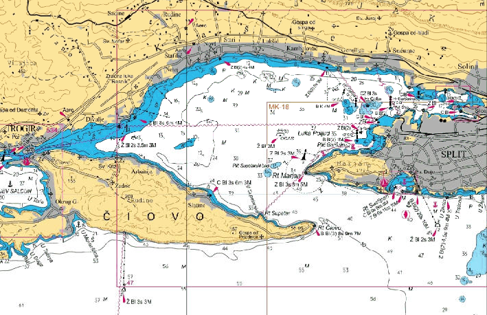
Adriatic Sea, Croatia. HHI coastal chart MK-16: Rogoznica - Split. Extract, original scale 1:100000 - Croatian Marine Data Geoportal
View online raster charts / Cartes marines papier consultables en ligne
Not for navigational use / Ne pas utilisez pour la navigation
Online raster nautical charts for the coasts of Croatia, scale of the charts 1 : 100 000. To access the nautical charts on the Geoportal: At the bottom and in the middle of the page click on the "List of layers" then on the left window click on "Male karte v2". - Navigacijski radiooglasi
Navigacijski radiooglasi na snazi. Pregled radiooglasa na ovim web stranicama ne može biti zamjena za praćenje radiooglasa putem obalnih radio postaja, niti oslobađa od odgovornosti zapovjednike i/ili članove posada od praćenja istih. Podaci objavljeni na stranicama e-Servisa Navigacijski radiooglasi, nisu i ne mogu se smatrati službenim podacima za navigaciju i sigurnost plovidbe!
- Radio Navigational Warnings
Radio Navigational Warnings in force. The Service of Radio Navigational Warnings on this web site may not be a substitute for the monitoring Radio Navigational Warnings through coastal radio stations, of their responsibility to monitor them masters and/or members of the crew. Information published on the web pages of Radio Navigational Warnings e-Service shall not be considered as official information for the safety of navigation!
- Oglas za pomorce (OZP)
”OGLAS ZA POMORCE” mjesečno je izdanje. Donosi obavijesti za ažuriranje pomorskih karata i navigacijskih publikacija Hrvatskog hidrografskog instituta za Jadransko more, Jonsko more i Malteške otoke. Sadržaj: I. Uvodna objašnjenja, pregled ispravaka - II. Ispravci karata - III. Ispravci peljara - IV. Ispravci popisa svjetala - V. Ispravci radioslužbe - VI. Ispravci kataloga - VII. Navigacijski radiooglasi - VIII. Obavijesti.
- Notice to Mariners (NtM)
”NOTICE TO MARINERS” is a monthly edition that contains information for keeping up-to-date Croatian charts and nautical publications for the Adriatic Sea, the Ionian Sea and the Maltese Islands. Contents: I. Explanatory Notes, Index of Corrections - II. Corrections to Charts - III. Corrections to Sailing Directions - IV. Corrections to List of Lights - V. Corrections to Radio Service - VI. Corrections to Catalogue - VII. Reprints of Radio Navigational Warnings - VIII. Information.

- Catalogue of nautical charts and publications
Plovput / Safety of Navigation
- Maritime Safety Information (MSI) / Emitiranje MSI informacija
NAVTEX and VHF broadcast schedule for navigational warnings and weather reports on Croatia. Also maps of coast stations.
- List of lighthouses / Svjetionici
List of Croatian lighthouses. Also a map of the Croatian lighthouses (HTML).
- Maritime Safety Information (MSI) / Emitiranje MSI informacija

| | D |


L'urgence prime la forme - By Cr - 2012-2024
For updates, corrections, new charts or new documents please send an e-mail to
For my father and my mother / Pour mon père et ma mère
