~ |
Online free nautical charts and publications
open data/open access - libre accès
Cartes marines gratuites et ouvrages nautiques en ligne
 | M |

| P | 
| ||
N
Netherlands/Pays-Bas
New Zealand/Nouvelle-Zélande
About Nautical Free
Nautical Free provides a list of free nautical charts and online publications.There is a list by country from letter A to letter V, for each country the organizations and for each organization a list of free online documents (charts, nautical books, notice to mariners...). There is two special lists: one for the international organizations and one for the private companies. There is also a reverse list by type of documents: sailing directions, radio signals, tide tables, nautical charts... You can also find on Nautical Free wave forecast maps for tomorrow, space weather forecast for GPS, how to check your computer clock, as well as information about celestial navigation or about ice navigation...
Au sujet de Nautical Free
Nautical Free fournit une liste de cartes marines gratuites et d'ouvrages nautiques en ligne.Il y a une liste par pays de la lettre A à la lettre V, pour chaque pays les organisations et pour chaque organisation une liste de documents libres en ligne (cartes marines, ouvrages nautiques, avis aux navigateurs...). Il existe deux listes spéciales : une pour les organisations internationales et une pour les sociétés privées. Il existe également une liste inverse par type de documents : instructions nautiques, ouvrages de radiosignaux, tables des marées, cartes marines... Vous trouverez également sur Nautical Free des cartes de prévision de la hauteur des vagues pour demain, des prévisions de la météo de l'espace pour les GPS, comment vérifier l'heure de son ordinateur, ainsi que des informations sur la navigation astronomique ou la navigation dans les glaces...
Advice / Conseils
For navigation use only updated regulatory documents /
Pour la navigation n'utiliser que des documents réglementaires à jour.
GPS is more accurate than nautical charts /
Un GPS est plus précis qu'un carte marine
Web Servers / Serveurs Web
You can use the nearest or faster server / Vous pouvez utiliser le serveur le plus proche ou le plus rapide :
- French mirror with one page by section / Serveur en France avec une page par section : http://nauticalfree.free.fr
- French mirror on one page / Serveur en France sur une page : http://nauticalfree.free.fr/onepage.html
- French mirror without image on one page / Serveur en France sans image sur une page : http://nauticalfree.free.fr/noimage/
- US mirror with one page by section / Serveur au États-Unis avec une page par section : http://nauticalfree.eu5.org
- US mirror on one page / Serveur au États-Unis sur une page : http://nauticalfree.eu5.org/onepage.html
- US mirror without image on one page / Serveur au États-Unis sans image sur une page : http://nauticalfree.eu5.org/noimage/
- US mirror on seven pages / Serveur au États-Unis sur sept pages : https://sites.google.com/site/nauticalfree/
Caption / Légende
- The nautical books are in standard fonts / Les ouvrages sont en caractères droits
- In Italic the maps and the charts / Les cartes sont en italiques
- The last item for an organization is the Notices to Mariners. The first issue of each year is often a special publication /
La dernier item pour un service hydrographique est un lien vers les avis au navigateurs. Le premier numéro de chaque année est souvent un numéro spécial
- Raster Navigational Charts (RNC)
- Bitmap electronic images of paper charts that conform to IHO standard S-61 /
Carte marine matricielle, fac-similé numérique d'une carte papier (scan) conforme à la norme de l'OHI S-61 - Electronic Navigational Charts (ENC)
- Vector charts that conform to IHO standard S-57 /
Carte électronique de navigation, carte vectorielle conforme à la norme de l'OHI S-57
|
|
Cartes marines gratuites et ouvrages nautiques en ligne : Pays-Bas, Nouvelle-Zélande, Nigéria et Norvège
N
Netherlands / Pays-Bas
- Hydrographic Service / Dienst der Hydrografie
- Varen doe je samen
- VTS-Scheldt: Common Nautical Management (CNM) / Gemeenschappelijk Nautisch Beheer (GNB)
Hydrographic Service
- Catalogue of Netherlands nautical charts and other nautical publications (HP7)
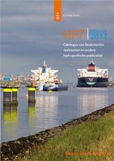
This catalogue contains information about the regular nautical charts and nautical publications as well as background information on new developments in relation to digital products and services. Published in Dutch and English. - Editions in force and editions to be published
List of charts and nautical publications in force. In the third column the most recent edition date of each publication is mentioned. Older publications are cancelled and cannot be updated with Notices to Mariners. In the last column the expected publication date of editions to be published is mentioned.
- Tidal guide
Information about tide tables and about stream atlases.
- Nautical software programs
Software for Windows and Apple / Logiciels pour Windows et Aspple
- CNAV: calculations of course, distance, tides and celestial navigation for voyage planning and execution
- Decca: convert between Decca lane counts and geographic or UTM coordinates. Calculations can be made in ED50 or WGS84
- PCTrans: provides many datum transformations and chart projections
- TSP: simplifies the maritime limits and zones available for download on our website.
- Coordinate systems at sea
For safe navigation at sea, it is important to know your position as well as the positions of obstacles. Positions are expressed in coordinates. Positions at sea are expressed in latitude and longitude, and height or depth with respect to a specified water level. Coordinates are only meaningful if you know the coordinate system they refer to. These are the so-called coordinate reference systems. Mariners have to know which coordinate reference system to use for positioning.
- Corrections to nautical publications
To support safe navigation, the Hydrographic Service publishes the most important changes to nautical publications. It does so by issuing Notices to Mariners (NtMs). The list contains all notices in force per nautical publication.
- Periodic lists
To support safe navigation, the Hydrographic Service publishes the most important changes to nautical products. It does so by issuing Notices to Mariners (NtMs). The weekly editions frequently contain periodical lists: P and T notices (Preliminary and Temporary) - Mobile offshore drilling units list (for Dutch charting area) - Measuring instruments list (not to fish nor anchor near these positions) - Cumulative list (NM applicable to the latest editions of the charts) - Water depth list (most recent water depths in the Wadden Sea area).
- Yearly publication NtM1 2021
Ntm1 (BaZ1) is a yearly publication with general and NtMs-related nautical information. Contents: Sale of Netherlands nautical charts and nautical publications - World Wide Navigational Warning Service (WWNWS) - Global Maritime Distress and Safety System (GMDSS) - Search and rescue signals - The Netherlands Coast Guard - Routeing measures - Pilotage...
- Notices to Mariners (NtM)
As a mariner, you need reliable data for safe navigation. Therefore, the Hydrographic Service publishes nautical charts and nautical publications. Since the situation at sea changes continuously, you are required to keep these products up to date. You can do so by using the Notices to Mariners (NtMs). You can select the changes to each nautical chart by week number or chart number. You can also incorporate the changes by means of a weekly PDF downloadable file.
- Catalogue of Netherlands nautical charts and other nautical publications (HP7)
Dienst der Hydrografie
- Catalogus van Nederlandse zeekaarten en andere hydrografische publicaties (HP7)
Deze catalogus geeft naast de vertrouwde gegevens van diverse zeekaarten en hydrografische publicaties tevens achtergrondinformatie met betrekking tot nieuwe ontwikkelingen op het gebied van met name digitale producten en dienstverlening.
- Actuele en in bewerking zijnde uitgaven
Overzicht van alle actuele uitgaven van zeekaarten en andere hydrografische publicaties. In de derde kolom is de meest recente publicatiedatum van iedere publicatie vermeld. Zeekaarten en publicaties met een oudere publicatiedatum zijn vervallen en kunnen niet meer worden bijgewerkt aan de hand van berichten aan zeevarenden. Van in bewerking zijnde uitgaven wordt in de laatste kolom de verwachte publicatiedatum genoemd.
- Coördinatenstelsels op zee
Voor veilige navigatie op zee is het belangrijk uw positie en die van obstakels te weten. Posities worden uitgedrukt in coördinaten. Op zee zijn dat vaak geografische lengte en breedte, en hoogte of diepte ten opzichte van een vastgestelde waterstand. Coördinaten hebben alleen betekenis als het coördinatenstelsel bekend is waaraan zij refereren. Dit zijn de coördinatenreferentiestelsels. Een zeevarende moet weten welk coördinatenreferentiestelsel hij gebruikt voor plaatsbepaling.
- Getijdengids
Informatie over de getijden op zee en algemene getijtheorie: Inleiding getijtafels - Inleiding stroomatlassen.
- Nautische computerprogramma's
Software for Windows / Logiciels pour Windows
- CNAV: Met het computerprogramma CNAV 4.1 kunt u de klassieke navigatieberekeningen exact en snel uitvoeren;
- Decca: Met Decca kunt u posities op zee berekenen aan de hand van Decca lane-informatie. Of andersom. De berekeningen zijn in het geodetisch datum WGS84 en ED50 uit te voeren;
- PCTrans: is een programma voor geodetisch en hydrografisch rekenwerk;
- TSP: Het programma vereenvoudigd de maritieme grenzen en zones die u op deze site kunt downloaden.
- Correcties op nautische publicaties
Om varen veilig te houden publiceert de Dienst der Hydrografie belangrijke wijzigingen op nautische boekwerken. De dienst doet dit met Berichten aan Zeevarenden (BaZ). Vindt u per boekwerk een opsomming van de relevante Berichten aan Zeevarenden (Correcties HP1 - The Netherlands Coast Pilot, Corrections HP2 - Liste des Pays-Bas et la lumière zone adjacente).
- Periodieke lijsten
Om varen veilig te houden publiceert de Dienst der Hydrografie belangrijke wijzigingen. De dienst doet dit met Berichten aan Zeevarenden (BaZ). In de weekedities BaZ verschijnen regelmatig lijsten met wijzigingen per nautische categorie. Op deze pagina vindt u een overzicht met de actuele lijsten: P en T berichten overzicht - Verplaatsbare boorplatforms overzicht - Meetinstrumenten overzicht - Cumulatieve lijst overzicht - Dieptestaat overzicht.
- BaZ in kaart gebracht
Deze brochure geeft uitleg over Berichten aan Zeevarenden en hoe deze moeten worden verwerkt.
- Jaarlijkse editie Berichten aan Zeevarenden (BaZ1) 2021
Naast de wekelijkse BaZ (Bericht aan Zeevarenden) verschijnt ook jaarlijks BaZ1 in digitale vorm. In BaZ1 staan algemene onderwerpen die van belang zijn voor schepen varend onder Nederlandse vlag. Inhoud: Verkoop van Nederlandse zeekaarten en hydrografische publicatie - World Wide Navigational Warning Service (WWNWS) - Global Maritime Distress and Safety System (GMDSS) - Onbedoelde alarmeringen met het GMDSS - De Nederlandse kustwacht - Routeringsmaatregelen - Beloodsing...
- Berichten aan Zeevarenden (BaZ)
De situatie op zee verandert continu. Boeien worden gelegd en gelicht, zandplaten verschuiven, containers slaan overboord en boorplatforms verhuizen. De Dienst der Hydrografie houdt deze veranderingen bij en publiceert de actuele situatie voor zeevarenden. Dat gebeurt in zogeheten Berichten aan Zeevarenden.

- Catalogus van Nederlandse zeekaarten en andere hydrografische publicaties (HP7)
Varen doe je samen
- Knooppuntenboekjes
Knooppunten: Een vaarwegknooppunt is een drukke locatie op de vaarweg waar sprake kan zijn van een verkeersonveilige situatie. In de ‘Knooppuntenboekjes’ staan per regio de belangrijkste vaarwegknooppunten beschreven. Gedetailleerde info per regio en knooppunt: 1a Noord-Holland - 1b Zuid-Holland - 1c Amsterdam-Rijnkanaal - 2 Deltawateren - 3 Friesland, Groningen en Drenthe - 4a Maas en de grote rivieren - 4b Gelderse IJssel - 5a Routes over de Waddenzee - 5b IJsselmeergebied - 6 langs de Noordzeekust - Knooppunten TOTAAL.
- 'Varen doe je Samen!' brochures
Op deze pagina vind je een overzicht van al onze brochures en andere uitgaven. Brochures: Brandveiligheid aan boord - Voorkom Motorstoring - Veiligheid aan boord - Communicatie op het water - Spelregels voor een veilige snelle vaart - Varen met slecht zicht - Reddingsvesten - Wat (niet) te doen in geval van onderkoeling - Man overboord! - Samen veilig varen - Veilig het water op! Vaarregels recreatie- en beroepsvaart - Werk veilig: draag uw reddingsvest! - Varen doe je samen! Op de Europese binnenwateren...
- Brochures « Naviguer ensemble »
Dans les brochures « Naviguer ensemble, Communication sur l’eau, Règles pour une navigation fluide et en toute sécurité, Rapidité et sécurité aux ponts et écluses et Le panneau bleu », vous trouverez en plus des principales règles de navigation, une foule d’idées et de conseils pratiques pour naviguer en toute sécurité.
- Brochures ‘Sail Together!’
The brochure ‘Sail Together!’contains the most important navigation rules, some advice and a number of practical tips for safe sailing. Other folders are: Rules for speed boats, Safety on board, Safe and fast through bridge and lock, Communication on the water, The blue sign in Europe. If you prepare yourself for your trip, you'll enjoy yourself much more!
- IJskaarten
IJsvorming op de vaarweg kan ernstige vertraging veroorzaken voor de scheepvaart. Daarnaast kunnen zogenaamde "ijsdammen" zorgen voor overstromingen. De ijstoestand op de Waddenzee, zeearmen en IJsselmeer is ook afhankelijk van de wind en/of het getij. De berichtgeving op deze pagina omvat de ijsberichtgeving voor de binnenwateren. Op de ijskaart van Nederland is de bevaarbaarheid van vaarroutes aangegeven. De kaart wordt dagelijks ververst zolang er ijs op de binnenwateren ligt en de binnenvaart er mogelijk hinder van ondervindt. Onder de kaart treft u een legenda aan met de verklaring van de in de kaart gebruikte lijnen, kleuren en codes (Vaarweginformatie).
- Cartes des glaces
La formation de glace sur les voies navigables peut ralentir considérablement la navigation. En outre, des embâcles peuvent être à l'origine d'inondations. Le niveau des glaces dans la Mer des Wadden, les bras de mer et l'IJsselmeer dépend également du vent et/ou des marées. Les avis présents sur cette page concernent les avis de glace pour les eaux intérieures. La navigabilité des routes est indiquée sur la carte des glaces des Pays-Bas. Cette carte est actualisée chaque jour tant qu'il y a de la glace sur les eaux intérieures, et que cela peut gêner la navigation intérieure. Sous la carte, une légende clarifie les traits, couleurs et codes utilisés (Service d'information sur les chenaux/Vaarweginformatie).
- Ice charts
Ice on the waterways can cause serious delays for shipping. In addition, so-called "ice dams" can cause flooding. The ice situation on the Waddenzee, estuaries and IJsselmeer also depends on the wind and/or the tide. The notifications on this page relate to ice notifications for the inland waters. The ice chart of the Netherlands shows the navigability of courses of navigation. The chart is updated on a daily basis for as long as there is ice on the inland waters and inland shipping may be affected by it. The key to the symbols underneath the map explains the lines, colours and codes used on the chart (Fairway Information Services/Vaarweginformatie).
- Knooppuntenboekjes

New Zealand / Nouvelle-Zélande
- Land Information New Zealand (LINZ)
- Maritime New Zealand
- Regional safety information (regional bylaws)
- MetService
Land Information New Zealand (LINZ)
- NZ Chart Catalogues
Our charts cover New Zealand waters, parts of Antarctica, and the south-west Pacific. You can search for ENCs and paper charts using the interactive spatial viewer or list views provided below.
- NZ Chart Catalogue - spatial viewer: interactive spatial map
- Electronic Navigation Charts (ENC) - list view
- Paper charts - list view
- NZ Chart Catalogue
The NZ Chart Catalogue Spatial View is an interactive spatial map that allows searching and locating of ENCs and paper charts. Search for charts by title or chart number and also filter charts based on the type, by region or by scale. Click a feature on the map in order to view chart details.
- New Zealand Nautical Almanac (NZ 204)
You can download a digital version of the entire New Zealand Nautical Almanac (NZ 204). The Almanac is published annually by Toitū Te Whenua. It covers the period 1 July to 30 June and provides official information to aid safe navigation in New Zealand waters. By law, ships need to carry the Almanac, a publication that is updated fortnightly through our Notices to Mariners. Contents: Record of Corrections from Notices to Mariners - Standard Times, International Date Line - Astronomical Information - Introduction to Tides, Tidal Predictions - Light List Information, Light Lists - Annual New Zealand Notices to Mariners - Maritime Contacts (Port Operators, Harbourmasters, Maritime New Zealand Offices) - Coastal Distances Table - Hydrographic Note - Alphabetical flags. Also:
- New Zealand Nautical Almanac - Extracts
Extracts of the New Zealand Nautical Almanac (NZ 204) are corrected according to changes notified in Notices to Mariners (NtMs), so they may be more up-to-date than the printed or the entire pdf Almanac. Contents: Astronomical information - Tides - Light list information - Annual Notices to Mariners - Maritime contacts - Report a hazard to navigation, submit an hydrographic note - Coastal Distances Table.
- List of Lights
LINZ maintains this list of lights to aid maritime navigation: General information sheet about NZ lights: North Island Lights List - South Island Lights List - Chatham Islands Lights List. Also general information.
- Tides and tidal streams
Find out about the sea level data, predictions and calculations we publish to help you navigate New Zealand tides and tidal streams. Sea level data, predictions and calculations to help navigate New Zealand tides and tidal streams. With daily tide prediction tables and offset/secondary port tide tables. The tide predictions on this website are not official tide tables.
- Tide predictions: Times and heights of high and low waters
- Introduction to tides: Basic understanding of tidal theory
- Tide prediction guidance
- Tidal stream predictions: For Te Aumiti/French Pass, Tory Channel/Kura te Au, information about Cook Strait
- Astronomical information
Tables with astronomical phenomena (orbital phenomena of the earth, solar and lunar eclipses, lunar perigee and apogee, phases of the moon), planet visibility, moonrise and moonset tables, sunrise and sunset tables, true bearing of the sun at sunrise and sunset.
- keeping your nautical charts up-to-date
Learn about keeping your nautical charts up-to-date with our Notices to Mariners.
- NZ ENC Service
Need to register and a S-63 UserPermit. The New Zealand Hydrographic Authority provides free of charge Electronic Navigational Charts (ENCs) for Mariners. Covering New Zealand, the South West Pacific and Antarctica. Electronic Navigational Charts (ENCs) are digital vector charts specifically designed for use in electronic navigational systems on-board ships. We create and maintain the official set of ENCs for New Zealand as well as parts of the South West Pacific and Antarctica waters. The NZ ENC Service is a subscription-based service providing mariners with access to free and regularly updated electronic navigational charts for New Zealand waters. The service provides registered customers with authoritative ENCs for New Zealand waters, plus automated fortnightly update notifications, at no cost.
- Summer sailing set to get safer with free official ENC charts
- How to get started
- Registration form
- Download charts and Update
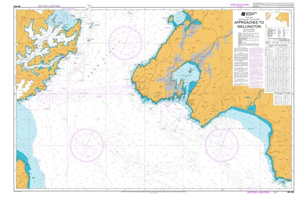
New Zealand: Approaches to Wellington - Also view online - NZMariner - Official Raster Navigational Charts (RNCs)
Raster map for upload (RNC/BSB) / Cartes marines papiers scannées téléchargables
NZMariner is the product name of New Zealand's Official Raster Navigational Charts (RNC) folio. This is available for download for free. LINZ publishes NZMariner in BSB format as an annual chart base file plus a monthly cumulative chart update file of corrections published in Notices to Mariners. NZMariner is going to be withdrawn at some point, but the date is not decided. LINZ now has full Electronic Navigation Chart (ENC) coverage, replacing the need for official raster navigation chart products. NZ ENCs are available freely through the subscription-based NZ ENC Service.- NZMariner Technical Documentation: Format, encryption and compatible navigational systems
- Downloadable chart images
TIFF raster map for upload / Cartes marines papiers scannées au format TIFF
Not for navigational use / Ne pas utilisez pour la navigation
LINZ provides electronic images of New Zealand’s official paper charts in high resolution TIFF format. These TIFF images are not maintained for Notices to Mariners (NTMs) and are NOT to be used for NAVIGATION. The images provided may not be current and do not replace the New Zealand official nautical charts corrected for NTMs. In the interests of good seamanship and safety of navigation, all craft navigating in New Zealand waters should purchase official New Zealand nautical charts for their intended voyage from a chart retailer or download the Official Raster Navigational Charts from LINZ’ website. For the download click on the chart number. Next click on "Download Paper chart" then use the section "Download Paper Chart as TIFF". - View Online Chart Images
Raster map for view online / Cartes marines papiers scannées consultables en ligne
Not for navigational use / Ne pas utilisez pour la navigation
The hydrographic raster data available through the LINZ Data Service is based on official Paper Navigational Charts published by the New Zealand Hydrographic Authority. These data does not replace official Navigational Charts; should not be used for navigation; are not corrected for Notices to Mariners. For navigation, mariners should use official New Zealand Charts as available from chart retailers. Click on + under the title of the chart. Also view chart by chart. - Maritime Safety Information (MSI): VHF, MF, HF & Satellites
Maritime Safety Information (MSI) is defined as navigational and meteorological warnings, meteorological forecasts, and other urgent safety-related messages. This information is of vital importance to all vessels at sea. Navigational warnings are broadcast for as long as the information is valid and shall remain in force until cancelled by the originating authority.
- Radio Distress Calling
Radio Distress Calling. Use only if in grave or imminent danger (by MaritimeNZ).
- Annual Notices to Mariners
Annual Notices to Mariners are standing notices that are issued each year in the New Zealand Nautical Almanac. Changes to Annual Notices are notified through the fortnightly edition of Notices to Mariners. Include: New Zealand Charting and Notices to Mariners - Radio Distress Calling - Maritime Safety Information - Shipping Routes Around the New Zealand Coast...
- Cumulative List of New Zealand Notices to Mariners
The cumulative edition of New Zealand Notices to Mariners lists the corrections affecting each chart. It is issued quarterly in NZ Notices to Mariners and is updated fortnightly on this website.
- New Zealand Notices to Mariners
LINZ publishes fortnightly New Zealand Notices to Mariners (NTMs). Fortnightly notices (New Zealand Notices to Mariners) advise mariners of important matters affecting navigational safety and are the authority for correcting New Zealand nautical charts. The fortnightly edition contains: Corrections to be made to authoritative nautical publications such as the LINZ Hydrographic Charts and the NZ Nautical Almanac - Details of the publication, withdrawal or cancellation of New Zealand nautical charts and nautical publications - Changes to NZMariner, the LINZ Raster Navigation Chart folio - Fetails of amendments to, release or withdrawl of British Admiralty nautical publications covering the New Zealand area of charting responsibility.

- NZ Chart Catalogues
Maritime New Zealand
- Safer Boating Guide
This booklet gives you essential information for an enjoyable and safe time on the water. Prep your boat - Check your gear - Know the rules. New Zealand is a boaties’ paradise with over 15,000 km of coast, waterways and lakes. Nearly half of all adult Kiwis go boating each year with their friends and families. Therefore, it’s vital that if you own a boat, you know how to prepare your boat, check your gear and understand the rules. If you’re new to boating, learn the lingo and get expert advice on what type of vessel and equipment best suits your needs.
- New Zealand's System of Buoys and Beacons
This book explains the buoyage and beaconage system in New Zealand waters. It describes the recommended requirements for aids to navigation in harbours and their approach channels, methods of marking and lighting, and also describes the requirements for oceanographic stations that may be established around our seaboard. Details of standard markings for Marine Farms, Offshore Isolated Dangers, Oil Rigs and other miscellaneous markings are also included. All members of the maritime community should find this book useful, particularly mariners, Regional Councils, Port Companies, and those studying for nautical examinations.
- Survive in cold water
Learn techniques to improve your chances of survival in cold water: Survival techniques for water - How the body reacts to cold.


Survive a man overboard - Postures for conserving your heat and energy - Rules on the water
It is your responsibility to know and understand the rules before heading out.
- Crossing the bar
Information and resources for skippers and crew when crossing any bar or river entrance. With clips on crossing the bar safely in specific regions: Tairua Bar, Raglan Bar (west coast bar), Kaituna Bar (Maketu bar), Bowentown Bar.
- Before you cross a bar: sticker with safety tips for bar crossing
- Radio Handbook: Your guide to marine communication
Your guide to marine communication. This handbook is a guide for operators of coastal and vessel radio stations, including operators of VHF (very high frequency) and SSB (single sideband, also called MF/HF) radios. It provides information about: How search and rescue is managed in New Zealand - Distress, urgency and safety calls, including appropriate use of cellphones - Radio-telephone procedures - Coverage - Useful contacts and terms. Handbook also on page Communications. - The maritime radio service for New Zealand
Find out how Maritime New Zealand is responsible for maintaining radio services for our coastal waters and the South Pacific.
- VHF marine radios save lives
A VHF radio is your rescue network at sea. Your call can be heard by many people at the same time and the distress channel - channel 16 - is monitored 24/7. Contents : Are you VHF Ready?, Buying a VHF radio, Know your VHF radio’s limits, VHF radio courses and resources, VHF Fact Sheet.
- Radio Handbook: Your guide to marine communication
- VHF Fact Sheet: for recreational boaties
- Coastguard Communications
- Maritime Radio VHF coverage: PNG map
- Major VHF Marine Channels
- VHF radio and Nowcasting channels
-
If you are in imminent danger and need immediate help, radio a distress call.
- Lighthouses of New Zealand
Find out about the lighthouses outside our harbour limits that are owned and maintained by Maritime New Zealand.
- Polar waters
Safety information and guidance for vessels operating in polar waters.
- Guidelines for fishing vessels in polar waters
These guidelines offer advice for operators of fishing vessels of 24 metres in length or more that operate in polar waters. These guidelines are modelled on the IMO’s International Code for Ships Operating in Polar Waters (‘Polar Code’). Applying these voluntary guidelines will help operators of fishing vessels in polar waters to safely navigate and manage the risks to their vessels, the people on board, systems and operations, and ensure they achieve the same level of safety as SOLAS vessels operating in polar waters
- Guidelines for pleasure yachts operating in polar waters
These guidelines for pleasure yachts of 300 gross tonnage and above have been developed by IMO member states to supplement existing industry and/or national standards. They provide additional guidance aimed at increasing the safety of yachts and persons on board, to mitigate the additional risk arising from the climatic conditions and other hazards when operating in polar waters. These guidelines are recommendations only. Their wording is designed to provide guidance, rather than mandatory direction (MSC.1/Circ.1642, 2021).
- Guidelines for fishing vessels in polar waters
- Fatigue
Safe crews fish more. Fatigue is a serious problem in commercial fishing, causing many devastating and sometimes fatal accidents. But it doesn't need to be a problem. By understanding fatigue – its triggers, warning signs, and consequences – you can keep on top of it, and minimise the risk of your next fishing trip turning into a tragedy. We've done our homework on fatigue to make it easy for you to do yours.
- What Is Fatigue?: Recognising fatigue (signs), tips for managing fatigue
- Understanding Fatigue: Importance of sleep, what causes fatigue, legal obligations
- How to develop a fatigue management plan for fishing boats
A guide for small fishing vessel owners and operators. Fatigue is a health and safety issue. Most maritime accidents caused by fatigue follow a lack of sleep or poor-quality sleep. By better understanding the causes and implementing strategies to manage fatigue, the risk of fatigue-related accidents will reduce. This sector guide is for vessel owners and operators. It contains: The importance of managing fatigue, Example of a fatigue management plan, How to write a fatigue management plan, How to document the steps for your internal review

- Health and Safety at Work Act 2015 resources
Download Maritime New Zealand’s publications on the Health and Safety at Work Act (HSWA) 2015 and associated regulations for work on board ships, and where ships are places of work.
- Health and Safety: A guide for mariners
This guide provides information about your responsibilities under the Health and Safety at Work Act (HSWA) 2015. This is your essential guide to meeting your health and safety obligations. It is relevant for everyone working in the maritime sector. Contents: 1. Health and safety legislation - 2. Duties, rights and responsibilities - 3. HSWA in action - 4. Applying HSWA duties in the maritime sector - 5. What to do when accidents happen.
- The Health and Safety at Work Act at a Glance
Maritime NZ has developed this brochure to help you understand your obligations under the Health and Safety at Work Act (HSWA) 2015. It explains how HSWA and the Maritime Transport Act (MTA) work together and introduces some new terms and duties under HSWA. It also includes a profile of a hypothetical maritime operator and explains how those involved meet their duties. HSWA at a Glance is a companion document to Maritime NZ’s Health and Safety: A guide for mariners.
- Health and Safety: A guide for mariners
- Safety updates
Read our updates on safety issues, and related matters. MNZ publishes safety updates on a variety of safety issues and proposals relating to these. The updates are published as required, and are distributed to those sectors directly involved. Topics: Hazards - People - Equipment, cranes and cargo - Navigation and stability - Regulation.
- New Zealand radio navigational warnings
Latest NAVAREA XIV and NZ coastal navigational warnings broadcast to ships in New Zealand waters. Every effort is made to keep the information on this website up-to-date but it is not always possible to add and cancel warnings in real-time. While NAVAREA XIV and New Zealand Coastal Navigational Warnings are made available on this website, Masters/Captains are still required to receive navigational warnings from the appropriate International Maritime Organization (IMO) or World Meteorological Organization (WMO) approved Global Maritime Distress and Safety System (GMDSS) broadcast service i.e. the International EGC Service. Many warnings are of a temporary nature, but others may remain in-force for several weeks and may be superseded by Notices to Mariners.
- Safer Boating Guide
Regional safety information (regional bylaws)
- Auckland
- Bay of Plenty
- Gisborne
- Hawke’s Bay
- Northland
- Taranaki
- Waikato
- Wellington
- Canterbury
- Grey
- Marlborough
- Nelson
- Otago
- Queenstown Lakes
- Environment Southland
- Tasman
Auckland Transport
Bay of Plenty Regional Council
- Boating in the Bay of Plenty booklet: rules and information on boating spots
- Mooring areas: Tauranga and Whakatāne
- Radio frequencies, weather and tides: Tauranga, Rotorua and Whakatāne radio marine frequencies
- Bay of Plenty Regional Navigation Safety Bylaw
Gisborne District Council
Hawke’s Bay Regional Council
- Safety on the Water: with VHF radio stations
- Navigation Safety Bylaw: boating safety, life jacket rules, navigation infrastructure...
Northland Regional Council
- Boating in Northland booklet: information to help keep you safe
- Guide for superyachts in Northland: advice for masters and agents of superyachts
- Cruise ship pre-arrival information – Bay of Islands: information to help plan the passage of cruise ships
- Harbourmaster Guidance, Whangarei Harbour: requirements for all commercial vessels
- VHF Radio stations
- Weather forecast information
- Northland Tide Tables: PDF file
- Maritime & coast publications
- Safe boating rules
- Navigation Safety Bylaw
- Who to call - contact information
Taranaki Regional Council
- Know Before You Go: Quick reference guide for recreational boats
- Navigation & safety in Port area
- Navigation Bylaws for Port Taranaki & Its Approaches
Waikato Regional Council
- Key rules for boating in the Waikato region
- How to cross a bar safelty: If in doubt, don't go out!
- Waterproof communications: Always carry two waterproof ways to call for help
- Lifejackets
- Navigation Safety Bylaw
Greater Wellington Regional Council
- Boating safety: Before you go, on the water, life jacket
- A quick guide to Cook Strait: safety of vessels and their crews
- Harbourmaster directions
- Boating facilities: Marinas, pole moorings, swing moorings and launching ramps
- Wellington Harbour Entrance Radio
- Wellington Regional Navigation Safety Bylaws: to ensure maritime safety
Environment Canterbury
- Canterbury Safer Boating Guide
- Navigation Safety Bylaw and Controls
- Harbourmaster’s Direction
- Commercial shipping: Important rules and bylaws
- Recreational boating: Communication, lifejackets, regulations
- Hazards, boating notices and events
Grey District Council
Marlborough Regional Council
Nelson City Council
Otago Regional Council
Queenstown Lakes District Council
Environment Southland Regional Council
Tasman District Council
- Navigation Safety Bylaw
- Guide to Boating and Water Sports in Tasman District
- Boating: Find out what you need to know as a boatie in Tasman

MetService
- Mariners Met Pack
The Mariners Met Pack (South West Pacific) was produced for MetService by former weather ambassador Bob McDavitt. BSc, MRSNZ, MNZM. We are pleased to make it available for mariners here on our website. Chapters: Basic Weather Forecasting - How to Read a Weather Map - Isobars and the Wind - South Pacific Weather - Tropical Cyclones - Case Study: June 1994 - Weather Maps by Fax - Codes: Winds and Waves - Where to get a Forecast. Also weather posters: New Zealand Cloud Types - Measuring The Wind.
- Understanding MetService’s Recreational Marine Forecasts
The recreational forecasts are written for high-use recreational areas: Bay of Islands, Auckland, Coromandel, Bay of Plenty, Hawke Bay, Kapiti, Mana, Wellington, and Christchurch (2015).
- Understanding MetService's Coastal Marine Forecasts
Forecasts for coastal waters cover the area from the coastline to 60 nautical miles (about 100km) out to sea. The New Zealand coast is divided into 18 areas (2015).
- Weather Radio schedule
Weather Radio schedule: HF weather radio facsimile (ZKLF, product, schedule and frequency) - HF weather broadcast (ZLM, content, schedule and frequency) - INMARSAT C weather broadcast (content and schedule).
- ZKLF Radio Facsimile schedule: PDF file
- New Zealand tides
Access to the tide forecasts by map. Tide data viewed or downloaded from this web site is not equivalent to or a replacement for the official tide data. For example:
- By regions: Kapiti and Wellington, Great Barrier...
- By costal areas: Colville...
- Or by main centres: Christchurch...
- Mariners Met Pack

Nigeria / Nigeria
Nigerian Navy Hydrographic Office (NNHO)
- Chart catalogue
The Nigerian Navy Hydrographic Office is at the final stage of building capacity for the production of Nigeria's National charts. Currently the office has developed a compendium of survey and charting plans for the entire Nigeria waters. These charts would be made available shortly.
- Online training charts for Nigeria
The office has produced series of training charts which are used by Nigerian Navy training chools/Establishments, for training of naval personnel on navigation. Additional symbols appear on these charts to illustrate a wider range for instructional purpose. Features appearing on these charts may therefore not exist in reality. Instructional charts: not to be used for navigation.
- Nigeria, online training chart - Approaches to Kokobioko Port
- Nigeria, online training chart - Okerenkoko River to Imo River
- Preface of Nigerian Tide Tables
This is the preface of the Nigerian Tide Tables annually published.
- Navigational Warnings for Nigeria
Type of warnings for Nigeria: NAVAREA II Warnings - Coastal Warnings - Local Warnings.
- Notice to Mariners
The Nigerian Navy Hydrographic Office provides timely Notices to Mariners for the correction of all Nigerian Government navigation charts and publications from a wide variety of sources, both foreign and domestic.
Norway / Norvège
- Norwegian Mapping Authority-Hydrographic Service / Kartverket-Sjødivisjonen
- Norwegian Coastal Administration / Kystverket

- Chart catalogue
Norwegian Mapping Authority-Hydrographic Service / Kartverket-Sjødivisjonen
- Catalogue of Norwegian nautical charts and nautical publications
The product catalogue provides an overview of nautical charts and nautical publications published by the Norwegian Hydrographic Service.
- Produktkatalog over norske sjøkart og nautiske publikasjoner
Produktkatalogen gir oversikt over sjøkart og nautiske publikasjoner produsert av Kartverkets sjødivisjon.
- Online catalogue of Norwegian nautical charts
Find nautical charts : Harbour Chart (from 1:5 000 to 1:25 000), Main charts (scale 1:50 000), Coastal Chart (from 1:200 000 to 1:350 000), General Charts (from 1:700 000 to 1:10 000 000).
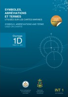
- Symbols and Abbreviations on Maritime Charts (INT 1)
The publication provides an overview of symbols and abbreviations used for Norwegian nautical charts. The text is in both Norwegian and English. In Norwegian the publication is named Symboler og forkortelser i norske sjøkart. It also goes by the name INT 1 or the Norwegian INT 1. It is the Norwegian version of the publication INT 1 – Symbols, Abbreviations and Terms used on Charts.
- Symbol og forkortingar i norske sjøkart (INT 1)
Skal du lese og forstå eit sjøkart, treng du heftet "Symboler og forkortelser i norske sjøkart". Heftet gir deg viktig informasjon og ei god oversikt over alle kartsymbol og forkortingar som er brukt i norske og internasjonale sjøkart. "Symboler og forkortelser i norske sjøkart" blir også kalla "INT 1" eller "norsk INT 1".
- Skolekart
Kartverket tilbyr gratis skolekart. Skolekartene er utsnitt fra ordinære sjøkart, og er laget for bruk i undervisning og til øvelser i bruk av sjøkart. De fleste skolekartene er utsnitt av standard sjøkart i målestokk 1:50 000. Stavanger er i målestokk 1:10 000. Skagerrak og Vestfjorden er i målestokk 1:350 000 (kystkart). Alle skolekartene kan brukes til opplæring. Skolekartene er laget i A3-format slik at de lett kan printes ut. Kartene er kun ment til bruk i undervisning og er derfor merket med «Ikke til navigasjonsbruk».
- Norgeskart
View online maps of Norway / Cartes de la Norvège consultables en ligne
Not for navigational use / Ne pas utilisez pour la navigation
To see RNC chart select "Bakgrunnskart -> Sjøkart Hovedkartserien". To see ENC chart: "Marin informasjon -> Elektroniske sjøkart (ENC)". - Sailing Directions: Svalbard and Jan Mayen (Volume 7)
The Norwegian Pilot Guide series (Den norske los) comprises eight books. Only Volume 7, which covers Svalbard and Jan Mayen, is available in English. The Norwegian Pilot Guide, Den norske los, is a supplement to the nautical charts. The publication contains supplemental information beyond what is portrayed on the charts, serves as reference material and is an important tool for use before, during and after sailing voyage. As large sea areas have not been sounded due to financialreasons, the description of the north easterly and easterly areas of Svalbard in particular are essentially based on experiences
- Farvannsbeskrivelsen Den norske los
Dette er første versjon av den digitale (HTML) farvannsbeskrivelsen Den norske los. Farvannsbeskrivelsen Den norske los er et oppslagsverk og et viktig hjelpemiddel både før, under og etter seilasen. Den norske los gir informasjon ut over det kartet kan gi og beskriver norskekysten. Hvordan bør seilasen praktisk gjennomføres? Hvilke farer og forhold bør en være oppmerksom på? Hvor er nærmeste nødhavn? Dette er spørsmål Den norske los gir svar på. Innhold er georeferert og du kan få oppslag ved å navigere og klikke på iconer i kartet eller ved bruk av søkefeltet. I versjon 1.0 vil det fortsatt være innhold fra pdf utgavene som vi ikke har fått georeferert. Bind 1 av bokserien Den norske los, Alminnelige opplysninger, og bind 7, Svalbard og Jan Mayen, er foreløpig ikke en del av den digitale utgaven av farvannsbeskrivelsen. Innhold fra disse to bøkene vil bli en del av digitale utgaven av Den norske los på et senere tidspunkt.
- Den norske los, bind 1. Alminnelige opplysninger
Alminnelige opplysninger er foreløpig ikke en del av den digitale Den norske los, den vil bli lansert på et senere tidspunkt. I bind 1 er det samlet en del opplysninger av allmenn interesse for navigeringen. Innhold: Statens kartverk Sjø, Kystverket, Lov om havner og farvann, Sjøflyhavner, Farleder, Skipsruting, Sjøtrafikktjenester, Navigasjonsinstallasjoner – oppmerking, Fyr og lykter og lanterner, Radarsvarer (Racon), Feil og mangler ved oppmerkingen/meldingstjeneste, Lostjenesten, Norsk beredskap mot akutt forurensning, Bestemmelser for norsk sjøterritorium, Fiskerigrenser, –soner og fiske, Den norske redningstjeneste, Satelittsystemer, Meteorologi, Geodesi, Oseanografi, Miljøvernbestemmelser, Kystseilas og sjømannskap for småbåteiere, Sjøveisreglene, Flagg og signalering, Tabeller, Alfabetisk stikkordregister.
- Den norske los, bind 7. Svalbard og Jan Mayen
Den norske los, bind 7. Svalbard og Jan Mayen er foreløpig ikke en del av den digital Den norske los, den vil bli lansert på et senere tidspunkt. Farvannsbeskrivelsen Den norske los er et oppslagsverk og et viktig hjelpemiddel både før, under og etter seilasen. Den norske los gir informasjon ut over det kartet kan gi og beskriver kysten. I tillegg til selve farvannsbeskrivelsen, vil man under kapittel I finne endel opplysninger av allmenn interesse som kan være av betyd-ning for seilasen i disse arktiske strøkene. For at man skal få vite mer om Svalbardområdet, er det skrevet korte artikler om f eks Svalbards historie, statlig administrasjon og tjenester, informasjon til besøkende, klima, flora og fauna, geologi samt fiskeriene. Fordi store sjøområder av budsjettmessige grunner ikke er opploddet, er beskrivelsen av særlig de nordligste og østligste områdene på Svalbard vesentlig basert på erfaringer.
- Den norske los, bind 1. Alminnelige opplysninger
- Den norske los (Historiske utgave, 2018)
Den norske los (Dnl) er en beskrivelse av farvannet langs norskekysten, Svalbard og Jan Mayen, og er et supplement til sjøkartene. Bøkene gir informasjon ut over det kartet kan gi Den norske los består av åtte bøker. Første bok i serien gir generelle opplysninger av betydning for sjøfarende, og brukes som et supplement til de øvrige bindene. De sju andre bøkene beskriver hver sin del av norskekysten og kysten rundt Svalbard og Jan Mayen.Hvordan bør seilasen praktisk gjennomføres? Hvilke farer og forhold bør en være oppmerksom på? Hvor er nærmeste nødhavn? Dette er spørsmål Den norske los gir svar på.Bøkene ble sist oppdatert mai 2018. Pdf utgavene av farvannsbeskrivelsene vil ikke bli ytterligere oppdatert. Historiske utgaver av Den norske los: 2A. Svenskegrensen – Langesund, 2B. Langesund – Jærens rev, 3. Jærens rev – Stad, 4. Stad – Rørvik, 5. Rørvik – Lødingen og Andenes, 6. Lødingen og Andenes – Grense Jakobselv.
- Coastal Radio – Maritime Safety Information (MSI)
Coastal radio broadcasts Maritime Safety Information (MSI) and forecasts on MF primary channels, available VHF working channels and Navtex.
- Kystradio – MSI, lyttevakt og værmeldinger
Kystradioen kringkaster Maritime Safety Information (MSI) og værmeldinger på MF primærkanaler, ledige VHF arbeidskanaler og Navtex.
- Maritime Safety Information (MSI)
Maritime Safety Information and traffic list with maps in norwegian: VHF channels for Northern-Norway and South Norway - MF channels and Navtex for Norway - VHF Channel for Scandinavia (Telenor Maritim Radio).

North
East
PassageYesterday's Sea Ice Edge for the Arctic Ocean (OSI SAF) - Sea Ice Products (OSI SAF/EUMETSAT)
By the Ocean and Sea Ice - Satellite Application Facility (OSI SAF). One of the objectives of the OSI SAF is to produce, control and distribute operationally in near real-time OSI SAF products using available satellite data with the necessary Users Support activities. For exemple : Global Sea Ice Concentration - Global Sea Ice Edge - Global Sea Ice Type - Low Resolution Sea Ice Drift - Medium Resolution Sea Ice Drift - Global Sea Ice Emissivity, SST...
- Cryo : information about the cryosphere (Norwegian Ice Service-NMI)
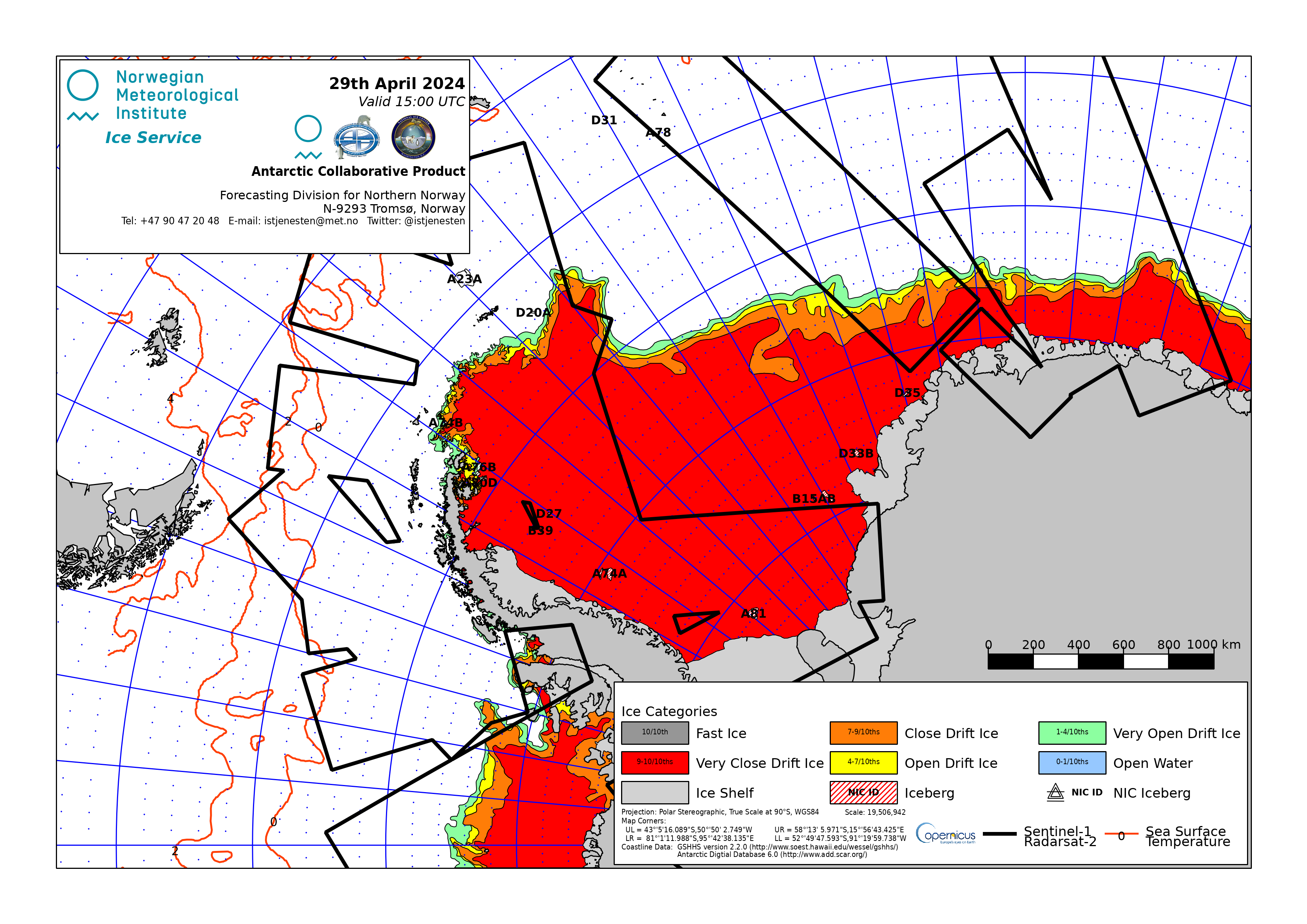
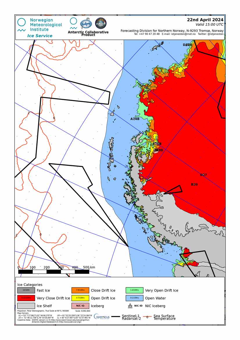
This web portal gives access to the latest products and information about sea ice, snow and permafrost - the cryosphere - from Norwegian Meteorological Institute. Ice charts & ice information: High resolution icechart for Svalbard - Ice charts for Boreal Seas (Eastern Greenland, Denmark Strait, Fram Strait, Svalbard with zoom on Isfjorden, Barents Sea, North and Baltic Sea, Oslofjord) - Collaborative Antarctic Ice Charts from NIS-MET Norway, U.S. NIC, and Russian AARI: Whole Antarctica with ice concentration stage of development and tabular iceberg analysis - During the Antarctic summer (October to April) Detailed charts for: Antarctic, Antarctic Peninsula, Weddell Sea East, Bransfield Strait, Adelaide Island). Also ice maps by weather API.
- Tide Tables for the Norwegian Coast and Svalbard
«Tide Tables for the Norwegian Coast and Svalbard» gives times and heights of high and low waters for 16 standard ports in Norway and the British port of Dover. Table B gives tidal corrections for predicting tidal heights and times in 175 secondary ports. The times of high and low waters are given in Norwegian standard time (UTC+1 hour). During the daylight saving time the time of day has to be increased by one hour. The time zone for the Dover tide table is UTC. The heights are given in cm above the Norwegian Chart Datum.
- Tidevannstabeller for den norske kyst med Svalbard
«Tidevannstabeller for den norske kyst med Svalbard» er Norges offisielle tidevannstabell. Tabellen gir tidspunkt og høyder for høy- og lavvann for 16 standardhavner i Norge. Som referanse for strømoppgavene i Nordsjøkartene er tidevannstabell for Dover tatt med. Tabellen inneholder også tidskorreksjoner og høydekorreksjonsfaktorer for bestemmelse av tidevannet i 175 sekundærhavner. Tidspunktene for høy- og lavvann i de norske havnene er gitt i norsk normaltid (UTC + 1 time). Når sommertid gjelder må de oppgitte tidene økes med 1 time. Tidevannstabellen for Dover er i tidssone UTC. Tidevannshøydene er gitt i cm over sjøkartnull, som også er referansenivå for dybder i sjøkartene.
- Se havnivå - Water level and tidal informations
Se havnivå provides water level and tidal information by place or position (HTML).
- Se havnivå - Vannstand og tidevannsinformasjon
Se havnivå: tidevann og vannstand etter sted eller posisjon (HTML).
- More About Tides and Water Level
The water level at a certain place is the sum of the astronomical tide and the weather’s effect on the water level. Globally, semi-diurnal tides are most common, meaning two high and low tides each day.
- Lær om tidevann og vannstand
Vannstanden varierer på grunn av tidevannet og påvirkning fra været. De fleste steder i verden har vi to høyvann og to lavvann hver dag (flo og fjære).
- Lær om referansenivå
For å kunne bestemme høyder og dybder må man ha noe å referere til – et nullnivå. Vi har ulike referansenivåer for sjø og land.
- Miscellaneous Notices to Mariners
This handbook is a guide for the use of the Norwegian NM (Efs), in addition to information about Norwegian nautical charts and ENCs, aids to navigation, pilot boarding, vessel traffic and ice services, coastal radio etc.
- Generell informasjon til Etterretninger for sjøfarende (Efs)
Denne håndboken er et nyttig hjelpemiddel for navigatøren. Håndboka gir veiledning om bruk av og innhold i Efs, info om sjøkart, sjømerker, los-, is- og meldingstjenester, kystradio og sjøtrafikksentralene o.l.
- Notices to Mariners (Efs)
The Etterretninger for sjøfarende (Efs) is published twice a month, and provides information on changes or defects in aids to navigation, discovery of new dangers and on shortcomings in Norwegian charts or publications, navigational warnings, gunnery exercises or other information of interest to mariners. In addition to temporary (T) and preliminary (P) notices in Norwegian waters
- Rettelser til sjøkart (Efs)
Sikkerhetskritiske oppdateringer og rettelser til offisielle norske sjøkart, publiseres i Etterretninger for sjøfarende (Efs) hver 14. dag. I tillegg publiseres midlertidige (T) og foreløpige meldinger (P) vedrørende seilas i norske farvann, skyteøvelser og andre advarsler.
- Catalogue of Norwegian nautical charts and nautical publications
Norwegian Coastal Administration / Kystverket
- The Coronavirus and Seagoing Traffic
The Norwegian government has introduced drastic measures in hopes of limiting the spread of the coronavirus. Our Maritime Pilot Service and Vessel Traffic Service centres ‒ as well as digital reporting and information services ‒ are functioning normally. We continue to ensure a national emergency preparedness against acute pollution and important installations for safe navigation at sea.
- Nautical charts form Norway to Svalbard (barentswatch.no)
View online charts / Cartes marines consultables en ligne
Not for navigational use / Ne pas utilisez pour la navigation
View online raster nautical charts from the coasts of Norway to the Svalbard including Jan Mayen, the Norwegian Sea and part of the Barents Sea. Select "Map"->"Nautical chart Norway" and deselect others items. - Nautical charts form Norway to Svalbard (routeinfo.no)
View online charts / Cartes marines consultables en ligne
Not for navigational use / Ne pas utilisez pour la navigation
View online raster nautical charts and ENC from the coasts of Norway to the Svalbard including Jan Mayen, the Norwegian Sea and part of the Barents Sea. Click on the left small map, under the -, to select the type of chart: raster, ENC, no chart. - Digital route service - routeinfo.no
The route service is free of charge, and has been developed to make voyages to Norwegian ports safer and easier. From routeinfo.no, mariners can download routes free of charge for efficient and good route planning in advance of a voyage. By searching for a port, or clicking on the map, you can get to the individual sailing route, or download the package with all the sailing routes. The data files are available in the international standard for navigation systems, RTZ and can be uploaded to the vessel’s ECDIS/ECS. The Norwegian Coastal Administration recommends that the reference routes be used when planning voyages to Norwegian ports. When choosing a route in routeinfo.no, you also get important information that applies to the specific route you have chosen: Current regulations for relevant ports and quays, Distances, VHF channels in VTS areas is available at waypoints where routes enter their service areas.
- Digital rutetjeneste - routeinfo.no
Rutetjenesten er gratis og utviklet for navigatører for å gjøre innseilingen til norske havner tryggere og enklere. Fra routeinfo.no kan navigatører laste ned seilingsruter gratis for effektiv og god ruteplanlegging i forkant av en seilas. Ved å søke på en havn, eller klikke i kartet, kan en komme til den enkelte seilingsrute, eller så kan man på infosiden laste ned pakken med alle seilingsrutene. Referanserutene fås på filformatet RTZ som er den internasjonale standarden for maritime navigasjonssystemer, og kan lastes rett inn på fartøyets ECDIS/ECS. Kystverket anbefaler at referanserutene brukes under planlegging av seilaser til norske havner. Ved valg av rute i routeinfo.no får man også opp viktig informasjon som gjelder for den spesifikke ruten du har valgt: Gjeldende forskrifter for anløp til aktuelle havner og kaier, Seilingsdistanser, VHF-kanal i sjøtrafikksentralområder (VTS) ligger i seilingsrute-filene på aktuelle waypoint, Kai- og havneplasseringer.
- Norsk Fyrliste
Norsk fyrliste beskriver maritime navigasjonsmerker som gir lyssignaler på land og i sjøen, samt informasjon om andre hjelpemidler for navigasjon. Her finner du den kontinuerlig oppdaterte fyrlista i PDF-versjon (List of lights).
- Overgang til IALA-standard
IALA har en anbefaling for hvordan sektorene på ei fyrlykt bør være inndelt for å være intuitiv og gi en god forutsigbarhet (IALA Guideline 1041 - Sector Lights Ed 3.0). Kystverket har besluttet å tilpasse seg denne anbefalingen, og starter å endre på sektorene fra 2019. Arbeidet er ventet å være ferdig innen utgangen av 2025. Prinsipp for anbefalingen er: Når en sjøfarende stevner mot en fyrlykt i hvit sektor, skal sektoren på styrbord side være grønn, og sektoren på babord side skal være rød. Dette gjelder uansett hvilken himmelretning man kommer fra.
- Contact the VTS service
Contact information to Vessel Traffic Service (VTS) centres in Norway: VHF channel, email, telephone.
- Kontakt sjøtrafikksentraltjenesten
Kontaktinformasjon til VTS-tjenesten: VHF kanal, e-post, telefon.
- Compulsory pilotage in Svalbard
For pilotage the same rules apply on Svalbard as for mainland Norway. I.e. vessels with at length of 70 meters or more and passenger vessels with a length of 50 meters or more are subject to compulsory pilotage when sailing in Svalbard internal waters. For vessels carrying dangerous cargo the length limits are shorter.
- Losplikt på Svalbard
De samme reglene for losplikt gjelder på Svalbard som på fastlandet. Det betyr at fartøy på 70 meter eller mer og passasjerfartøy på 50 meter eller mer er lospliktige ved seilas innenfor grunnlinjene. For fartøy med farlig last er lengdegrensene kortere.
- ArcticInfo - Information on Arctic waters
ArcticInfo provides mariners with important information on Arctic conditions and decision support for safe navigation in Arctic waters. The service is map-based, free and accessible for everyone. It covers a wide area off the coast of Norway, Iceland, Russia, Canada and Greenland - including the Barents Sea and North Sea. Services: Ice map, AIS data, Weather forecast, Depth curves, Quay conditions, Storm warnings, Overview of Norwegian maritime borders, Reporting option.
- ArcticInfo - Informasjon om arktiske farvann
ArcticInfo.no gir sjøfarende informasjon om seilingsforhold i arktiske farvann, og beslutningsstøtte for tryggere ferdsel i Arktis. Tjenesten er kartbasert og tilgjengelig for alle. Den dekker et stort havområde utenfor Norge, Island, Russland, Canada og Grønland - inkludert Barentshavet og Nordsjøen. Tjenester i ArcticInfo: Iskart, AIS-data, Værvarsel, Dybdekurver, Kaiforhold, Uværsvarsel, Oversikt over norske maritime grenser, Rapporteringsmulighet.
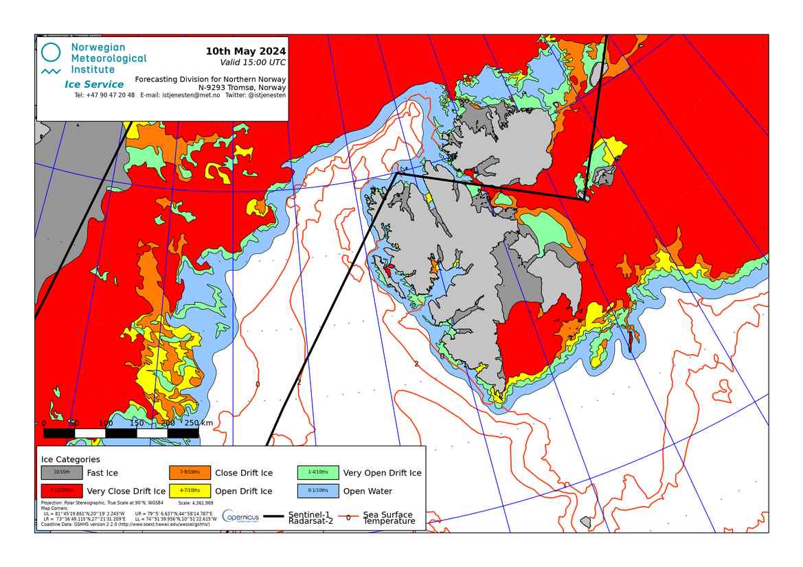
Ice chart for Svalbard (MET Norway/NIS) - Norwegian Ice Service
We provide the national ice service for vessel traffic. This includes updated information on ice conditions in Norwegian waters from the Swedish border to Kristiansand, and information on icebreaking in the main and secondary fairways outside port areas. Ice reports are available from December 1 to March 31.
- Istjenesten i Norge
Gjenfrosne eller isete farvann og ising på fartøy skaper utfordringer for skipstrafikken. Når minusgradene blir mange og kulda vedvarer, tetner isen til i fjordarmer og smale sund langs kysten av Sør-Norge. Kystverket overvåker og melder is situasjonen fra svenskegrensen til Rogaland hele vintersesongen.
- Forecast for waves
Forecast for selected fairways and areas on the Norwegian coast the coming 66 hours. Wave forecasts for particularly vulnerable areas help us to decide whether it is safe to be at sea. The service provides forecasts for selected shipping lanes and the areas around them. Forecasts are at three-hour intervals up to 66 hours in advance. The shipping lane forecasts contain data for significant and maximum wave height and wave direction for every hundred metres along particularly vulnerable coastal shipping lanes (BarentsWatch).
- Bølgevarsel for farleder
Bølgevarsel for spesielt utsatte områder og strekninger gjør det lettere å avgjøre om det er trygt å ferdes på havet. Tjenesten gjelder både varsel langs utvalgte farleder og i området rundt disse farledene. Det gis varsel i tre timers intervaller inntil tre døgn fram i tid. Farledsvarslene inneholder data for signifikant og maksimal bølgehøyde, samt bølgeretning for hver hundre meter langs spesielt utsatte farleder langs kysten vår. Farledsvarslene inneholder data for signifikant og maksimal bølgehøyde, samt bølgeretning for hver hundre meter langs spesielt utsatte farleder langs kysten vår (BarentsWatch).
- Navigational warnings
The NCA is responsible for sending navigational warnings for the Norwegian Sea, the Greenland Sea and the western part of the Barents Sea, an area known by mariners as NAVAREA XIX. We are also the national coordinator for coastal warnings for the Norwegian coast and the coast of Svalbard.
- Navigasjonsvarsler
Kystverket er koordinator for NAVAREA XIX med ansvar for å sende navigasjonsvarsler for Norskehavet, Grønlandshavet og vestre del av Barentshavet. Kystverket er også nasjonal koordinator for navigasjonsvarsler med ansvar for å sende varsler for norskekysten og kysten av Svalbard.
- The Coronavirus and Seagoing Traffic

| | P |


L'urgence prime la forme - By Cr - 2012-2024
For updates, corrections, new charts or new documents please send an e-mail to
For my father and my mother / Pour mon père et ma mère
