~ |
Online free nautical charts and publications
open data/open access - libre accès
Cartes marines gratuites et ouvrages nautiques en ligne
 | G |

| J | 
| ||
I
Iceland/Islande
India/Inde
About Nautical Free
Nautical Free provides a list of free nautical charts and online publications.There is a list by country from letter A to letter V, for each country the organizations and for each organization a list of free online documents (charts, nautical books, notice to mariners...). There is two special lists: one for the international organizations and one for the private companies. There is also a reverse list by type of documents: sailing directions, radio signals, tide tables, nautical charts... You can also find on Nautical Free wave forecast maps for tomorrow, space weather forecast for GPS, how to check your computer clock, as well as information about celestial navigation or about ice navigation...
Au sujet de Nautical Free
Nautical Free fournit une liste de cartes marines gratuites et d'ouvrages nautiques en ligne.Il y a une liste par pays de la lettre A à la lettre V, pour chaque pays les organisations et pour chaque organisation une liste de documents libres en ligne (cartes marines, ouvrages nautiques, avis aux navigateurs...). Il existe deux listes spéciales : une pour les organisations internationales et une pour les sociétés privées. Il existe également une liste inverse par type de documents : instructions nautiques, ouvrages de radiosignaux, tables des marées, cartes marines... Vous trouverez également sur Nautical Free des cartes de prévision de la hauteur des vagues pour demain, des prévisions de la météo de l'espace pour les GPS, comment vérifier l'heure de son ordinateur, ainsi que des informations sur la navigation astronomique ou la navigation dans les glaces...
Advice / Conseils
For navigation use only updated regulatory documents /
Pour la navigation n'utiliser que des documents réglementaires à jour.
GPS is more accurate than nautical charts /
Un GPS est plus précis qu'un carte marine
Web Servers / Serveurs Web
You can use the nearest or faster server / Vous pouvez utiliser le serveur le plus proche ou le plus rapide :
- French mirror with one page by section / Serveur en France avec une page par section : http://nauticalfree.free.fr
- French mirror on one page / Serveur en France sur une page : http://nauticalfree.free.fr/onepage.html
- French mirror without image on one page / Serveur en France sans image sur une page : http://nauticalfree.free.fr/noimage/
- US mirror with one page by section / Serveur au États-Unis avec une page par section : http://nauticalfree.eu5.org
- US mirror on one page / Serveur au États-Unis sur une page : http://nauticalfree.eu5.org/onepage.html
- US mirror without image on one page / Serveur au États-Unis sans image sur une page : http://nauticalfree.eu5.org/noimage/
- US mirror on seven pages / Serveur au États-Unis sur sept pages : https://sites.google.com/site/nauticalfree/
Caption / Légende
- The nautical books are in standard fonts / Les ouvrages sont en caractères droits
- In Italic the maps and the charts / Les cartes sont en italiques
- The last item for an organization is the Notices to Mariners. The first issue of each year is often a special publication /
La dernier item pour un service hydrographique est un lien vers les avis au navigateurs. Le premier numéro de chaque année est souvent un numéro spécial
- Raster Navigational Charts (RNC)
- Bitmap electronic images of paper charts that conform to IHO standard S-61 /
Carte marine matricielle, fac-similé numérique d'une carte papier (scan) conforme à la norme de l'OHI S-61 - Electronic Navigational Charts (ENC)
- Vector charts that conform to IHO standard S-57 /
Carte électronique de navigation, carte vectorielle conforme à la norme de l'OHI S-57
|
|
Cartes marines gratuites et ouvrages nautiques en ligne : Islande, Inde et Italie
I
Iceland / Islande
- Icelandic Coast Guard Hydrographic Department (ICG-HD) / Sjómælingasvið Landhelgisgæslunnar
- Icelandic Road and Coastal Administration (IRCA) / Vegagerðin
- Icelandic Meteorological Office / Veðurstofa Íslands
Icelandic Coast Guard Hydrographic Department (ICG-HD) / Sjómælingar Íslands
- Vessel Reporting
Icelandic commercially operated ships shall report their position to the Icelandic Coast Guard through the Automatic Identification System (AIS). This means that foreign vessels are visible in this tracking system. Vessels exceeding 300 GT (other than fishing vessels and government vessels) shall report their arrival in part with a notice of 24 hours to the Icelandic Coast Guard through a SafeSeaNet (SSN) notice. All fishing vessels and other vessels that are not covered by the rules of SSN, except government vessels coming from abroad, shall report their arrival in port with a notice of 24 hours to the Icelandic Coast Guard on the appropriate electronic form.
- Guidelines for masters of cruise and passenger ships arriving in Iceland
Sailing in Icelandic waters may be very demanding and there are few places in the world where a change in weather can be as abrupt. Weather can be very changeable, especially in winter. Danger can also arise in the summer when low pressure areas with high wind conditions and added wave height can compromise maritime safety. It is therefore important to proceed carefully and follow rules on maritime safety in all respects.
- Catalogue of Charts / Kortaskrá
ICG-HD publishes nautical charts and other nautical publications such as List of Lights, Pilots etc. for mariners around Iceland.
- Icelandic List of Lights / Vitaskrá
Lights, buoys, beacons, radiobeacons, racons, DGPS. Beginning with Reykjanes lighthouse and going westward around Iceland.
- Sjávarföll (Tides)
Á eftirtöldum höfnum er hægt að nálgast stöðu sjávarfalla, sýnd eru 10 mín. gildi: Reykjavík, Grindavík, Húsavík, Hvanney, Ísafjörður, Sandgerði, Skagaströnd, Vestmannaeyjar, Þorlákshöfn.
- Guidelines for masters of cruise and passenger ships arriving in Iceland
The objectives of Guidelines for masters are : 1. To ensure that the masters of cruise and passenger ships comply with Icelandic laws and regulations. 2. To ensure that passenger ship tours and itineraries at sea and on land do not violate nature conservation and environmental laws of Iceland. 3. To draw the attention of masters of passenger ships to the safety of their vessels and their passengers when visiting Iceland.
- Port information guide (AIP)
This information sheet is written by the Associated Icelandic Ports (Faxaports) for Masters of seagoing vessels, shipping lines, agents, publishers of nautical information and any other party that needs nautical information. Faxaports runs the harbours and ports of Reykjavík, Grundartangi, Akranes and Borgarnes. The Port of Reykjavík is divided into the Gamla höfn (Old harbour) and Sundahöfn.
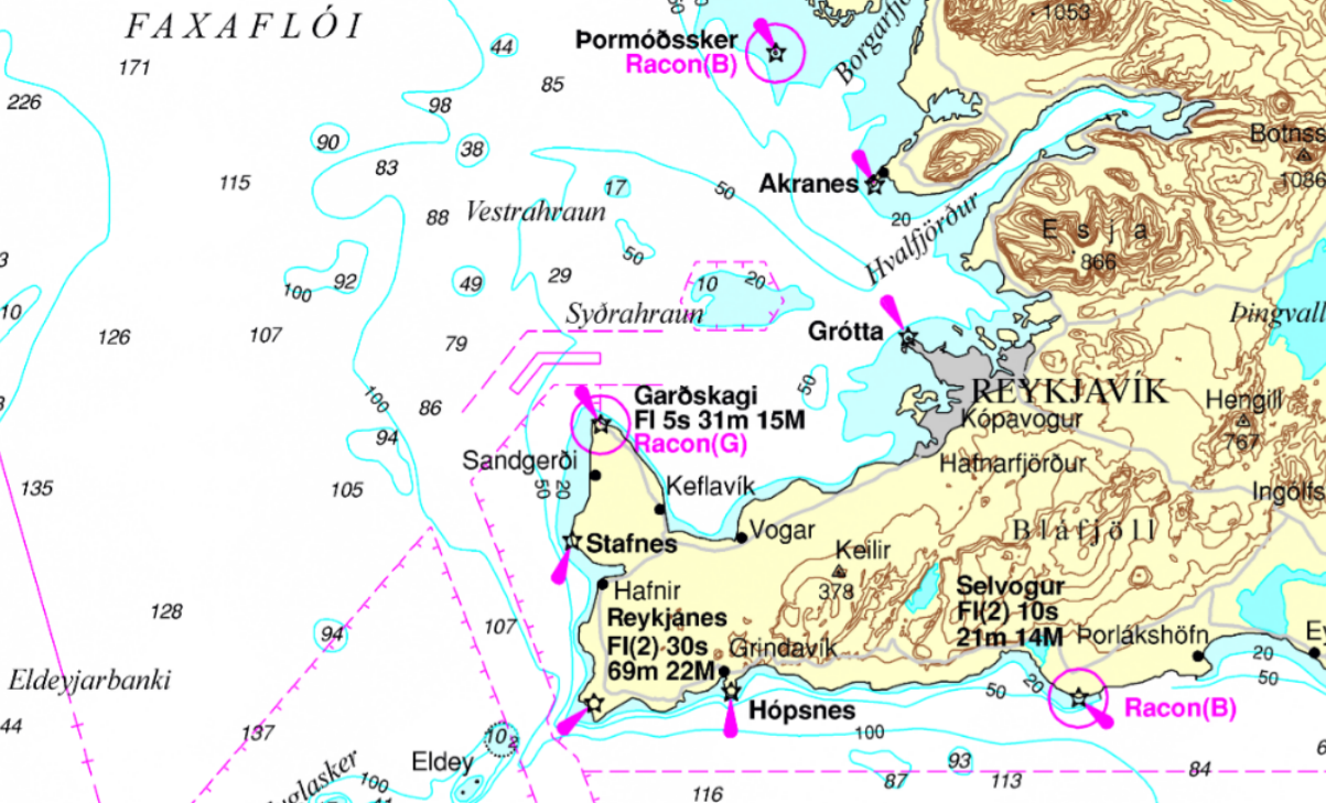
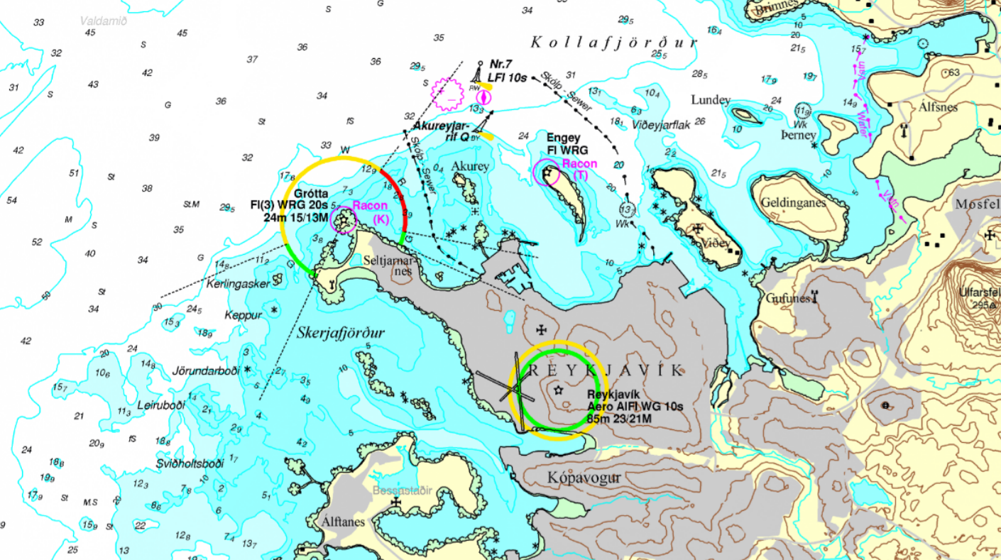
- Online raster charts / Sjókort á rastaformi
View online charts (RNC) for Iceland / Cartes marines consultables en ligne (CMM) pour l'Islande
Not for navigational use / Ne pas utilisez pour la navigation
Interactive web map wiewer with RNC charts for Iceland with transit charts, coastal charts, harbour plans and approach charts.
- Listi yfir tilkynningar til sjófarenda
Listinn sem hér fylgir er tekinn saman til hagræðingar fyrir notendur sjókorta. Í honum er að finna upplýsingar um útgáfuár sjókorta sem eru í gildi (útgáfuár eða mán./ár). Jafnframt er í listanum getið um leiðréttingar á sjókortunum sem birtar hafa verið til og með ofangreindri dagsetningu.
- Cumulative list of Icelandic Notices to Marines
This list records the date of issue of the current edition of each chart and of subsequent relevant Icelandic Notices to Mariners up to and including NM‘s from above-mentioned date. Users of this list are reminded that the authoritative source for information concerning current editions of Icelandic charts and the corrections that affect them are the Editions of Icelandic Notices to Mariners.
- Tilkynningar til sjófarenda
Í Tilkynningum til sjófarenda eru einnig birtar ýmsar tilkynningar og aðvaranir er varða siglingar. Þá eru leiðréttingar á Vitaskrá birtar þar. Ritið er gefið út eftir þörfum en að jafnaði hefur það verið fimm til sex sinnum á ári.
- Icelandic Notices to Mariners
Changes and corrections are issued in Notices to Mariners (NM´s). The NM´s contain information on items that need to be amended in a chart and it is the users responsibility to keep his charts updated.
- Vessel Reporting
Icelandic Road and Coastal Administration (IRCA) / Vegagerðin
- Waves, weather, tides and currents forecast maps
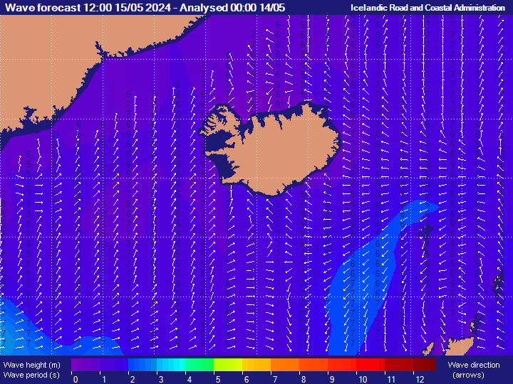
Maps for Icelandic waters, High seas and N-Atlantic with waves, weather or tides forecast. By clicking on a specific location, forecast will be given in a chronological order. For waves the coloured areas stand for wave height in meters, the number stands for average wave period in seconds and the arrows stand for average wave direction. The probable maximum wave height can be up to twice the significant wave height (More information).
North Atlantic Ocean: From Denmark Strait to Norvegian Sea Wave height around Iceland for tomorrow, UTC+0 (Height in metres)
Lands: East Greenland - Iceland - Faroe - Shetland - North Scotland- Wave forecast in shallow waters
Wave forecast in shallow waters applies to areas where the seabed bathymetry affects the wave propagation. It is based on numerical models taking in account the local bathymetry, offshore waves and wind. Select a location on the map or from the menu to the left to get the forecast.
- Tides in harbours
Tides for the current month: for 24 hours by 1 hour or for 72 hours by 3 hours.
- Tides
Tide for a location: enter latitude and longitude or select location on the map. Forecast with Tides (m), Current Direction (°), Current Speed (m/s), Surge (m) and Sea height (m).
- Orðasafn siglingamála (Glossary)
Hjá Siglingastofnun var að staðaldri unnið að söfnun hugtaka og orðasambanda á ensku og íslensku á sviði siglingamála, bæði sem snerta almennt starf stofnunarinnar og alþjóðasamstarf. Sá orðalisti sem birtist hér er aðeins lítið brot af hugtaka- og orðtakasafni á sviði siglingamála sem safnað hefur verið í.

- Waves, weather, tides and currents forecast maps
Icelandic Meteorological Office / Veðurstofa Íslands
- Hafístilkynningar
Hafístilkynningar síðustu 30 daga, kort og myndir (Ice reports).
- Sea-ice maps last 30 days
Weekly sea-ice maps for the area between Iceland and Greenland. Traduction Icelandic to English for the sea-ice maps: Hafískort - Gildistími -> Sea-ice map - Validity; hafísjaðar -> sea-ice perimeter ; áætlaður hafísjaðar -> estimated sea-ice perimeter; hitaskil í hafi -> temperature separator in the ocean. Also legend of symbols in Icelandic.
- Orðasafn og tákn fyrir hafís
Hugtök og tákn er varða hafís má finna í meðfylgjandi skjölum og á mynd. Skjölum: Alþjóðleg hafístákn, Eggjatáknin - stutt lýsing, Ísorðasafn (Ice symbols).
- Sea ice symbols
Sea ice symbols: An explanation of international ice symbols (the "egg" code) is available (DMI, 1982). Also the ice chart colour code standard (WMO & JCOMM, 2004).
- Sea Ice around Iceland
- Sea-ice observations last 30 days: Navtex messages
- Sea ice density: satellite map
- Hafístilkynningar

India / Inde
- Indian Naval Hydrographic Department (INHD) / भारतीय नौसेना जल सर्वेक्षण कार्यालय
- India Meteorological Department (IMD) / भारत मौसम विज्ञान विभाग
Indian Naval Hydrographic Department (INHD) / भारतीय नौसेना जल सर्वेक्षण कार्यालय
- Catalogue of Indian Paper Charts, ENCs and Publications (INP-10)
Indian Naval Hydrographic Department provides comprehensive coverage of Indian Ocean Region through its Nautical Charts, ENC's and Nautical Publications.
- Online Catalogue of Charts and Electronic Navigational Charts (ENC's)
This catalogue provides a comprehensive and up-to-date reference of INHO paper charts and Electronics navigational charts (ENC). This service allows the user to search according to criteria like name of the chart, chart number, area, folios, scale etc. The page also provides a link to the Indian Notices to Mariners. Facility to print the list of selected charts is also available for the users. It is updated fortnightly to ensure access to the latest information.
- Free digital publications
Online books and chart from the Indian Naval Hydrographic Department.
- Symbols and abbreviations used on charts (INP-5020, INT 1)
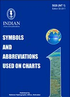
Chart 5020 provides a reference to the many symbols and abbreviations used on Indian and International paper Charts. This edition of Charts 5020 (INT 1) is based on the “Chart Specifications of the IHO (International Hydrographic Organization)”. - Maritime Information Chart - Indian Ocean Region (INP-5071)
Maritime Information Chart for Indian Ocean Region. This chart is depicting relevant Maritime Information as a ready reckoner. Includes: International Maritime Boundary Line - Navarea Limits - Maritime Rescue Coordination Centre Limits - International Shipping Lanes - Choke Points - Exclusive Economic Zone - Major Ports. Not to be used for navigation. Scale 1:10,000,000.
- Indian Maritime Safety & Security Chart (INP-5010)
This chart depicts key information pertaining to mariners safety and security of various critical areas. Type of information: Emergency contact, Search and rescue, Piracy and armed robbery, Reporting system... This chart is to be used for maritime safety and security un conjunction with relevant large scale and other navigation publication as published by different regional Hydrographic Offices. Not to be used for navigation. Scale 1:12,500,000.
- National Maritime Search and Rescue Manual
NMSAR Manual (2020 Edition). The aim of this manual is to assist those who are responsible for establishing, managing, supporting/ facilitating and conducting SAR operations to understand the following: (a) Functions and importance of SAR services. (b) Components and support infrastructure essential for SAR. (c) Training needed to co-ordinate, conduct and support SAR operations. (d) Communications functions and requirements for SAR. (e) Coordinating functions for ensuring efficiency by sharing resources. (f) Basic principles of managing and improving SAR services to ensure success (ICG-NMSAR Board).
- Inforce Navigational Warnings
Navigational Warnings carry information which may have a direct bearing on the safety of life at sea. It is the fundamental nature of the Navigational Warnings that they will often be based on incomplete or unconfirmed information and mariners will need to take this into account when deciding what reliance to place on the information contained therein. Select at least the years.
- Navtex warnings in force for Indian Coast
- Navigational warnings in force for NAVAREA VIII
- Navarea Warnings Search Engine
- Indian Notices to Mariners - Special Edition 2020
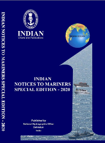
Notices published in the Special Edition are of permanent nature. Any amendment/addition to these Notices shall be issued through Fortnightly Indian Notices to Mariners. Mariners are therefore advised to "retain this edition" till its supersession/cancellation by this office. This seventh edition of the Indian Notices to Mariners, Special Edition contains Special Notices to Mariners 1 to 28 which are of permanent nature. Index: Availability of Notices to Mariners, Reliance on charts and predicted tides, Satellite Communication In Indian Waters, Weather bulletins issued to ships by the Indian Meteorological Department, Warning to ports and storm signal stations, Distress and rescue at sea-ships and aircraft, The Indian ship position and information reporting system (INSPIRES), Radio navigational warnings, Instructions for Reporting Dangers, Information about radar beacons, Traffic separation scheme-ships routeing, IALA maritime buoyage system, Notices to Mariners - explanation of terms, Satellite navigation systems... - Indian Notices to Mariners - Annual Edition 2022
The Annual edition to Indian Notices to Mariners is published yearly that provides a complete record of notices issued in the previous year and before for the Indian Chart Folios. Contents: List of Charts and Permanent Corrections, Unexploded Charges, Temporary and Preliminary Notices, List of Depots & Chart Agents, Indian Hydrographic Publications - Price List, Cautionary Notes, Marine Information.
- Search Indian Notices to Mariners
This section allows mariners to access all Indian Notices to Mariners individually as well as edition wise. Four type of interactive filters are available for ease of search of corrections to Chart in downloadable pdf format. First filter “Search by Chart” generates all inforce notices applicable to the specified IN Chart number. Second filter “Search by INT” generates all inforce notices applicable to the specified INT Chart number. Third filter “Search by Notice” displays the required notice by combination of notice number and year. Fourth filter “Search by Year” outputs entire edition along with tracings and individual notices promulgated in the selected year.
- Indian Notices to Mariners
Published the 1st & 16th of every month. Contents: I List of Charts Affected - II Permanent Notices - III Temporary and Preliminary Notices - IV Marine Information - V NAVAREA VIII Warnings inforce - VI Corrections to Sailing Directions - VII Corrections to List of Lights - VIII Corrections to List of Radio Signals - IX Reporting of Navigational Dangers.
- Catalogue of Indian Paper Charts, ENCs and Publications (INP-10)
India Meteorological Department (IMD) / भारत मौसम विज्ञान विभाग
- Port Warning & Signals
In accordance with international procedure, ports are warned and advised to hoist "Signals" whenever adverse weather is expected over the ports for the oceanic areas, in which it is located due to the tropical cyclone. However, regional difference exists. The warning messages normally contain information on the location, intensity, direction and speed of movement of the tropical cyclone and the expected weather over the port (CWD/RSMC).
- Frequently Asked Questions (FAQ) on Tropical Cyclones
More than a hundred Frequently Asked Questions on Tropical Cyclones: What is a tropical cyclone?, Why do ‘tropical cyclones' winds rotate counter-clockwise (clockwise) in the Northern (Southern) Hemisphere? What does "maximum sustained wind" mean?, How does it relate to gusts in tropical cyclones?, What is the energy potential of a Tropical Cyclone?, How are low pressure system classified in India? What are the differences between low, depression and cyclone?, etc (CWD/RSMC).
- Interactive Cyclone Track Map
This is an interactive GIS enabled map showing track and intensity of a cyclonic disturbance. The black line indicates the observed track and the red line shows the forecast track. The uncertainty in the track forecast is represented by green colored "cone". The state of sea is defined based on the maximum sustained winds associated with the system and accordingly action is suggested for fishermen (CWD/RSMC).
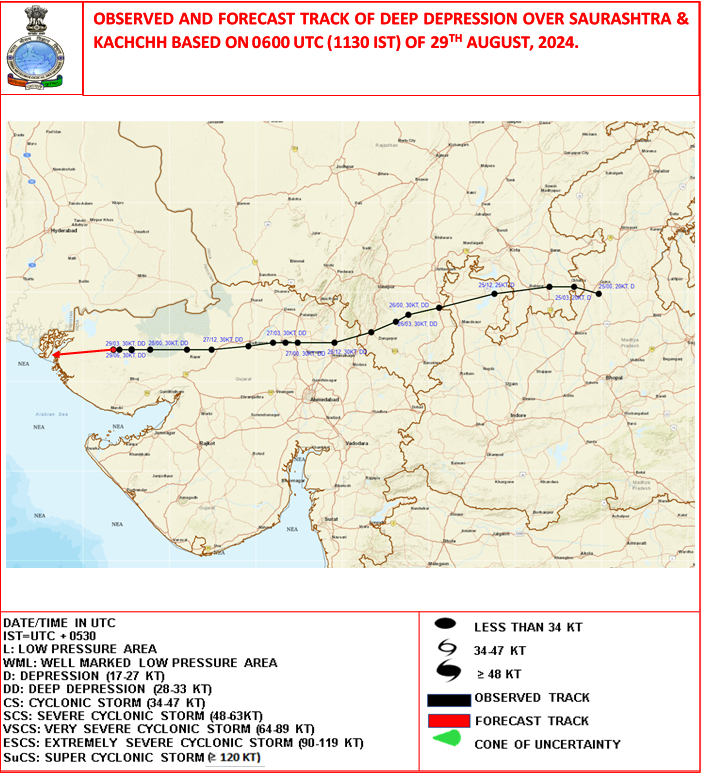
North Indian Ocean, India: Cyclone Wind Warning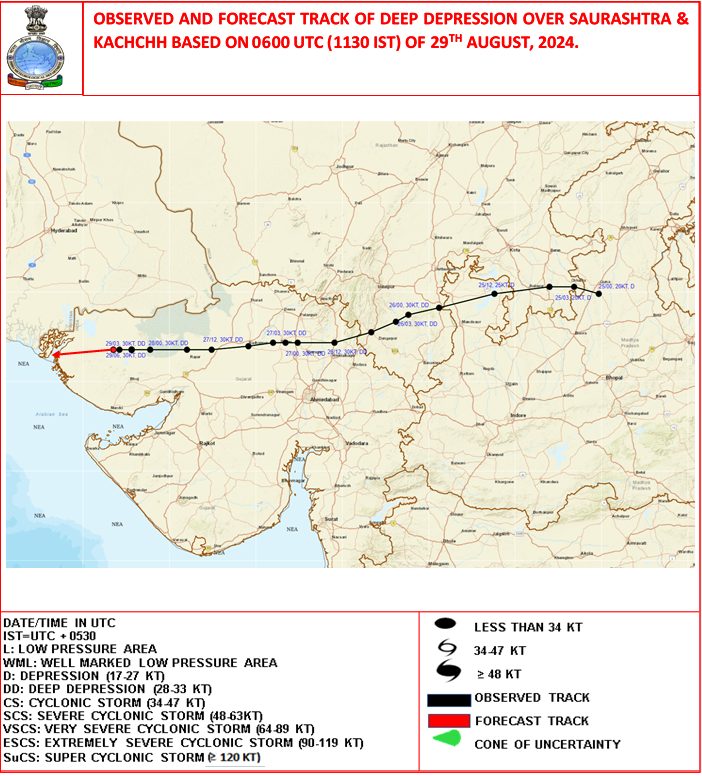
Track of cyclonic disturbance (RSMC/IMD)
- Terminology on Cyclonic disturbances over the North Indian Ocean
Terminology on cyclonic disturbances: From "Afternoon" to "Zone of disturbed weather" (CWD/RSMC).
- The Indian Astronomical Ephemeris 2022
The Indian Astronomical Ephemeris is published anually by the Positional Astronomy Centre, Kolkata for providing astronomical data to observational astronomers and other users, such as Panchang makers. While astronomical ephemeris with similar data are compiled by seven more countries in the world, the Indian Ephemeris is designed to cater to our particular national requirements (More information).
- Predicted Astronomical Tide
Map with locations for predicted astronomical tide for 5 days (ESSO-INCOIS).
- Port Warning & Signals
Italy / Italie
Istituto Idrografico della Marina (IIM) / Hydrographic Institute
- Catalogo Generale delle carte e delle pubblicazioni nautiche 2021 (I.I. 3001)
Il Catalogo Generale delle Carte e delle Pubblicazioni Nautiche presenta ed elenca tutta la produzione editoriale dell’Istituto Idrografico della Marina e i servizi offerti.
- General Catalogue of charts and nautical publications 2021 (I.I. 3001)
This General Catalogue of charts and nautical publications lists all the products published by the Istituto Idrografico della Marina, as well as all the technical data available for sale to private users. In compliance with the IHO Technical Resolutions, Contents, General lnformation and Instructions for the updating of charts and nautical publications are in English as well as in Italian.
- Norme per l'impiego della dotazione nautica
Un pratico vademecum sul buon uso della documentazione nautica. Un breve estratto su come utilizzare la documentazione nautica, come aggiornarla, quali sono i limiti e le attenzioni da porre in essere per il loro uso corretto.
- Fari e Segnalamenti - Italia
Il Servizio Fari ha realizzato questa sezione a solo scopo informativo. Le informazioni contenute non possono essere utilizzate per fini operativi ed in particolare quale ausilio alla navigazione in sostituzione della documentazione nautica ufficiale edita dall Istituto Idrografico della Marina Militare e delle informazioni nautiche emesse dagli Enti competenti (HTML).
- VTS Nazionale - Manuali Utente / National VTS - User Manuals
Scopo di questi manuali è quello di fornire ogni utile indicazione per una corretta interazione tra gli utenti ed il VTS, rendendo efficace l’azione di ausilio e di assistenza alla navigazione marittima propria del sistema VTS.
The purpose of these manuals is to provide all relevant information to ensure proper interaction between users and VTS, making effective action to assist and support the shipping of its VTS system.
Indice : Stretto di Messina - La Maddalena (Bonifacio Traffic) - Palermo - Mazara del Vallo - Bari - La Spezia - Savona - Trapani - Genova -Taranto - Brindisi - Trieste (Guardia Costiera). - Previsione del vento e mare nel Mediterraneo (LaMMa)
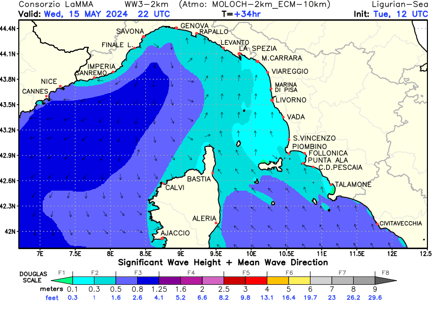
L'altezza significativa (Hs o H 1/3) è l'altezza media del terzo di onde più alto. In pratica se si mettono in scala crescente di altezza tutte le onde presenti in un'area della superficie del mare e si prende la media del terzo più alto si ottiene l'altezza significativa. Questa misura ha il vantaggio di essere molto vicina all'altezza che un osservatore esperto rileva ad occhio nudo dal ponte di una barca. Esempio: previsione di mare molto mosso con onde di 2 metri (altezza significativa (Hs) di 2 metri). Che tipo di onde posso incontrare in mare? – 1 onda ogni 2000 (Hmax) avrà altezza di 4 metri – 1 onda ogni 100 (H 1/100) avrà altezza di 3,3 metri ( 2 metri x 1,67) – 1 onda ogni 10 (H 1/10) avrà altezza di 2,5 metri ( 2 metri x 1,27). L'altezza massima dell'onda è il doppio dell'altezza significativa s(Info sul modello).
Mediterraneo centrale nord : Mare e Vento Mar Ligure : Altezza onda in metri per domani (LaMMa - Widget vento e mare
Questo widget permette di inserire le mappe di previsione sullo stato del mare e del vento sul tuo sito web. Il widget contiene anche un link alle pagine 'vento e mare' pubblicate sul web Lamma per poter approfondire la previsione e selezionare differenti aree. Per generare il codice scegliere la larghezza e l'area di interesse.
- Consuetudini Navali
Consuetudini navali ad uso del diporto nautico. Raccoglie appunto tutte le consuetudini marinare riguardo alla corretta esposizione delle bandiere a bordo. Indice : Bandiere a bordo delle unità da diporto - Bandiera Nazionale - Gran Pavese o Gala di Bandiere - Bandiera di cortesia - Guidone sociale...
- Atlante della correnti superficiali dei mari italiani
Atlante con 12 carte mensili delle correnti, 1:2,500,000, proiezione di Mercatore.
This monograph contains twelve monthly chats, outlining surface circulation in the Italian seas with the vector system, while the speed is given in knots. - Dinamiche della copertura glaciale artica e rotte di navigazione
Studio sulla regione Asrtica. Lo studio fornisce una recente panoramica della dinamica della copertura glaciale artica in srelazione allo sviluppo di nuove rotte di navigazione, con l’obiettivo di fornire uno strumento di conoscenza di base in una regione sempre più oggetto di interessi socio-economico a livello planetario.
- Elementi di Idrografia
Questo compendio sull’Idrografia vuole essere un utile ausilio all’Idrografo che si accinge ad esercitare la propria attività nell’ambito della rappresentazione dell’ambiente marino in tutti i sui aspetti. Indice: La definizione di idrografia, La misura, L’errore, Dall’errore all’incertezza, Number e risoluzione, Il reference, Oltre l’incertezza e il reference, Oltre la singola misura: la combinazione di più misure, 4D reference frame, Il reference frame strumentale, Tra gli strumenti e i risultati: il body frame, Il reference frame planimetrico, Il reference frame verticale, Il reference temporale...
- L’eredità dei Colombo
Dal “Libro de Conto” di Cristoforo e da quello del fratello Bartolomeo. Da oltre 500 anni, l’impresa di Cristoforo Colombo ha entusiasmato navigatori e marinai di ogni età e periodo storico, ed impegnato studiosi e appassionati di navigazione a ricostruire l’attraversamento dell’Oceano Atlantico verso Occidente e, soprattutto, verso Oriente. Indice: Sopravento, Posizionamento, Georeferenzialità. Potere marittimo, Logistica, Evoluzione delle conoscenze gli effetti del vento sulle vele, Scarroccio, La cappa e la panna, Cartografia nautica, Bacinodromia, Le maree e l’orologio astronomico, Il tempo antropico, Conoscenza dell’ambiente marino, Coordinate, Sferografia, Materiale nautico, Estimo, Definizioni e misure.
- Aggiornamento delle Pubblicazioni
Raccolta riepilogativa delle pubblicazioni soggette ad aggiornamento sistematico.
- Norme per la tenuta e l’aggiornamento delle carte e delle pubblicazioni nautiche edite dall’IIM
Il presente Disciplinare deve essere tenuto a bordo come “dotazione nautica” da alcune navi ma deve essere rispettato da chiunque utilizzi una carta o una pubblicazione nautica e il mancato rispetto può portare a ipotesi sanzionatorie. In definitiva si applica a tutte le navi seguendo il concetto cardine che solo attraverso un corretto e adeguato uso e aggiornamento sia delle carte che delle pubblicazioni nautiche si può garantire la sicurezza della navigazione.
- Premessa agli avvisi ai naviganti 2022 e avvisi ai naviganti di carattere generale
Da conservarsi per tutto l’anno in corso. Indice: Premessa agli Avvisi ai Naviganti - Avvisi annuali fondamentali - Avvisi di carattere generale emessi negli anni precedenti ed ancora in vigore
- Avvisi ai Naviganti
Gli Avvisi ai Naviganti hanno lo scopo di far conoscere agli utenti tutte le notizie, sia di carattere temporaneo che definitivo, interessanti la sicurezza della navigazione, che ancora non figurano nei documenti nautici ufficiali. Con Elenco di controllo (consente di controllare lo stato di aggiornamento) e Raccolta semestrale (informazioni nautiche ed avvisi NTM).
- Catalogo Generale delle carte e delle pubblicazioni nautiche 2021 (I.I. 3001)
| | J |


L'urgence prime la forme - By Cr - 2012-2024
For updates, corrections, new charts or new documents please send an e-mail to
For my father and my mother / Pour mon père et ma mère
