~ |
Online free nautical charts and publications
open data/open access - libre accès
Cartes marines gratuites et ouvrages nautiques en ligne
 | T |

| V | 
| ||
U
Ukraine/Ukraine
UAE Emirates/ÉAU-Émirats
United Kingdom/Royaume-Uni
About Nautical Free
Nautical Free provides a list of free nautical charts and online publications.There is a list by country from letter A to letter V, for each country the organizations and for each organization a list of free online documents (charts, nautical books, notice to mariners...). There is two special lists: one for the international organizations and one for the private companies. There is also a reverse list by type of documents: sailing directions, radio signals, tide tables, nautical charts... You can also find on Nautical Free wave forecast maps for tomorrow, space weather forecast for GPS, how to check your computer clock, as well as information about celestial navigation or about ice navigation...
Au sujet de Nautical Free
Nautical Free fournit une liste de cartes marines gratuites et d'ouvrages nautiques en ligne.Il y a une liste par pays de la lettre A à la lettre V, pour chaque pays les organisations et pour chaque organisation une liste de documents libres en ligne (cartes marines, ouvrages nautiques, avis aux navigateurs...). Il existe deux listes spéciales : une pour les organisations internationales et une pour les sociétés privées. Il existe également une liste inverse par type de documents : instructions nautiques, ouvrages de radiosignaux, tables des marées, cartes marines... Vous trouverez également sur Nautical Free des cartes de prévision de la hauteur des vagues pour demain, des prévisions de la météo de l'espace pour les GPS, comment vérifier l'heure de son ordinateur, ainsi que des informations sur la navigation astronomique ou la navigation dans les glaces...
Advice / Conseils
For navigation use only updated regulatory documents /
Pour la navigation n'utiliser que des documents réglementaires à jour.
GPS is more accurate than nautical charts /
Un GPS est plus précis qu'un carte marine
Web Servers / Serveurs Web
You can use the nearest or faster server / Vous pouvez utiliser le serveur le plus proche ou le plus rapide :
- French mirror with one page by section / Serveur en France avec une page par section : http://nauticalfree.free.fr
- French mirror on one page / Serveur en France sur une page : http://nauticalfree.free.fr/onepage.html
- French mirror without image on one page / Serveur en France sans image sur une page : http://nauticalfree.free.fr/noimage/
- US mirror with one page by section / Serveur au États-Unis avec une page par section : http://nauticalfree.eu5.org
- US mirror on one page / Serveur au États-Unis sur une page : http://nauticalfree.eu5.org/onepage.html
- US mirror without image on one page / Serveur au États-Unis sans image sur une page : http://nauticalfree.eu5.org/noimage/
- US mirror on seven pages / Serveur au États-Unis sur sept pages : https://sites.google.com/site/nauticalfree/
Caption / Légende
- The nautical books are in standard fonts / Les ouvrages sont en caractères droits
- In Italic the maps and the charts / Les cartes sont en italiques
- The last item for an organization is the Notices to Mariners. The first issue of each year is often a special publication /
La dernier item pour un service hydrographique est un lien vers les avis au navigateurs. Le premier numéro de chaque année est souvent un numéro spécial
- Raster Navigational Charts (RNC)
- Bitmap electronic images of paper charts that conform to IHO standard S-61 /
Carte marine matricielle, fac-similé numérique d'une carte papier (scan) conforme à la norme de l'OHI S-61 - Electronic Navigational Charts (ENC)
- Vector charts that conform to IHO standard S-57 /
Carte électronique de navigation, carte vectorielle conforme à la norme de l'OHI S-57
|
|
Cartes marines gratuites et ouvrages nautiques en ligne : Ukraine, ÉAU-Émirats, Royaume-Uni, États-Unis et Uruguay
U
- Ukraine / Ukraine
- United Arab Emirates / Émirats arabes unis
- United Kingdom / Royaume-Uni
- USA / États-Unis
- Uruguay / Uruguay
Ukraine / Ukraine
State Hydrographic Service of Ukraine (SHSU) - Ukrmorcartographia / Держгідрографію - Укрморкартографія
- Catalog of publications and nautical charts
- On-line catalog of nautical charts: papers charts, ENC for North Black Sea and rivers (Dnipro, Pivdennyi Buh & Danube)
- Paper Charts of the Black Sea and Sea of Azov: List of the charts - Scheme of the charts - On-line catalog
- Paper Charts of the Mediterranean Sea: List of the charts - Scheme of the charts
- ENC cells for Ukraine: Overview, General, Coastal, Approach & Harbour
- Nautical Chart Albums for Yachtsmen: From Odesa to Bosporus Strait, Odesa to Kerchenska Strait & Odesa to Bosporus
- River Navigational Charts
- Dnipro River (ERNC): Scheme - On-line catalog
- Pivdennyi Buh River (ERNC): Scheme - On-line catalog
- Danube River (ERNC): Sheme - On-line catalog
- On-line ERNC catalog: ENC for rivers
- Guides, Publications, Documentation
- Prices : Charts - Publications
- Viewer for online ENC chart
View online ENC charts / Cartes ENC visualisables en ligne
Black Sea & Ukraine / Mer Noire & Ukraine
View online ENC charts for Black Sea with scale 1/250.000. For the coasts of Ukraine and Sea of Azov scale 1/75.000 or 1/25.000. Also AIS data on the charts. - River Navigational Charts
Inland paper navigational chart / Carte papier pour la navigation intérieure
Dnieper & Danube river / Fleuves Dniepr et Danube
River Navigational Chart is an essential tool used for solving any navigational issues, such as examination, analyzing and selection of the data on navigational and hydrographic situation on rivers. The site shows images of the official navigational charts. All the cartographical images are scoping ones not suitable for use for navigational purposes. The SHSU does not bear responsibility if they are used for unintended purposes.
- Reference charts
Reference charts with medium to hight resolution, PNG files.
- World Time Zones Chart (N°3003)
- Protected Areas and Objects in Ukrainian Waters of the Black Sea and the Sea of Azov (N°3002)
- Маяки
У зв`язку з агресією рф проти України деякі функції сайту тимчасово вимкнено.
Маяки : ФДУ "Миколаївський район Держгідрографії" - ФДУ "Одеський район Держгідрографії" - ФДУ "Керченський район Держгідрографії"- ФДУ "Севастопольська філія Держгідрографії ім. Л.І. Мітіна". - Океанографічний атлас Чорного та Азовського морів (№ 601)
Атлас є першим в Україні спеціалізованим виданням такого роду, що за багатьма параметрами не має аналогів у світі. Його унікальність визначається тематичним охопленням, детальним висвітленням океанографічних, кліматичних та інших параметрів Азово-Чорноморського басейну, а також повнотою баз даних, використаних у процесі побудови карт Атласу. В Атласі представлено карти за багатьма характеристиками морського довкілля, у тому числі такими, які раніше не входили до подібних видань.
- Нормативно-правові документи
Нормативно-правові документи: Міжнародна конвенція з охорони людського життя на морі 1974 (SOLAS) - Протокол 1988 року до Міжнародної конвенції SOLAS 1974 року - Міжнародна конвенція про пошук і рятування на морі 1979 року (SAR)...
- Прибережні попередження (ПРИП)
У зв`язку з агресією рф проти України деякі функції сайту тимчасово вимкнено.
Прибережне Попередження (ПРИП) - повідомлення, що доводять до мореплавців інформацію про зміни навігаційних умов та режиму плавання на Чорному та Азовському морях ДУ «Держгідрографія». Дані, викладені у ПРИП, містять навігаційні та метеорологічні попередження, повідомлення щодо безпеки в районах відкритого моря і іншу термінову інформацію. ПРИПи передаються за допомогою системи НАВТЕКС (MSI). - Повідомлення мореплавцям
Основним призначенням Повідомлень мореплавцям є вчасне доведення до відома мореплавців: інформації про важливі зміни у навігаційній обстановці і режимі плавання у морському регіоні України; оновлених навігаційних даних для систематичної підтримки на сучасному рівні морських карт і посібників для плавання; відомостей про видання, перевидання чи вилучення з користування морських карт, посібників для плавання; рішень і постанов з питань забезпечення безпеки мореплавства у водах України. Перелік випусків Повідомлень мореплавцям із чинною коректурою :
- Notices to Mariners
The main purpose of Notices to Mariners is to inform mariners timely on: important changes of navigational situation and regime of navigation in maritime region of Ukraine; updated data for keeping nautical charts and sailing directions systematically up to date; information about publication, republication and withdrawal from delivery nautical charts and sailing directions; decisions and regulations for ensuring safety of navigation within Ukrainian waters. Also list of Notices to Mariners with :
- Catalog of publications and nautical charts
United Arab Emirates / Émirats arabes unis
Dubai Maritime City Authority / سلطة مدينة دبي الملاحية
- A guide to navigate through Dubai waters - Marinas of Dubai
A guide to navigate through Dubai waters for all visiting water crafts. Contents: Overview of Dubai, Culture of Dubai, Attractions of Dubai, Marinas of Dubai, Requirements for Getting Sail sPermission, Facts of Dubai, Do’s and Dont’s of Water Safety.
- Boating Safety Guide for Dubai
We recommend all operators of marine crafts to refer to this guide and keep it handy at all the marine craft at all times. Table of Contents: Prepating for a trip, Safe Navigation, Emergencies, Safety equipment, Marinas in Dubai (2016).
- دليل السلامة البحرية
تسعى حكومة دبي من أجل تطوير القطاع البحري وتأمين أقصى درجات السالمة البحرية للمحافظه على سالمة األرواح والمنشآت والبيئة، ولتحقيق هذه الغاية تم وضع هذا الدليل اإلرشادي من قبل سلطة مدينة دبي المالحية وبالتعاون مع القيادة العامة لشرطة دبي لمشغلي الوسائل البحرية الترفيهية في إمارة دبي وذلك لإلبحار بالوسيلة البحرية بطريقة آمنة، ونوصي جميع مشغلي الوسائل البحرية باالطالع عليه واالحتفاظ به على متن الوسيلة البحرية.
- Tides for Dubai / المد والجزر
Tide prediction in feet over 9 days for Dubai.
- Marine Library / المكتبة البحرية
Marine Library with guides, application forms and others.
- Navigational warnings for Dubai / التحذيرات الملاحية
Navigational warnings for Dubai in English and in Arabic.
- A guide to navigate through Dubai waters - Marinas of Dubai

United Kingdom / Royaume-Uni
- ADMIRALTY / United Kingdom Hydrographic Office (UKHO)
- Maritime and Coastguard Agency (MCA)
- Bermuda Department of Marine & Ports Services
- Met Office (UKMET)
- visitMyHarbour.com
- HARBOURGUIDES.com
- RCC Pilotage Foundation
ADMIRALTY / United Kingdom Hydrographic Office (UKHO)
The UKHO intends to withdraw from paper chart production by 2026 - ADMIRALTY Digital Catalogue (ADC)
Software for Windows / Logiciel pour Windows
The ADMIRALTY Digital Catalogue (ADC) provides a comprehensive and up-to-date reference of ADMIRALTY Maritime Data Solutions, including Standard Nautical Charts and Nautical Publications, as well as AVCS, ARCS, ADMIRALTY ECDIS Service and T&P NMs. Users can search for these products by type, scale or a defined route, with weekly updates available online to keep you fully up-to-date. Load the file ADC_Full_WK... Extract this zip files and start Setup.exe.- ADC User Guide: Includes information on installation and the user interface
- ADMIRALTY Small Craft Chart Catalogue (NP109)
NP109 is the Small Craft Chart catalogue with coverage of UK and Irish waters.
- Coverage Diagram, Title, notes, MSI, and tidal stream information
- Guide to Keeping your Small Craft Charts up-to-date
- ADMIRALTY Online Catalogues for Paper Charts & Publications
Theses files features some of the ADMIRALTY paper products currently available.
- Chart Availability List (CAL) - Leisure Chart Folios Coverage
- Routeing Charts Limits - Maritime Security Charts (MSC)
- List of Radio Signals: List by Volumes - Coverage Diagrams: Volume 1 (NP281), Volume 2 (NP282), Volume 3 (NP283), Volume 6 (NP286).
- Sailing Directions (pilots): Sailing Directions Status - Sailing Directions Coverage Diagram
- Tide Tables & Tidal Stream Atlas: List of Tide Tables - Tide Tables Coverage - Tidal Stream Atlas Coverage
- List of Lights and Fog Signals: List by Areas - Coverage Diagram
- Paper Products Price List
- ADMIRALTY Online Catalogues for Digital Publications
The UKHO produces two types of digitised nautical publications: ADMIRALTY Digital Publications (ADP) and ADMIRALTY e-Nautical Publications (AENPs or in short e-NPs). ADP (software) includes ADMIRALTY TotalTide (ATT), ADMIRALTY Digital List of Lights (ADLL) and ADMIRALTY Digital List of Radio Signals (ADRS). ADMIRALTY e-NPs include electronic versions (e-books) of Sailing Directions and other reference nautical publications.
- Coverage Diagrams for ADP (softwares): TotalTide - ADLL (list of lights)
ADRS by content - ADRS 1, 3, 4, 5 & ADRS 2 - ADRS 6 (radio signals) - ADLL equivalents in List of Lights Paper Publications
- Coverage Diagrams for AENP (e-books): Sailing Direction - Tidal Stream Atlas
- AENPs Price List (e-books)
- ADP Price Lists (softwares): TotalTide - ADRS (radio signals) - ADLL (list of lights)
- Coverage Diagrams for ADP (softwares): TotalTide - ADLL (list of lights)
- Guidance on the Use of ADMIRALTY Digital Publications
Information and guidance on the safe and effective use of UKHO's digital nautical publications: ADMIRALTY Digital Publications (ADP) and ADMIRALTY e-Nautical Publications (AENPs or in short e-NPs).
- ADMIRALTY Digital Products User Guides
The UKHO produces two types of digitised nautical publications: ADMIRALTY Digital Publications (ADP) and ADMIRALTY e-Nautical Publications (AENPs or in short e-NPs). ADP (software) includes ADMIRALTY TotalTide (ATT), ADMIRALTY Digital List of Lights (ADLL) and ADMIRALTY Digital List of Radio Signals (ADRS). ADMIRALTY e-NPs include electronic versions (e-books) of Sailing Directions and other reference nautical publications.
- ADMIRALTY Digital Catalogue (ADC) User Guide
- ADMIRALTY Digital Publications (ADP): ADP User Guide AENPs Price List ADP Support Films
- AENP e-Reader User Guides (e-NP):e-NP Reader 1.4 User Guide - e-NP Reader 1.3 User Guide
- AENP e-Reader Support Films (e-NP):e-NP Reader 1.4 Support Films - e-NP Reader 1.3 Support Films - More e-NP Reader 1.3 Support Films
- Guide to update ADP and AENP using the ADP DVD
- Information about ADMIRALTY digital charts
- ENC (AVCS):
Coverage by areas and DVDs
ADMIRALTY Vector Chart Service (AVCS) User Guide - Important Information for AVCS users - Latest information available on the use of ENCs
ADMIRALTY Information Overlay AIO User Guide - Status of T&P information in ENCs
AVCS Installation Guides for ECDIS - Raster Charts (ARCS): Coverage diagram by areas (by CDROM) - ADMIRALTY Raster Chart Service (ARCS) User Guide
- ADMIRALTY ECDIS Service (ENC+raster): Global coverage diagram - Coverage diagram for Europe
- ENC (AVCS):
Coverage by areas and DVDs
- Popular downloads
Find popular files and downloads for ADMIRALTY products and services.
- S-101 Trial Cells: The Solent inc. ports of Southampton and Portsmouth
S-101 ENC / Carte vectorielle au format S-101
The Solent inc. ports of Southampton and Portsmouth (UK) / The Solent avec les ports de Southampton et Portsmouth Not to be used for navigation / Ne pas utiliser pour la navigation
These fully compliant trial S-101 ENC products (S-101 ENCs will eventually replace S-57 ENCs) have been produced to support ECDIS manufacturers and associated partners in the development and practical use of these navigational datasets. These products conform to the IHO S-100 data framework and depict a major maritime area of southern England – the Solent and approaches to the Ports of Southampton and Portsmouth. The data coverage matches that of the existing S-57 GB ENC schema for conformity and to aid comparison and interoperability with additional S-100 products. These products should only be used for testing purposes and are not to be used for navigation. - Zones of Confidence (ZOC) table
Information on page 123 (VII-2). Category Zone of Confidence (CATZOC) values are assigned to geographical areas to indicate whether data meets a minimum set of criteria for position, depth accuracy and seafloor coverage. The Zone of Confidence (ZOC) value is dependent on the positional and depth accuracy of the survey. Our Zones of Confidence (ZOC) table outlines the position accuracy, depth accuracy and seafloor coverage for each of these values to help you manage the levels of risk during navigation (NtM 34/2021).
- A Guide to Identifying Counterfeit ADMIRALTY Products
This simple guide has been provided to help you identify genuine ADMIRALTY products and reduce the risk of counterfeits being used for navigation.
- ADMIRALTY EasyTide
The service provides tidal data for ports in the United Kingdom. Free predictions up to 7 days with printer friendly version (HTML).

World Map of Time Zones (HMNAO) - HMNAO World Time Zone Map
HMNAO produces a world time zone map for use in its publications (PNG & PDF files, black and white map). Map also available on: USNO website. PDF color maps below:
- Standard time zone chart of the world - PDF color map (NtM 05/2023)
- Standard time zone chart of Europe & North Africa - PDF color map (NtM 05/2023)
- Astronomical Almanac Online Glossary
The glossary contains concise definitions of many of the important astronomical terms necessary to understand and make use of the data presented in The Astronomical Almanac. Its contents remain the same from year to year, but occasionally terms are added or dropped. The information is available as HTML or as PDF.
- The UK Air Almanac (AP 1602)
This publication, produced to the requirements of the Royal Air Force, presents in tabular and graphical form astronomical data required for the planning of activities, in particular aircraft movements, where the amount of daylight, the duration of twilight, and the position and phase of the Moon are important. This annual volume contains data for the times of rising and setting of the Sun and Moon, as well as the twilight times for latitudes between North 72° and South 60°. Graphical methods for determining this information at altitudes of up to 60,000 feet and at high latitudes are also provided, as are standard times for many places around the world.
- Sight Reduction Forms
These PDF copies of sight reduction forms are available:
- From The Nautical Almanac (NP 314): NA Concise Sight Reduction Form
- From Rapid Sight Reduction Tables for Navigation (NP303/AP3270): Rapid Sight Reduction Form, Volume 1 and Rapid Sight Reduction Form, Volume 2 & 3
- Admiralty Customer Service Portal
The Knowledge Base of the Customer Service Portal contains a lot of useful information on commonly reported or already answered queries: installation, error, update...
- Security Related Information to Mariners
The Security Related Information to Mariners (SRIM) service provides all of the data you need to maintain the Q Series charts as well as additional security related information which will aid passage planning. New threats including embargo, exclusion zones and specific maritime Safety and Security of Navigation (SASON) advice will be promulgated on this page. You can view the active Security Related Information to Mariners (SRIM) by clicking on the Q chart number. More information.
- Red Sea, Gulf of Aden and Arabian Sea (Q6099)
- Mediterranean Sea (Q6110)
- Persian Gulf and Arabian Sea (Q6111)
- Karachi to Hong Kong (Q6112)
- Andaman Islands to Torres Strait including Indonesia (Q6113)
- West Africa including Gulf Of Guinea (Q6114)
- SAFETYNET - Satellite transmission schedule for GMDSS service
EGC MSI Broadcast Systems Operational Information. This is the latest information about the transmission schedule (UTC) for NAVAREA with navigational information and METAREA with meteorological information. Broadcast times for MET information published in the table above are for routine Weather Messages. Storm Warnings are also broadcast on receipt. Routine broadcasts of Navigational Warnings and meteorological forecasts are made at scheduled times over a single nominated satellite for each NAVAREA/METAREA. Unscheduled broadcasts of SAR alert relays and severe weather warnings will be made over all satellites which serve the area concerned (UKHO NtM, Section VI).
- NAVAREA - Navigational information (page 180, 6.10)
- METAREA - Meteorological information (pages 181 & 182, 6.11 & 6.12)
- Radio Navigational Warnings (RNWs)
NAVAREA 1 radio navigational warnings and UK coastal warnings (WZs) in force.The provision of navigational warnings on this website is not intended to be a substitute for, or an alternative to, the International SafetyNET service or the International NAVTEX service,
- How to update Standard Nautical Charts (SNCs) Tutorials
We provide regular ADMIRALTY Notices to Mariners (NMs) to help you ensure your ADMIRALTY charts are maintained and up-to-date with the latest safety critical information. To help you carry out these updates, we've created a range of short tutorials that demonstrate how to apply NMs using our tracings, what equipment you should use and what to do if you make a mistake. You can access these films by clicking on the links below. Alternatively you can view the whole playlist on the ADMIRALTY YouTube Channel.
- ADMIRALTY Digital Publications Updates
If you are unable to take advantage of the automatic updating option within the ADMIRALTY Digital Publications application, you can obtain the updates you need from here. The update files obtained here will contain all the information you need to bring your ADLL (lights)/ ADRS (radio signals)/ ATT (tide) products fully up to date (How to use this service).
- Annual Summary of Notices to Mariners (NP247)
To supplement Weekly NMs, the UKHO produces an Annual Summary of Notices to Mariners (NP247). This publication contains:
- the Annual Notices to Mariners (overview of each of the 26 sections),
- a summary of Temporary and Preliminary Notices to Mariners still in force at the start of the year,
- and a Cumulative Summary of Amendments to ADMIRALTY Sailing Directions and Miscellaneous Nautical Publications with NP247(2).
- Annual Summary of Notices to Mariners: Updates to Sailing Directions and Miscellaneous Nautical Publications - NP247(2)
NP247(2) contains the text of all updates to current editions of ADMIRALTY Sailing Directions and Miscellaneous Nautical Publications which have been published in Sections IV and VII of ADMIRALTY of Notices to Mariners and which remain in force on 31 December.
- Cumulative List of ADMIRALTY Notices to Mariners (NP234)
This publication records the date of issue of the current edition of each navigational chart and of subsequent relevant Notices to Mariners issued. The list is published annually, with:
- NP234 - Part A (2023) in January and
- NP234 - Part B (2022) in July
- Searchable NMs Database for Charts
The UKHO's searchable NMs database, known as NM Websearch, allows users to to search by Chart number for NM text, full colour NM Blocks and Notes. Options: Search for Updates by Chart Number - Search for Updates by Chart Number from a specified NM Number/Year only - Search for Updates by Chart Number from a specified date only - Search for Individual Notices to Mariners by NM Number and Year - View Update list by Chart Number.
- How to update ADMIRALTY Vector Chart Service (AVCS)
We supply all AVCS customers with weekly electronic updates via Internet download or DVD. To obtain AVCS updates via the Internet, you can use our public FTP website with the following login credentials. The AVCS Online Updating Service (AVCS OUS) uses software to provide immediate access to the latest digital chart updates for subscribers of the AVCS service. The service is complimentary to the DVDs available for AVCS and offers quick access to the most up-to-date information.
- ADMIRALTY Notices to Mariners
ADMIRALTY Charts and Publications should be maintained so that they are fully up-to-date for the latest safety-critical navigational information. The ADMIRALTY Notices to Mariners service provides all of the data you need to maintain our products. ADMIRALTY NMs contain all the corrections, alterations and amendments for the UKHO's worldwide series of ADMIRALTY Charts and Publications. The ADMIRALTY Notices to Mariners are published weekly (More information).
- ADMIRALTY Notices to Mariners Guidance Notes
- How to update ADMIRALTY Standard Nautical Charts (SNCs): Support films
- Searchable Notices to Mariners for Charts
- ADMIRALTY Digital Catalogue (ADC)
Maritime & Coastguard Agency (MCA)
- Custom rules for sailing your pleasure craft to, from and within UK waters
Check UK customs rules for private individuals who use a pleasure craft (like a yacht or other boat) for recreational use, or temporarily import one as a non-UK resident. (HM Revenue & Customs notice 8).
- Brexit transition: Report goods arriving at a UK port on a commercial vessel
If you’re the ships’ master (or their agent) of a commercial vessel, you will need to report any goods that are arriving on your vessel at a UK port. From 1 January 2022 new reporting procedures will apply (HM Revenue & Customs).
- Prevention of infectious disease at sea (MGN 652)
This guidance note provides information and recommendations on: The causes and prevention of Infectious diseases on board ship - Appropriate immunisations against infectious diseases likely to be encountered by seafarers in the course of their duties - Specific requirements for prevention of insect borne diseases including malaria - Infections encountered in the seafarer’s home country or whilst on shore leave are mostly outside the scope of this document - Where to get further advice.
- Iridium GMDSS recognised mobile satellite service (MIN 636)
This note is intended to give awareness and advise UK flag vessels of a new recognised mobile satellite service in the Global Maritime Distress and Safety System (GMDSS). The IMO has recognised Iridium as meeting the necessary technical criteria of a GMDSS Satellite Service.
- Maritime Safety Information leaflet
MSI leaflet: Information about Maritime Safety Information (MSI) broadcast times and areas. Her Majesty's Coastguard is responsible in the UK for the broadcast of marine weather forecasts and Maritime Safety Information (MSI) on NAVTEX, VHF and MF and for providing the Radio Medical Advice Link Call (MEDILINK) Service. With amendments apply to the MSI Leaflet.
- Distress Signals and Prevention of Collisions (MSN 1781)
This Notice and the Rules referred to in it are an integral part of the Merchant Shipping (Distress Signals and Prevention of Collisions) Regulations 1996, which came into force on 1 May 1996. These Regulations implement the Convention on the International Regulations for Preventing Collisions at Sea, 1972, as amended. They enhance safe navigation, by prescribing the conduct of vessels underway, specify the display of internationally-understood lights and sound signals and set out collision avoidance actions in close quarter situations. Also Corrigendum. This publication was withdrawn on 16 January 2017. MSN 1781 has been replaced by MSN 1781 Amendment 2 that refer to the IMO COLREG publication.
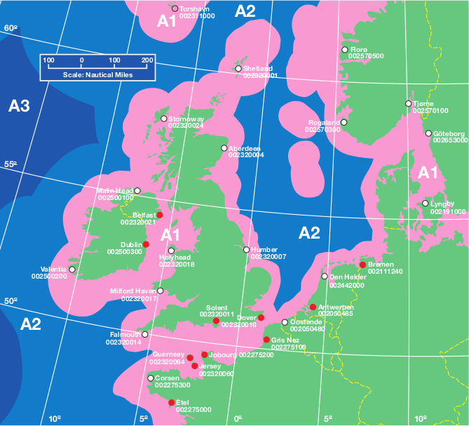
GMDSS sea areas around UK - Coast stations: 🔴 VHF only, ◯ VHF & MF
A1: VHF coverage - A2: MF coverage - A3: HF & satellites coverage- Navigation Safety Leaflets
MCA information leaflets about navigation, communication and safety at sea for seafarers on ships, yachts and fishing vessels:
- GMDSS: benefits of digital selective calling (DSC) - GMDSS: sea areas and procedures for small boat users
- SOLAS regulations for pleasure boat users - Life saving signals
- Channel navigation information service (CNIS) - Navigation safety for UK seafarers
- ...
- GMDSS: benefits of digital selective calling (DSC) - GMDSS: sea areas and procedures for small boat users
- Navigation: Watchkeeping Safety - Use of VHF Radio and AIS (MGN 324)
Guidance on the use of Very High Frequency radio (VHF) and the appropriate use of the Automatic Identification System (AIS). Given the continuing number of casualties where the misuse of very high frequency marine radio has been established as a contributory factor, it has been decided to re-issue the MCA guidance on the use of Very High Frequency radio (VHF). Additionally, appropriate use of the Automatic Identification System (AIS), especially with regard to collision avoidance, has been highlighted in conformance with the IMO guidelines.
- Guidance: Ship security
This guide explains how maritime security is managed in the UK, how to comply with EU regulation on ship security, how security measures are applied and how you should comply with them. It also provides guidance on how to deal with stowaways and deter acts of violence against merchant ships, such as piracy and armed robbery (2018).
- Measures to Counter Piracy, Armed Robbery and other Acts of Violence against Merchant Shipping (MGN 440)
This Marine Guidance Note (MGN) provides links to websites containing information countering Piracy, Armed Robbery and other Acts of Violence against Merchant Shipping (2011).
- Threat of piracy: use of armed guards on UK flagged vessels
Guidance for owners of UK flagged vessels on the use of armed guards to defend against the threat of piracy in exceptional circumstances. This guidance covers, amongst other things, the exceptional circumstances under which the use of armed guards may be considered, the factors to be included in the risk assessment, advice on selecting a private security company, and a requirement for the shipping company to produce a counter-piracy plan and submit a copy to the department (2015).
- Code of practice: cyber security for ships
Information on implementing and maintaining good cyber security practices on maritime vessels. Ship cyber security code of practice providing actionable advice on: Developing a cyber security assessment and plan to manage risk - Handling security breaches and incidents - Highlighting national and international standards used - The relationship to existing regulation (2017).
- Pleasure Vessels - Guidance and Applicable UK Regulations (MGN 538)
This guidance note provides an overview of the Merchant Shipping legislation that applies to pleasure vessels, including rules relating to certification and manning requirements. The relevant regulations cited in this note apply to UK pleasure vessels wherever they may be and for some of the regulations to non-UK pleasure vessels in UK waters.
- The yacht master's guide to the UK flag
This guide mainly deals with issues specific to UK registered large commercial yachts, such as operations and manning standards, and what to do about them. The guide covers the following: manning qualifications, hours of work crew agreements, official log books and their completion, GMDSS logs, health and safety, medical stores and care, surveys, audits and ILO Inspections,continuous synopsis records, UK publications to be carried, training (More information about large yachts).
- Fishermen's safety guide

Guidance for fishermen on and health and safety best practice, and applying merchant shipping and fishing vessel regulations. This guide outlines safe working practices and emergency procedures for fishermen. It provides a broad range of advice in respect of fishing vessel safety and should be used by everyone: owners, skippers and crew. This guide should be used as a reference guide but can also prepare yourself on what to do in an emergency.
- Fishing vessel survey: quick guide to survey preparation
Use this guide to help prepare for a survey. It explains what the surveyor will be looking at during the ‘out of water’ and ‘on board’ survey. Find out what things you can check before the survey so that you can identify and solve problems beforehand. The ‘on board’ survey covers 8 areas for you to check in detail. These are: wheelhouse, wheelhouse top/casing top/shelter top, accommodation, main deck, fish room, engine room, equipment tests, vessel operations and drills.
- Safety of fishing vessels and crew
Information for owners, operators, skippers and crew about safety standards in the fishing industry. This collection offers guidance to support and encourage safe working practice at sea and meeting legal/technical requirements for fishing vessel safety. Topics covered are: Fishing vessel standards and surveys - Fishing crew safety guides and leaflets - Technical advice - Codes of practice.
- Fishing vessel health and safety
Owners of UK-flagged fishing vessels are responsible for basic health and safety on board their boats, safe working practices and safety equipment. This guide explains health and safety provisions and how to ensure crew working practices are safe by complying with regulations for safe manning levels and working times. You will also find information on the safe use and maintenance of work equipment and fishing gear, as well as emergency and lifesaving equipment. The guide also outlines risk assessment of hazards and provides a list of organisations that can supply further information on safe working practices for fishing vessels. Updates:
- Code of Practice for Safety of Small Fishing Vessels (MSN 1871)
- Code of Safe Working Practice for Fishing Vessels (MSN 1872)
- Code of Practice for Construction and Safe Operation, Fishing Vessels (MSN 1873)
- Fishing Vessels: Emergency Drills (MGN 570)
- Fishing vessels: prevention of man overboard (MGN 571)
- Health and Safety at Work: Electromagnetic Fields Guidance (MGN 559)
Exposure to high levels of electro-magnetic fields (EMFs) can give rise to effects that may be irritating or unpleasant, or sometimes harmful and cause burns. This guidance contains information to help employers to: Identify sources of electromagnetic fields (EMF) in workplaces on ships - Assess the exposure of workers to EMF in the workplace - Decide what, if anything they may need to do to protect workers from the riskarising from exposure to EMF- Assess and control any risks from EMFs - Apply for an exemption from certain aspects of the Regulations. See also the Electromagnetic Fields Regulations (2016, No.1026).
- The ship captain's medical guide (SCMG)
Practical medical guidance for laymen (non-doctors) working on board a ship. This manual is written for laymen (non-doctors) working on board a ship. It contains a wide range of authoritative advice and will help you: assess and treat injuries, diagnose and treat illness, on journeys where you won’t have quick access to professional medical advice (22nd edition, 1999). This publication was withdrawn on 2019.
- Telemedical advice service (TMAS) for ships at sea (MGN 623)
How to obtain telemedical advice when a medical incident or medical emergency arises at sea. This note explains that contact should first be made with HM Coastguard, who will then put the caller in touch with one of the UK’s designated TMAS providers.
- Maritime Labour Convention: List of MCA Notices and Notes (MGN 470)
The Maritime Labour Convention, 2006 (MLC) introduces minimum global standards to promote decent living and working conditions for seafarers. This note lists all MCA merchant shipping notices and marine guidance notes which provide standards or guidance for implementation of the this Convention.
- Safe and compliant operation of vessels
Safety standards and advice for vessel operators. See also the Merchant Shipping Regulations and the Fishing Vessels Regulations.
- Merchant shipping notices (MSNs)
Merchant Shipping Notices (MSNs) contain the technical information that is associated with the Regulations (Statutory Instruments) laid down by Parliament. The letter suffix after the M-notice number tells you if it relates to merchant ships and/or fishing vessels: (M) for merchant ship - (F) for fishing vessels - (M+F) for both merchant ships and fishing vessels.

- Custom rules for sailing your pleasure craft to, from and within UK waters
Bermuda Department of Marine & Ports Services
- Yachts (Private) sailing to Bermuda
A voyage under sail to Bermuda can be a rewarding and relaxing experience—provided that you plan your voyage carefully and check and prepare your vessel adequately. This Information Sheet should be used in addition to all the other traditional reference material available. Table of Contents: Voyage Plan - Charts, Books and Supplies - Communications - Radio Aids to Navigation - Approaches to Bermuda - Pilotage and Entering Harbour - Anchorage and Berthing Facilities - Approach Lights to Bermuda - Lighted Buoys, Beacons, Ship’s Channel - Shore Lights, Beacons...
- Maritime Safety Information (MSI)
Broadcast schedule for Bermuda Radio (callsign ZBR) on VHF, MF and NAVTEX with: Latest urgent marine information - Safety information including navigational and meteorological warnings - Tropical weather advisories - Bermuda area weather forecasts - METAREA IV USA national weather service high seas forecast - USA NWS Southwest North Atlantic and Bermuda area weather forecasts.
- Guide to Marine VHF Radiotelephone Communications in Bermuda
Printable VHF Guide. A marine VHF set is a combined transmitter and receiver and only operates on standard, international frequencies known as channels. Contents: Marine VHF Radiotelephone Communications, Distress, urgency and safety – the priority of communications, Distress broadcast procedure, Marine VHF services available in Bermuda.
- Navigation Warnings
Navigation Warnings for Bermuda with Notice to Mariners (NTP) and Local Navigation Warnings (LNW).

- Yachts (Private) sailing to Bermuda
Met Office (UKMET)
- Guide to marine forecasts
The guides below will provide you with a description of what you will see on the marine weather pages, with details of how to view or change your view of the content. Guides : Shipping forecast key - Inshore waters forecast key - High seas forecast key - Extended outlook key - Marine forecasts glossary - Beaufort wind force scale - Radio broadcast times...
- Weather Factsheets
These factsheets clearly describe and illustrate the processes involved in global weather and climate, providing the most up-to-date answers and information.
- An introduction to clouds: with clouds classification
- The Beaufort Scale: with sea states photographs
- The Shipping Forecast: with forecast areas, glossary
- Air masses and weather fronts: introduction
- Interpreting weather charts: with list of weather symbols
- Sea ice: an introduction
- Space weather
- Glossaries, Handbooks & Guides (archive)
- Meteorology for Mariners
The aim of this book is to present the elementary theory of meteorology in a way that is suitable for Merchant Navy Officers and to explain its practical application to safe and economic ship operations. The contents of this book should satisfactorily cover the meteorological syllabuses for Department of Trade examinations for certificates of competency for Deck Officers in the Merchant Navy. It may also serve as a useful book of reference for those who have completed their courses of study and wish to maintain a good working knowledge of meteorology (1993).
- The Marine Observer's Handbook
The Marine Observer's Handbook is written for three purposes: (1) To assist officers aboard United Kingdom vessels, who voluntarily make observations at sea on behalf of Meteorological Services, to carry out this work in an efficient and uniform manner. (2) To encourage all mariners to take an interest in recording observations of (a) meteorology, (b) marine phenomena and wild life, (c) optical phenomena, and (d) basic oceanography, and to assist them in their study of these important and interesting subjects. (3) To provide a book of reference for candidates for Certificates of Competency issued by MSA, the Marine Safety Agency of the Department of Transport (1995).
- Meteorology for Mariners
- UK tide times
Tide times are available for around 500 locations in United Kingdom and are displayed beneath the weather forecast for up to five days ahead. In the UK we mostly experience a semi-diurnal tide which means we experience two high tides and two low tides each day. These occur approximately every 12 hours and 25 minutes.
- Marine observations
Latest marine observations for offshore for offshore (buoys & light vessels) ansd the coast (land systems & stations).

- Guide to marine forecasts
visitMyHarbour.com
- Charts of UK and Ireland harbours
View online charts / Cartes consultables en ligne
Not for navigational use / Ne pas utilisez pour la navigation
Visit My Harbour for Free Nautical Charts and Pilotage, UK Wide Coverage. This site is an online pilotage guide, here to provide timely and detailed information about the various ports and harbours, estuaries, rivers and inlets around the coasts of the UK and Ireland. Each harbour (NOT JUST marinas) has full sailing directions, free charts, and photo galleries. - Random UKHO chart
View online charts / Cartes consultables en ligne
Not for navigational use / Ne pas utilisez pour la navigation
Show one chart of the UK Hydrographic Office with a worldwide random choice.
Also chart of Falmouth Inner Harbour Including Penryn, England South Coast (AC18, 1:5.000).

- Charts of UK and Ireland harbours
HARBOURGUIDES.com
- Sailing and Passage Planning Charts for United Kingdom and Ireland
View online RNC charts / Cartes RNC consultables en ligne
Not for navigational use / Ne pas utilisez pour la navigation
This website has been derived in part from material obtained from the UK Hydrographic.
- Sailing and Passage Planning Charts for United Kingdom and Ireland
Royal Cruising Club Pilotage Foundation (RCCPF)
- Publications Catalogue 2021
The Royal Cruising Club Pilotage Foundation works in collaboration with experienced sailing authors and many yachtsmen and women, who contribute information to make it the authoritative provider of pilotage books and passage planning resources for cruising areas worldwide. Although more details of our numerous publications are available on the website this pdf download lists them all in an A4 format.
- Publications Catalogue
The RCCPF publishes nautical books and downloads about ocean sailing, coastal ports and anchorages worldwide. With each book description there is free additional information.
- Pilotage information
The RCCPF publishes nautical books and downloads about ocean sailing, coastal ports and anchorages worldwide. The Foundation publishes pilotage information through books and a range of media accessible via its own website. You need to sign up so that you can access and download our range of free publications. Areas: Crete - South Orkney Islands - South Atlantic Islands- South Georgia - South Shetland Islands - Antarctic Peninsula - South West Africa - Southern California Channel Islands - Fiji Lau Group - Aleutian Islands and Alaska to Vancouver Island including British Columbia - French Guiana, Suriname and Guyana. Some pilots:
- Victor Wejer's Periplus to Northwest Passage
Victor Wejer has produced an annual guide to the North West Passage which is an essential source of up to date information for any yacht considering a passage in this area. The latest edition of this essential guide for anyone contemplating the NW Passage is now available for download as a supplement for RCC Pilotage Foundation Arctic and Northern Waters.
- Aleutian Islands and the Alaska Peninsula to Prince William Sound
This file covers the Aleutian Islands and the Alaska Peninsula to Prince William Sound – plus notes for onwards southerly sailing. Separate Cruising Notes include reports on routing down through SE Alaska and British Columbia to the Gulf Islands.
- A Yachting Pilot for Crete
This pilot has been produced independently by Tony and Tessa Cross but the authors have very kindly given permission for it to be distributed by the RCCPF. The authors regularly update this pilot. It was first published in 2015 but this is the version dated June 2018. We endeavour to keep the latest version on this website but details of changes to the file can be found at the link below.
- A Cruising Guide to French Guiana, Suriname and Guyana
The countries of French Guiana, Suriname and Guyana form a cruising ground that is still well off the beaten track. Cruising boats visiting these countries number only a few hundred each year, and the majority of cruisers visit just a handful of anchorages. The rest of the region is almost unvisited by tourists or by cruisers. It is generally undeveloped, and provides an opportunity for cruisers to experience pristine rainforest with abundant flora and fauna, small towns, and jungle settlements of considerable cultural interest.
- South Africa to the Caribbean - A Passage Planning Guide
Driven by concerns over security along the Red Sea route, the cruising route from South Africa to the Caribbean has become increasingly popular in recent years. This new Royal Cruising Club Pilotage Foundation publication covers the principal routes from South Africa to the Caribbean. Author, Chris Hamblin, has brought together his own research with the cruising information and photos contributed to the Pilotage Foundation by yachtsmen and women who have sailed these routes in recent years
- South Shetland Islands and Antarctic Peninsula
The RCC Pilotage Foundation is grateful to Pete Hill and Noël Marshall for describing their experiences during cruises to these waters. These separate accounts overlap in the Shetland Islands.
- ...
- Victor Wejer's Periplus to Northwest Passage
- Polar Yacht Guide
Polar Yacht Guide for non-SOLAS pleasure yachts in Polar Waters. The goal of this guide is to encourage safe and environmentally-friendly navigation by pleasure yachts in Polar Waters, attention is drawn to the Polar Code. A group of experienced high latitude sailors have written the Polar Yacht Guide (PYG) as a voluntary code of practice. The PYG, which is specifically designed for yachts, is in three parts: (a) Safety of navigation and voyage planning for all polar waters, (b) Arctic waters and (c) Antarctic waters. The PYG is intended to supplement existing guides and pilot books. The authors and contributors believe it will be more effective than mandatory legislation.
- Electronic Navigation Systems - Guidance for safe use on leisure vessels
The objective of this booklet is to provide guidance on the safe use of electronic navigation and associated systems on leisure vessels. Indeed, good navigational safety is still dependent on the continuous assessment by the skipper/navigator of all the navigation-related information available on the vessel – and not just over-concentrating on some, however beguiling they may be. So the aim of this booklet is to improve awareness of the current vulnerabilities and how to mitigate them, enabling all of us to make better and safer judgements, both when we are passage planning and when we are at sea. This is a summary of operational issues highlighting, where appropriate, the advantages and drawbacks of different systems and approaches, the "keys to safety" in many operational situations. Content: GNSS in marine navigation, Electronic charts and their display systems, Using Radar and AIS, Guarding against electronic failure on small craft, Key navigational skills, Future Developments (RIN & alt.).
- Pilotage Notices
Worldwide geo-referenced information about pilotage are available on this website. The RCCPF welcomes all feedback including about new pilotage information,
- Updates and Supplements
This page lists all the currently available updates and supplements for the RCCPF's publications. These are also downloadable from the individual publication pages of the website.
- Publications Catalogue 2021

United States of America / États-Unis d'Amérique
- NGA Maritime Safety Office
- United States Coast Guard (USCG)
- Office of Coast Survey (OCS/NOAA)
- National Weather Service (NWS/NOAA)
- Tides & Currents (CO-OPS/NOAA)
- U.S. National Ice Center (USNIC)
- Naval Meteorology and Oceanography Command (NMOC/US Navy)
- NRL's Marine Meteorology Division (MMD/NRL/US Navy)
- Admiralty and Maritime Law Guide
NGA Maritime Safety Office
- Search Catalog of Hydrographic Products
Use the Catalog Search to retrieve specific product information as listed in the NGA Catalog of Hydrographic Products. Select a type of product (Charts or Publications) from the options below to display its interactive Database Query form.
- American Practical Navigator (Pub. 9)
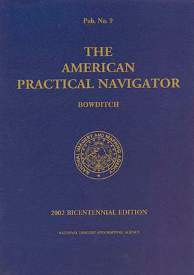
The American Practical Navigator (NGA Pub. 9), first published in 1802, was billed as the "epitome of navigation" by its original author, Nathaniel Bowditch. The text has evolved with the advances in navigation practices since that first issue and continues to serve as a valuable reference for marine navigation in the modern day. The publication describes in detail the principles and factors of navigation, including piloting, electronic navigation, celestial navigation, mathematics, safety, oceanography and meterology. It also contains various tables used in typical navigational calculations and solutions, including the formulas used to derive the tabular data.
- Distances Between Ports (Pub. 151)
The Distances Between Ports (NGA Pub. 151) publication contains tabulated distances between departure ports, junction points, and arrival ports worldwide, organized alphabetically
- International Code of Signals (Pub. 102)
The International Code of Signals (NGA Pub. 102) publication contains descriptions and graphic depictions of a specific vocabulary of signals and the various methods used to transmit them.
- NGA List of Lights
Worldwide coverage, 7 volumes. The List of Lights, Radio Aids and Fog Signals is published in seven volumes, as Publication numbers 110 through 116. Each volume contains lights and other aids to navigation that are maintained by or under the authority of foreign governments. With radiobeacons and differential GPS stations.
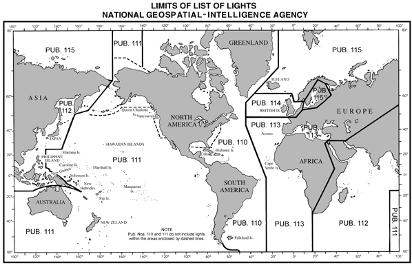
- NGA List of Lights (Pub. 113)
The West Coasts of Europe and Africa, the Mediterranean Sea, Black Sea and Azovskoye More (Sea of Azov), West and South Coasts of France.
- NGA List of Lights (Pub. 114)
British Isles, English Channel and North Sea, North Coasts of France.
- Worldwide...
- Radar Navigation and Maneuvering Board Manual (Pub. 1310)
The Radar Navigation and Maneuvering Board Manual (NGA Pub. 1310) contains, in a single volume, information on the fundamentals of shipboard radar, radar operation, collision avoidance, navigation by radar, and a description of vessel traffic systems in US waters.
- Radio Navigational Aids (Pub. 117)
Worldwide coverage. The Radio Navigational Aids (NGA Pub. 117) publication contains a detailed list of selected worldwide radio stations that provide services to the navigator. The publication is divided into chapters according to the nature of the service provided. Services include RDF and Radar stations; stations broadcasting Navigational Warnings, time signals or medical advice; communication traffic for distress, emergency and safety, including GMDSS; and long range navigational aids.
- Sailing Directions Enroute
Worldwide coverage, 42 volumes. Sailing Directions (Enroute) include detailed coastal and port approach information, supplementing the largest scale chart of the area. Each publication is subdivided into geographic regions, called sectors, which contain information about the coastal weather, currents, ice, dangers, features and ports, as well as a graphic key to the charts available for the area.
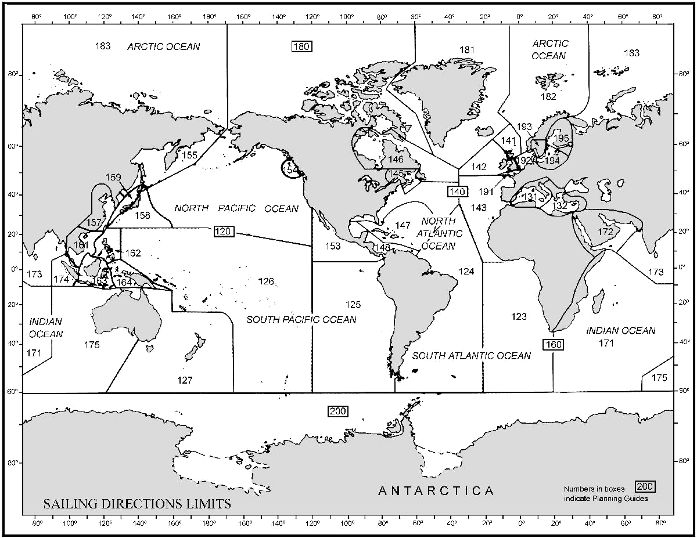
- Sailing Directions Enroute (Pub. 131)
Western Mediterranean, South Coasts of France
- Sailing Directions Enroute (Pub. 143)
West Coast of Europe and Northwest Africa, West Coasts of France
- Sailing Directions Enroute (Pub. 191)
English Channel, North Coasts of France
- Worldwide...
- Sailing Directions Planning Guides
Worldwide coverage, 5 volumes. Sailing Directions (Planning Guides) include relevant physical, political, industrial, navigational and regulatory information about the countries adjacent to a particular ocean basin in a single volume.
- Sailing Directions Planning Guide (Pub. 140)
North Atlantic Ocean and Adjacent Seas
- Worldwide...
- Sailing Directions Planning Guide (Pub. 140)
- Sight Reduction Tables for Air Navigation (HO-249)
The Sight Reduction Tables for Air Navigation (HO249) are published in three separate Volumes. Volume I of Pub 249 used by both the marine and air navigator, contains altitude (to the nearest minutes) and true azimuth values of seven selected stars for the complete ranges of latitude and hour angle of Aries. These seven stars represent the best selection for observation at any given position and time, and provide the data for presetting instruments before observation and for sight reduction afterwards. Volumes II and III cover latitudes 0°-40° and 39°-89° respectively and are primarily used by the air navigator in conjunction with observations of celestial bodies to calculate the geographic position of the observer. - Sight Reduction Tables for Marine Navigation (HO-229)
The Sight Reduction Tables for Marine Navigation (HO229) is published in six Volumes, each of which contains two eight-degree zones of latitude with a one-degree overlap between Volumes. They are designed to facilitate the practice of celestial navigation at sea. The tables are primarily used with the Intercept method of sight reduction by entering arguments of latitude, declination, and Local Hour Angle and obtaining tabulated altitudes and azimuth angles. The tables are prepared and published by NGA on an as needed basis.
- Celestial Navigation Calculators
JavaScript programs / Programmes en javascript
Compass Error from Amplitudes Observed on the Visible Horizon - Altitude Correction for Air Temperature - Table of Offsets - Latitude and Longitude Factors - Altitude Correction for Atmospheric Pressure - Altitude Factors & Change of Altitude - Pub 229 - Compass Error from Amplitudes Observed on the Celestial Horizon - Meridian Angle and Altitude of a Body on the Prime Vertical Circle. - Nautical Calculators
JavaScript programs / Programmes en javascript
The Nautical Calculators can be used to solve many of the equations and conversions typically associated with marine navigation: Celestial Navigation - Conversions - Distance - Log and Trig - Sailings - Time Zones - Weather Data. Each calculator page is a self-contained JavaScript program that can be downloaded and used off-line. After displaying an individual calculator page, use the "Save As..." command in your browser window to download the page to your computer. - USCG Light List
List of lights for the United States coasts. The USCG Light List is published in seven volumes and contains lights and other aids to navigation used for general navigation that are maintained by or under the authority of the U.S. Coast Guard and located in the waters surrounding the United States and its Territories.
- USCG Light List Summary of Corrections
These links are a summary of annual Light List Corrections from the Local Notice to Mariners for the United States coasts.
- World Port Index (Pub. 150)
The World Port Index (NGA Pub. 150) contains the location and physical characteristics of, and the facilities and services offered by major ports and terminals world-wide (approximately 3700 entries), in a tabular format. Entries are organized geographically, in accordance with the diagrams located in the front of the publication.
- U.S. Chart No. 1: Nautical Chart Symbols, Abbreviations and Terms
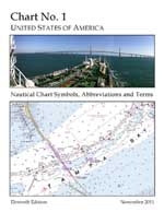
U.S. Chart No. 1, Nautical Chart Symbols, Abbreviations and Terms, presents the symbols depicted on paper nautical charts produced by the NGA and the NOAA, and on raster representations of these charts such as Raster Nautical Charts.
- Online Nautical Chart Viewers for international waters
View online charts / Cartes marines consultables en ligne
Charts by charts / Une carte à la fois
Not for navigational use / Ne pas utilisez pour la navigation
The NGA charts are NOT corrected for Notice to Mariners; however, a link to the latest corrections is given for each chart. Use these charts as a ready reference or planning tool. Navigate with the official printed or digital charts (Nauticalchartsonline).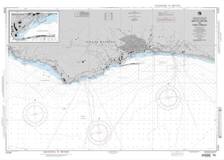
- Arctic regions: NGA Nautical Charts for upload
Charts for upload and print / Cartes marines téléchargables et imprimables (PDF)
Not for navigational use / Ne pas utilisez pour la navigation
For the Arctic regions 27 NGA charts: Norwegian Sea and Adjacent Seas, Greenland to Kara Sea, North Star Bugt Anchorage (Greenland - West Coast) Denmark, Poluostrov Kamchatka to Aleutian Islands including Komandorskiye Ostrova, Kara Sea to Bering Straight, Hudson Straight and Bay... From the "Map Products" section of the NGA Arctic Support website. - Guidance on the proper display scale of Digital Nautical Chart
Displaying Digital Nautical Chart (DNC) data at a scale larger than the data compilation scale is known as Over-Scaling. This is an unsafe practice because it gives the mariner a false sense of the positional accuracy of navigation hazards and incorrect distance between features, which could lead to unsafe mission planning and navigation. This is a particular concern for the small-scale General and Coastal DNCs. NGA strongly recommends that ECDIS display DNC libraries at their data compilation scale.
- Using Nautical Charts with Global Positioning System
With the advent of the Global Positioning System (GPS), mariners can now navigate with much greater precision than ever before possible. This brochure focuses on the inherent limitations of nautical charts when plotting positions from GPS receivers.
- Declination: Magnetic North Pole Shifting Rapidly and Unpredictably
The Earth’s north magnetic pole is shifting so rapidly that steps are being taken to ensure it doesn't impact navigation. For example, over the past few decades the North magnetic pole has been drifting toward Siberia at an irregular speed: this migration can adversely affect the accuracy of navigation. This leads to more frequent updates of the World Magnetic Model, which describes the planet’s magnetic field and value of declination (GeoGarage blog).
- Handbook of Magnetic Compass Adjustment (Pub. 226)
The Handbook of Magnetic Compass Adjustment (DMA Pub. 226) includes information about terrestrial magnetism, the theory behind magnetic compass adjustment, and detailed procedures for manual correction of magnetic compass error.
- Magnetic Variation Charts WMM2020
The World Magnetic Model is the standard model used by the U.S. Department of Defense, the U.K. Ministry of Defence, the North Atlantic Treaty Organization (NATO) and the International Hydrographic Organization (IHO), for navigation, attitude and heading referencing systems using the geomagnetic field. It is also used widely in civilian navigation and heading systems. The model, associated software, and documentation are distributed by NCEI on behalf of NGA. The model is produced at 5-year intervals, with the current model expiring on December 31, 2024. Smartphone and consumer electronics companies rely on the WMM to provide consumers with accurate compass apps, maps, and GPS services.
- Magnetic Variation Charts: Declination (2020)
Magnetic declination is an important concept for accurate navigation. A compass will always point along the lines of magnetic force (which converge on what are called the magnetic poles). The angle between the direction of force and the direction of the geographic north pole is called the declination. As one moves across the surface of the globe, lines of constant magnetic declination are called isogonic lines. These charts below depicts, for 2020, isogonic contours of magnetic variation at 2° intervals (Main Field Declination). The WMM now includes “Blackout Zones” around the magnetic poles, as defined by the strength of the horizontal field. Between 2000 and 6000 nanotesla (nT) horizontal field strength is the “Caution Zone” where compasses may start to become prone to errors. The area around the pole between 2000 and 0nT is the “Unreliable Zone” where compasses may become inaccurate.
- World Chart: declination between latitudes 70°N and 70°S
- Northern Polar Region Chart: declination for north of 55°N latitude
- Southern Polar Region Chart: declination for south of 55°S latitude
- Online World Map: global, Arctic and Antarctic declination until 2020 (NGDC/NOAA)
- Magnetic Variation Annual Change Charts: Annual Change Declination (2020)
As the earth's magnetic field varies over time, the positions of the north and south magnetic poles gradually change. The magnetic declination at a given location also changes over time. These charts below depicts, for 2020, isogonic contours of annual change in magnetic variation at 2' intervals (Annual Change Declination). More information about The World Magnetic Model (NCEI).
- World Chart: annual declination change between latitudes 70°N and 70°S
- Northern Polar Region Chart: annual declination change for north of 55°N latitude
- Southern Polar Region Chart: annual declination change for south of 55°S latitude
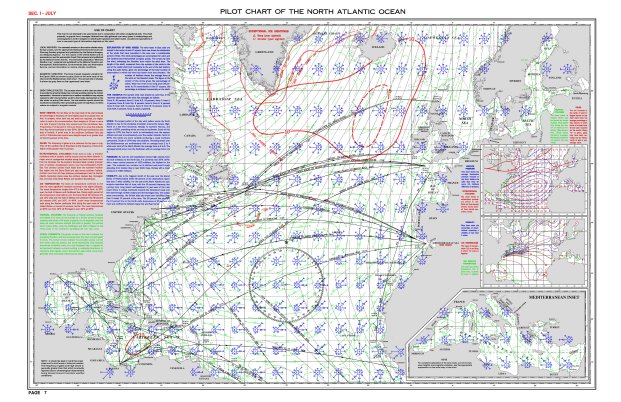
- Atlas of Pilot Charts
Worldwide coverage, 5 areas. Pilot Charts depict averages in prevailing winds and currents, air and sea temperatures, wave heights, ice limits, visibility, barometric pressure, and weather conditions at different times of the year. The information used to compile these averages was obtained from oceanographic and meteorologic observations over many decades during the late 18th and 19th centuries.
- Summary of Corrections publications
Summary of Corrections publications, separated into five regional Volumes, contain a summary of Notice to Mariners corrections issued from the edition date of each chart or publication product up to the "Corrected through NTM" number of the Volume.
- Navigational Warnings
In support of the Global Maritime Distress and Safety System (GMDSS), Broadcast Warnings are promulgated by the Worldwide Navigational Warnings Service (WWNWS) to provide rapid dissemination of information critical to navigation and the safety of life at sea. Navigational Warnings are issued regularly and contain information about persons in distress, or objets and events that pose an immediate hazard to navigation. There is a world map with the navigational warning limits. A query form is also available to retrieve Broadcast Warnings from the online database.
- Navigational Warnings Prototype Web Map Application
The Navigational Warnings Prototype Web Map Application, can be used with a web browser to display in-force Broadcast Warning messages, Navigational Warning and SAR limits, and their Points of Contacts.
- Information from the Office of Maritime Security (MARAD)
The Office of Maritime Security (MAR-420) supports the U.S. maritime transportation system, the U.S. Merchant Marine, and other elements of the U.S. maritime industry. We provide information for U.S.-flag vessels. Table of Contents: Maritime Security Communications with Industry (MSCI) - Piracy and Armed Robbery Against Ships - Maritime Domain Awareness (MDA) - Maritime Administration Certification of Cruise Vessel Security and Safety Act (CVSSA) Training Providers - Port Security Grant Program - Maritime Cyber Security - Federal Maritime Security Agency Information - Regional Threat Information and POCs - Office of Maritime Security Contacts.
- Maritime Security Communications with Industry (MSCI) Web Portal
The U.S. Maritime Advisory System serves as the consolidated U.S. government system for communication with U.S. maritime industry stakeholders regarding potential or observed maritime security threats. The U.S. Maritime Alert has been developed to expeditiously provide basic information (location, incident type, and date/time) on reported maritime security threats to U.S. maritime industry interests. A U.S. Maritime Advisory may follow the issuance of a U.S. Maritime Alert and is intended to provide more detailed information, when appropriate. The U.S. Maritime Advisory System utilizes a “whole-of government” approach vice a single U.S. government agency approach. While U.S. Maritime Alerts and Advisories are transmitted by the National Geospatial-Intelligence Agency and are posted on the MARAD-hosted MSCI Web Portal, they should not be referred to as originating from a single agency (MARAD).
- U.S. Maritime Alerts: Provide basic information on reported maritime security threats
- U.S. Maritime Advisories: Provide more detailed information on maritime security threats
- Piracy Information
The Worldwide Threats to Shipping Report, compiled and published weekly by the Office of Naval Intelligence, contains a summary of recent piracy acts and hostile actions against commercial shipping worldwide, organized by geographic region. The report also includes any recent developments in the efforts to prevent piracy and prosecute the aggressors. Anti-shipping Activity Messages (ASAM) include the locations and descriptive accounts of specific hostile acts against ships and mariners. The reports may be useful for recognition, prevention and avoidance of potential hostile activity. Use the online form to submit an Anti-shipping Activity Message report. You can also search the Anti-shipping Activity Messages (ASAM) database for detailed reports of hostile acts.
- NtM 01: Special Notice to Mariners Paragraphs
This notice contains a variety of subjects amplifying information not usually found on charts or in navigational publications. Paragraphs 1 thru 74 are “special notice to mariners paragraphs” which are promulgated once each year in the interest of safe navigation: The Prudent Mariner (1), Nautical Chart Symbols and Abbreviations Information (2), Special Warnings (5), Urgency and Safety Signals (10), International Distress Signal (42), Vessel Traffic Services Frequencies (25), Worldwide Navigational Warning Service (43), MARAD Advisories (49), Space Weather Impacts (73)...
- US Notice to Mariners
The US Notice to Mariners provides timely marine safety information for the correction of all US Government navigation charts and publications from a wide variety of sources, both foreign and domestic. To ensure the safety of life at sea, the information published in the Notice to Mariners is designed to provide for the correction of unclassified nautical charts, the unclassified NGA/DLIS Catalog of Hydrographic Products, United States Coast Pilots, NGA List of Lights, USCG Light Lists, and other related nautical publications produced by NGA, NOS and the USCG.
- Search Catalog of Hydrographic Products
United States Coast Guard (USCG) - Navigation Center
- MSIB: Worldwide Navigational Warnings Service
The Coast Guard has issued Marine Safety Information Bulletin (MSIB) 05-21 to provide a brief overview of the Global Maritime Distress and Safety System (GMDSS) Worldwide Navigational Warnings Service. The IMO, in cooperation with the IHO and WMO, established a worldwide navigational warnings service to ships. Twenty-one navigational and meteorological areas (NAVAREAs and METAREAs) were established with responsibility for coordination and broadcast assigned regionally to various countries. Ships fitted with an inexpensive GMDSS Inmarsat-C or Iridium LT-3100S ship earth station will receive these international NAVAREA and METAREA warnings, as well as alerts from rescue coordination centers.
- Various GPS Interference & AIS Spoofing
Issue: Instances of significant GPS interference have been reported worldwide in the maritime domain. This interference can result in lost or inaccurate GPS signals affecting bridge navigation, GPS-based timing, and communications equipment (including satellite communications equipment). Over the last six months, an area in which multiple instances were reported was the Strait of Hormuz. The U.S. Coast Guard Navigation Center (NAVCEN) webpage, https://navcen.uscg.gov/gps-problem-report-status, contains a chronological list of recently reported GPS problems. Additionally, Automatic Identification Systems (AIS) are open, unencrypted, and unprotected radio systems intended to operate on non-secure VHF-FM channels. As such, AIS signals can be spoofed, resulting in incorrect or missing AIS data.
- Use of Electronic Charts and Publications in lieu of Paper Charts, Maps and Publications
The purpose of this Navigation and Vessel Inspection Circular (NVIC) is to provide U.S. Cosat Guard marine inspectors and the maritime industry with uniform guidance regarding what the Coast Guard now considers equivalent to the chart and publications carriage requirement in the Title 33 and Title 46 of the Code of Federal Regulations (C.F.R.).
- USCG Light List
These USCG Light List is published in seven volumes and contains lights, sound signals, buoys, daybeacons, and other aids to navigation used for general navigation that are maintained by or under the authority of the U.S. Coast Guard and located in the waters surrounding the United States and its Territories. These Light List products are corrected through the latest Coast Guard LNM for each Coast Guard District.
- Vessel Traffic Services
The purpose of a Vessel Traffic Service (VTS) is to provide active monitoring and navigational advice for vessels in particularly confined and busy waterways. There are two main types of VTS, surveilled and non-surveilled. VHF communications network forms the basis of most major services. The Coast Guard operates 12 Vessel Traffic Centers (VTC).
- Vessel Traffic Services (HomePort)
VTS information (Chartlets, General Information, News and Events and User Guides) for these VTS areas: Berwick Baay, Houston Galveston, Louisville, Lower Mississippi River, New York, Port Arthur, Puget Sound, Saint Mary's River, San Francisco and Tampa.

- Vessel Traffic Services (USCG)
VTS information for these areas:
- Los Angeles-Long Beach: VTS Users Manual - VTS Brochure -Vessel Operating Procedures - Vessel Agent Handbook> (MXSOCAL)
- U.S. Aids to Navigation System
This booklet will give you, the recreational boater, the basic information you need about the U.S. Aids to Navigation System (USATONS). This information will help you recognize, understand, and navigate by the colors, shapes, numbers, and lights you will encounter on the water. It will also give you the basic tools you need to read a nautical chart (Boating Safety Division).
- Amalgamated international & U.S. inland navigation rules
This HTML document is an amalgamation of the International Regulations for Preventing Collisions at Sea (72 COLREGS) and the U.S. Inland Navigation Rules, their Annexes, and associated Federal regulations. Click on camera images to view a graphic rendition of a rule.
- Navigation Rules Frequently Asked Questions
- International and Inland Navigation Rules: Chapter 2 from U.S. Coast Pilot 5
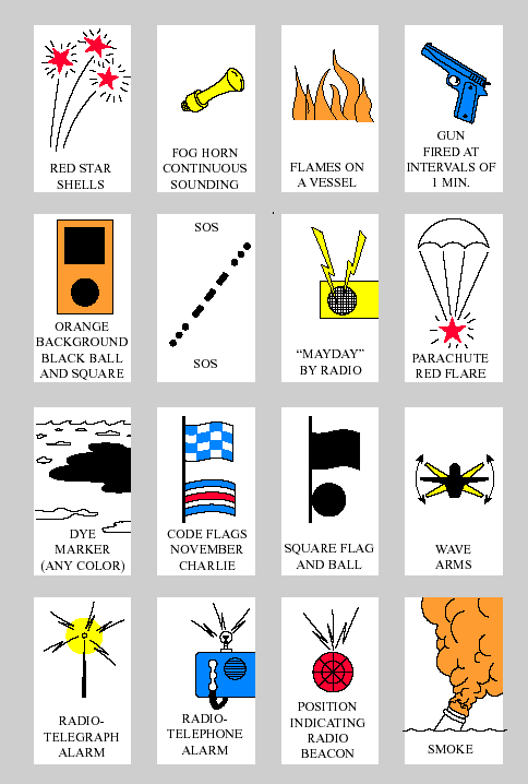
- Navigation Rules Flash Cards
Practice Your Visual NAVRULES! This is is a randomly selected visual NAVRULE problem from our flashcard database. In many cases, what is presented are words or phrases, and you should think of the definition or definitions that meet the condition(s) of the words or phrases. Then, click on the image to obtain the correct answer(s).
- The Ship's Medicine Chest and Medical Aid at Sea
This edition is not meant to be a detailed “how to” book for specific diseases. Current information on specific diagnostic and treatment protocols is better obtained from onshore medical consultation. Instead the purpose of this edition is to provide enough information so that someone, who has had the required classroom and other practical skills training, can examine a patient and appropriately communicate the medical findings to a shore-based practitioner (US DHHS/PHS, Pub. 03-2024, 2003).
- Fishing Vessel Safety
- Publication & References: Safety Checklist, Safety Equipment Survival Card, Stability Card...
- Flyers: Stability, Estabilidad, Cold Water, Aguas Frias, Falls Overboard, Caídas Al Agua, Cold Water Survival Hypothermia...
- Marine Safety Booklets & Manuals: Commercial Fishing Vessel Safety Digest, Federal Requirements For Commercial Fishing Industry Vessels, Emergency Instruction & Drill Manual, Sổ tay hướng dẫn và diễn tập trong trường hợp khẩn cấp cho tàu đánh cá thương mại... (AMSEA)
- Commercial Fishing Vessel Safety Digest
Commercial fishing has consistently remained one of the most dangerous occupations in the nation. Ensuring that vessels are in full compliance with safety requirements and crews are trained in safety and survival techniques, we can contribute to improving the safety record of the commercial fishing industry. The Commercial Fishing Vessel Safety Digest brings together all the federal regulations applicable to the operation of uninspected commercial fishing vessels in one location and in an easy to read and understand format. These include safety and survival equipment, navigation safety, pollution prevention, and emergency instruction and traning. The Digest of valuable to anyone associated with the U.S. commercial fishing industry including individual fishermen, fleet operators, instructors/trainers, equipment providers, USCG personnel, and others involved with the industry (USCG & AMSEA).
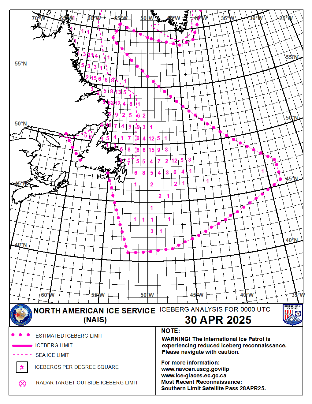
- North American Ice Service (NAIS)
The North American Ice Service provides year-round maritime safety information on iceberg and sea ice conditions in the vicinity of the Grand Banks of Newfoundland and the east coast of Labrador, Canada. The purpose of the NAIS Iceberg Bulletin and Chart is to advise mariners of the estimated iceberg extent within the region.
- NAIS Broadcasts: station, time and frequencies
- Today's NAIS Iceberg Chart: iceberg and sea ice limits, icebergs per degree square (Info sheet=
- Today's NAIS Iceberg Bulletin: with longitude and latitude limits (Info sheet)
- Weekly Iceberg Outlook: every Wednesday
- Icebergs and Sea Ice: definition, location
- Iceberg Formation: mass, size, shape
- Radiotelephone Handbook
The Radiotelephone Handbook is a user’s guide addressing proper radiotelephone procedures. It consolidates portions of International Telecommunication Union radio regulations and various allied communications publications into a single source reference for field use.
- USCG ceased monitoring HF voice distress frequencies
The U.S. Coast Guard ceased monitoring all High Frequency (HF) shortwave voice distress frequencies within the contiguous United States and Hawaii on 7 February 2022. HF voice distress watchkeeping continue unaffected in Alaska and Guam. HF watchkeeping on HF distress and safety digital selective calling (DSC) frequencies also continue unaffected at all locations.
- Maritime Telecommunications & GMDSS
In 1979, a group of experts drafted the International Convention on Maritime Search and Rescue, which called for the development of a global search and rescue plan. This group also passed a resolution calling for the development of a Global Maritime Distress and Safety System (GMDSS) to provide the communication support needed to implement the global search and rescue plan.
- Sending a distress call
- Transmission of DSC Distress Alert
- Cancelling a false alerts
- SafetyNET Manual
- Channel Information: U.S. VHF - MF & HF
- Emergency position indicating radiobeacon (EPIRB)
- GPS User Equipment Introduction
The Navstar Global Positioning System (GPS) is a space-based radio-positioning and timetransfer system. GPS provides accurate position, velocity, and time (PVT) information to an unlimited number of suitably equipped ground, sea, air and space users. Passive PVT fixes are available world-wide in all-weathers in a world-wide common grid system (hostile imitation). GPS comprises three major system segments, Space, Control, and User (1996). More GPS Technical References
- GPS Standard Positioning Service Performance Standard
This document defines the levels of performance the U.S. government makes available to users of the GPS Standard Positioning Service (SPS), also known as the civilian GPS service. With current (2018) Signal-in-Space (SIS) accuracy, well-designed GPS receivers have been achieving horizontal accuracy of 3 meters or better and vertical accuracy of 5 meters or better 95% of the time.
- GPS Space Segment/Navigation User Interfaces: Interface Specification (IS-GPS-200)
Interface Specification IS-GPS-200 defines the requirements related to the interface between the Space Segment (SS) of the GPS and navigation User Segment (US) for radio frequency link 1 (L1) and link 2 (L2).
- GPS Constellation status
The Operational Advisory (also known as a GPS Status Message) provides a summary of the status of the satellite constellation. A GPS Notice Advisory to Navstar Users (NANU) is an advisory message to inform users of a change in the GPS constellation. These messages are released 72 hours in advance for planned maintenance. These messages are also used to notify users of unscheduled outages. General NANUs can be used to disseminate general GPS information.
- Current Notice Advisory to Navstar Users (NANU): Change in the GPS constellation
- General information NANU: general GPS information
- Current GPS Operational Advisory message (OPS Advisory): summary of the status of the satellite constellation
- GPS Frequently Asked Questions
- GPS Acronyms and Abbreviations

GPS Satellite Position - NM/blue: not monitored - DNU/red: do not use (FAA) - Report a GPS service outage or anomaly
The Navigation Center appreciates your reports regarding service degradations, disruptions, or other incidents or anomalies. If you are experiencing GPS issues relating to land-based or maritime positioning, navigation, or timing signals, please submit a GPS disruption report using the form. If your GPS unit or others' GPS units are leading people to an incorrect address OR are otherwise leading people to an incorrect location, the problem is not likely a "GPS" problem, but rather, it is very likely a MAPPING problem. Unfortunately, the Navigation Center cannot assist you with GPS unit mapping problems, as we do not develop, control, nor repair the mapping software contained in GPS units, including vehicle navigation systems.
- GPS Problem Reports Status
List of GPS problem reports: Disruption Date/Time, Location, Description, Cause and Closed Date. Civil GPS Users are encouraged to submit reports of GPS problems to NAVCEN. A form to submit reports can be found on our GPS Problem Reporting webpage. Some information from those reports is shared here along with input from interagency partners and the most likely cause of the report.
- Automatic Identification System (AIS) Overview
Imagine a shipboard radar or an electronic chart display that includes a symbol for every significant ship within radio range, each with speed and heading. Each ship "symbol" can reflect the actual size of the ship, with position to GPS accuracy. By "clicking" on a ship symbol, you can learn the ship name, course and speed, classification, call sign, registration number, MMSI, and other information. The AIS is a shipboard broadcast system that acts like a transponder, operating in the VHF maritime band, that is capable of handling well over 4,500 reports per minute and updates as often as every two seconds.
- Long Range Identification and Tracking (LRIT) Overview
The Long Range Identification and Tracking (LRIT) system is a designated International Maritime Organization (IMO) system designed to collect and disseminate vessel position information received from IMO member States ships that are subject to the International Convention for the Safety of Life at Sea (SOLAS). LRIT is a satellite-based, real-time reporting mechanism.
- Amver Ship Reporting Manual
The Automated Mutual Assistance Vessel Rescue System (Amver) is a worldwide voluntary ship reporting system operated by the United States Coast Guard (USCG) to promote safety of life and property at sea. Amver’s mission is to quickly provide SAR authorities, on demand, accurate information on the positions and characteristics of vessels near a reported distress. Any merchant vessel anywhere on the globe, on a voyage of greater than 24 hours duration, is welcome in the Amver system and family. International participation is voluntary regardless of the vessel’s flag of registry, the nationality of the owner or company, or ports of call (Manual in English, Chinese and Dutch).
- Marine Safety Information Bulletins (MSIB)
The US Coast Guard is releasing guidance and updated protocols for a variety of operations, maritime policies and regulatory requirements via Marine Safety Information Bulletins (MSIB). These releases has been issued for public information and notification purposes only.
- U.S. Coast Guard Maritime Security (MARSEC) Levels
The Coast Guard employs a three-tiered system of Maritime Security (MARSEC) Levels designed to easily communicate to the Coast Guard and our maritime industry partners pre-planned scalable responses for credible threats.
- Broadcast Notice to Mariners (BNM)
NAVCEN is expanding availability of near-real-time Maritime Safety Information (MSI) to all U.S. waterways. To search and retreive BNM messages for an area of interest, begin by clicking on area on USCG District map or use District Selector.
- USCG Local Notice to Mariners (LNM)
Local Notices to Mariners by CG District. The USCG Local Notice to Mariners is updated weekly and is available for download in Portable Document File (PDF) Format.

Office of Coast Survey
National Oceanic and Atmospheric Administration
U.S. Department of Commerce- MSIB: Worldwide Navigational Warnings Service
Office of Coast Survey (OCS/NOAA)
All traditional NOAA paper nautical charts will be canceled by January 2025 NOAA has already started to cancel individual charts and will shut down all production and maintenance of traditional paper nautical charts and the associated raster chart products and services by January 2025. Mariners and other users of nautical charts are encouraged to use the electronic navigational chart (NOAA ENC®), NOAA's premier nautical chart product. Read more information about the Future of NOAA Charts.
- End of Traditional Paper Charts: transition to ENC
In November 2019, NOAA initiated a five-year process to end all raster nautical chart production, including the five traditional paper chart products. NOAA is intent on easing the transition to ENC-based products while continuing to support safe navigation. NOAA is aware that some chart users prefer paper charts. Although production of traditional paper charts will stop, a new form of paper nautical chart will be available through the NOAA Custom Chart capability (currently in prototype form). This system will enable users to create, customize, and print paper charts themselves, or have large format charts printed and delivered by a NOAA certified print-on-demand (POD) chart agent.
- Transforming the NOAA ENC
Implementing the National Charting Plan. Like many other chart producing national agencies, NOAA has recognized a change in mariners' preference for (and in some cases, required use of) ENCs over paper nautical charts and has adopted an “ENC-First” production process. That is, ENCs are recognized as being the "first" or the primary nautical chart product produced by NOAA. Critical corrections, such as newly discovered shoals and other dangers to navigation are applied to ENCs first. Table of Contents: Introduction - Importance of Nautical Charts for Maritime Commerce - ENC Related Regulation Changes - ENC-First Chart Production Strategy - Gridded ENC Product Scheme - Enhancements Implemented in New ENCs - Larger, Standard Scale Coverage - Depth Contour Metrification - Resolution of discontinuities in adjacent ENCs - Minimum Channel Depths on ENCs - Comparative Ease of Updating ENC Data - Precision navigation and High Definition Charts - Estimated ENC Rescheming Schedule - Glossary.
- Status of New NOAA ENCs - Rescheming
The layout of the extents or footprints of ENC charts is called a scheme – a term meaning a systematic configuration. ENC rescheming is a major component of the charting plan and is the means by which many other aspects of the plan will be implemented – such as compiling depth contours in metric intervals. The current ENC scheme is based on the extents of the paper nautical charts from which ENCs were originally digitized. Rescheming will replace this puzzle-piece layout with a rectangular grid of ENCs, often providing larger scale and more detailed coverage than the existing paper charts. This interactive map shows progress in gridding the NOAA ENC product suite, as described in Transforming the NOAA ENC: Implementing the National Charting Plan.
- NOAA Chart Display Service (NCDS)
The new NOAA Chart Display Service (NCDS) renders NOAA electronic navigational chart (NOAA ENC®) data with “traditional paper chart” symbology in applications for which a basemap of nautical chart data is desired. The new service uses symbols, labels, and color schemes familiar to those who have used NOAA paper nautical charts. This preview of the viewer available on the Coast Survey website give you an idea of what the NCDS rendered data looks like (More information).
- NOAA Custom Chart: ENC to PDF charts
Create and download charts based on your own scale, extent, and paper size settings. NOAA Custom Chart is a dynamic map tool which enables users to create their own paper and PDF nautical charts derived from the official NOAA electronic navigational chart (ENC). The online tool uses official NOAA ENC data to create nautical charts with customized scale and extent, which can then be downloaded as PDF files. The charts feature traditional chart components such as paper chart symbology – including NOAA-style symbols for aids to navigation and dangers to navigation, and a quality of data diagram. While these printable PDFs look a bit different from traditional paper charts, and initially will not meet carriage requirements for regulated vessels, NOAA Custom Chart utilizes the best available data, delivers an improved service for users, and ensures consistency between ENC and NOAA Custom Chart PDFs, resulting in the best quality chart regardless of the final format (More information).
- Example of custom chart: San Francisco Approaches - Scale 1:20000, unit in metres, two depth zone shades, A0 page size, generation date 21 April 2021
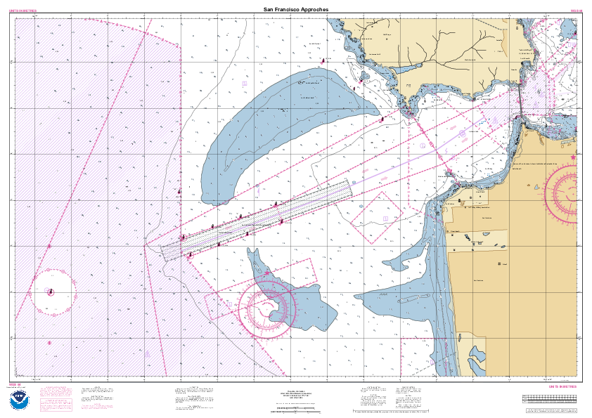
- NOAA Chart Locator
NOAA Chart Locator shows the limits of NOAA charts on a map and when you click on the area chart it is possible to view or upload it. With the link "NC" there is also a listing that provides all corrections to this chart. The information are available for raster charts (paper charts, PDF charts, booklet charts, RNC) and ENC.
- United States Coast Pilot
The United States Coast Pilot consists of a series of nautical books that cover a variety of information important to navigators of coastal and intracoastal waters and the Great Lakes. Issued in nine volumes, they contain supplemental information that is difficult to portray on a nautical chart. Available in one PDF file (top of the page) and a PDF, HTML or XML file by chapter.
- Distances Between United States Ports
Distances Between United States Ports contains distances from a port in the United States to other ports in the United States and from a port in the Great Lakes, United States, to Canadian ports in the Great Lakes.
- National Charting Plan
A Strategy to Transform Nautical Charting. This plan describes a strategy to make comprehensive improvements across the entire suite of NOAA nautical chart products. Part I describes the current set of NOAA nautical chart products and their distribution. Part II describes some of the steps we are taking to improve those products, including changes to chart formats, scales, data compilation, and symbology. At the end of Part II, some thoughts are presented about the long-term future of NOAA navigational products.
- Frequently Asked Questions About Nautical Charts, ENC and RNC
Each NOAA nautical chart contains a vast amount of information unique to the geographic area that it covers. While each chart is unique, it is assembled using standard conventions that are understood by the mariner. Sections of the FAQ: General, Nautical Charts, ENC, RNC and Hydrographic Data & Products.
- Chart Carriage Requirements
Regulations and other documents related to nautical chart and publication carriage requirements for commercial vessels in U..S waters: Code of Federal Regulations - Federal Register Notices - USCG Circulars.
- U.S. Chart No. 1: Symbols, Abbreviations and Terms used on Paper and ENC
U.S. Chart No. 1 describes the symbols, abbreviations, and terms used on nautical charts. It is produced by NOAA and the National Geospatial-Intelligence Agency. The symbols for paper charts and their analogous digital products, such as NOAA raster navigational charts (NOAA RNC®) are shown, as well as the symbols used to portray NOAA electronic navigational charts (NOAA ENC®) data on Electronic Chart Display and Information Systems (ECDIS).
- Channel depths: USACE Hydrographic Surveys (eHydro)
With the new edition of NOAA raster charts, channel legends and tabulations, where indicated, reflect the U.S. Army Corps of Engineers (USACE) project depths. The channel may be significantly shoaler, particularly at the edges. For detailed channel information and minimum depths as reported by USACE, use NOAA Electronic Navigational Charts. USACE surveys and channel condition reports are also available on the USACE Hydrographic Surveys (eHydro) application. The hydrographic surveys provided by this application are to be used for informational purposes only and should not be used as a navigational aid. Channel conditions can change rapidly and the surveys may or may not be accurate. NOAA publishes the official navigation charts to be used in US waters by mariners.
- starpath.com/getcharts
A shortcut to NOAA chart downloads by starpath.com: 1) Interactive chart viewer and individual download for RNC, ENC, or pdf - 2) Download individual ENC by chart number - 3) Download individual RNC by chart number - 4) Download ENC regions by state or USCG district...
- Online Nautical Paper Chart Viewers for U.S. waters - Single Chart Display
View online paper charts / Cartes papiers consultables en ligne
Single Traditional Chart Display / Une carte à la fois
Not for navigational use / Ne pas utilisez pour la navigation
Displays charts in web browser. View NOAA's 1000+ U.S. coastal and Great Lakes nautical charts that provide up-to-date navigational information to mariners. These charts are updated weekly and include all of the latest Notice to Mariners corrections.- Example: View online chart 18649 - Entrance to San Francisco Bay
- Example: View online chart 11013 - Straits of Florida and Approache
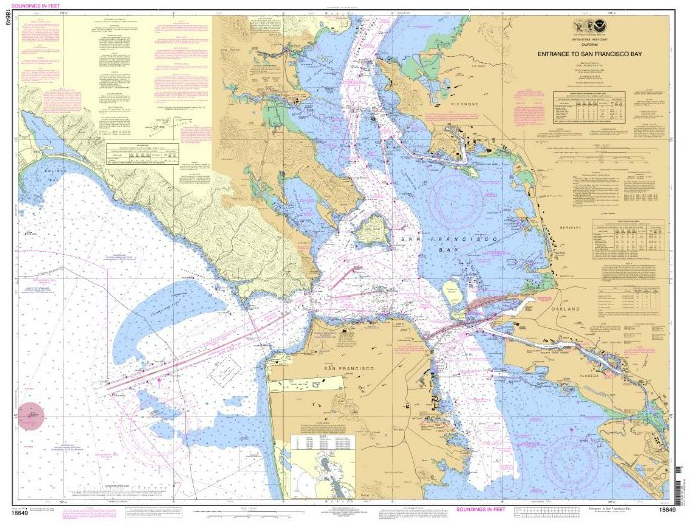

- PDF Nautical Charts: charts to upload and print for U.S. Waters
Charts for upload and print / Cartes marines téléchargables et imprimables (PDF).
Don't use for regulated commercial vessels / Ne pas utilisez pour la marine marchande.
Updated weekly / Mise à jour chaque chaque semaine.
Full-size, 400dpi printable charts. NOAA’s newest addition to the nautical charting portfolio is the new Portable Document Format (PDF) nautical chart, which provides up-to-date navigation information in this universally available file type. The PDF nautical charts are available for a three-month trial period, from October 22, 2013, to January 22, 2014. Key features of the PDF nautical chart: Updated Weekly - Available Immediately - Enhanced Readability - Printable - Easy to view. For mariners using paper charts to meet chart carriage requirements under federal regulations, only printed charts provided by NOAA certified Print-on-Demand (POD) providers will meet U.S. requirements when the traditional lithographic nautical charts are no longer available. - BookletChart: letter format charts to upload and print for U.S. Waters
Charts on booklet for upload and print / Cartes marines en livret téléchargables et imprimables (PDF).
Don't use for regulated commercial vessels / Ne pas utilisez pour la marine marchande.
Updated weekly / Mise à jour chaque chaque semaine.
8.5" x 11" printable panels of the charts for U.S. Coasts. The NOAA BookletChart is an experimental product that you can print at home for free. They are made to help recreational boaters locate themselves on the water. The Booklet Chart is reduced in scale and divided into pages for convenience, but otherwise contains all the information of the full-scale nautical chart. - Custom PDF Nautical Charts: charts to upload and print for U.S. Waters
Custom charts for upload and print / Cartes marines personnalisées téléchargables et imprimables (PDF)
Not to be used for navigation / Ne pas utiliser pour la navigation
A prototype version of a powerful new online tool, NOAA Custom Chart, is now available for boaters and other nautical chart users. The application enables users to define the scale and paper size of custom-made nautical charts centered on a position of their choosing. The user may download, view, and print the output. Start guide: Click on the green icon on the top and select the scale chart and the paper size - Click on the second icon and click on the map to select a location - Wait - Click on the third icon and move the red rectangle on the selected area - Click on the green circle on the left and click on "Export Products" - Wait - Click on the PDF link with a name like "Dynamic Area, Chart_?, GeoPDF". All products generated by this prototype service are for demonstration purposes only and are not to be used for navigation. - Raster Navigational Charts for U.S. Waters - Upload RNC
Raster map for upload / Cartes marines papiers scannées téléchargables (RNC/BSB)
Updated weekly / Mise à jour chaque chaque semaine.
Graphical interface to upload RNC file chart by chart. NOAA Raster Navigational Charts (NOAA RNC®) are full-color digital images of NOAA's entire suite of paper charts. NOAA provides weekly updates to the RNCs, which are available for free on this site in the BSB format. NOAA RNC® files are official data that can be used in many types of electronic charting systems, including Raster Chart Display Systems (RCDS) and Electronic Chart Display and Information Systems (ECDIS). The Raster Navigational Charts are available in BSB format.- Example: RNC file for chart 11013 - Straits of Florida and Approaches
- Example: RNC file for chart 12326 - Approches to New York
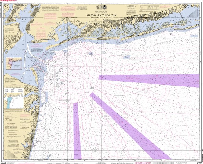
- Chart Downloader for NOAA RNC - Non graphical interface
Raster map for upload / Cartes marines papiers scannées téléchargables (RNC/BSB)
Updated weekly / Mise à jour chaque chaque semaine
Non-graphical interface (listing) to upload one or multiple RNC at a time.- Upload RNC file chart by chart
- Upload RNC file for specific charts
- Upload RNC file by USCG districts, state or region
- RNC Tile Service - Upload of raster charts for web map tools
Raster map with upload for web map tools / Cartes marines papiers scannées téléchargables pour site web.
Seamless Display / Affichage continue
Not for navigational use / Ne pas utilisez pour la navigation
The NOAA RNC Tile Service is comprised of 15 million individual chart tile images. Each full RNC is cut into thousands of smaller “tiles” that display much faster than full RNC images. The tile service provides geo-referenced, nautical chart tile sets for the public that comply with several web map and map tile standards. NOAA RNC tiles can be used with GPS enabled electronic chart systems or other “chart plotter” display systems to provide real-time vessel positioning. Tiles are also being used on third party nautical data integration websites. NOAA RNC tile service data DOES NOT meet USCG chart carriage requirements for commercial vessels. - Electronic Navigational Charts for U.S. waters - Upload ENC
Electronic Navigational Charts for upload / Cartes marines vectorielles téléchargables (ENC)
Updated weekly / Mise à jour chaque chaque semaine
Graphical interface to upload ENC file chart by chart. Vector files of chart in S-57 format. NOAA Electronic Navigational Charts (NOAA ENC®) are vector data sets that represent NOAA's newest and most powerful electronic charting product. NOAA ENCs conform with the International Hydrographic Office (IHO) S-57 international exchange format, comply with the IHO ENC Product Specification, and are provided with incremental updates that supply Notice to Mariners corrections and other critical changes. NOAA ENCs and updates are available for free download. NOAA ENC data may be used to fuel Electronic Chart and Display Information Systems (ECDIS).
Click on "Electronic Charts (ENC)". On the map select a chart and on the section "Available Products" click on "ENC" to get the ENC version.- Example: ENC file for chart US2EC01M - Straits of Florida and Approaches
- Example: ENC file for chart US4NC30M - Cape Hatteras-Wimble Shoals to Ocracoke Inlet
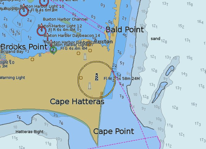
- Chart Downloader for NOAA ENC - Non graphical interface
Electronic Navigational Charts for upload / Cartes marines vectorielles téléchargables (ENC)
Updated weekly / Mise à jour chaque chaque semaine
Non-graphical interface (listing) to upload one or multiple ENC at a time.- Upload ENC file chart by chart - List sorted by name
- Upload ENC file chart by chart - List sorted by date
- Upload ENC file by USCG districts, states or region
- List of latest editions of NOAA nautical products
A weekly update of the edition numbers and other information about current versions of NOAA nautical products: Find out if you have the latest edition of NOAA nautical products. The lists below include the edition number and date of the latest version of each product and additional information. The lists are updated weekly.
- NOAA Chart Updates Service
From this site, you can access the same chart updates that NOAA uses to update their Print-on-Demand paper charts. Enter a chart number and the service display a listing that provides all corrections that apply to this chart. While information provided by this listing is intended to assist in the updating of nautical charts, it must not be used as a substitute for the United States Coast Guard, National Geospatial-Intelligence Agency or Canadian Coast Guard Notice to Mariner publications.
- NOAA Weekly Chart Updates
With this service the weekly correction for NOAA charts are displayed on a map. How do you know when it is time to get a new chart? The idea is to give users the ability to visually identify where all changes (water depths, shoreline, obstructions or other features) are occurring on their charts each week. With that information, you can make your own determination about when you may want to purchase an updated paper chart or download an updated raster or electronic navigational chart. The update includes the position of each update (latitude and longitude), the action that needs to occur, along with a brief description of the item and any additional labeling that should be added to the chart (More information about the Weekly Chart Updates).

- End of Traditional Paper Charts: transition to ENC
National Weather Service (NWS/NOAA)
- Marine Fact Sheets
This is a sample of the most frequent questions that I have been asked over the past 35+ years. I have gathered and consolidated information from numerous sources to address these questions thus creating a general reference guide for mariners. This reference guide was created primarily for distribution at boating, fishing and diving shows.
- Marine Forecasts: Dissemination Information
Marine weather forecasts via different way: internet, radio, satellite...
- Dissemination of Marine Weather by the NWS: NOAA Weather Radio, Alaska Marine VHF Voice, Alaska Marine HF Voice 4125 kHz, Really Simple Syndication (RSS), NOAAPort, Space Weather, Internet...
- Marine Weather Broadcasts from the USCG: USCG Radiofax, USCG HF SITOR (NBDP), USCG HF Voice, USCG VHF Voice
- NWS service participation in the GMDSS: NAVTEX, INMARSAT-C SafetyNET, Iridium SafetyCast
- NWS Products via Amateur "Ham" Radio"
- NWS Marine Products via NOAA Telephone Recordings
- How can I get a marine forecast via E-mail?
- ...
- Frequently Asked Questions About NOAA/NWS Marine Products and Services
FAQ about NOAA/NWS marine products and services with 30 questions and answers.
- Worldwide Marine Radiofacsimile Broadcast Schedules
The schedules contained in this publication were obtained from official and unofficial sources. The information herein may neither be complete or accurate. Wherever possible, the schedules are dated with the latest change available.
- Online Marine Radiofax Charts
The latest version of marine weather charts for broadcast by the U.S. Coast Guard are available from the National Weather Service Telecommunication Gateway on this server. Charts: wind, wave, ice, surface, upper air, cyclone danger area, sea surface temperatures, satellite imagery. Areas: North West Atlantic - North Pacific and Tropical East Pacific - Gulf of Mexico, Caribbean, Tropical Atlantic, and Tropical East Pacific - Alaska, Northeast Pacific and North Pacific - Central, Southeast and North Pacific. Wind gusts can be a further 40 percent stronger than the averages on the charts and maximum waves may be up to twice the significant height.
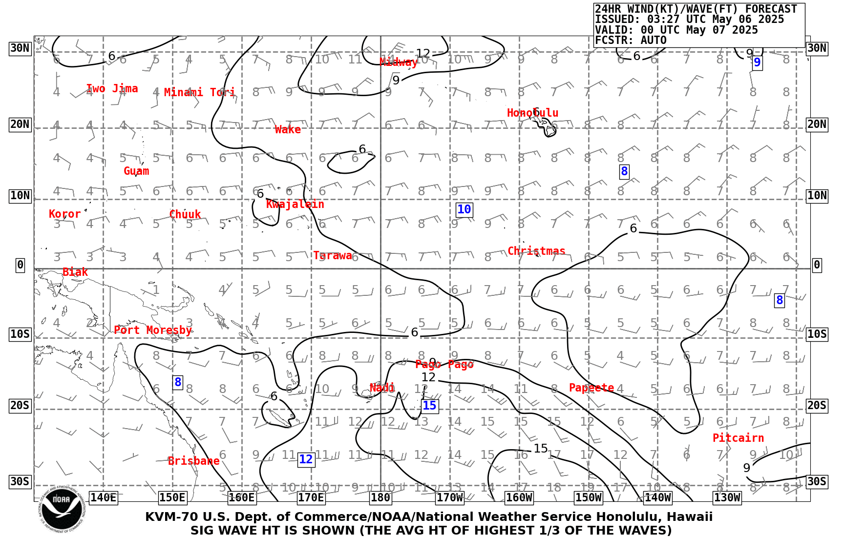
Central Pacific Ocean: 24HR Wine/Wave Forecast - Height in feet
Also Analysis Chart and Forecast at 48HR - Valid Time 00h or 12h UTC- RadioFax Schedules
Products listed on this page are provided by the Ocean Prediction Center, the National Weather Service Forecast Office in Anchorage and the National Hurricane Center. The forecast area includes the offshore and high seas waters. The products are transmitted via high frequency (HF) through transmitters of the United States Coast Guard. The HF shortwave signal is decoded by Weather FAX receivers onboard ships in the forecast area. The broadcast frequencies are listed at the at the bottom of the page.
- OPC's Radiofacsimile User's Guide
Ocean Prediction Center's Radiofacsimile Charts User's Guide. In consultation with its users, OPC has designed a timely product suite of graphics and high seas marine warnings and forecasts. When displayed together and organized the charts provide the mariner with a complete meteorological and oceanographic picture. Prudent decision making dictates the mariner use all available information from as many sources as possible. Also in PDF.
- Terminology and Weather Symbols
Terminology and weather symbols from the NOAA Ocean Prediction Center (OPC): Graphical Products Legend, Standard Text Abbreviations, Fronts, Low & High Pressure Systems and Miscellaneous Key Terms, Station Plots, Wind Speed and Direction, Freezing Spray and Ice Edge, Conventions Used With Warnings for Extratropical Systems, Conventions Used With Warnings for Tropcial Systems, Seas, Miscellaneous Terminology.
- National Weather Service Glossary
This glossary contains information on more than 2000 terms, phrases and abbreviations used by the NOAA-NWS. Many of these terms and abbreviations are used by NWS forecasters to communicate between each other and have been in use for many years and before many NWS products were directly available to the public. It is the purpose of this glossary to aid the general public in better understanding NWS products. You can either type in the word you are looking for in the box or browse by letter.
- Wind/Wave Analysis and Forecasts
These charts depict winds (knots) with winds barbs and significant wave heights (feet or meters). The combined sea heights are depicted in solid contours of three feet or one meter increments with relative maxima or minima combined sea state values enclosed inside a box under or adjacent to the area of interest. The ice edge is displayed as a bold jagged line (bright blue) during the winter months. On the offshore & adjacent waters analysis for the East coast of USA & Canada there is buoys and ships data: reported sea state from buoys and ships is in feet and is colored red (green for IR satellite maps), the period of predominant swell wave is in seconds and is colored purple (bright blue), the swell direction is shown by the black (white) arrows, and the reported wind speed and direction is shown by the blue (yellow) arrows. Significant wave height is defined as the average height of the highest 1/3 of wave heights observed (More information). The central value of significant wave heights imply that higher individual waves are possible.
- Atlantic Ocean
- Northwest Atlantic - Offshore & Adjacent Waters for the East coast of USA & Canada (OPC)
- Analysis - Analysis & IR satellite - Forecasts: 24HR (Height in feet)
- Pacific Ocean
- Arctic Pacific - Offshore & Adjacent Waters for Alaska (OPC Fax)
- Forecasts: 24HR valid at 00Z - 24HR valid at 12Z (Height in feet)
- Northest Pacific - Offshore & Adjacent Waters for the West coast of USA & Canada (OPC Fax)
- Analysis - Analysis & IR satellite - Forecasts: 24HR (Height in feet)
- North Pacific - High seas from North America to Asia (OPC)
- Analysis (sea state) - Forecasts: 48HR - 96HR (Height in meters)
- Tropical East Pacific - Offshore & Adjacent Waters form Mexico to Peru (NHC)
- Analysis (sea state) - Forecasts: 24HR - 48HR - 72HR (Height in feet)

- Atlantic Ocean
- Marine Service Charts (MSC) for Alaskan Waters
Marine Service Charts (MSC) for Alaskan Waters list frequencies, schedules and locations of stations disseminating NWS products. They also contain additional weather information of interest to the mariner. The front side of the charts shows the map and the back side shows the text that accompanies the chart.
- Ice Map graphics around Alaska
Ice Desk: The NWS Sea Ice Program produces daily sea ice analysis maps and sea surface temperature maps for marine areas located around Alaska including Cook Inlet. Sea ice forecasts focused on changes to the ice edge in the next 5 days and the Sea Ice Advisory text product are produced every Monday, Wednesday, and Friday.
- Zoomable Maps of Alaska with ice concentration, stage or forecast
- Daliy Sea Ice Concentration Analysis
- Five Day Sea Ice Forecast
- Sea Surface Temperature Analysis
- ...
- Great Lakes Ice Information
Ice Analysis: ice concentration charts & estimated ice thickness charts - Graphical Ice Forecasts - Text Ice Forecasts - Ice Climatology.
- Observers' Guide to Sea Ice
This booklet is intended for use by volunteers to report aerial, shipboard, or shoreline observations of ice conditions at sea to authorities such as the National Weather Service, National Ice Center, U.S. Coast Guard, pilots’ associations, port authorities, or other maritime interests. Emphasis here is on conditions of concern to mariners with regard to safe passage of ships.
- Cold Water Hazards and Safety
Survival time is greatly diminished for someone immersed in water below 70 degrees. When cold water makes contact with your skin, cold shock causes an immediate loss of breathing control. This dramatically increases the risk of sudden drowning even if the water is calm and you know how to swim. The danger is even greater if the water is rough. Immersion in cold water is immediately life-threatening for anyone not wearing thermal protection, like a wetsuit or drysuit, and not wearing a life jacket. Roughly 20 percent of those who fall into cold water die in the first minute of immersion due to cold water shock. Even strong swimmers will lose muscle control in about 10 minutes. Body heat can be lost 25 times faster in cold water than in cold air. Wearing a life jacket significantly increases chances of survival.
- National Hurricane Center (NHC) Web Widgets
Web Widgets are small pieces of code that can be embedded and used on any other web page. To follow tropical systems that the National Hurricane Center is monitoring, you can use the following widget on your website:

Tropical Cyclone Status Updates
for Atlantic & Eastern Pacific
- Hawaii html widgets to view tropical system distances
Html widgets to view tropical system distances for Hawaiian Waters. Also others Hawaii html widgets. List of Html widget for Hawaii: Watches, warnings and advisories, Surf forecasts or observations, Buoy observations, Hawaii area synopsis, Climatic information, Upcoming tidal information and Astronomical information (WFO Honolulu).
- Tropical Cyclone Preparedness Guide
Summary: What is a Tropical Cyclone? - Hurricane Hazards - Tropical Cyclone Graphical Products - Ways to Stay Informed - What To Listen For - Are You Ready - Family Emergency Plan.
- Ciclones Tropicales: Guía de Preparación
Sumario: ¿Qué es un Ciclón Tropical? - Peligros del Huracán - Productos Gráficos de Ciclones Tropicales - Maneras para Mantenerse Informado - A Qué Prestar Atención - ¿Está Usted Preparado? - Plan Familiar de Emergencia.
- Global Tropics Hazards Outlook (GTH)
On Thuesday, the Climate Prediction Center (NWS/NCEP/CPC) produces a hazards assessment for the global tropics for the upcoming 2-3 week time period. The Global Tropics Hazards Outlook is a probabilistic forecast for areas with elevated probabilities for above- or below-median rainfall, above- or below-normal temperatures and regions where tropical cyclogenesis is favored for the upcoming Week-2 and Week-3 time periods.The rainfall outlook is for precipitation integrated over a week and targets broad-scale patterns, not local conditions as they will be highly variable. Above (below) median rainfall forecast areas are depicted in green and brown respectively.

Weeks 2-3 Global Tropics Hazards Outlook (GTH)
Experimental Service - Not for navigational use- NHC Marine Product Descriptions
National Hurricane Center Marine Product Descriptions: Text Products - Graphical Products - Other Tropical Analysis and Forecast Branch (TAFB) Services. Including: NHC Marine Radiofax Broadcast Schedule.
- Tropical Cyclone Concerns for Marine Interests
I’m often asked the question “What do I do with my boat when there is a hurricane approaching?" I have gathered and consolidated information from numerous sources to help the boat owner in the analysis of his/her particular situation. Then the boat owner can determine the best method to prepare their boat for the eventual tropical cyclone encounter. The suggestions mentioned in this paper are intended to guide the mariner in developing an individual preparedness plan to help preserve life and protect their property.
- Tropical Cyclone Formation Probability Product
The Tropical Cyclone Formation Probability Product by NOAA/NESDIS/OSPO provides an estimate of the probability of tropical cyclone formation within the next 24 to 48 hours in 1 by 1 degree latitude/longitude areas from 45S to 45N and 0 to 360E. For guidance purposes only.
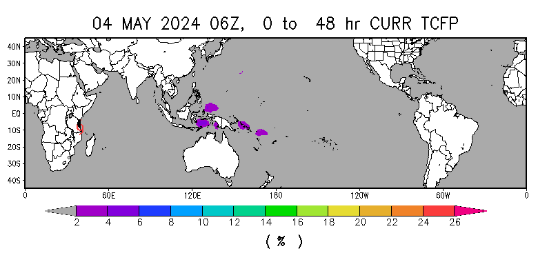
48 Hour Tropical Cyclone Formation Probability
For guidance purposes only - Not for navigational use- List of Active Tropical Storms
List and map of active tropical storms with 48 hour tropical cyclone formation probalility map (NOAA/NESDIS/OSPO/SPSD).
- Hurricane Preparedness: Marine Safety
Hurricanes have been the cause of many maritime disasters and unfortunately, there is no single rule of thumb that can be used by mariners to ensure safe separation from a hurricane at sea. Instead, constant monitoring of hurricane potential & continual risk analysis when used with some fundamental guidelines become the basic tools to minimize a hurricane's impact to vessels at sea or in port.
- Experimental Graphicasts - Today's Marine Weather Story
The Tropical Analysis and Forecast Branch (TAFB) is providing a graphical weather depiction that will highlight primary weather features of interest. A graphicast is produced for each basin. The graphicasts are intended to communicate to our users the most critical marine or other significant forecast issue(s) of the day (heavy precipitation/flooding, volcanic ash) in an effort to provide enhanced decision support services (DSS) to them. The image has planned updates once per day in the early afternoon.
East Pacific: Graphicasts - Today's Marine Weather Story (Also cyclone graphic) 
Atlantic: Graphicasts - Today's Marine Weather Story (Also cyclone graphic) - 5-Day Graphical Tropical Weather Outlook
Graphics with current disturbances, five-day cyclones formation chance and tropical or sub-tropical cyclones. During the off-season, Special Tropical Weather Outlooks will be issued as conditions warrant.
- 2-Day Graphical Tropical Weather Outlook
Graphics with current disturbances, two-day cyclones formation chance and tropical or sub-tropical cyclones. During the off-season, Special Tropical Weather Outlooks will be issued asconditions warrant.
- 48hr High Wind and Associated Seas
Between December 1 and May 14 (outside of hurricane season).
The high wind and associated seas graphic is produced by the National Hurricane Center to depict areas of high winds and related seas over the Atlantic and East Pacific waters between December 1 and May 14 (outside of hurricane season). South of 30°N, areas are depicted for winds higher than 25 knots with the corresponding seas noted. North of 30°N, areas are depicted for winds of gale force (34 knots) or higher with the corresponding seas noted. Ranges in which the 25/34 knot thresholds are the upper limit (i.e. 25-35 knots) are included on the graphic. For more information.
East Pacific: Tropical Cyclone Danger Graphic (Also see Graphicast) 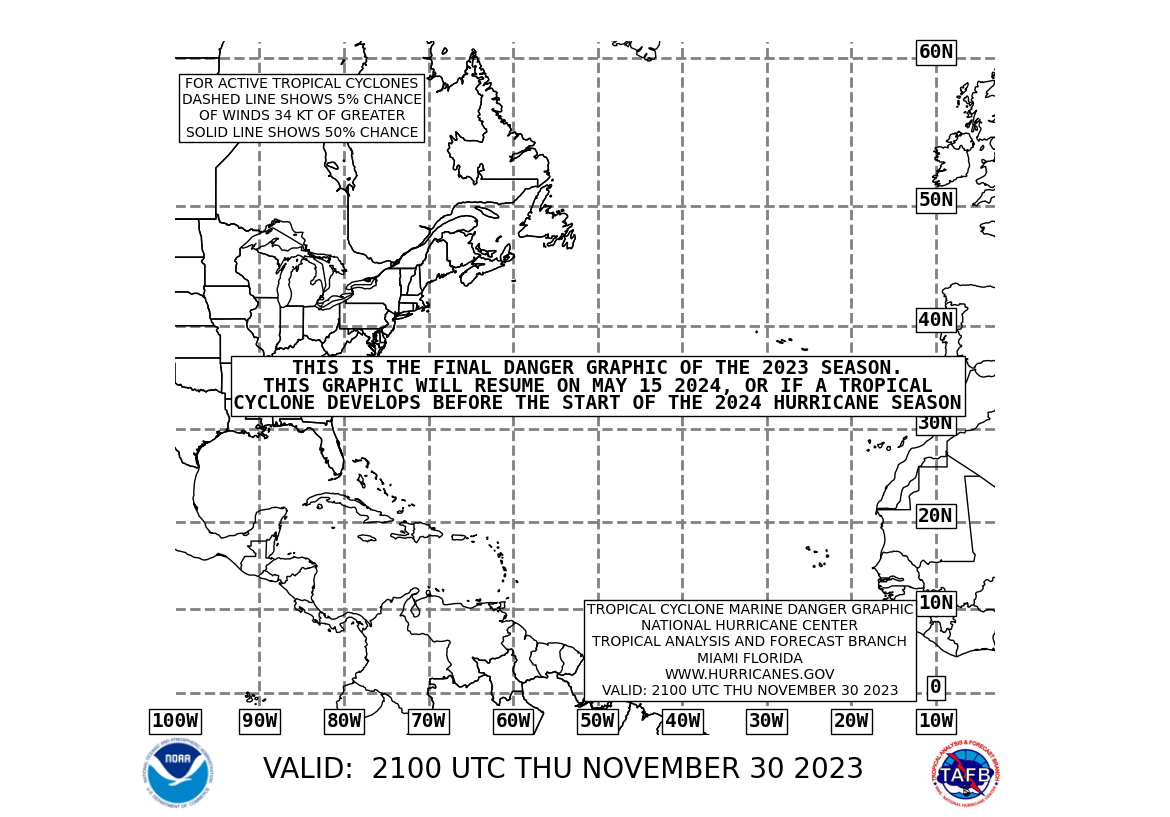
Atlantic: Tropical Cyclone Danger Graphic (Also see Graphicast) - Tropical Cyclone Danger Graphic (Mariner's 1-2-3 Rule)
Between May 15 and November 30 (hurricane season).
The tropical cyclone danger graphic is intended to depict the forecast track and corresponding area of avoidance for all active tropical cyclones and to depict areas for which tropical cyclone formation is possible within the next 36 hours over the Atlantic and East Pacific waters between May 15 and November 30 (hurricane season). The 3-day forecast track of each active tropical cyclone is depicted along with a shaded "danger" region, or area of avoidance. The danger area is determined by adding 100, 200, and 300 nautical miles to the tropical storm force radii (34 knots) at the 24-, 48-, and 72-hour forecast positions, respectively (hence the Mariner's 1-2-3 rule). For more information. - Mariner's Guide For Hurricane Awareness In The North Atlantic Basin
This guide will hopefully aid the Mariner in understanding the complex structure and behavior of tropical cyclones in the North Atlantic Ocean. Once armed with this knowledge, and the information on where to acquire forecasts and guidance for current tropical cyclones, the mariner can be prepared to "weather the storm" or better yet, avoid these catastrophic events altogether.
- Weather observations from buoys
National Data Buoy Center (NDBC) provides hourly observations from a network of buoys and Coastal Marine Automated Network (C-MAN) stations. All stations measure wind speed, direction, and gust; barometric pressure; and air temperature. In addition, all buoy stations, and some C-MAN stations, measure sea surface temperature and wave height and period. Large numbers of boaters use the observations, in combination with forecasts, to make decisions on whether it is safe to venture out. When away from a computer/the Internet Dial-A-Buoy gives mariners an easy way to obtain weather reports. Also mobile access to the buoys.
Transatlantic: buoy observations from Lesser Antilles to Cape Verde Islands Lesser Antilles
/
Petites AntillesWest Tropical Atlantic
Station 41040
North Equatorial One
470 NM East of Martinique
1660 NM West of Cabo VerdeWest Tropical Atlantic
Station 41041
North Equatorial Two
890 NM East of Martinique
1260 NM West of Cabo VerdeCentral Tropical Atlantic
Station 13008
Reggae
1310 NM East of Martinique
810 NM West of Cabo VerdeEast Tropical Atlantic
Station 13002
NE Extension
2210 NM East of Martinique
310 NM North of Cabo VerdeCape Verde
/
Cap-Vert - Marine Publications
Publications of value to the mariner: NOAA publications, NGA Publications, U.S. Coast Guard Publications, Navy Publications, Non-U.S. Government Publications, International Publications.
- Mariners Weather Log
The Mariners Weather Log (MWL) contains articles, news and information about marine weather events and phenomena, worldwide environmental impact concerns, climatology studies, storms at sea, and weather forecasting. The MWL is dedicated to the NWS Voluntary Observing Ship (VOS) Program, Port Meteorological Officers (PMOs), cooperating ships officers, and their vessels. Including: Marine Weather Review. Some articles:
- Forecasts: Marine Weather Forecasting in the National Weather Service - Weather Fax Charts versus Electronically Derived GRIBs - Mariner’s Guide to the 500-Millibar Chart
- Ice: Vessel Icing - International Ice Patrol
- Waves: When Do Ocean Waves Become 'Significant'? A Closer Look at Wave Forecasts - Expecting the Unexpected Wave: How the National Weather Service Marine Forecasts Compare to Observed Seas - Waves and the Mariner - Dynamic Fetch: Some Insight Into Rapid Increase in Sea Wave Heigh
- Hurricanes: Hurricane Avoidance Using the "34-Knot Wind Radius" and "1-2-3" Rules - The Saffir/Simpson Hurricane Scale: An Interview with Dr. Robert Simpson - Severe Weather Port Evaluation Effort at the Naval Research Laboratory
- ...
- NWS Observing Handbook No. 1
The importance of ship reports cannot be overstated: for every 100 observations on land, there is only about 1 observation at sea. Without your participation in the Voluntary Observing Ship (VOS) program, there would be vast marine areas without data, making weather forecasting nearly impossible for these areas. Reporting weather not only contributes to your safety, but adds to your basic knowledge of seamanship.


- Marine Fact Sheets
NOAA Tides & Currents
- NOAA Tide Predictions
Tide Predictions for USA, Pacific and Caribbean Islands. NOAA Tide Predictions allows users of the Tides and Currents website to generate tide predictions for up to 2 years in the past or future, at any of 3000+ locations around the United States. This website service provides both a graphical plot of the predictions as well as a tabular listing and printable pages. Also it is possible to choose a station using the Tides station map.
- NOAA Current Predictions
At this time, NOAA Current Predictions is being presented as an alternative method to retrieve current predictions from the traditional Tidal Current Predictions. Initially, both prediction products will be available through the Tides and Currents website. After a period of time, the existing tidal current predictions will be removed from the Tides and Currents website and NOAA Current Predictions will become a fully operational product. Also it is possible to choose a station using the Currents station map.
- Tides and Currents station map
The Tides and Currents station map can be used to locate stations that provide water levels, meteorological observations, and current observations/predictions, as well as other products. Hovering the mouse over the site icon reveals the latest data listing, and clicking on the icon will bring up the data graphs below the map. Search criteria along the right margin allow the user to identify various data products, geographic regions, or data types from both active and historical sites.
- Tides and Waters Levels Tutorial
The Tides and Waters Levels Tutorial is an overview of the complex systems that govern the movement of tides and water levels.
- Currents Tutorial
This page explores different kinds of currents, how they are measured and how they affect our lives. A complete lesson, it provides a test/review and podcast as well as links to additional resources.
- Hawaii html widgets with tidal/weather/astronomical information
Html widgets to view upcoming tidal information for Hawaii: Nawiliwili, Port Allen, Honolulu, Haleiwa, Kahului, Kihei, and Kona. Also others Hawaii html widgets: Watches, warnings and advisories, Surf forecasts or Surf observations, Buoy observations, Synopsis, Hawaii area synopsis, Climatic information, Astronomical information and Tropical system distances (WFO Honolulu/WFS).
Tidal information for Nawiliwili (Kaua'i, USA) Tidal information for Honolulu (O'ahu, USA) Tidal information for Kahului (Maui, USA) - Our Restless Tides
"Our Restless Tides" provides comprehensive information about the astronomical and physical forces that cause and affect the world's tides. Detailed diagrams and mathematical formulae illustrating the forces acting on the world's oceans are presented.
- Understanding Tides
"Understanding Tides" is a technical publication authored by Stacy Dopp Hicks, provides in-depth explanations of many aspects of tides, including Gravitational Attraction, Sun-Earth and Moon-Earth Systems, Spring and Neap Tides, Tide-Generating Forces, Tidal Waves in Gulfs and Estuaries, Tidal Bores, and Tidal Harmonic Constituents.
- Tidal Currents Educational Pamphlet
Man in his never ending search for knowledge and in his travels on the sea has long known about the ocean's tides and currents. Although he may not have fully understood the reasons for the movements of these waters, he was very much aware of their benefits and dangers to him.
- Tidal Analysis and Prediction
The purpose of this book is to provide the reader with the knowledge required to carry out the most accurate tidal analysis and tidal prediction possible using any set of water level or current data that he or she may have available. The book is also intended to provide the reader with tools to interpret the analysis results with respect to the hydrodynamics (the physics of the water movement) of the bay or ocean from which the data were obtained, so that these results can best be used for particular oceanographic applications (NOAA Special Publication NOS CO-OPS 3).
- Mariners Weather Log
The Mariners Weather Log (MWL) is dedicated to the NWS Voluntary Observing Ship (VOS) Program. and contains articles, news and information about marine weather events and phenomena, worldwide environmental impact concerns, climatology studies, storms at sea, and weather forecasting. Some articles about physical oceanography:
- Ocean/atmosphere: Ocean Currents: Not Really Like Rivers In the Sea - The Coriolis Effect: Motion On a Rotating Planet - The Perfect Storm Surge
- Tides: Why Are the Tides So Predictable? - Tides in Shallow Water
- Waves: How Does the Wind Generate Waves? - Waves Beneath the Sea
- ...
- Glossary of Tide and Current Terminology
The "Glossary of Tide and Current Terminology" is and indispensable reference tool lists and defines more than 400 terms and concepts concerned with the tidal phenomena and its measurement. Also HTML version: Tides and Currents Glossary.

- NOAA Tide Predictions
U.S. National Ice Center (USNIC)
- USNIC Product Catalog
The mission of the U.S. National Ice Center (USNIC) is to provide global to tactical scale ice and snow products, ice forecasting, and other environmental intelligence services for the United States Government. The USNIC Product Catalog presents a listing of products and services available to external customers. Each product listing includes a description, coverage area, parameters analyzed, sources, output format, dissemination, and customers. The table of contents will link to the products.
- USA - Chesapeake and Delaware Bays Ice Concentration Chart
A periodic ice chart that displays ice conditions based off the Mid Atlantic analysis. An ice chart is produced when suitable satellite coverage over the region and/or reliable observations are reported. Ice coverage is detailed by color coded ice concentrations. Chart updated daily, when ice is present. Also with ice presence, a weekly outlook is produced that details the upcoming weather conditions and its affect on ice conditions. Areas: Chesapeake Bay (Norfolk, Newport News, Baltimore) and Delaware Bay (Wilmington, Philadelphia). Also available KMZ files.

- USA - Great Lakes Ice Charts
Great Lakes daily ice charts are produced in cooperation with the U.S. National Ice Center (USNIC) and Canadian Ice Center. During the ice season ice coverage is detailed by total ice concentration, ice type with its concentration, and ice floe size, which are represented within the WMO egg code. The charts are separated into eastern and western portion of the Great Lakes and available in color and black/white. The East chart covers Lakes Huron, Erie, and Ontario and the West chart covers Lakes Superior and Michigan. Also available GIS shapefiles, KMZ files and ASCII Files (More information). USNIC also produces periodic ice charts for U.S. Coast Guard District 9 support broken into ice concentration, ice thickness/type, and a combination of both. These charts are updated twice weekly, on Tuesday and Thursday during the Great Lakes ice season (More information).
- USA - Great Lakes Forecast, Outlook, and Summary
In cooperation with NAIS forecasts, an outlook, and seasonal summary are produced in support of the Great Lakes ice season. These documents provide ice and environmental information that are broken out through main areas throughout the Great Lakes region. The documents produced are as follow: 30 Day Forecast (Created throughout the ice season on the 1st and 15th of the month), Seasonal Outlook (Annual outlook produced at the beginning of the ice season) and Seasonal Summary (Annual summary produced at the end of the ice season).
- North America - Seasonal Ice Outlook
A prognosis of sea ice conditions for winter and summer months. The outlook is published annually by 1 June and cover these areas: North Alaskan coast, Canadian Arctic Archipelago, eastern Canadian Arctic waters, and the Hudson Bay.
- North America - Arctic 30-Day Outlooks
Documents providing the 30-day prognosis and update of ice conditions for each of the three NAIS Arctic regions; a write up and graphic are provided within the document. The outlooks are published the 1st and 15th of the month from 15 June - 01 December and cover these areas : The East outlook covers the eastern portion of North American waters to include the Eastern Canadian Archipelago, Baffin Bay, Davis Strait, Foxe Basin, and Northern Labrador Sea. The West outlook covers the western portion of North American waters to include the High Arctic region, Western Canadian Archipelago, Beaufort Sea, and Chukchi Sea. The Hudson Bay outlook covers the Hudson Bay, Foxe Basin, Davis Strait and northern Labrador Sea.
- Arctic Daily Forecast Charts
A graphical representation of the daily ice analysis that depicts ice free in white, marginal ice zone (ice concentration up to 80%) in yellow, and pack ice (ice concentration 80% and greater) in pink. The graphic also displays the 48-hour forecast ice edge line. Both products are created to cover the entire Arctic based on region, Atlantic and Pacific (More information).
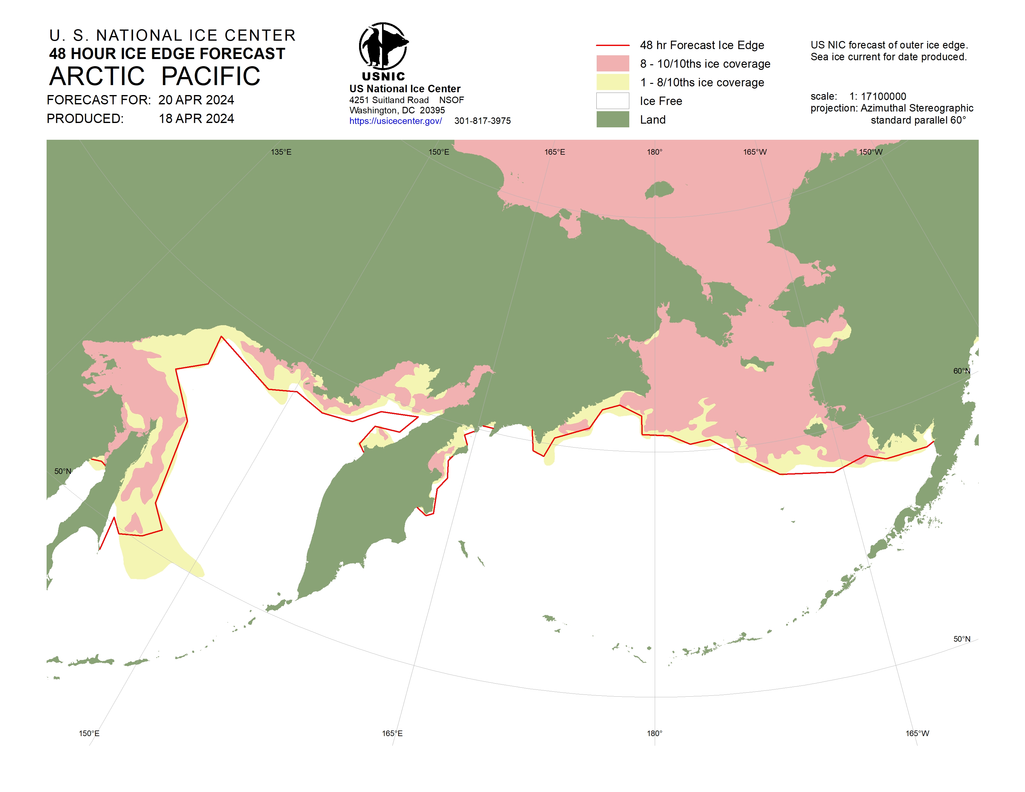
Pacific Arctic - 48 Hour Ice Edge Forecast 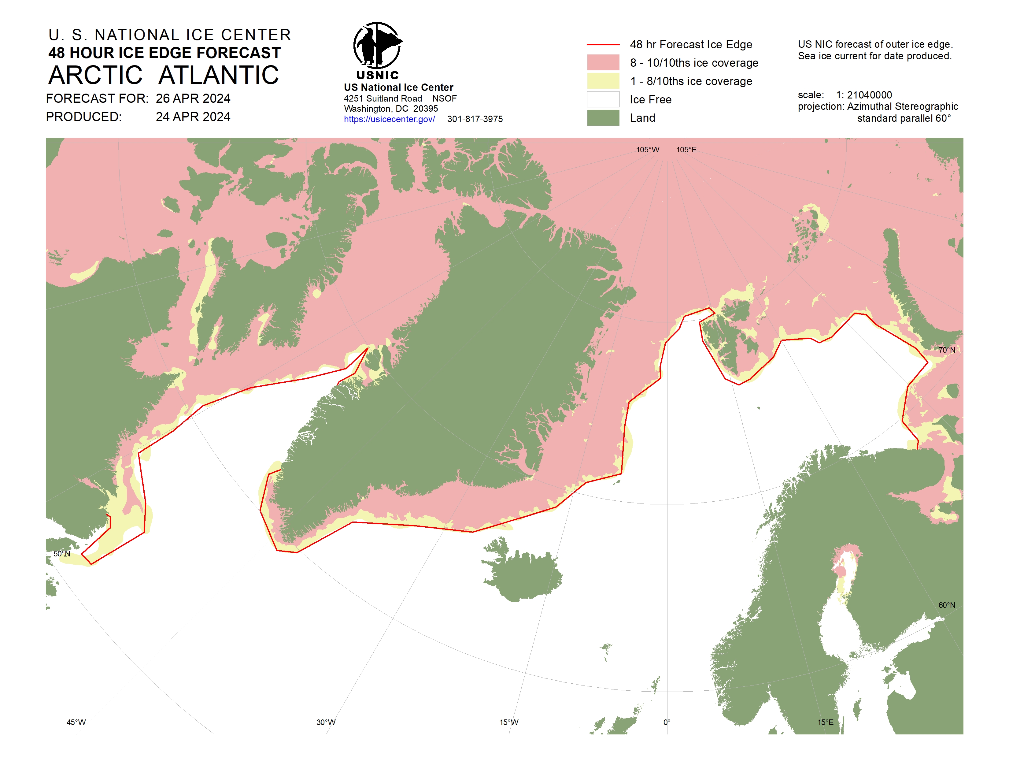
Atlantic Arctic - 48 Hour Ice Edge Forecast - Arctic and Antarctic - Weekly Ice Concentration Chart
A graphical representation of ice concentrations based on the weekly ice analysis. Weekly update on Friday. Also available GIS shapefiles, KMZ files and ASCII Files.
- Arctic and Antarctic - Weekly Stage of Development Chart
A graphical representation of the estimated stage of development/ice thickness (ice types) based on the weekly ice analysis. Weekly update on Friday. Also available GIS shapefiles.
- Arctic and Antarctic - Daily Marginal Ice Zone Chart (MIZ)
A graphical representation of the daily ice analysis that depicts the marginal ice zone (ice concentration up to 80%) in yellow and pack ice (ice concentration 80% and greater) in red. Also available GIS shapefiles, KMZ files and ASCII files.
- Arctic and Antarctic - 30-Day Ice Extent Change Chart
A graphical representation of the change in sea ice extent over the last 30 days. Weekly update on Friday.
- Arctic and Antarctic - Trivariate Ice Charts
Graphic representation of ice information gathered over a specified time. These charts provide an accurate, comprehensive, and easily understood characterization of analyzed sea ice conditions. Trivariate Sea Ice Presence products are derived from USNIC archived data to provide a characterization of analyzed sea ice conditions in the polar regions. Colors indicate that only pack ice (red), marginal ice zone (green), or ice free (blue) conditions were present. These products blend ice data over time based on Single Year (data analyzed based on previous year) and Compendium Year (annual data analyzed from 2007 to current). The Arctic and Antarctic trivariate charts are divided into six regions. Updated twice a month, on the 16th and last day of the month. Also available KMZ file (More information).
Arctic Regional Synopsis - Bering Sea (Russia - USA)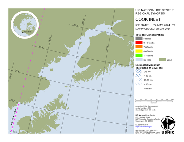
Arctic Regional Synopsis - Cook Inlet (Golf of Alaska, USA)- Arctic Regional Synopsis
Regional charts and associated synopsis write-up capture ice and environmental conditions throughout the Arctic which are based on the U.S. National Ice Center’s weekly analysis. Charts and synopses are updated weekly on Fridays. Note: Baltic Sea analysis is provided by the Finnish Meteorological Institute. The Canadian Archipelago (Canada East, Canada North, Canada West, and Hudson Bay) analysis is provided by the Canadian Ice Service. Includes Baltic Sea, Barents Sea, Canadian Region, Greenland Sea, Kara Sea, Laptev Sea, East Siberian Sea, Chukchi Sea, High Arctic, Sea of Japan, Sea of Okhotsk, White Sea, and Yellow Sea.
- Arctic Shipping Routes
These charts shows ice concentration and best path based on ice conditions. A graphical representation of the ice edge and area of 40% or greater ice concentration; a write-up of ice conditions is included in the product. The Northwest passage concentrates on transit from Pacific to Atlantic Ocean via the Arctic through Bering Strait into the Canadian Archipelago and exiting through the Labrador Sea. The Northern Sea Route concentrates on transit from Pacific to Atlantic Ocean via the Arctic through Bering Strait into the Laptev Sea and exiting through the Barents Sea. Seasonal chart completed weekly on Friday during the Arctic melt season, approximately from late July to mid-October (More information).
- Collaborative Antarctic Ice Charts (AARI-NIC-NMI)
Antarctic ice charts from Norwegian Ice Service (NIS-NMI), U.S. National Ice Center (NIC), and Russian Arctic and Antarctic Research Institute (AARI). Charts for the whole of Antarctica (concentration and stage of development) are updated on Thursdays throughout the year. During the Antarctic summer (October to April) detailed ice charts for: Antarctic Peninsula, Weddell Sea East, Bransfield Strait and Adelaide Island.
- Weekly Antarctic Peninsula Charts
A weekly chart produced between November to March that concentrates on the Antarctic Peninsula area. Charts are broken into the East and West portions of the Antarctic Peninsula, charts display ice concentrations based off weekly ice analysis and ice thickness from GOFS model. Weekly update on Thursday, from November until the end of March.
- Antarctic - Seasonal Outlook for Ross Sea and McMurdo Sound
A seasonal outlook is produced (Dec-Feb) and updated regularly for ice conditions throughout the Ross Sea with focus on McMurdo Sound and McMurdo Station resupply. The document gives detailed information, graphics, and a narrative for the forecasted ice condition. Updated bi-weekly until meltout is complete, approximately from late November to mid-February.
- Antarctic Iceberg Data
U.S. National Ice Center (USNIC) is the global entity that names, tracks, and documents Antarctic icebergs that meet the criteria of 20 sqNM or greater, or 10 NM on its longest axis. Data presented are iceberg name, length (nm), width (nm), location (latitude/longitude), location (region), and date of last update (More information).
- USNIC Product Catalog
Naval Meteorology and Oceanography Command (NMOC/US Navy)
- METOC Portal
Significant wave height is shown in the charts, this is the average height of the highest one-third of waves.
Maximum waves may be up to twice the significant height. Height in feet.- North Altantic: Surface Analysis with Wind and Seas Warning Areas (NOOC/FWC Norfolk)
- North Atlantic, USA, East Coast: Special Weather Advisory - Winds and Seas (NOOC/FWC Norfolk)
North Atlantic, USA, East Coast: Special Weather Advisory (Winds and Seas) - Text - North Atlantic, Florida (USA) & Bahamas: Tongue of the Ocean Operational Area (OPERA) - Weather Forecast - (NOOC/FWC Norfolk)
- North Atlantic: High Wind and Seas Warning (NOOC/FWC Norfolk)

High Wind and Seas Warning for the North Atlantic at 00 UTC (Also 12 UTC) - Height in feet - Baltic Sea : High Wind and Seas Warning (NOOC/FWC Norfolk)
- Mediterranean and Black Sea: High Wind and Seas Warning (NOOC/FWC Norfolk)
- Mediterranean Sea: Special Weather Advisory - Winds and Seas (NOOC/FWC Norfolk)
Mediterranean Sea: Special Weather Advisory (Winds and Seas) - Text - East Atlantic, Baltic and Mediterranean Sea: Combined Sea Height Analysis (NOOC/FWC Norfolk)
The combined sea height (Hc) is defined as the square root of the sea-wave height squared plus the swell-wave height squared. The combined sea height represents an approximation of the height of the highest crests of water formed when the crests of sea waves interact with the crests of swell waves. On the map red arrows shown predominant wave direction, blue squares are observations with waves height and wind barbs are observations with wind speed & direction (also sea waves direction). Height in feet.

Europe: Combined Sea Height Analysis (today at 00Z or 12Z) - Height in feet - South Atlantic: High Wind and Seas Warning (NOOC/FWC Norfolk)
- East Pacific, USA, West Coast: Southern California Operational Area (SOCAL) - Weather Forecasts (NOOC/FWC San Diego)
- Pacific and Indian ocean: Surface Analysis with Wind and Seas Warning Areas (NOOC/FWC San Diego)

Pacific and Indian ocean: Surface Analysis with Wind and Seas Warning Areas - Height in feet- Forecaster Handbook for the Western North Pacific (NOOC/NOACY Yokosuka)
To understand the weather situation in the Western North Pacific and Japan. Table of contents: Geography - Oceanography - Climatology - Tropical Cyclones - Forecasting - Tropical Cyclone Tracks - Terminology.
- Tropical Cyclone Quick Reference Guide (NOOC/FWC Norfolk)
- Tropical Warnings: Atlantic Ocean (NOOC/FWC Norfolk)
- Typhoon Warning Information: Northwest, Central and Eastern Pacific - North Indian Ocean - Southern Hemisphere (JTWC)
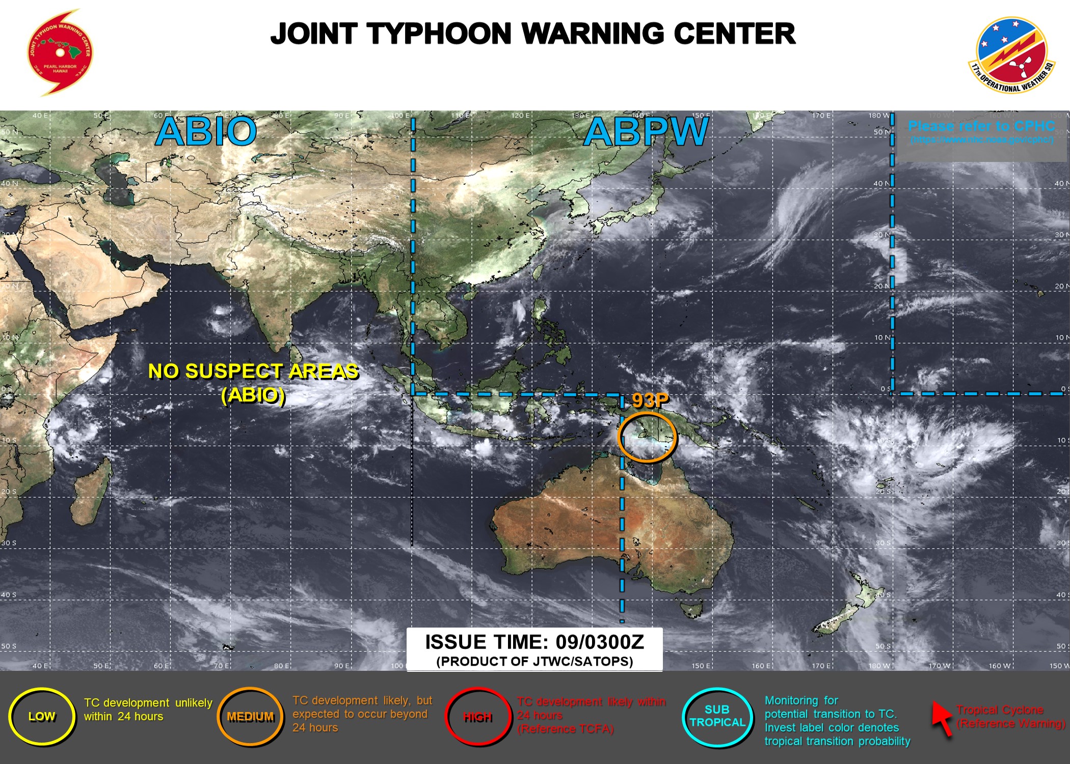
Typhoon Warning Information for Northwest Pacific & North Indian Ocean
Includes Bay of Bengal and Arabian Sea (FAQ)- Satellite Data Tropical Cyclone Page - TCWEB (FNMOC)
Tropical Cyclone Web Page Goals: 1) To minimize the threat of tropical cyclones to military and civilian interests world-wide that are affected by tropical cyclone activity - 2) To combine geostationary and polar orbiting satellite data together so that the Navy and the rest of the military community can have a centralized real-time source of data pertaining to tropical cyclones.
The tropical cyclone forecasts shown here aren't yet operational and are presently in beta testing and operational demonstration. FNMOC is not responsible for their use in the forecasting of tropical cyclones. SSM/I products displayed here have not been verified against FNMOC WebPage products and may differ in color tables and units of measurement. Concerned customers should confirm these forecasts with official sources.
- USNO Portal
- Astronomical Almanac Glossary
The glossary contains concise definitions of many of the important astronomical terms necessary to understand and make use of the data presented in The Astronomical Almanac. Its contents remain the same from year to year, but occasionally terms are added or dropped.
- Celestial Navigation Data
Celestial navigation data for assumed position and time. Computes almanac data for major solar system bodies and navigational stars for an assumed position and time. This page allows you to obtain all the astronomical information necessary to plot navigational lines of position from observations of the altitudes of celestial bodies. Simply fill in the form below and click on the "Get data" button at the end of the form. A table of data will be provided giving both almanac data and altitude corrections for each celestial body that is above the horizon at the place and time that you specify. Sea-level observations are assumed. The almanac data consist of Greenwich hour angle (GHA), declination (Dec), computed altitude (Hc), and computed azimuth (Zn).
- Navigational Star Chart
This chart displays constellations and the 57 navigational stars used in the Air and Nautical Almanacs. The navigational stars are distinguished by their proper names. The sidereal hour angle (SHA) and declination of stars can be seen on the chart. The rectangular shape of the chart distorts the relative positions of the stars in the polar regions.
- HMNAO World Time Zone Map
HMNAO produces a world time zone map for use in its publications. This map is available in PDF and PNG. Also available on HMNAO website.
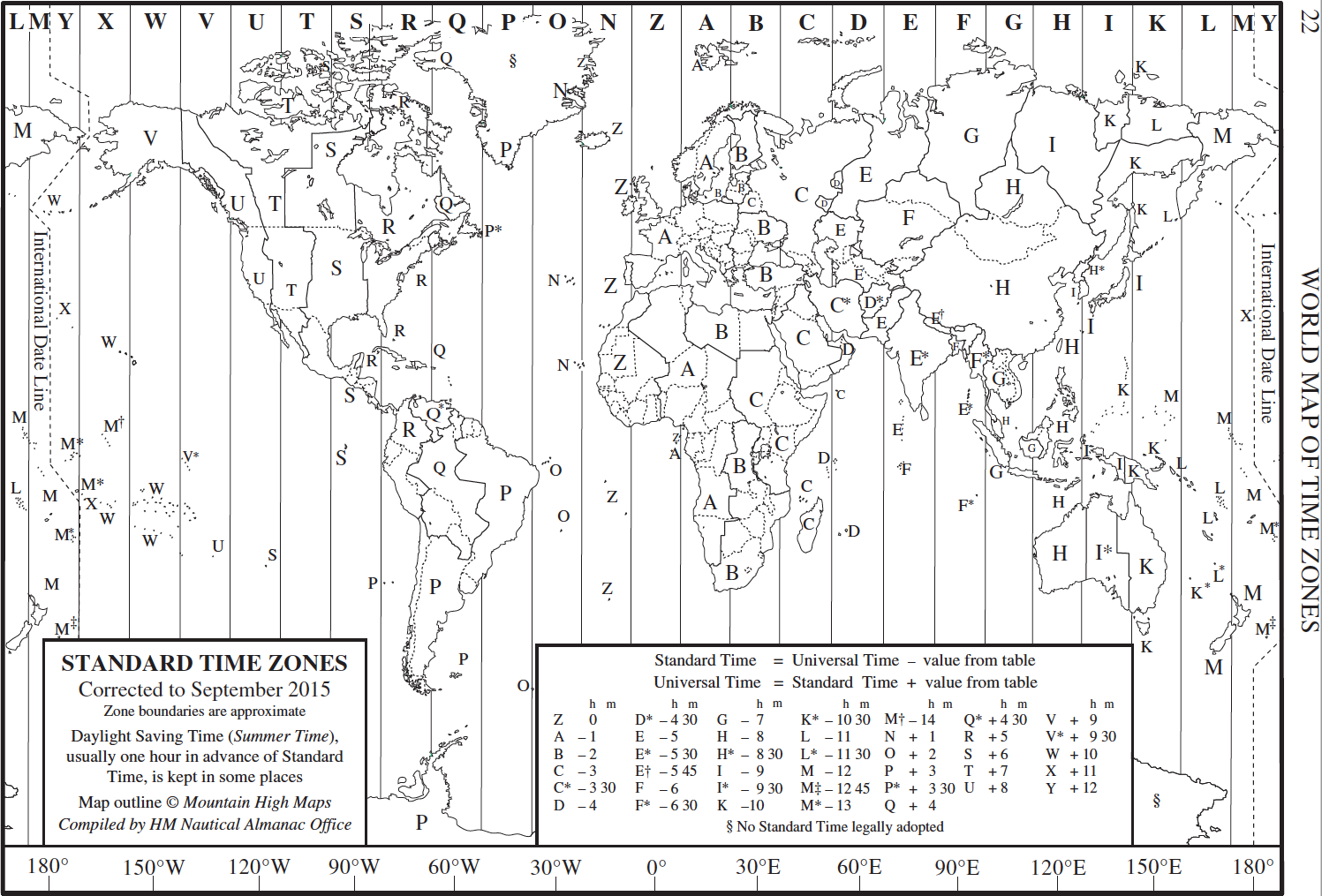
World Map of Time Zones (2015) - The Air Almanac 2022
The Air Almanac contains the astronomical data required for air celestial navigation. It provides the following data tabulated at 10-minute intervals to a precision of 1 arcminute: the Greenwich hour angle and declination of the Sun, Moon, and three navigational planets; the Greenwich hour angle of Aries; rise and set times of the Moon for a range of latitudes; and other data. Each edition also contains sky diagrams for each month; sunrise, sunset, and twilight tables; and positions of the navigational stars (TheNauticalAlmanac.com).
- The Air Almanac
The Air Almanac contains the astronomical data required for air celestial navigation. The book provides the following data tabulated at 10-minute intervals to a precision of 1 arcminute: the Greenwich hour angle and declination of the Sun, Moon, and three navigational planets; the Greenwich hour angle of Aries; rise and set times of the Moon for a range of latitudes; and other data. Each edition also contains sky diagrams for each month; sunrise, sunset, and twilight tables; and positions of the navigational stars.

- North Altantic: Surface Analysis with Wind and Seas Warning Areas (NOOC/FWC Norfolk)
NRL's Marine Meteorology Division (MMD/NRL/US Navy)
- Hurricane Havens Handbook - North Atlantic
This Handbook provides guidance for assessing a hurricane threat's circumstances and likely impact on the given port to support decision-makers' reasonable choice between either remaining in port or evading at sea. This choice is based on informed compromise between a harbor's protective qualities, and the possibility that a sortie will prove to have been unnecessary (HTML, 2016).
- Typhoon Havens Handbook - Pacific
Severe tropical cyclones, also known as typhoons or hurricanes, are among the most destructive weather phenomena a ship may encounter whether the ship be in port or at sea. When faced with an approaching tropical cyclone, a timely decision regarding the necessity and method of evasion must be reached. Basically, the question is: Should the ship remain in port, evade at sea, or if at sea, should it seek the shelter offered by the harbor? This Handbook examines a number of western Pacific and Indian ocean ports and evaluates their potential as typhoon havens. This information should provide useful guidance to commanding officers in answering the above questions (HTML, 2018).
- Severe Weather Port Guide
These handbooks are intended as guidance for ship captains whose vessels are threatened by actual or forecast strong winds, high seas, restricted visibility or thunderstorms in the listed port areas. These regions are renowned for numerous areas where "Local Effects" on winds, seas, and visibility can cause dangerous operating conditions. Prior knowledge of these local characteristics and the resultant effects encountered can be extremely useful in the decision making process. Causes and effects of such hazardous conditions are discussed and precautionary or evasive actions are suggested for various vessel situations (HTML, 2014-2016).
- European Severe Weather Port Guide
- African Severe Weather Port Guide
- Middle East Severe Weather Port Guide
- Central America/South American Severe Weather Port Guide
- Puget Sound Area Heavy Weather Port Guide (Washington State, USA)
- European Severe Weather Port Guide
- NRL Tropical Cyclone Page
An extensive collection of current and archived satellite imagery, satellite data products, and other displays, providing global coverage for tropical cyclone monitoring and analysis. The tropical cyclone forecasts displayed here are the latest forecasts received at NRL, and may or may not be the most current forecasts available from the operational centers. NRL collects these forecasts for ATCF project development, and is not responsible for their use in the forecasting of tropical cyclones. Concerned customers should confirm these forecasts with official sources.
- Tropical Cyclone Forecaster's Reference Guide (TCFRG)
The electronic version of TCFRG consists of seven chapters and Tropical Cyclone Links and Web Sites. Chapter 1 presents a summary of who is doing what, and forecast accuracy, difficulty and variability. Chapter 2 is a short review of tropical large-scale climatology and synoptic models. Chapter 3 delineates the tropical cyclone formation problems and presents a tropical cyclone formation alert checklist used at the Joint Typhoon Warning Center. Chapter 4 focuses on tropical cyclone motion, including a survey of tropical cyclone motion hypotheses and motion forecasting techniques. Chapter 5 discusses tropical cyclone forecast aids including empirical, statistical and dynamic aids. Chapter 6 defines the tropical cyclone intensity and emphasizes single station/ship intensity forecast procedures. Chapter 7 presents tropical cyclone structure. Knowledge of general meteorology, interest in tropical cyclone phenomena and experience of weather forecasting will enable use of the TCFRG (HTML, 1998).
- The Arctic Forecaster's Handbook
With continuing ice-melt and more open water present, increased commercial and military traffic will become evident, but not without cost. Surface Fleet and Aircraft Carrier Operations in the Arctic Ocean is a new challenge for the Arctic Forecaster. Snow, ice, freezing rain, wind, wind chill, floating ice and icebergs, to name a few, can take a toll quickly, rendering the fleet, equipment, communications and crew operations extremely difficult. The prudent Arctic forecaster will consider all products from climatology, satellite imagery through numerical products. The forecaster will need to more frequently update environmental information, build a good forecast and environmental recommendation to the fleet commanders in order to ensure the fleet is kept out of "harms-way" and remains an effective force. Use of this handbook will assist the Arctic Forecaster in that endeavor (HTML, 2015).
- Arctic Climatology
The following materials are provided as an introduction to Arctic region climate, weather, and other environmental conditions. A basic objective is to provide materials that will assist users in developing a workable understanding and appreciation of the unique polar conditions including extreme cold, month long daylight and dark periods, and ice covered waters. Terminology and products specific to regional environmental factors will be addressed and used throughout the materials. Tables, graphs and glossaries addressing Arctic environmental conditions are provided as introductory and reference materials (HTML, 2014).

- Hurricane Havens Handbook - North Atlantic
Admiralty and Maritime Law Guide
The Admiralty and Maritime Law Guide includes over 1,500 annotated links to admiralty law resources on the Internet and a growing database of admiralty case digests, opinions and international maritime conventions. The emphasis is on the law of the United States and the focus is on Internet resources that can be used in an effective and practical manner by admiralty attorneys and maritime professionals.
 Maritime Safety Office
Uruguay / Uruguay
Servicio de Oceanografía, Hidrografía y Meteorología de la Armada (SOHMA)
- Catálogo de Cartas y Publicaciones Náuticas (2D)
Esta publicación contiene la información referida a las cartas y publicaciones náuticas editadas por el Servicio de Oceanografía, Hidrografía y Meteorología de la Armada (SOHMA), de la República Oriental del Uruguay.
- Listoda de Cartas y Publicaciones Náuticas
Cartas, cartas náuticas electrónicas, publicaciones, hojas y laminas publicadas por el SOHMA (HTML).
- Tabla de Mareas (3)
El Servicio de Oceanografía, Hidrografía y Meteorología de la Armada (SOHMA), acorde a sus cometidos publica desde el año 1976 la predicción de mareas de algunos puertos de la República Oriental del Uruguay y de la República Argentina, en "Almanaque" y luego en "Tablas de Marea". Desde 1991 se comenzaron a incluir las predicciones horarias de alturas de marea para la Base Científica Antártica ARTIGAS (Isla Rey Jorge, Islas Shetland del Sur), producto de investigaciones que se vienen realizando desde el año 1987. Se busca en esta edición INTERNET dar una nueva herramienta práctica y útil para el hombre de mar y todos aquellos que puedan necesitar este tipo de información.
- Almanaque (6)
Acorde a sus cometidos, el Servicio de Oceanografía, Hidrografía y Meteorología de la Armada brinda en forma anual y continúa desde 1934, información en materia astronómica para uso náutico y general. La Publicación Nro 6, Almanaque, informa para cada día, las horas calculadas de salidas y puestas de sol y luna, e inicio y fin de los crepúsculos. Informa además el inicio de las fases lunares, de las posiciones notables de la tierra (estaciones - festividades) y los eclipses.
- Librillo de Nubes y Estado del Mar (12D)
Publicación de bolsillo para tener una rápida referencia visual de los diferentes tipos de nubes y estados del mar, facilitando su identificación.
- Laminas publicadas por el SOHMA
- Lámina del Código Internacional de Señales (51)
- Escala Beaufort de Fuerza del Viento y Estado del mar (52)
- Interpretación Gráfica Parcial de Algunas Disposiciones del Reglamento Internacional para Prevenir los Abordajes, 1972 (54)
- Señales Acústicas y Luminosas - Reglamento Internacional para Prevenir Abordajes, 1972 (55)
- Tabla de Distancias: informa la distancia entre algunos puertos uruguayos (56)
- Frecuencias y horarios de transmisión de Avisos a los Navegantes y Boletines Meteorológicos (57)
- Estaciones costeras de Prefectura Nacional Naval (58)
- ...
- Acumulativo de correcciones de cartagraphía náutica
Estas publicaciones (CORRECCIONES) incluyen todos los Avisos Definitivos que generan un cambio permanente en cada carta náutica. Los mismos son un compendio de los distintos Folletos de Avisos a los Navegantes publicados desde la fecha de impresión de la edición vigente y que afectan a la misma. Asimismo,cada Aviso Definitivo detallado en esta publicación, refleja únicamente la afectacióna la carta específica mencionada, omitiendo los contenidos que refieren a otras cartas náuticas incluidas en la misma corrección. Los gráficos asociados a Avisos Definitivos, no están incluidos en este compendio, incluyéndose una referencia al Folleto de Avisos a los Navegantes que contiene los mismos para su rápida búsqueda.
- Avisos a los Navegantes
Los Avisos a los Navegantes brindan toda la información de utilidad relacionada con las modificaciones en lasayudas a la navegación, los peligros para la navegación, nuevos sondajes de importancia y de una manera más general, toda información que afecta a las cartas y publicaciones náuticas. El Servicio de Oceanografía, Hidrografía y Meteorología de la Armada (SOHMA) publica los Avisos a los Navegantes mensualmente a través de este Folleto (Publicación Nº 8).
- Catálogo de Cartas y Publicaciones Náuticas (2D)

| | V |


L'urgence prime la forme - By Cr - 2012-2024
For updates, corrections, new charts or new documents please send an e-mail to
For my father and my mother / Pour mon père et ma mère
