~ |
Online free nautical charts and publications
open data/open access - libre accès
Cartes marines gratuites et ouvrages nautiques en ligne
 | J |


| L | 
| ||
K
Republic of Korea/République de Corée
About Nautical Free
Nautical Free provides a list of free nautical charts and online publications.There is a list by country from letter A to letter V, for each country the organizations and for each organization a list of free online documents (charts, nautical books, notice to mariners...). There is two special lists: one for the international organizations and one for the private companies. There is also a reverse list by type of documents: sailing directions, radio signals, tide tables, nautical charts... You can also find on Nautical Free wave forecast maps for tomorrow, space weather forecast for GPS, how to check your computer clock, as well as information about celestial navigation or about ice navigation...
Au sujet de Nautical Free
Nautical Free fournit une liste de cartes marines gratuites et d'ouvrages nautiques en ligne.Il y a une liste par pays de la lettre A à la lettre V, pour chaque pays les organisations et pour chaque organisation une liste de documents libres en ligne (cartes marines, ouvrages nautiques, avis aux navigateurs...). Il existe deux listes spéciales : une pour les organisations internationales et une pour les sociétés privées. Il existe également une liste inverse par type de documents : instructions nautiques, ouvrages de radiosignaux, tables des marées, cartes marines... Vous trouverez également sur Nautical Free des cartes de prévision de la hauteur des vagues pour demain, des prévisions de la météo de l'espace pour les GPS, comment vérifier l'heure de son ordinateur, ainsi que des informations sur la navigation astronomique ou la navigation dans les glaces...
Advice / Conseils
For navigation use only updated regulatory documents /
Pour la navigation n'utiliser que des documents réglementaires à jour.
GPS is more accurate than nautical charts /
Un GPS est plus précis qu'un carte marine
Web Servers / Serveurs Web
You can use the nearest or faster server / Vous pouvez utiliser le serveur le plus proche ou le plus rapide :
- French mirror with one page by section / Serveur en France avec une page par section : http://nauticalfree.free.fr
- French mirror on one page / Serveur en France sur une page : http://nauticalfree.free.fr/onepage.html
- French mirror without image on one page / Serveur en France sans image sur une page : http://nauticalfree.free.fr/noimage/
- US mirror with one page by section / Serveur au États-Unis avec une page par section : http://nauticalfree.eu5.org
- US mirror on one page / Serveur au États-Unis sur une page : http://nauticalfree.eu5.org/onepage.html
- US mirror without image on one page / Serveur au États-Unis sans image sur une page : http://nauticalfree.eu5.org/noimage/
- US mirror on seven pages / Serveur au États-Unis sur sept pages : https://sites.google.com/site/nauticalfree/
Caption / Légende
- The nautical books are in standard fonts / Les ouvrages sont en caractères droits
- In Italic the maps and the charts / Les cartes sont en italiques
- The last item for an organization is the Notices to Mariners. The first issue of each year is often a special publication /
La dernier item pour un service hydrographique est un lien vers les avis au navigateurs. Le premier numéro de chaque année est souvent un numéro spécial
- Raster Navigational Charts (RNC)
- Bitmap electronic images of paper charts that conform to IHO standard S-61 /
Carte marine matricielle, fac-similé numérique d'une carte papier (scan) conforme à la norme de l'OHI S-61 - Electronic Navigational Charts (ENC)
- Vector charts that conform to IHO standard S-57 /
Carte électronique de navigation, carte vectorielle conforme à la norme de l'OHI S-57
|
|
Cartes marines gratuites et ouvrages nautiques en ligne : République de Corée
K
Republic of Korea / République de Corée
- Korea Hydrographic and Oceanographic Administration (KHOA)
- Korea Meteorological Administration (KMA)
Korea Hydrographic and Oceanographic Administration (KHOA)
- Catalogue of Nautical Charts and Publication
This catalogue is a fully comprehensive reference in graphical and textual form detailing the inventory of all nautical charts and publications published by the Korea Hydrographic and Oceanographic Administration. It was published and revised data until September 2016. Any subsequent changes, such as new publications or cancellation of nautical charts and publications, will be published in Notices to Mariners by KHOA.
- View online nautical publications
In Korean view online nautical publications: Pilots, Ocean passage pilot, Nautical distance tables,List of Lights and fog signals, Tide tables, Tidal current tables, Charts symbols abbreviations and terms, Catalogue of Charts and Publications.
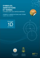
- 해도도식 / Charts Symbols, abbreviations and Terms (Pub. No 910)
해도도식 해도에 사용되는 여러가지 정보(해안선, 수심, 해저저질, 위험물, 등심선, 항로표지 등)의 기호와 약자를 수록.
Pub. No 910 contains the complete symbols and abbreviations used on national charts of the Korea Hydrographic and Oceanographic Agency (KHAO). View online document. - 등대표 / List of lights and Fog Signals (Pub. No 410)
우리나라 동·남·서해안 전 연안에 설치된 항로표지의 번호, 명칭, 위치, 등질, 등고, 광달거리, 도색, 구조, 기타사항을 수록.
This List of Lights ans Fog Signals for the coast of Korea provices detailed information of aids to navigation (AtoNs) installed on land or at sea which cannot be depicted on nautical charts. - 천측력 / 2022 Nautical Almanach (Pub. No 310)
천문항해시 원양에서 선위를 결정하는데 사용되며, 주요행성의 적위, 항성의 항성시각과 일·월출·몰시각 및 박명시각 등.
The Nautical Almanac is used to determine the ship's position off the coast during astronomical navigation. It contains the declination of major planets, the sidereal time of the stars, and the time of day, moonrise, sunset and twilight, etc. - 천측계산표, 태양방위각표
천측계산표, 태양방위각표 (Sight reduction tables for marine navigation in 6 volumes and also Azimuths of the Sun in one volume. View online documents).
- 스마트 조석예보
실시간 고조정보 (Tidal Forecast)
- Korea Map of Yacht Sailing Route
KHOA has published a new edition of Korea Map of Yacht Sailing Route containing yacht routes in Korea and latest marina information. Yachts are emerging as a new small-scale leisure activity due to social distancing caused by the pandemic. Seeing this trend, KHOA has put together various yacht information from basic knowledge to selection of routes into a publication so that even beginners can enjoy yachts conveniently and easily. The publication depicts yacht routes in the Republic of Korea on chart-based sheets, allowing users to select routes by estimated time and lists latest marina information for yacht repair, supplies and mooring. In particular, this second edition features QR codes which show aerial videos of beautiful marinas, procedure for entering and departing ports, information on operator’s license tests, and safety rules and is available in English and Korean versions. KHOA hopes that the publication will help all yacht lovers enjoy marine leisure activities safely.
- 요트 · 낚시정보도
국민들의 건강한 해양레저 활동을 위한 요트·낚시정보도는 주요 도서지역의 낚시포인트, 채비요령, 교통정보, 안전수칙 뿐만 아니라 수심, 조류, 물때정보 등 요트 및 낚시에 필요한 각종 알찬 정보를 수록하였습니다 (Information for yachts and fishing with charts).
- 요트낚시정보도
국민들의 건강한 해양레저 활동을 위한 요트·낚시정보도는 주요 도서지역의 낚시포인트, 채비요령, 교통정보, 안전수칙 뿐만 아니라 수심, 조류, 물때정보 등 요트 및 낚시에 필요한 각종 알찬 정보를 수록하였습니다 (Information for yachts and fishing with charts).
- 등대표
등대정보 (Map with List of Lights)
- 전국VTS센터
VTS
- 해양조사 용어사전
다양한 해양 용어 및 항목들에 대한 정보를 제공합니다.
- Annual Summary of Korean Notices to Mariners
This 2020 Annual Summary of Korean Notices to Mariners has been published in accordance with the recommendations of the International Hydrographic Organization (IHO) and the long-term plan of KHOA to contribute to the safety of navigation. This publication has put together the weekly notices to mariners issued in 2020. It also contains navigational warning information including the Chart of Firing and Bombing Exercise Areas in the Coast of Korea, NAVTEX (Navigation Telex) and World With Navigational Wanting Service (WWNWS) and navigational safety information such as the Vessel Traffic Services (VTS). We hope that the publication will serve as an useful guide for safe navigation by all mariners.
- Notice to Mariners
It is mandatory for all ships to have up to date nautical charts and nautical publications for sailing. To support that, we provide weekly notices to mariners gratis to ensure navigational information is updated and to improve the safety of navigation.

- Catalogue of Nautical Charts and Publication
기상청 / Korea Meteorological Administration (KMA)
- Typhoon information
The cone contains the probable path of the storm center but does not show the size of the storm. Hazardous conditions can occur outside of the cone.
Radio Fax ChartInternet Chart Internet Chart Typhoon Information for the North West Pacific (UTC+9) - Online Marine Radiofax Charts
Korean page: 해양기상방송(WE-FAX)은 국내의 기상실황 및 예보의 무선통신에 관한 사항을 서비스하며, 한국연안은 물론 원양을 항해중인 선박, 연안 여객선, 어선 및 선박회사 등 기상 정보를 필요로 하는 기관에서 본 방송을 수신하여 조업, 항해, 운항 등에 활용하도록 하는 중요한 무선통신임
- 방송 시간표 (List of charts by broadcast time)
- 해양기상방송자료 (List by type of charts)
- 방송내용 및 제원 (Frequencies of HLL2 fax station)
- 세계주요 영역기상방송 센터 (World map with fax stations: call sign & frequencies)
- 해양지수
우리나라 주변해역의 착빙위험 예측정보. 3시간 간격의 72시간까지의 착빙지수를 예상. 착빙 정도에 따라 색구분. 도움말.
- Icing Index
Map with analysis and forecast for the risk of icing on waters around Korea. Legend: Icing index (< 0 to > 83) - Colors with icing level and icing speed (blue = no icing, speed: 0 cm/ħr, green = lightness, < 0.7 cm/hr, yellow = medium, 0.7 ~ 2 cm/hr, orange = severe, 2 ~ 4 cm/hr, red = very severe, > 4 cm/hr). Time: UTC+9.
- 연근해선박기상정보(월간)
연근해선박기상정보: 해양기상특성정보, 조석정보, 해양안전정보, 어업기상정보.
- Typhoon information

| | L |


L'urgence prime la forme - By Cr - 2012-2024
For updates, corrections, new charts or new documents please send an e-mail to
For my father and my mother / Pour mon père et ma mère

